Position:69.562°N 145.300°W – Depth: 2.2 km
From the USGS summary of this event:
“The August 12, 2018, M 6.4 earthquake southwest of Kaktovik, Alaska, occurred as the result of strike slip faulting in the North Slope of Alaska. Preliminary focal mechanism solutions indicate faulting occurred on a steeply dipping fault striking either north-northeast (left-lateral), or east-southeast (right-lateral). This earthquake occurred within the interior of the North America Plate, in the east-west striking Sadlerochit Mountains at the northeast end of the Brooks Range. This region is seismically active. Before this earthquake sequence, 34 magnitude 4 and larger earthquakes have been recorded within 100 km of the August 12th mainshock since 1990. The event of August 12, 2018, M 6.4 is the largest instrumentally recorded earthquake in Alaska’s North Slope.”
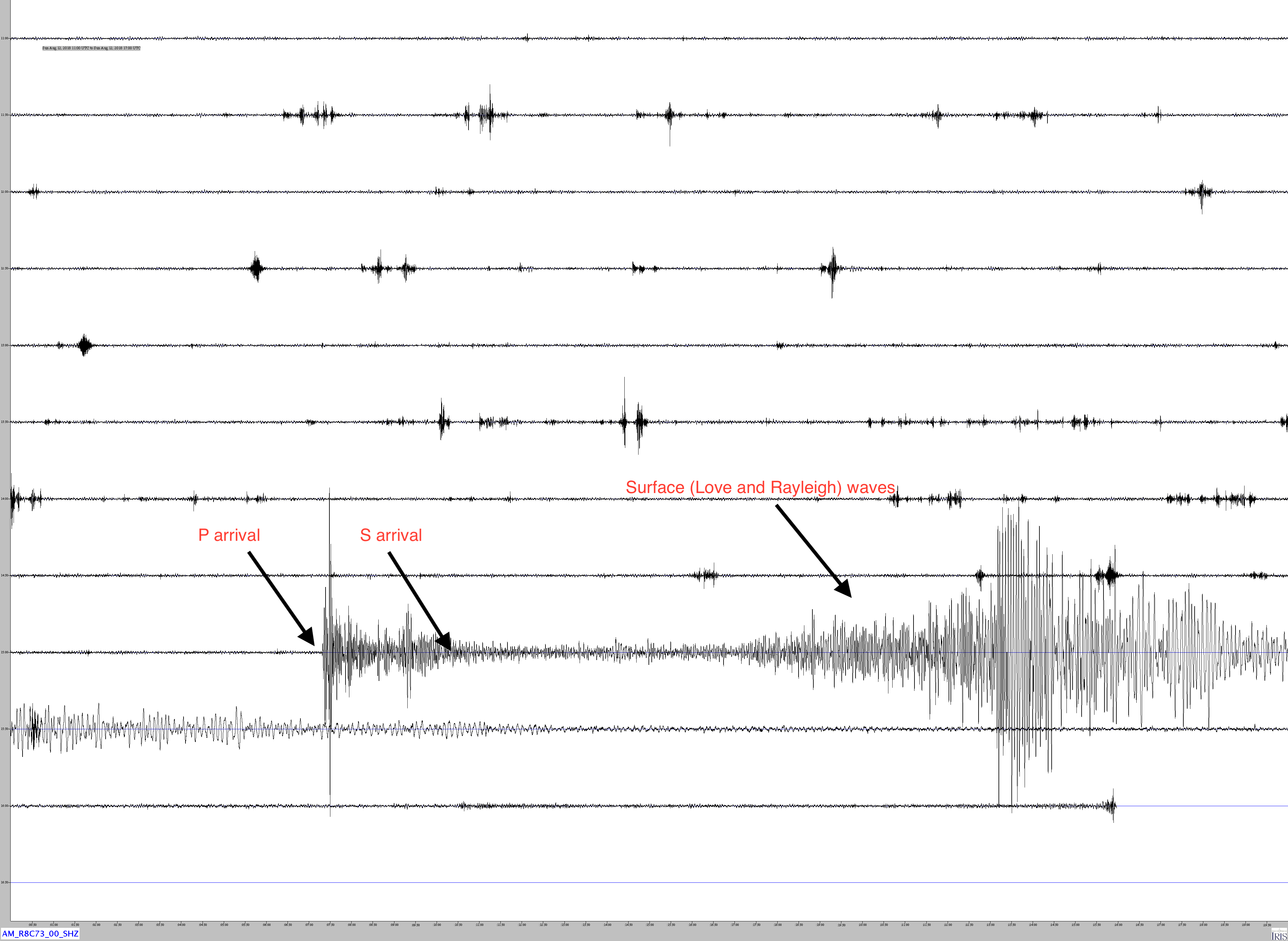
Jamaseis heliocoder trace of AM.RC8C73.00.SHZ. Notice the high amplitude surface waves in the image. These can be seen in the trace for almost two hours after onset.
Distance: 45.8 Deg. 5,159 km
Azimuth: 92.5 Deg.
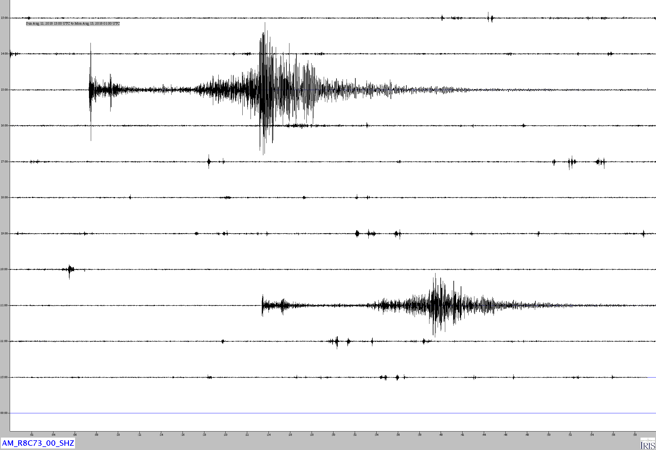
Another Jamaseis image (AM.R8C73.00.SHZ, Exton) showing the initial earthquake as well as the magnitude 6.1 aftershock that occurred at 21:15:01 UTC
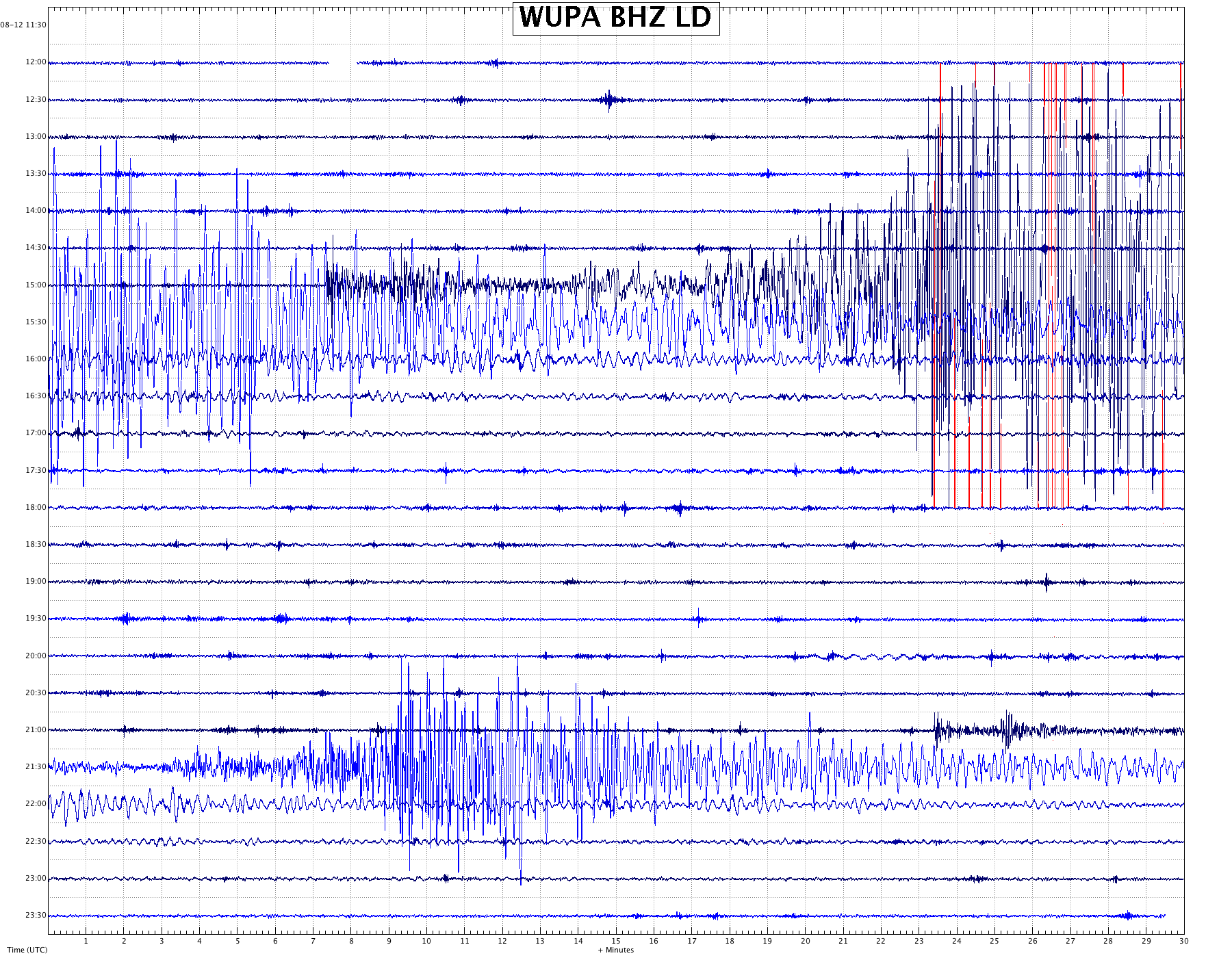
Here is the trace from LD.WUPA.BHZ at West Chester University about 10 km (6 miles) south of AM.R8C73.00.SHZ. WUPA is a broad-band seismometer which is sensitive down to about .01 Hz, i.e. a period of almost two minutes. Note that the surface waves are even stronger at these lower frequencies, particularly around 10 – 15 seconds per cycle.
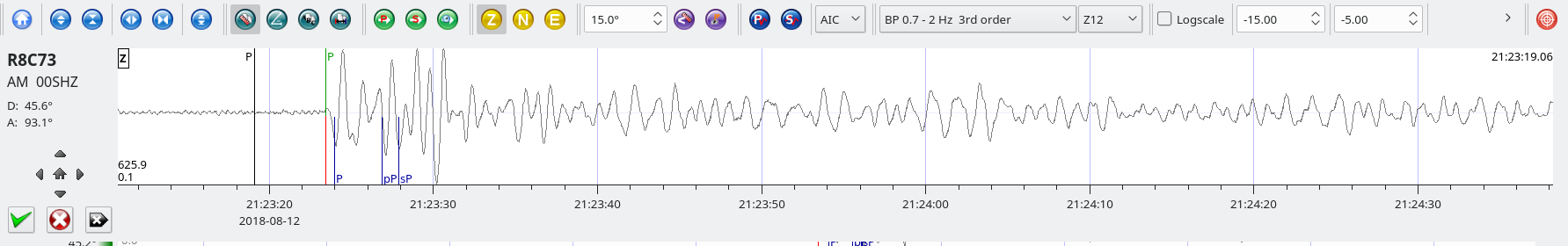
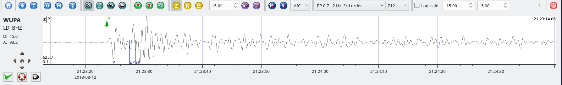
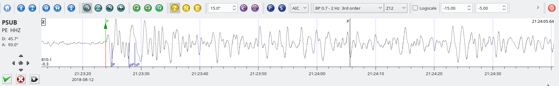
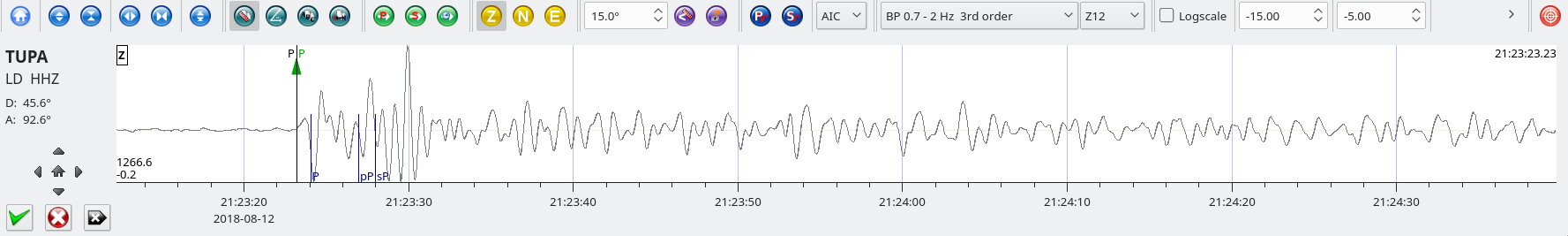
SeisComP3 traces for AM.R8C73.00.SHZ (Exton PA), LD.WUPA.BHZ (West Chester University, West Chester PA), PE.PSUB.HHZ (Peen State Delaware County Campus), and LD.TUPA.HHZ (Temple University Ambler Campus) showing the P wave arrivals.
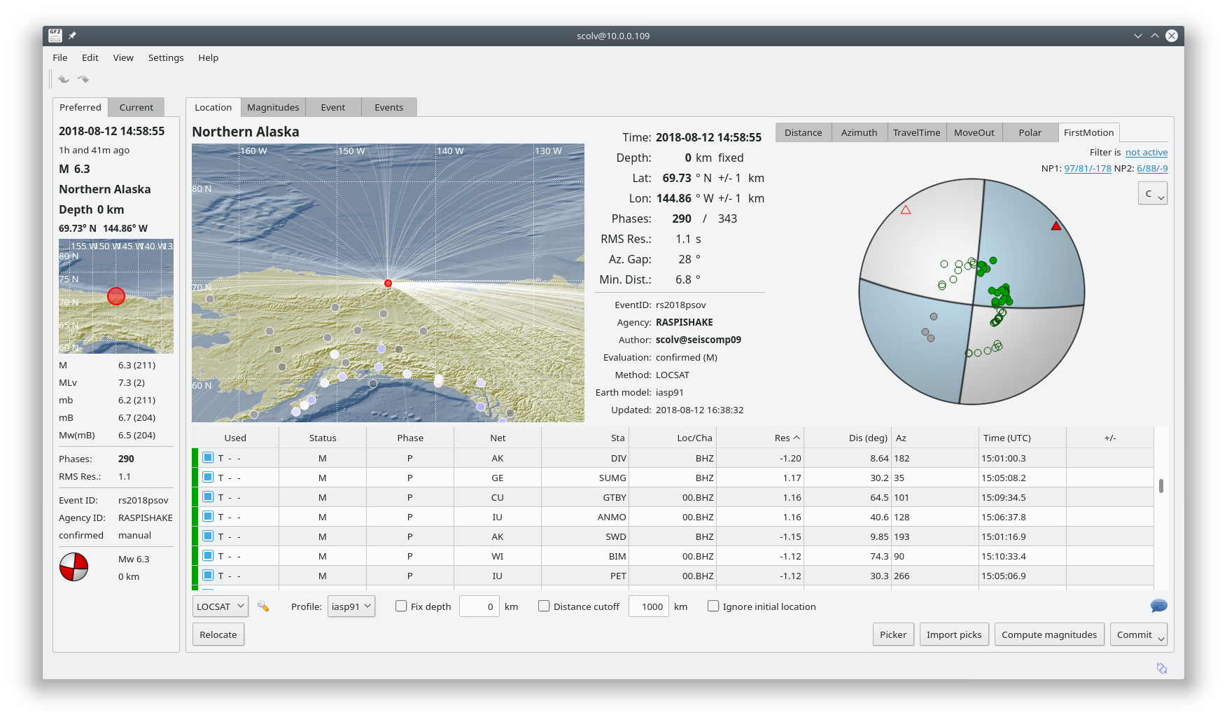
This SeisComP3 screenshot shows the focal mechanism which is typical of a strike-slip fault.