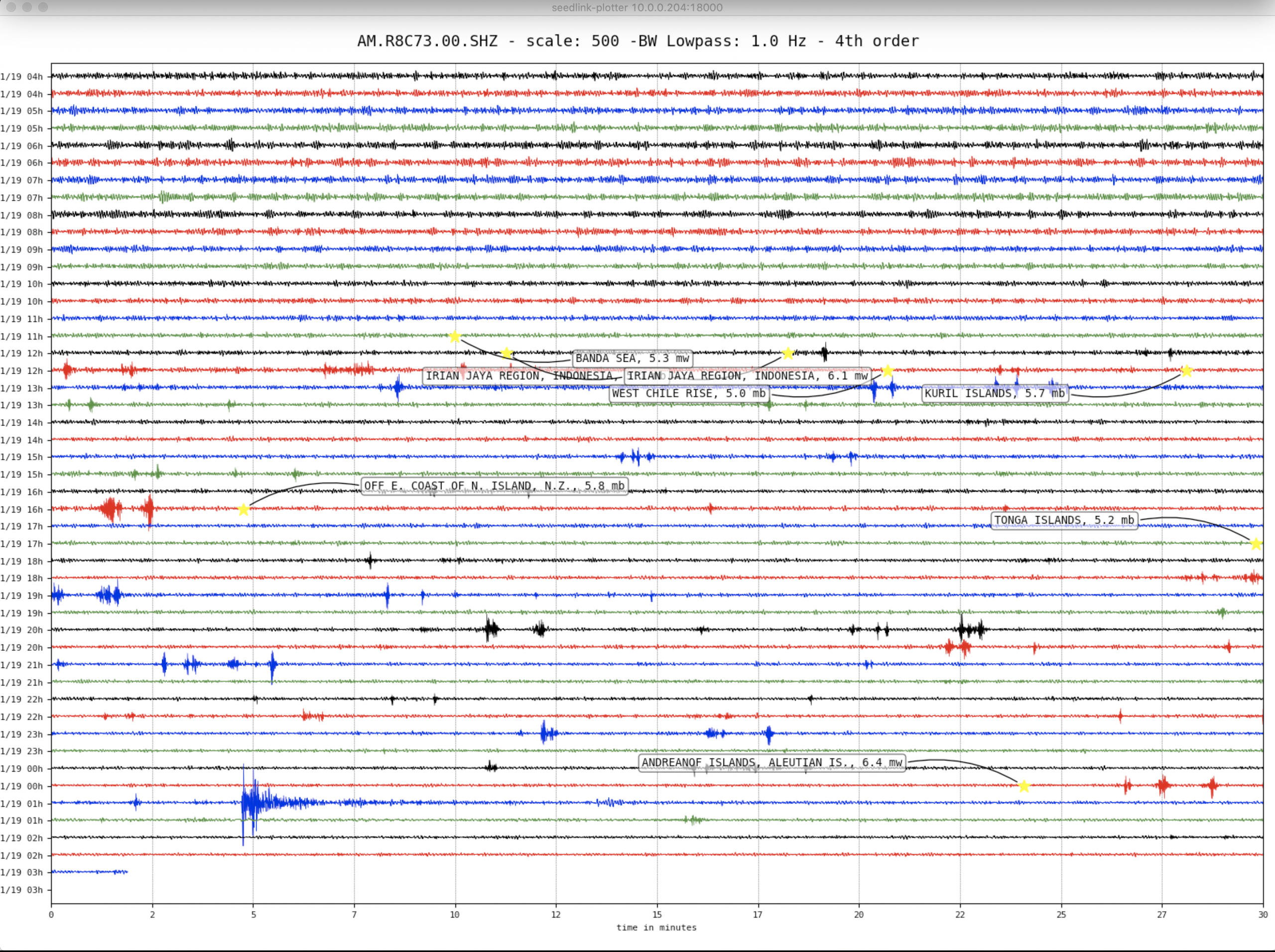
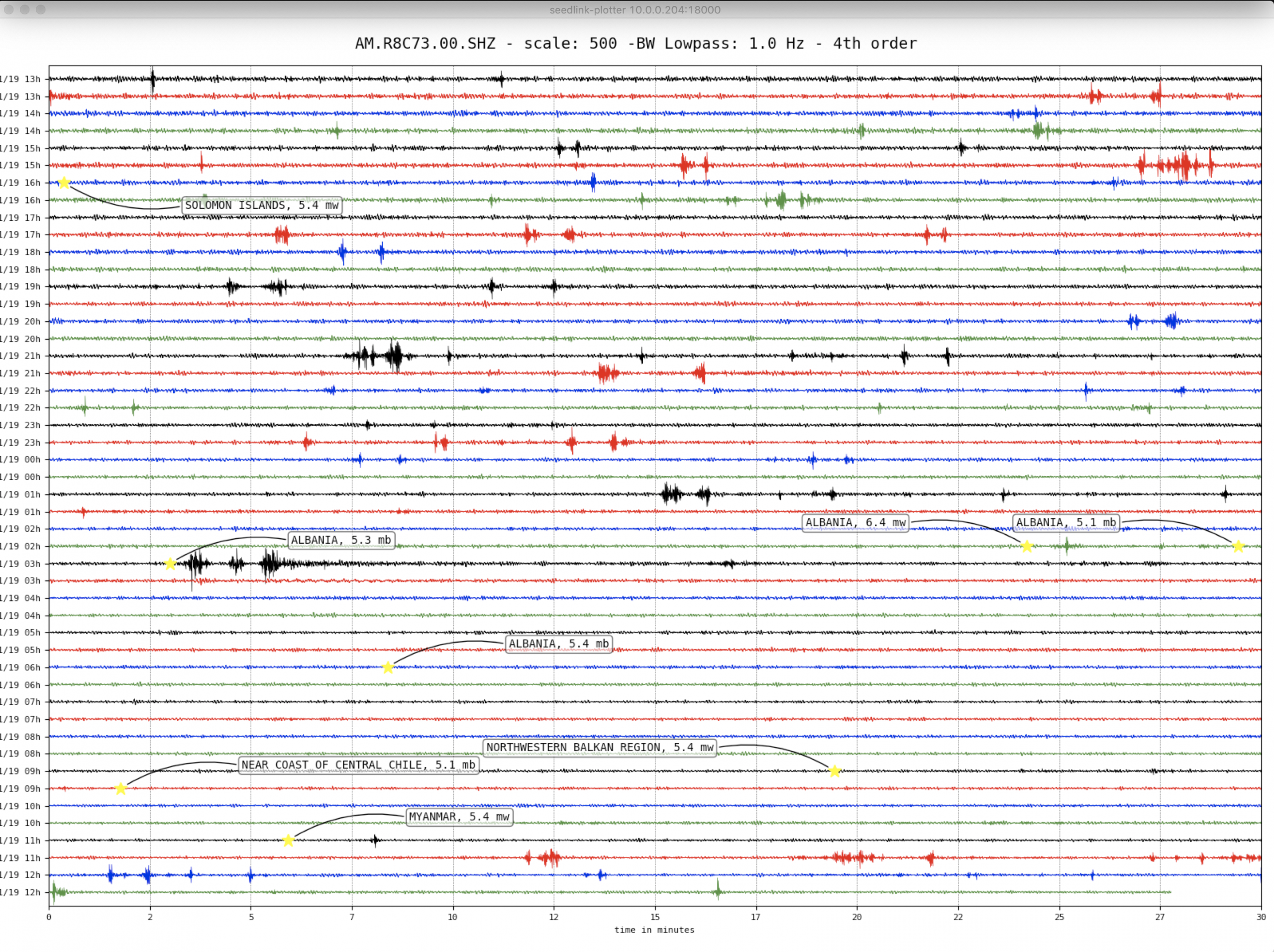
Albania – M6.4 – Nov 26, 2019 at 02:54:12 UTC
12km WSW of Mamurras, Albania
| Latitude | Longitude | Depth (km) | Dist (Deg) | Dist (Km) | Azimuth | |
|---|---|---|---|---|---|---|
| 41.521 | 19.559 | 20.0 | 68.2 | 7,580 | 304.7 |
Tectonic Summary
The November 26, 2019, M 6.4 Albania earthquake occurred as the result of thrust faulting near the convergent boundary of the Africa and Eurasia plates. Focal mechanism solutions indicate reverse slip on a shallow or steeply dipping fault. Northwest-Southeast striking reverse faulting is consistent with the tectonics of the region. At the location of this event, the Africa plate converges with the Eurasia plate at a rate of 73 mm/year.
Tectonics of the Mediterranian Sea, in the convergent boundary region between Africa and Eurasia, are complex, and involve the motions of numerous microplates and regional-scale structures. In the context of the November 26, 2019 earthquake, reverse faulting in Albania on the eastern shores of the Adriatic is consistent with the closing of that sea, and shortening across the mountain belts stretching from Croatia to Greece.
Large earthquakes are common in this region; seven M6 and larger events have occurred within 150 km of this November 26 earthquake over the past 100 years. The largest was a M6.9 earthquake on April 15, 1979 that occured 70 km to the north-northeast of the November 26th earthquake, killing 100 people in Montenegro, 35 in Albania and leaving 100,000 people homeless. A M6.7 earthquake on November 30, 1967, 80 km to the east of today’s event, resulted in 19 fatalities and significant damage in the surrounding region.
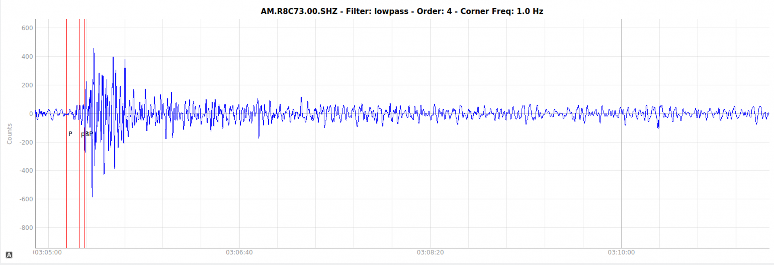
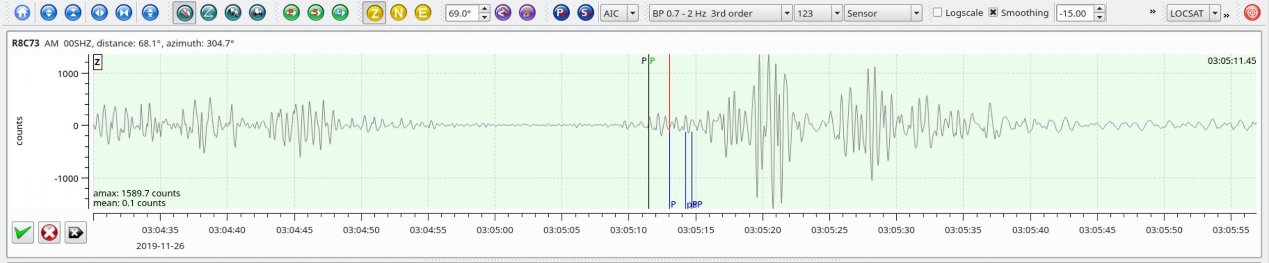
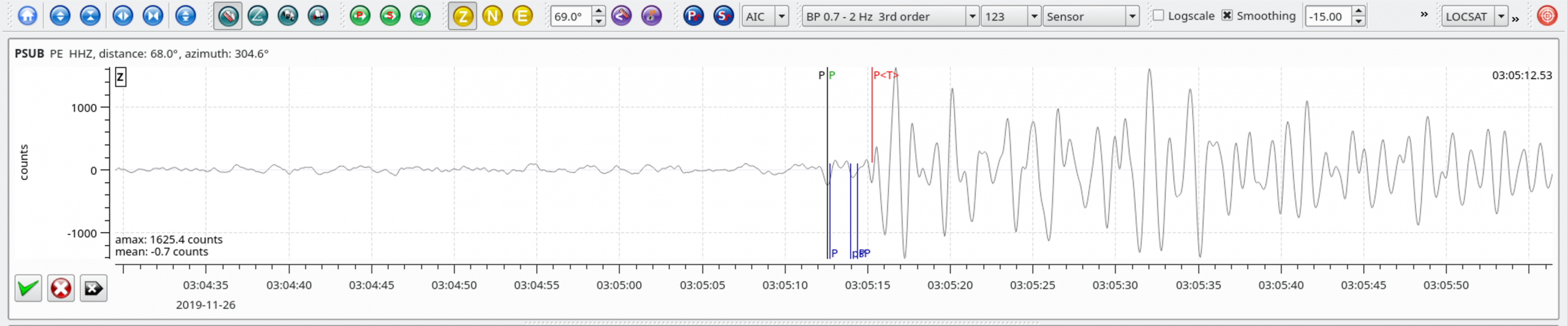
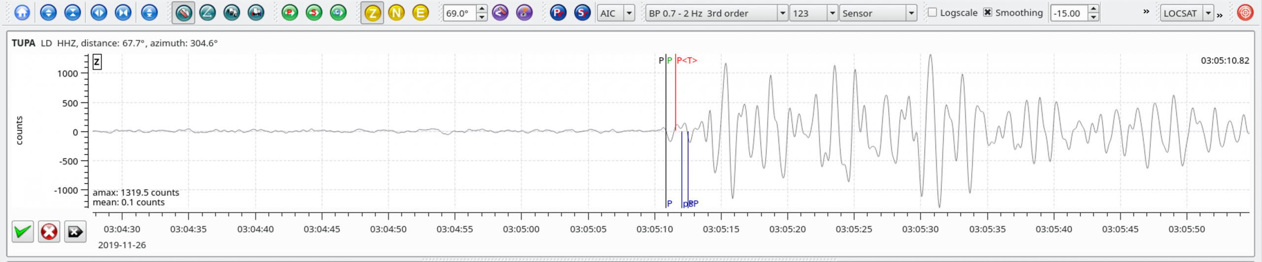
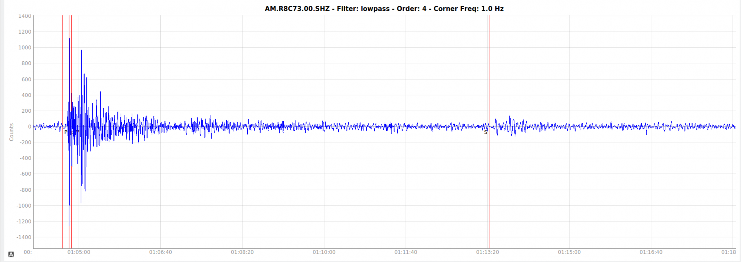
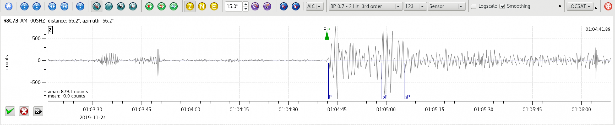
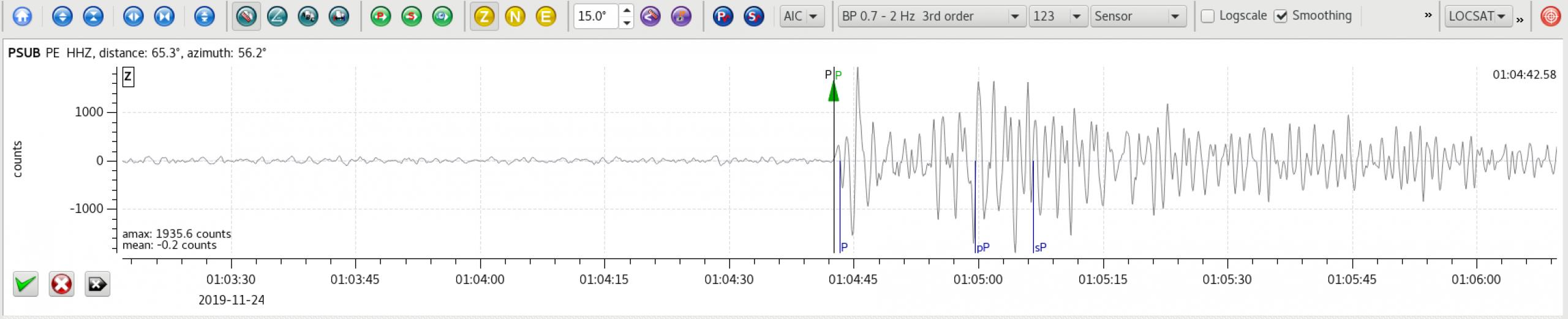
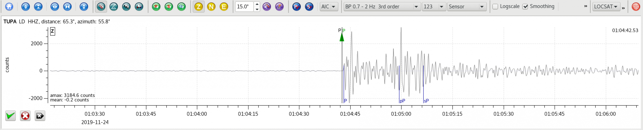
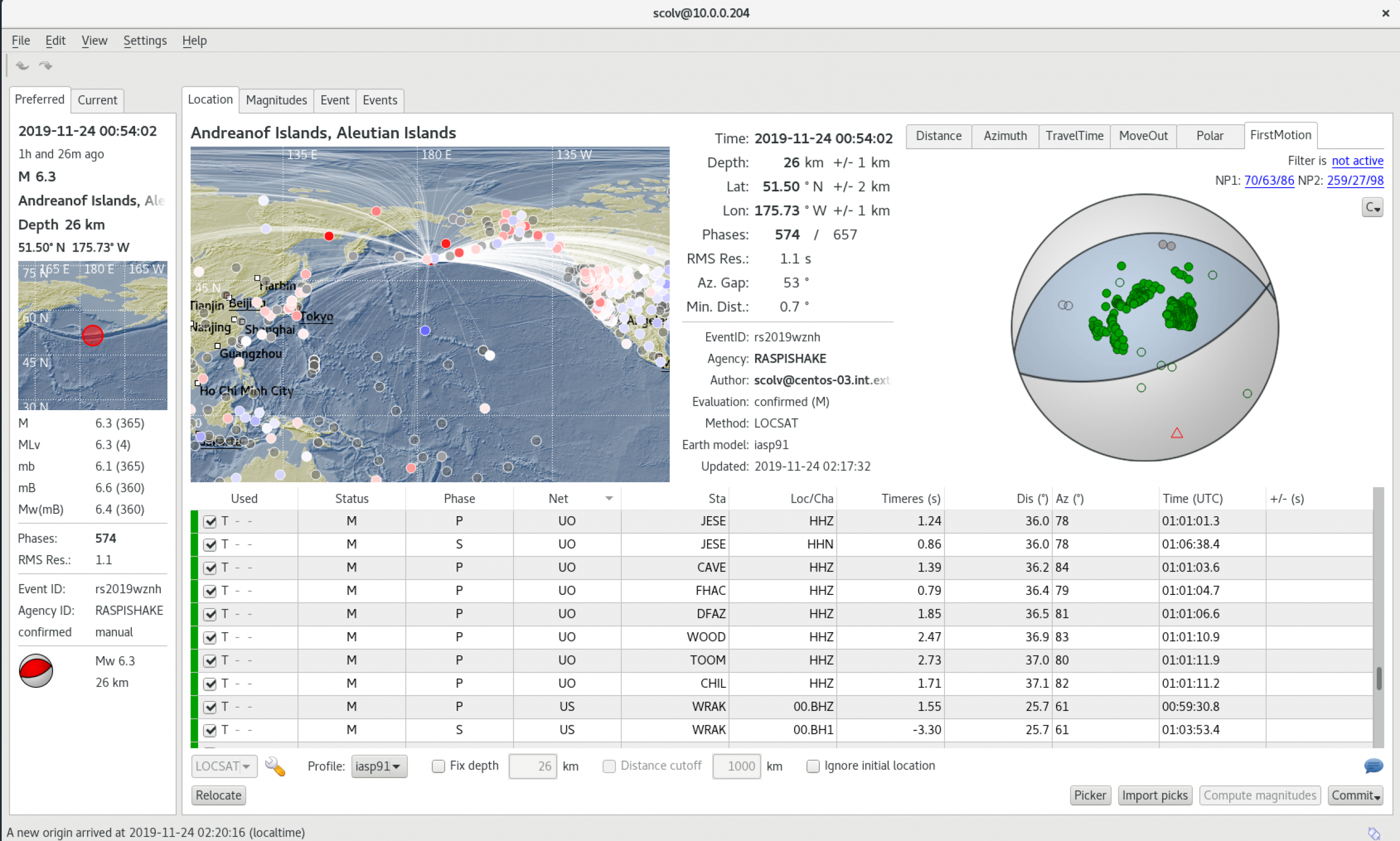
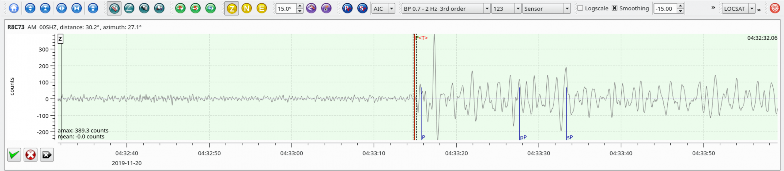
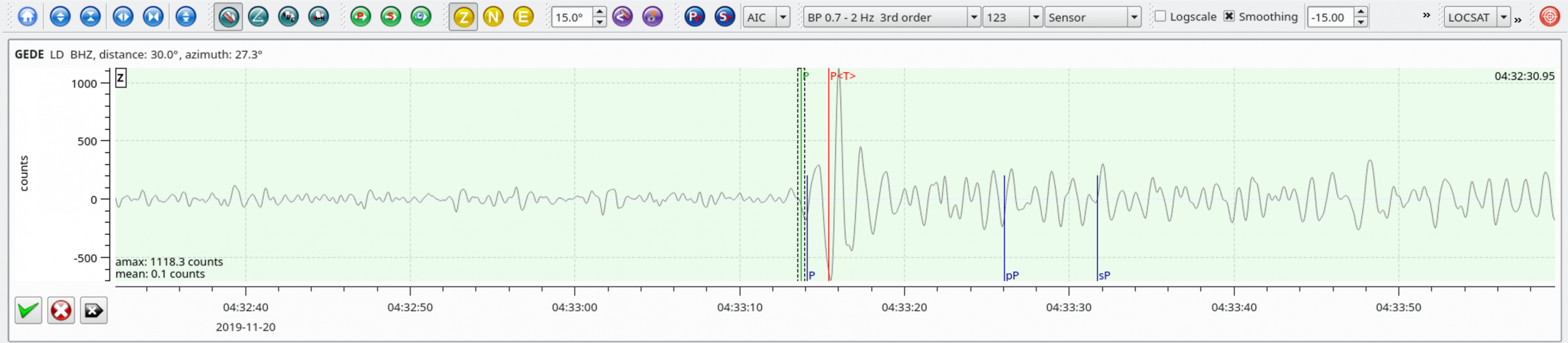
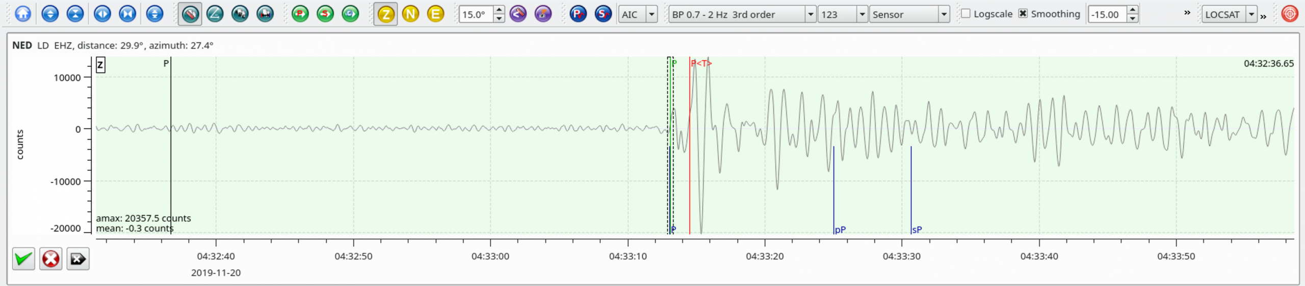
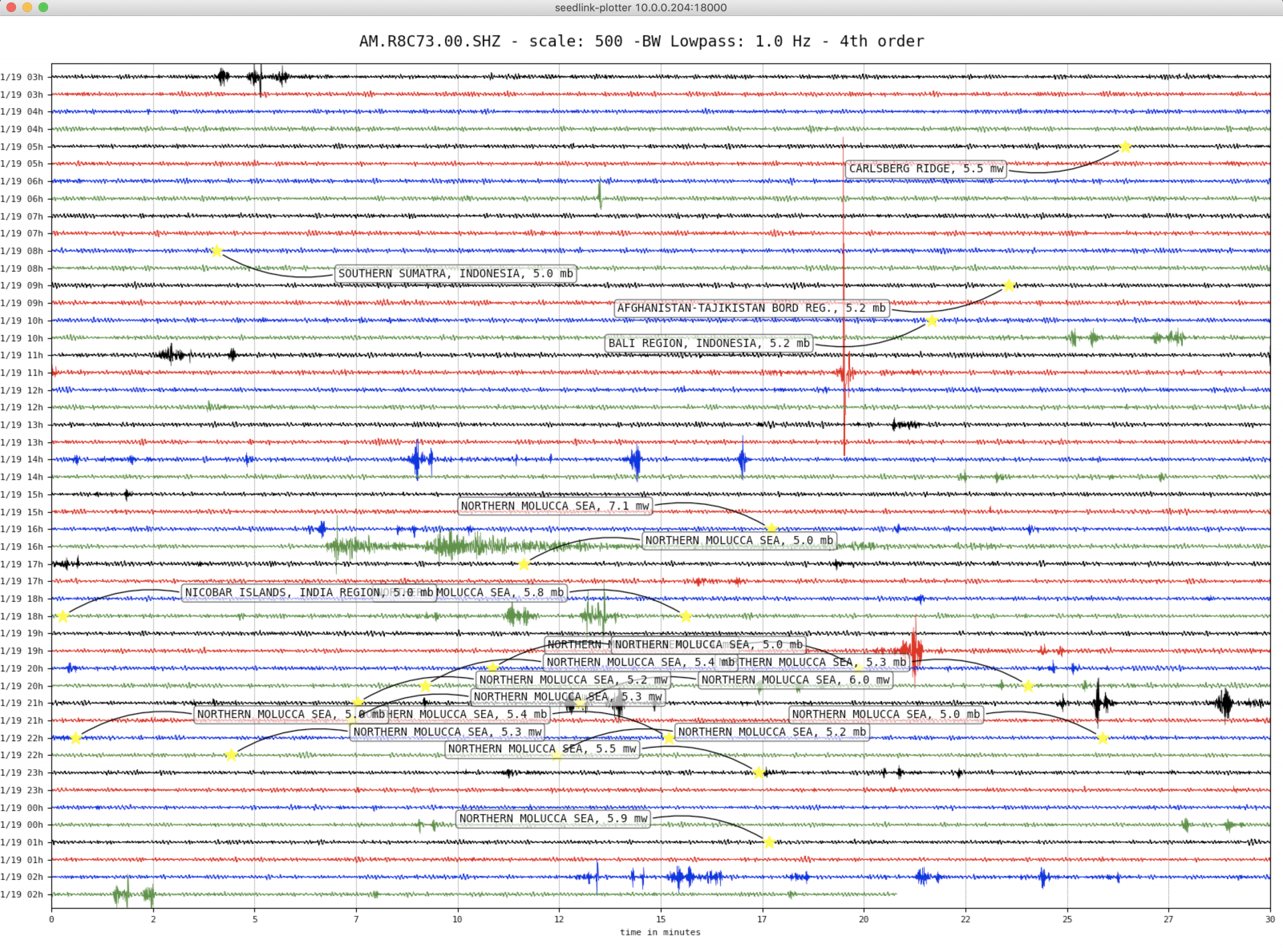
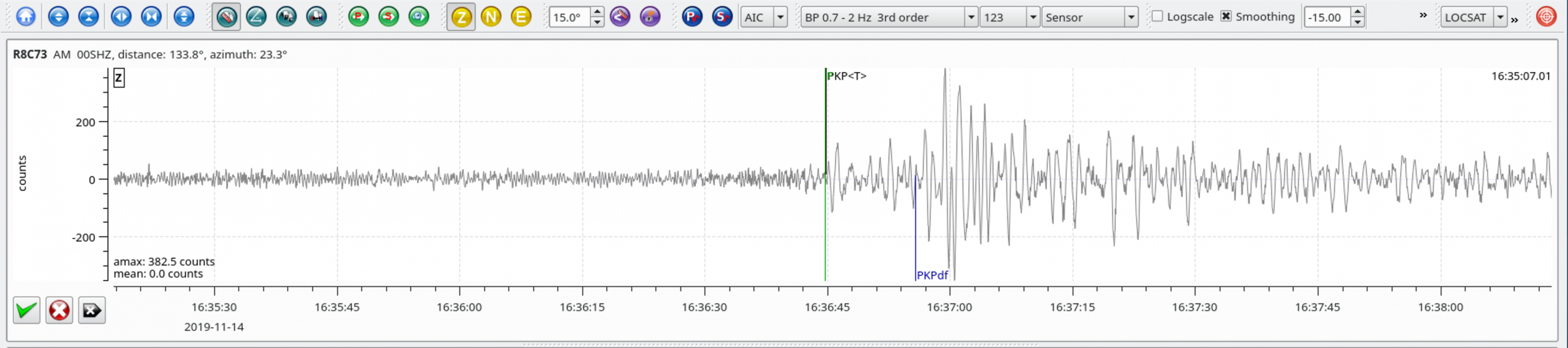
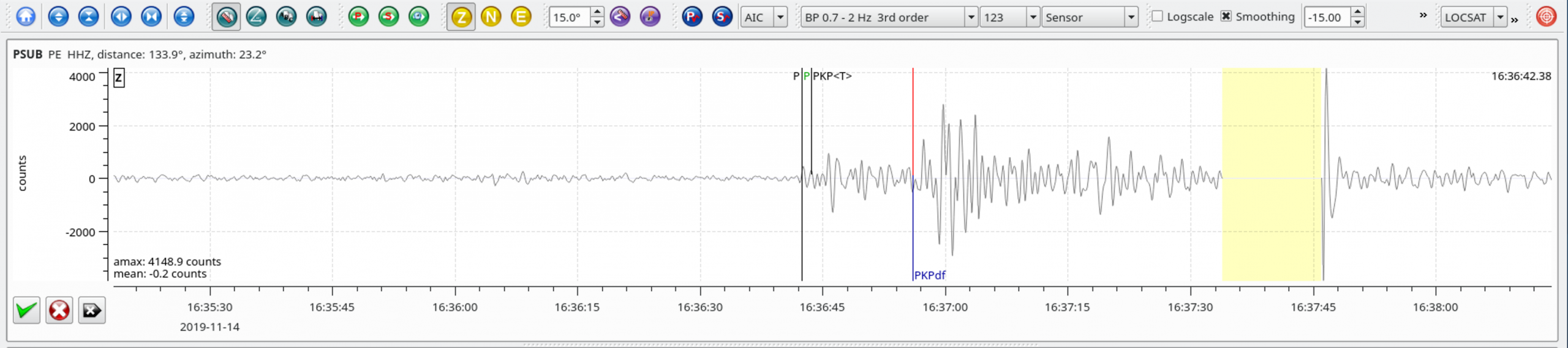
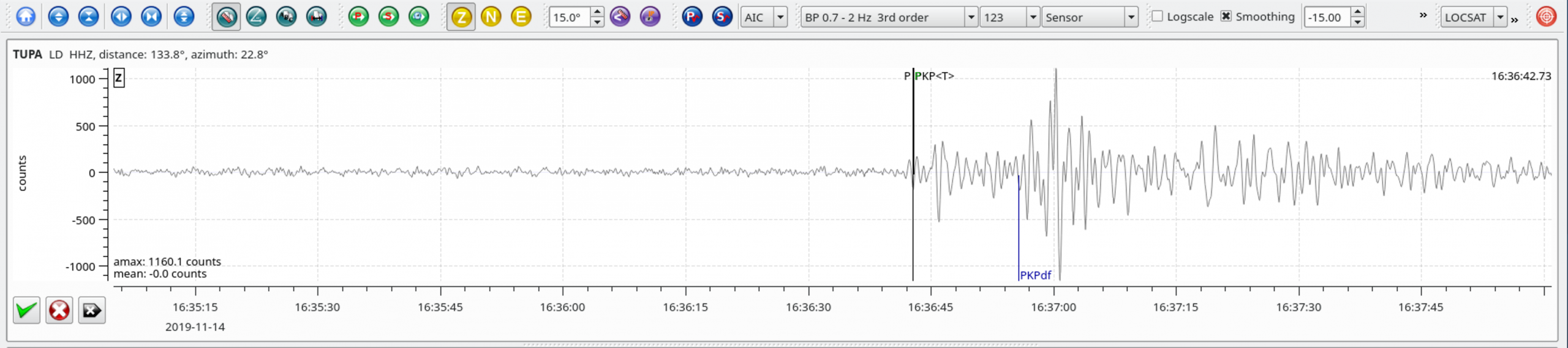
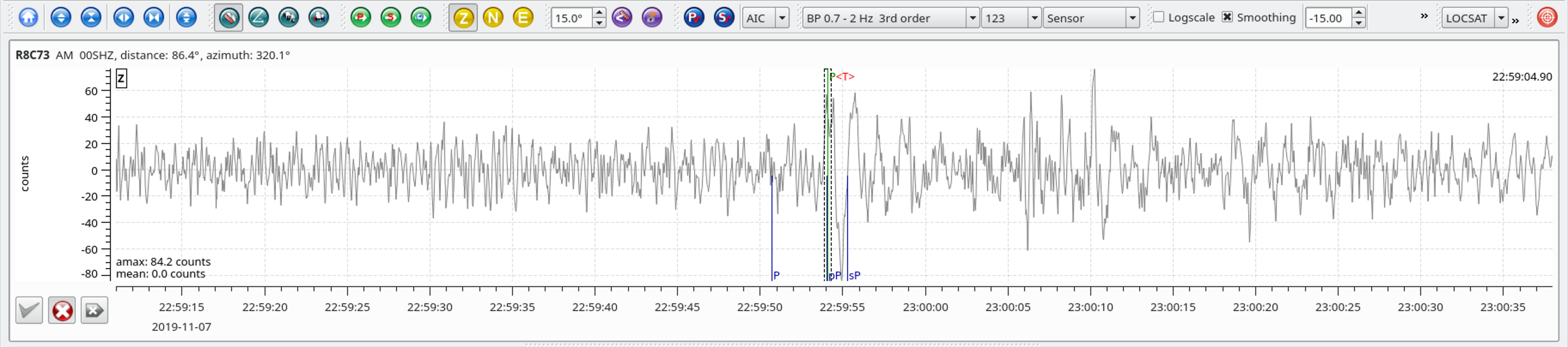
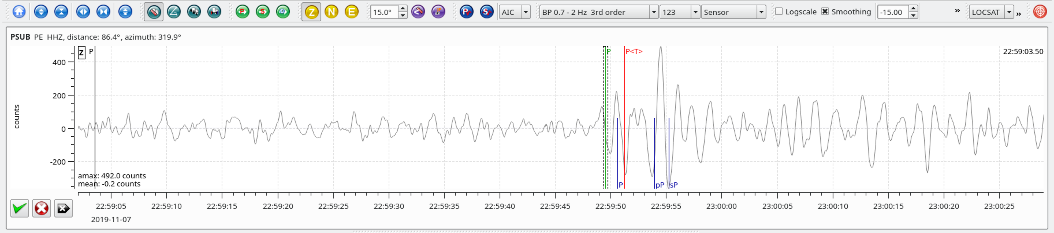
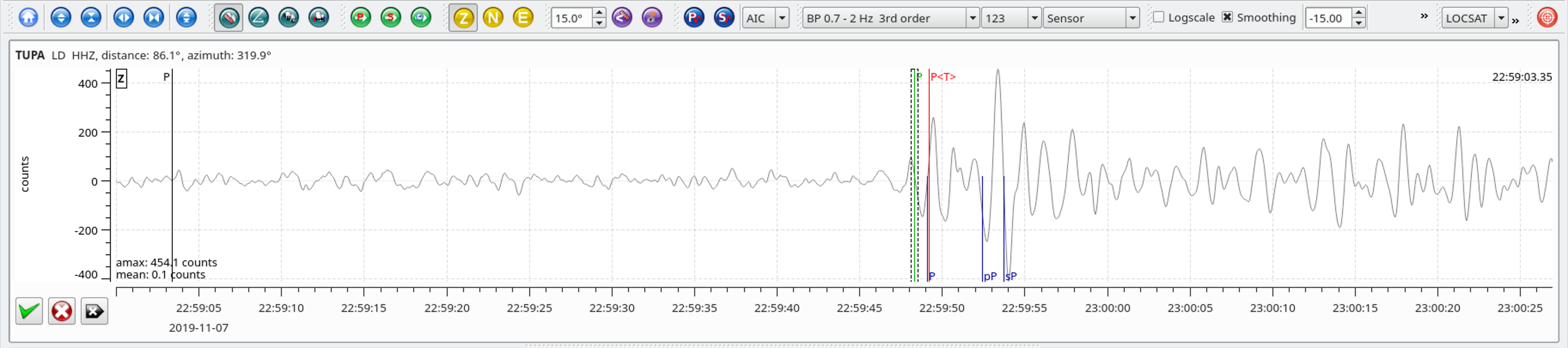
Local SeisComP3 P-wave Arrivals