Tectonic Summary
From the USGS Information Page:
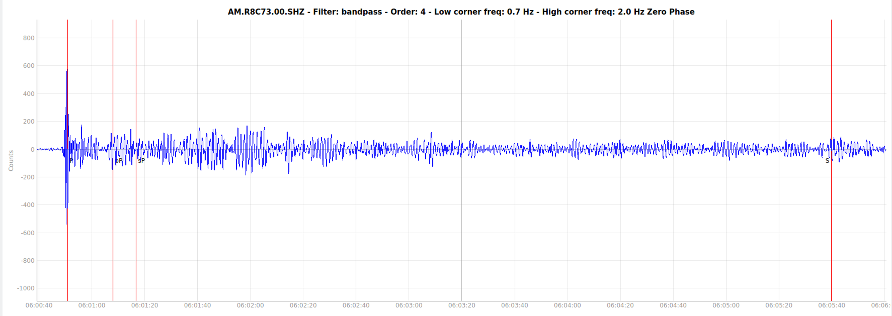
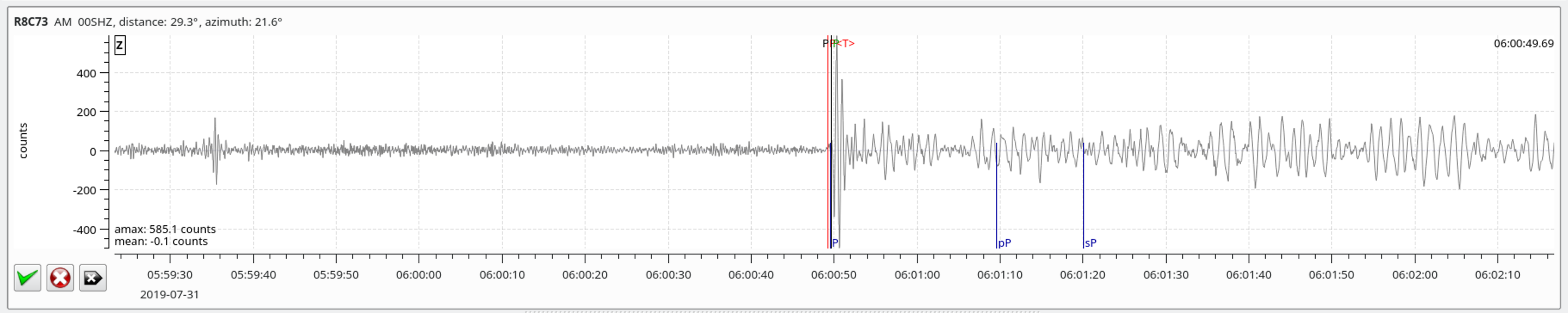
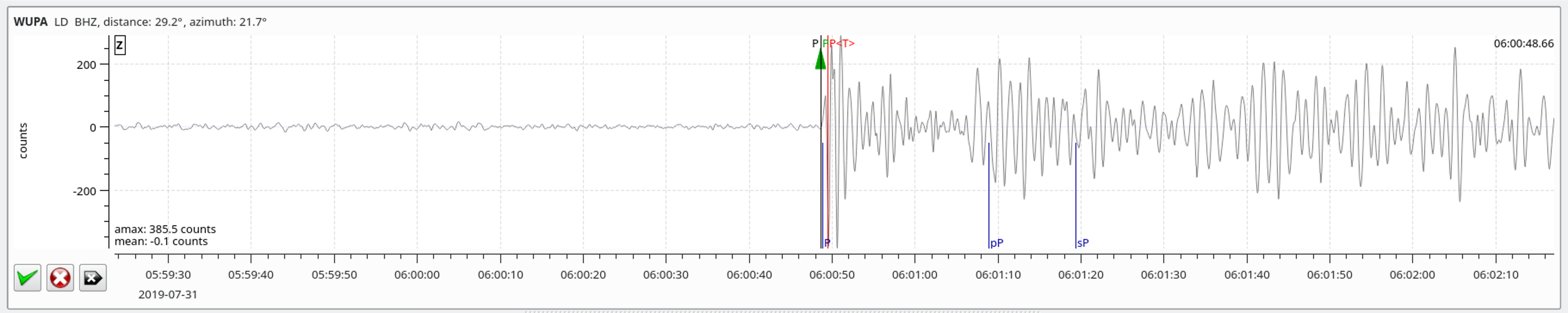
The July 14, 2019, M 7.3 earthquake near the southern end of the island of Halmahera, Indonesia, occurred as the result of shallow strike slip faulting in the complex plate boundary region of eastern Indonesia, within the oceanic lithosphere of the Sunda plate. Faulting mechanism solutions for the event indicate that slip occurred on a steeply dipping structure striking either southwest (right lateral faulting) or southeast (left lateral faulting). Aftershocks since the M 7.3 event have generally aligned with the plane striking southeast.
Tectonics in eastern Indonesia are extremely complex and are dominated by the mostly convergent interactions of the Pacific, Australia, Philippine Sea, and Sunda plates. The edges of the Sunda and Australia plates are also often subdivided into smaller tectonic blocks, including the Molucca Sea and Birds Head microplates in the region of the July 2019 earthquake. In this context, the July 2019 event most closely aligns with the boundary between the Birds Head and Molucca Sea microplates, about 130 km to the southeast. At depth beneath this earthquake and the Molucca Sea in general (predominantly to the north and west of this event), the inverted-U-shaped Halmahera plate, which has no surface expression, also plays a role in regional tectonics. At the location of the July 14th earthquake, the Sunda and Philippine Sea plates are converging in an east-west direction at a rate of approximately 110 mm/yr, and the Sunda and Pacific plates are converging in an east-west direction at a rate of approximately 96 mm/yr.
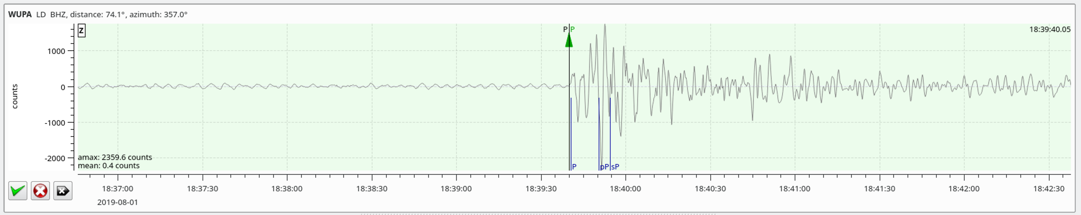
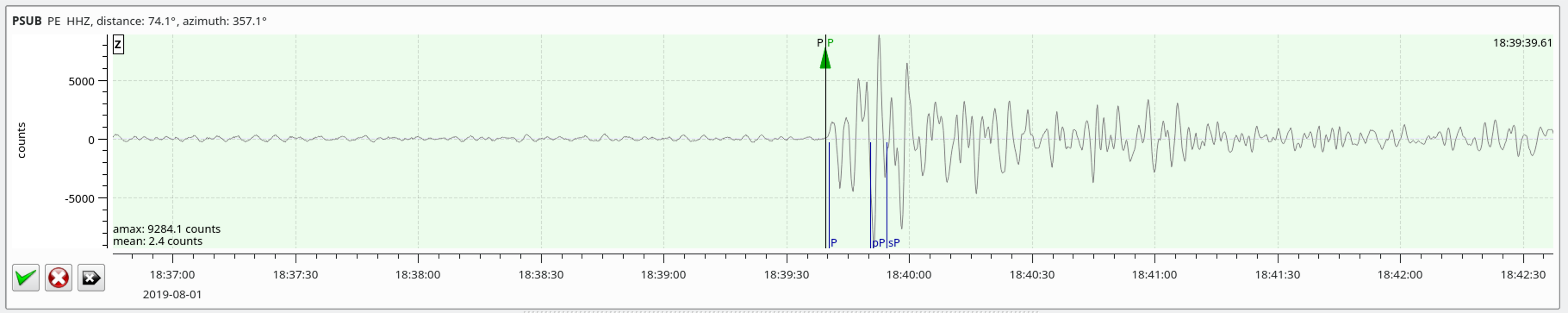
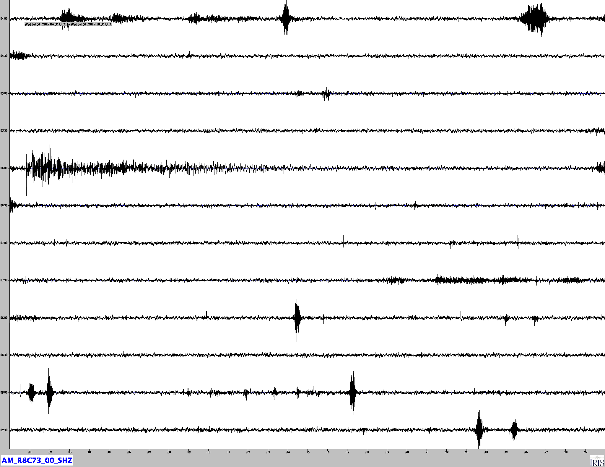
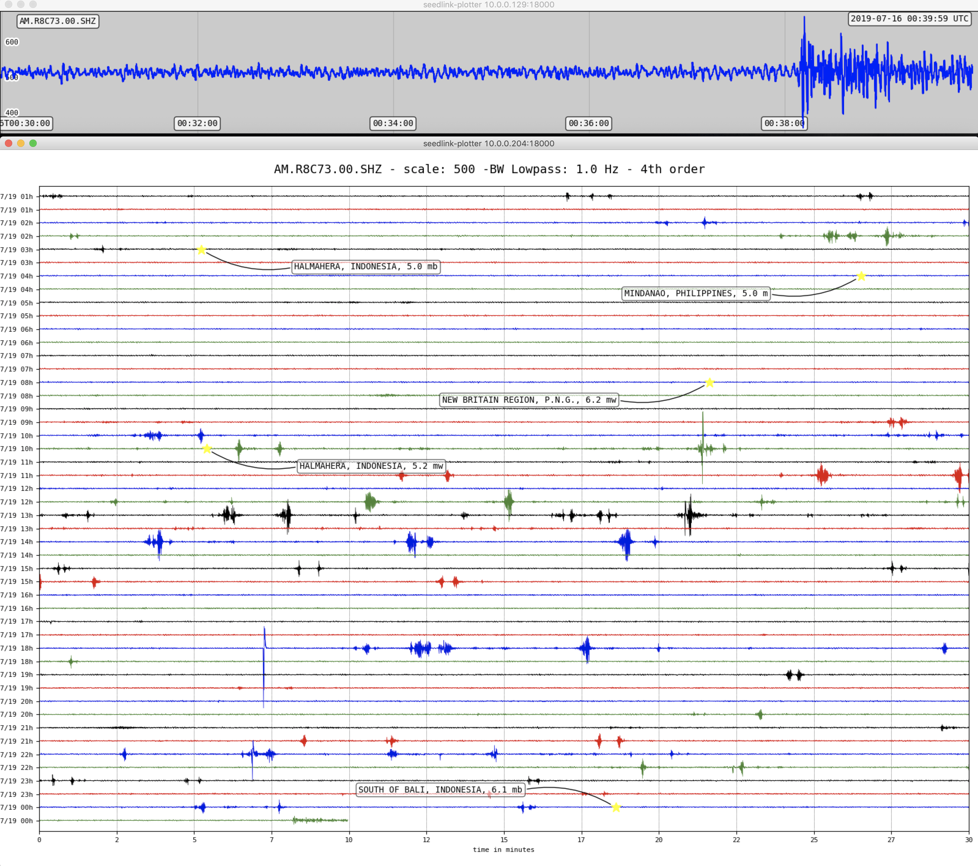
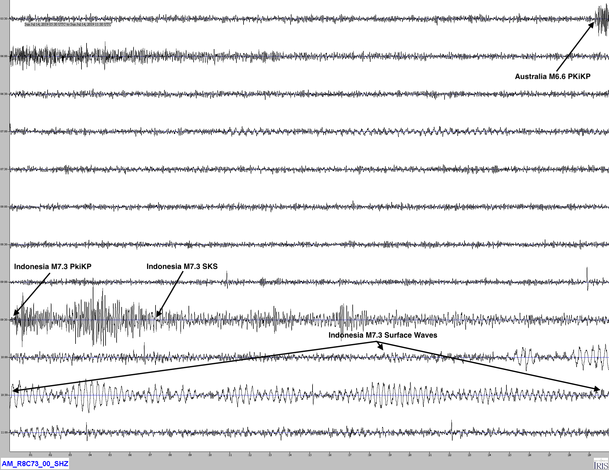
This area of the Halmahera Sea has hosted 35 M 6+ events within 250 km of the July 14, 2019, earthquake in the last half-century. None of these were M 7+. Within the first three hours of the July 14th, 2019 earthquake, the USGS has recorded 17 aftershocks, distributed in an approximate northwest-southeast direction about the M 7.3 shock. The largest of these was a M 5.8, 33 minutes after the M 7.3 earthquake.