Vanuatu – M6.3 – Mar 20, 2019 at 15:23:58 UTC

52km E of Luganville, Vanuatu

Position: – 15.595°S 167.651°E  – Depth: 119.0 km

USGS Information Page

Distance from Exton PA: 120.5 Deg – 13,380 Km – Azimuth: 52.5 Deg

Detail of P wave arrival (no filter applied).

SeisComP3 traces for AM.R8C73.00.SHZ (Exton PA), LD.WUPA.BHZ (West Chester PA), and PE.PSUB.HHZ (Media PA) showing the P wave arrivals. There isn’t much to see here as only a weak spike was detected from this very distant event. Note however that the RaspberryShake (R8C73) was the only seismometer to actually generate an arrival in SeisComP3. The other two instruments, expensive lab grade seismometers at local universities did not generate arrivals in SeisComP. 


Fault plane solution for this event.

Bolivia – M6.3 – Mar 15, 2019 at 05:03:50 UTC

28km S of Cliza, Bolivia

Position: – 17.857°S 65.891°W – Depth: 358.3 km

USGS Information Page

Distance from Exton PA: 58.4 Deg – 6,486 Km – Azimuth:351.2 Deg

Waveform between the P and S wave arrivals (0.7 – 2.0 hz Butterworth bandpass filter).

Detail of P wave arrival (no filter applied).

SeisComP3 traces for AM.R8C73.00.SHZ (Exton PA), LD.WUPA.BHZ (West Chester PA), and LD.GEDE.BHZ (Greenville DE) showing the P wave arrivals.


Fault plane solution for this event.

Bomb Cyclone – Mar 13, 2019

On March 13th a rapidly developing lo pressure system brought blizzard conditions to a large stretch of the Great Plains. Here are some AWIPS II screenshots:

Dramatic GOES-16 images of the storm near sunset.

NEXRAD composite radar superimposed over the GOES-16 satellite image.

Surface isobars showing a central pressure below 972 hPa!

Hokkaido, Japan – M6.0 – Mar 2, 2019 at 03:22:52 UTC

191km SE of Nemuro, Japan

Position: 41.934°N 146.948°E – Depth: 10.0 km

USGS Information Page

Distance from Exton PA: 89.6 Deg – 9,968 Km – Azimuth: 31.2 Deg

SeisComP3 traces for AM.R8C73.00.SHZ (Exton PA), LD.WUPA.BHZ (West Chester PA), and LD.GEDE.BHZ (Greenville DE) showing the P wave arrivals.


Peru – M7.0 – Mar 1, 2019 at 08:50:41 UTC

27km NNE of Azangaro, Peru

Position: 14.684°S 70.127°W

 – Depth: 257.4 km

USGS Information Page

Distance from Exton PA: 54.8 Deg – 6,082 Km – Azimuth: 354.8 Deg

Tectonic Summary

From the USGS Information Page

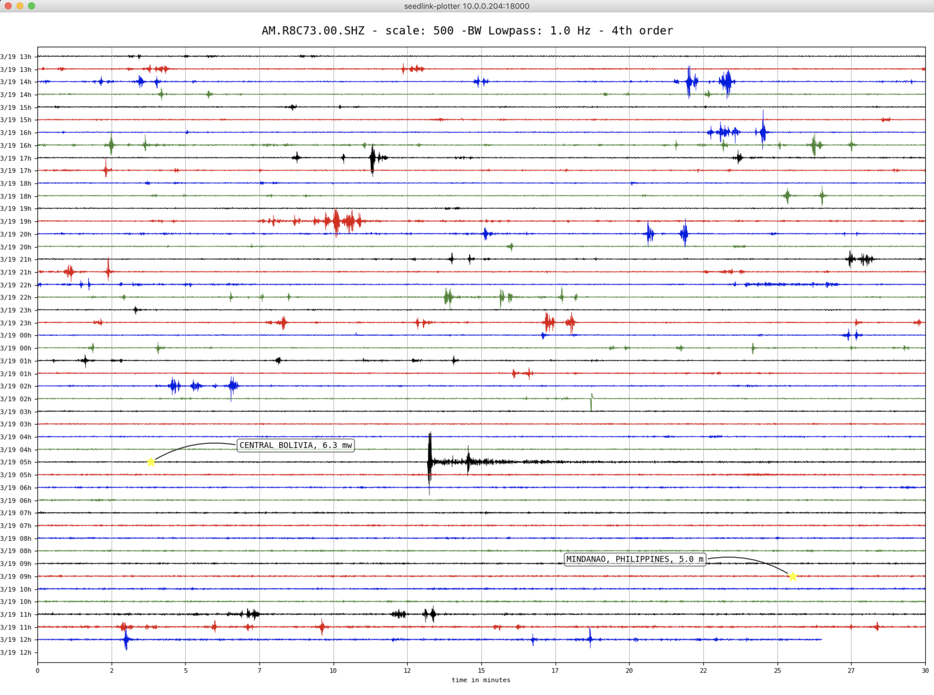
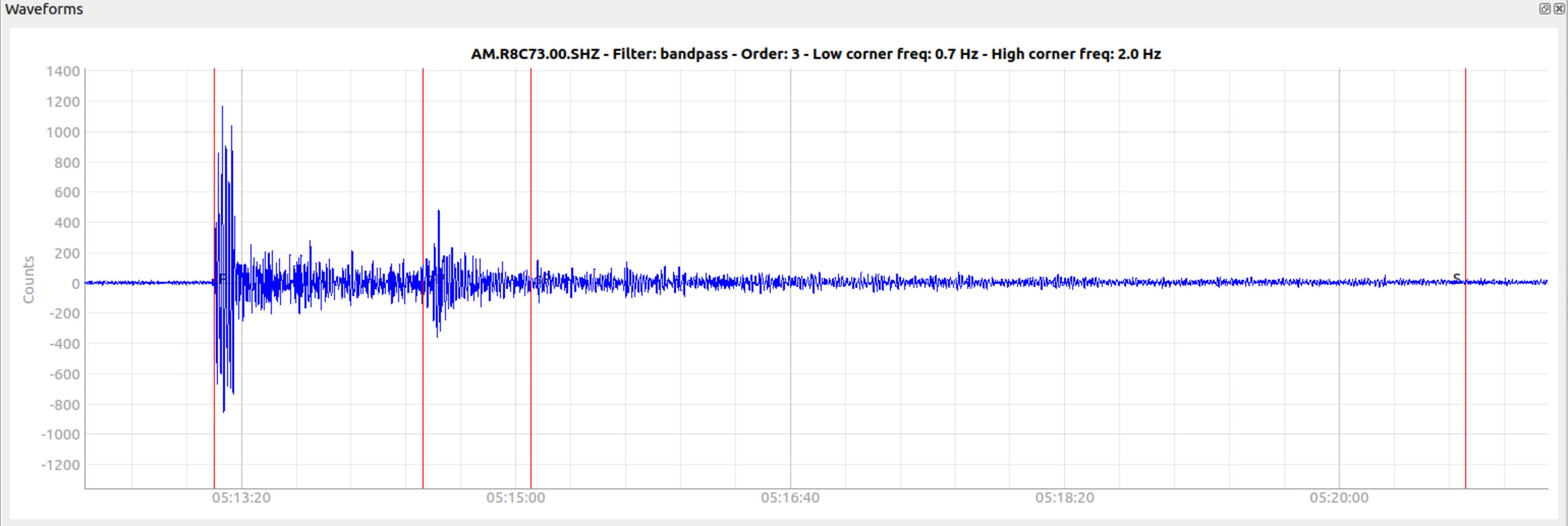
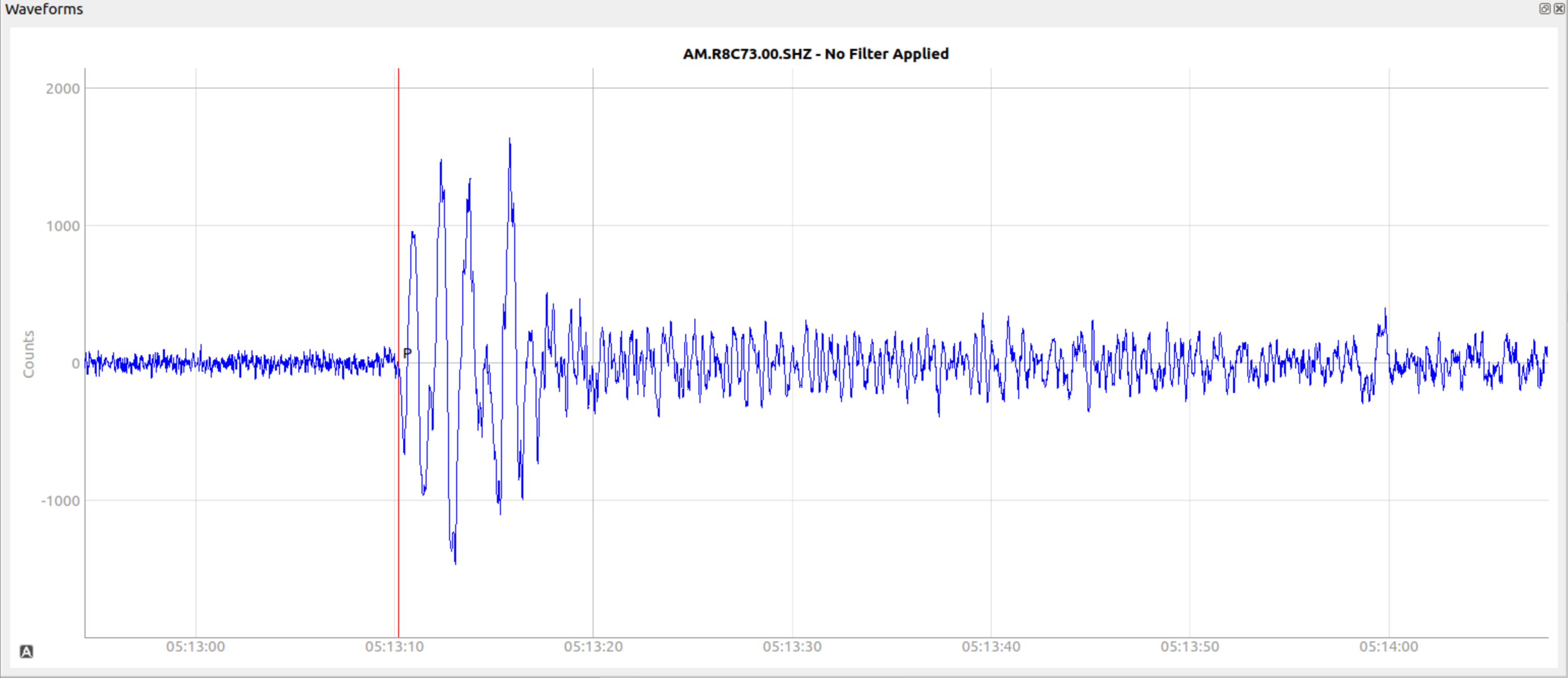
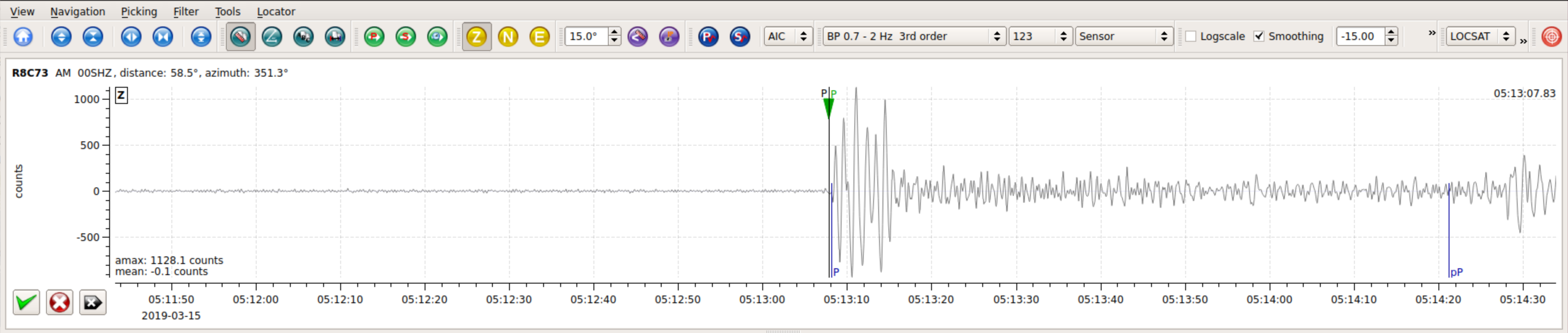
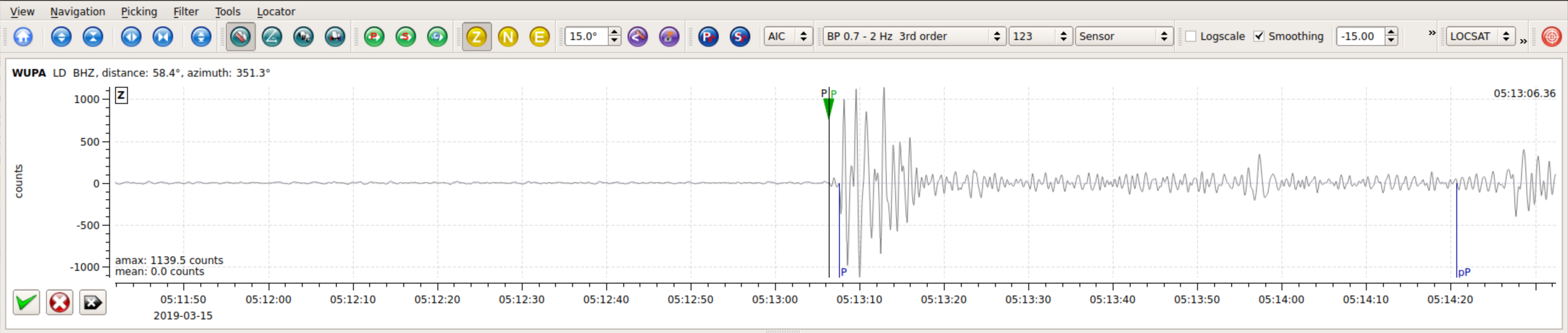
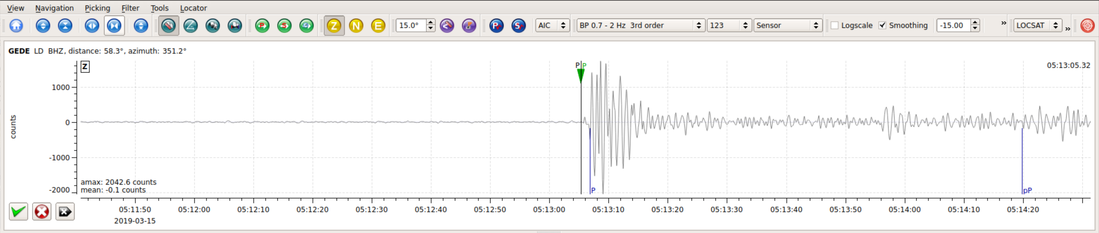
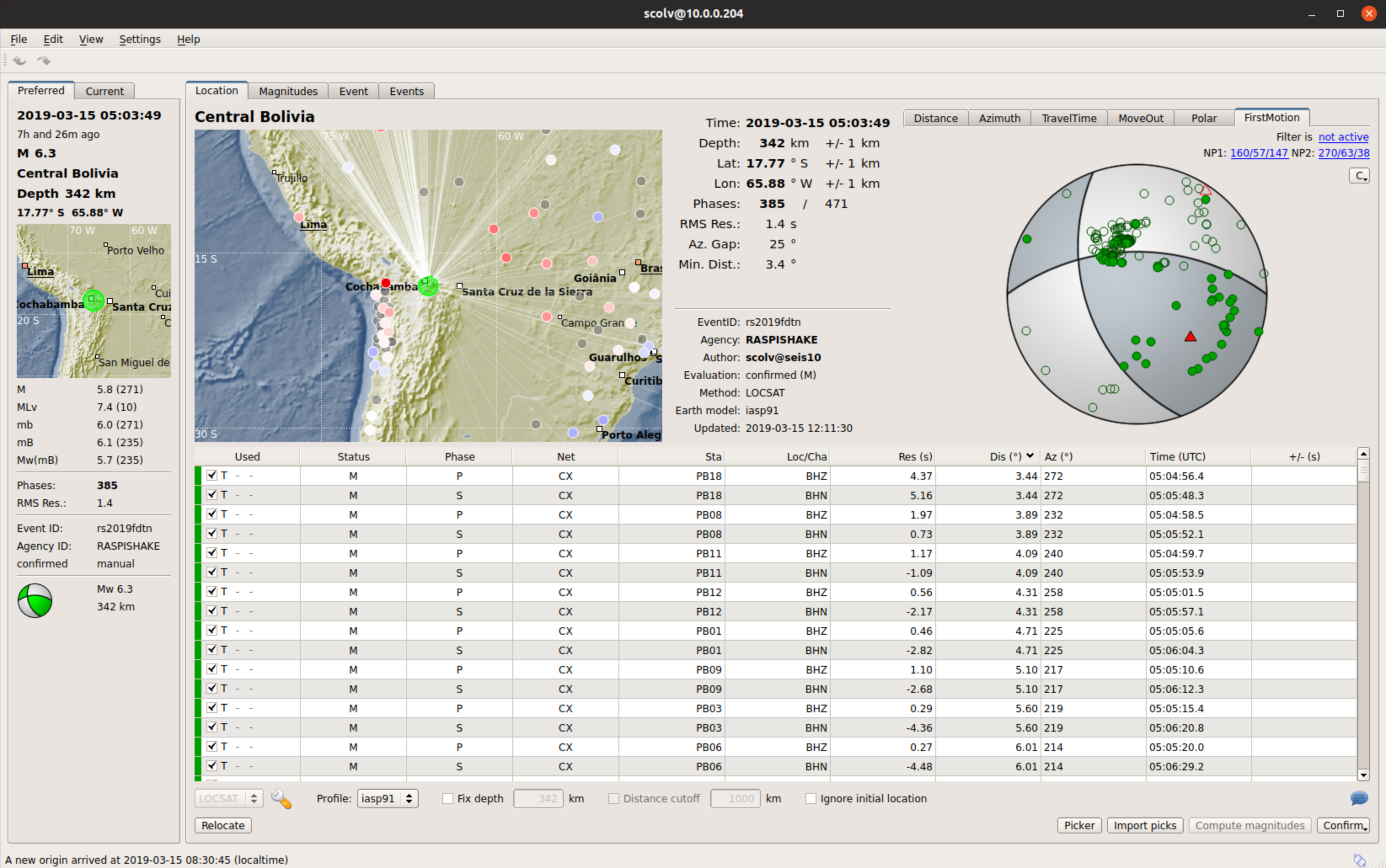
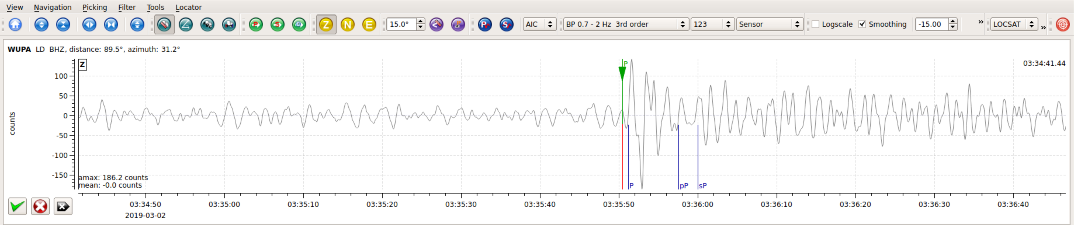
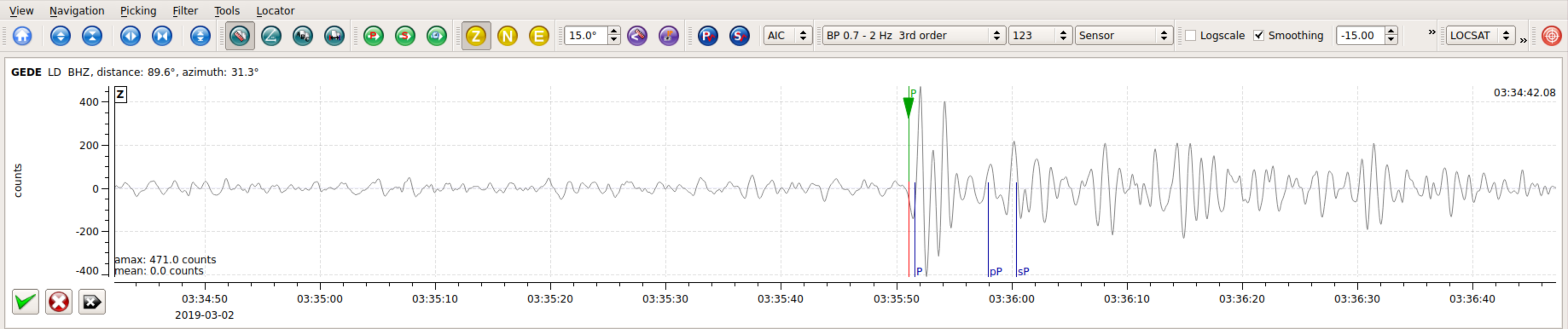
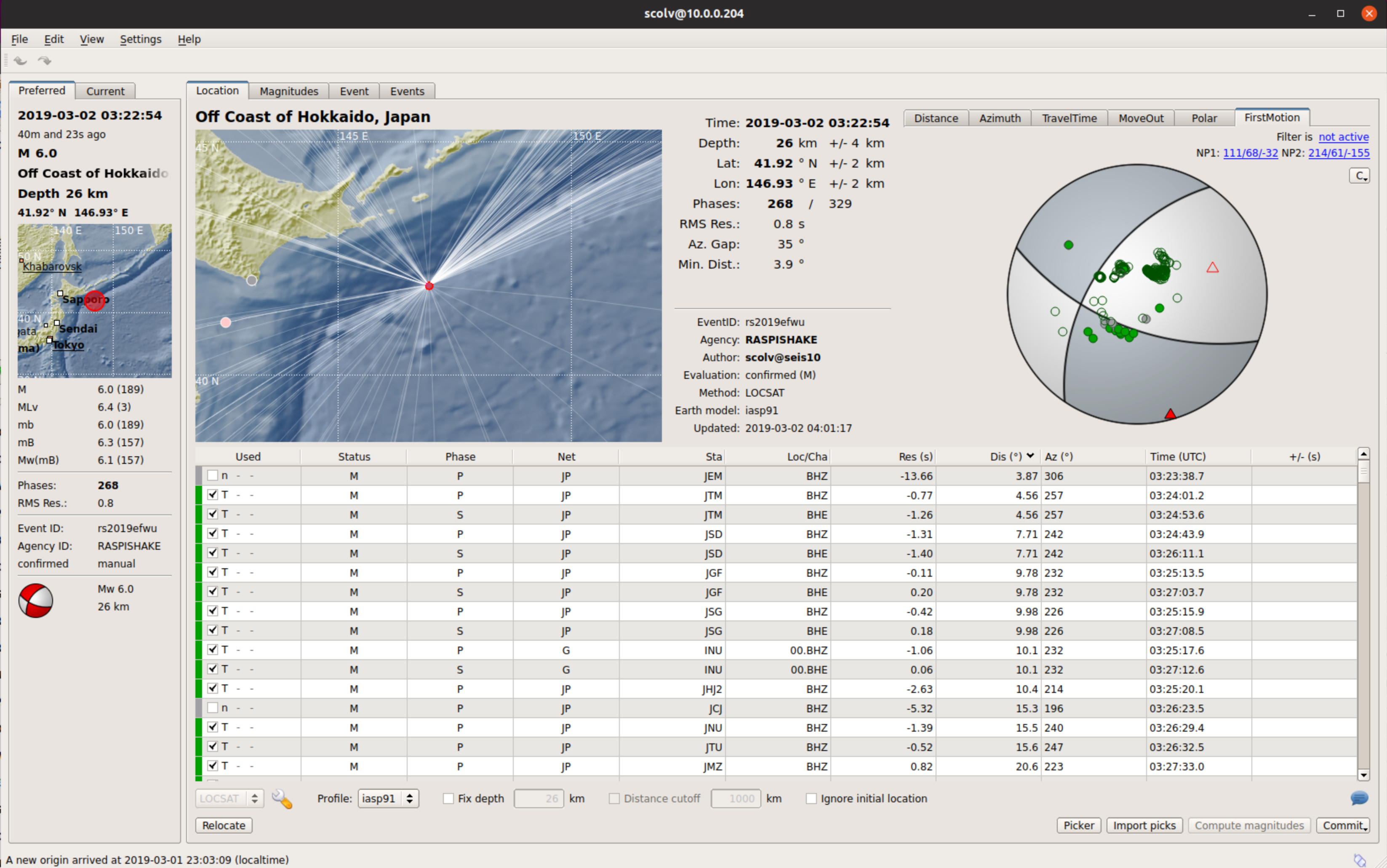
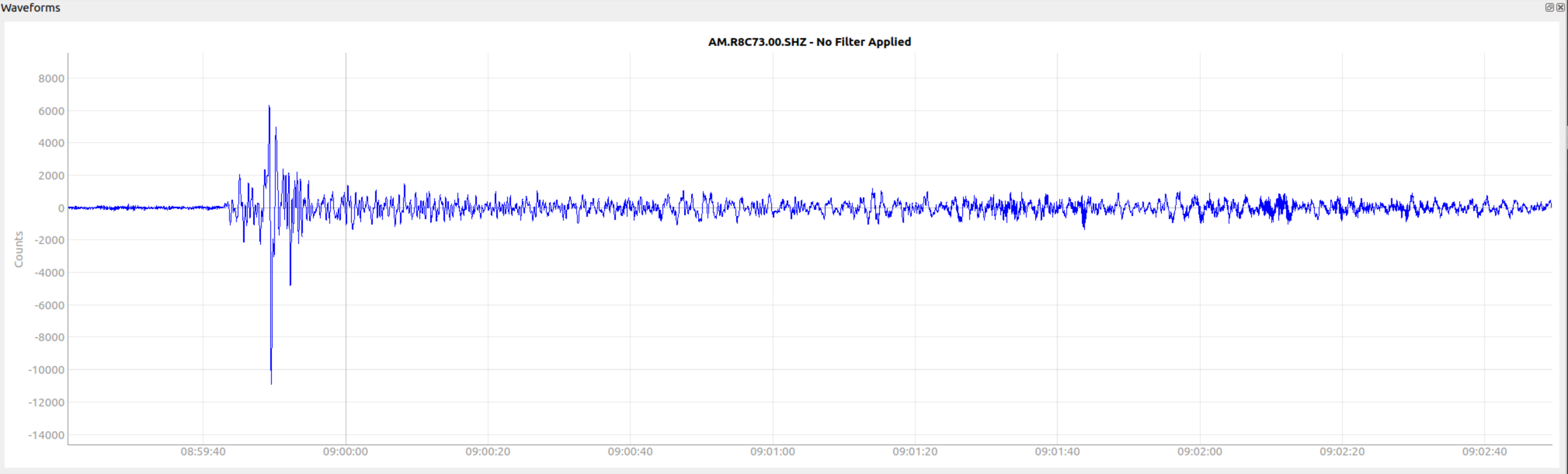
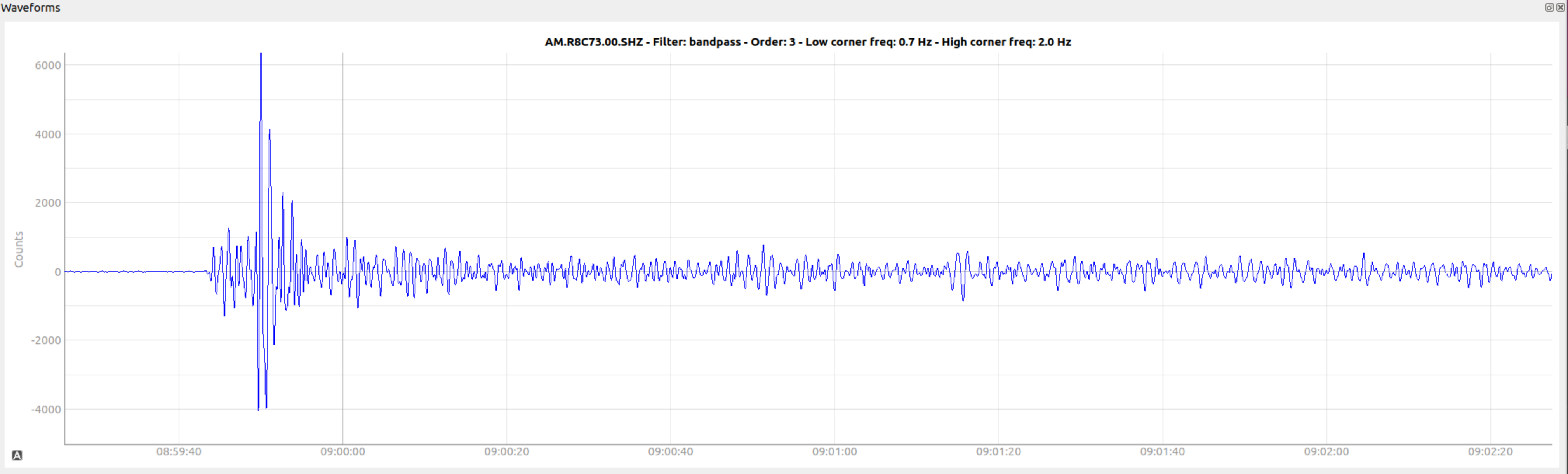
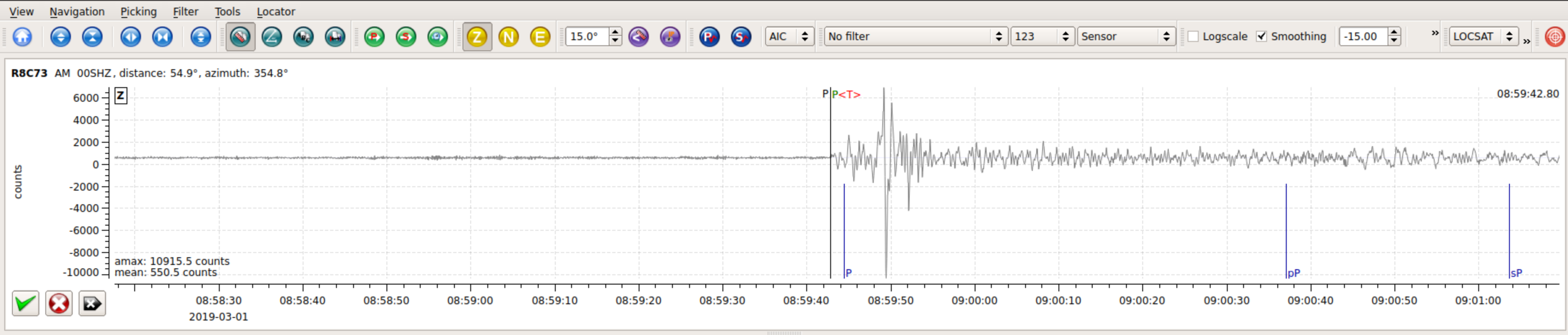
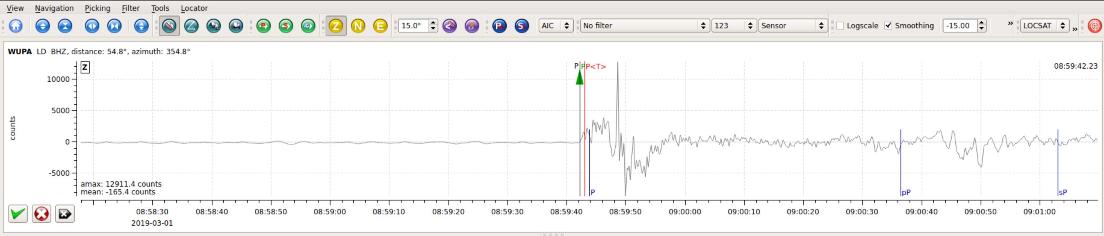
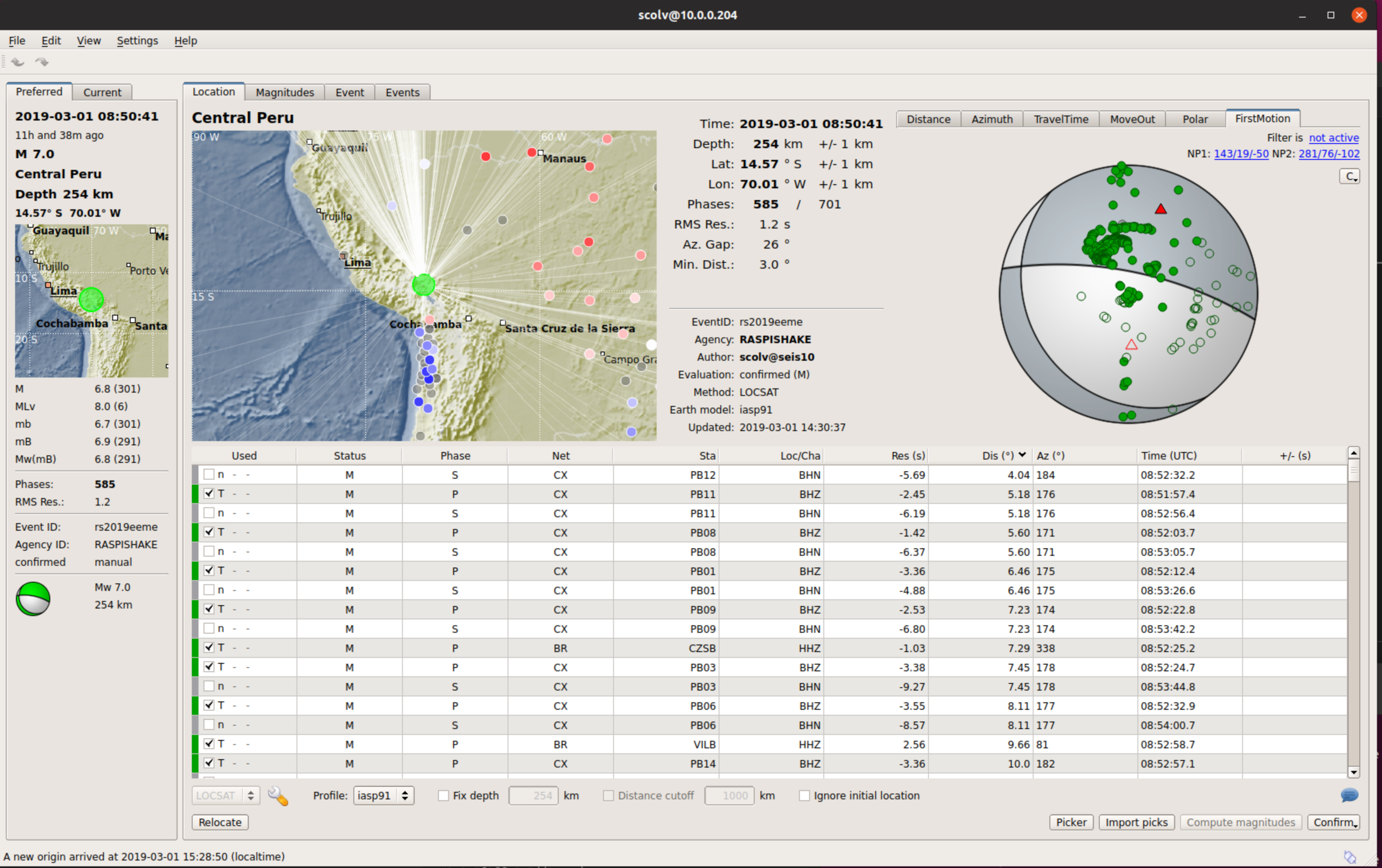
The March 1, 2019, M 7.0 Peru earthquake near Lake Titicaca, occurred as the result of normal faulting at an intermediate depth, approximately 260 km beneath southeastern Peru within the lithosphere of the subducted Nazca plate. Focal mechanism solutions indicate that rupture occurred on either a steeply dipping normal fault striking westward, or on a shallowly dipping normal fault striking to the southeast. Slip on a fault of either orientation would accommodate the down-dip extension of the Nazca slab. At the location of the earthquake, the oceanic Nazca plate moves east-northeast relative to the South America plate at a rate of about 71 mm/yr, subducting at the Peru-Chile Trench west of the Peruvian coast and sinking into the mantle beneath South America. Like most western South America earthquakes, this event was caused by strains generated by the ongoing subduction process.

Earthquakes like this event, with focal depths between 70 and 300 km, are commonly termed intermediate-depth earthquakes. Intermediate-depth earthquakes represent deformation within subducted slabs rather than at the shallow plate interface between subducting and overriding tectonic plates. They typically cause less damage on the ground surface above their foci than is the case with similar-magnitude shallow-focus earthquakes, but large intermediate-depth earthquakes may be felt at great distance from their epicenters. Deep-focus earthquakes, those with focal depths greater than 300 km, also occur in the subducted Nazca plate farther east from the Peru-Chile Trench, beneath western Brazil and central Argentina. Earthquakes have been reliably located to depths of about 650 km in this region.

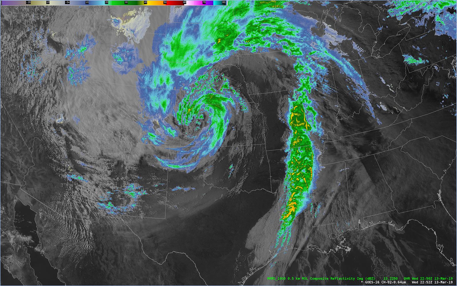
The Peru-Chile Trench is an area that hosts large earthquakes quite regularly. Within 500 km of the February 22nd earthquake, there have been 10 other intermediate depth earthquakes with magnitudes of 6.5+ over the preceding century. Today’s earthquake is the largest of these; another M 7.0 event occurred about 280 km to the northwest in July 1991, at a depth of about 100 km. That event caused some damage in Cuzco.

Heliocorder tracde of AM.R8C73.00.SHZ

Traces of AM.R8C73.00.SHZ with no filter and a 0.7 – 2 hz bandpass filter.

SeisComP3 traces for AM.R8C73.00.SHZ (Exton PA), LD.WUPA (West Chester PA), and LD.TUPA.HHZ (Ambler PA) showing the P wave arrivals.


Fault plane solution for the event.