Kamchatka Russia – M6.1 – Dec 24, 2018 at 12:41:19 UTC

Position: 55.417°N 164.435°E – Depth: 10 km

Jamaseis heliocoder trace of AM.RC8C73.00.SHZ. 
Distance: 72.0 Deg. 8,005 km
Azimuth: 44.3 Deg.

SeisComP3 traces for AM.R8C73.00.SHZ (Exton PA), LD.WUPA.BHZ (West Chester University, West Chester PA), and PE.PSUB.HHZ (Peen State Media PA campus) showing the P wave arrivals.

Kamchatka Russia – M7.3 – Dec 20, 2018 at 17:01:55 UTC

Position: 55.100°N 164.699°E – Depth: 16.6 km

Tectonic Summary

From The USGS Information Page:

The December 20, 2018 M7.3 earthquake east of Kamchatka peninsula, Russia, occurred as the result of oblique faulting in the northern Pacific Ocean, near the junction of the Kuril-Kamchatka and Alaska-Aleutian oceanic trenches. Focal mechanism solutions indicate slip occurred on a steeply dipping fault striking to the southwest, or on a moderately dipping fault striking northwest. At the location of this earthquake, the Pacific plate moves towards the northwest with respect to the North America plate at a rate of about 76 mm/yr, subducting beneath and translating past the North America plate at the Alaska-Aleutian trench immediately south of this event. The location, depth, and focal mechanism solution indicate this earthquake may have occurred as the result of interplate faulting along this plate boundary structure, or on a related fault taking up motion between these two plates. 

The region surrounding today’s earthquake is an active plate boundary and regularly experiences moderate to large earthquakes. Twenty-one other earthquakes of M6.5+ have occurred within 250 km of this event over the preceding century. Many of these occurred within the Kuril-Kamchatka subduction zone to the west of today’s earthquake. The largest nearby historic event in the Alaska-Aleutian system was a M7.0 earthquake to the east of today’s event in August 1925. A M6.7 event occurred to the northeast of today’s earthquake in December 2003. Events in this region are unlikely to cause earthquake-related damage due to their remote location, far from populations.

Jamaseis heliocoder traces of AM.RC8C73.00.SHZ and LD.WUPA.BHZ.
Distance: 72.1 Deg. 8,019 km
Azimuth:44.4 Deg.

SeisComP3 traces for AM.R8C73.00.SHZ (Exton PA), LD.WUPA.BHZ (West Chester University, West Chester PA), and PE.PSUB.HHZ (Media PA) showing the P wave arrivals.

Southeastern Pennsylvania – M2.4 – Dec, 20, 2018 at 14:56:59 UTC

Position: 39.99°N   75.61.170°W – Depth: 4 km

This was a very small tremor that occurred very near our location. It could have been either an earthquake or a quarry blast (there is a quarry a few kilometers from here). While the quake was not felt here, I have at least one report of shaking in the area. The USGS did not report anything on their site however.

SeisComP3 traces for AM.R8C73.00.SHZ (Exton PA), LD.WUPA.BHZ (West Chester University, West Chester PA), and PE.PSUB.HHZ (Peen State, Media) of the quake. These are all filtered with a 1Hz highpass Butterworth filter.

Pacific Ocean South of Easter Island – M6.2 – Dec 19, 2018 at 01:37:40 UTC

Position: 36.118°S 101.019°W – Depth: 10.0 km

SeisComP3 traces for AM.R8C73.00.SHZ (Exton PA) and LD.WUPA.BHZ (West Chester University, West Chester PA) showing the P wave arrivals.

Distance:  79.5 Deg – 8,823 Km

Azimuth: 19.6 Deg

Tennessee – M4.4 Dec 12, 2018 at 09:14:43 UTC

Position: 35.614°N 84.740°W – Depth: 9.0 km

USGS Information Page

Not a big earthquake by most standards, but this occurred in the eastern United States where earthquakes are not too common. It was felt as far away as Atlanta GA.

Tectonic Summary

From the USGS Information Page:

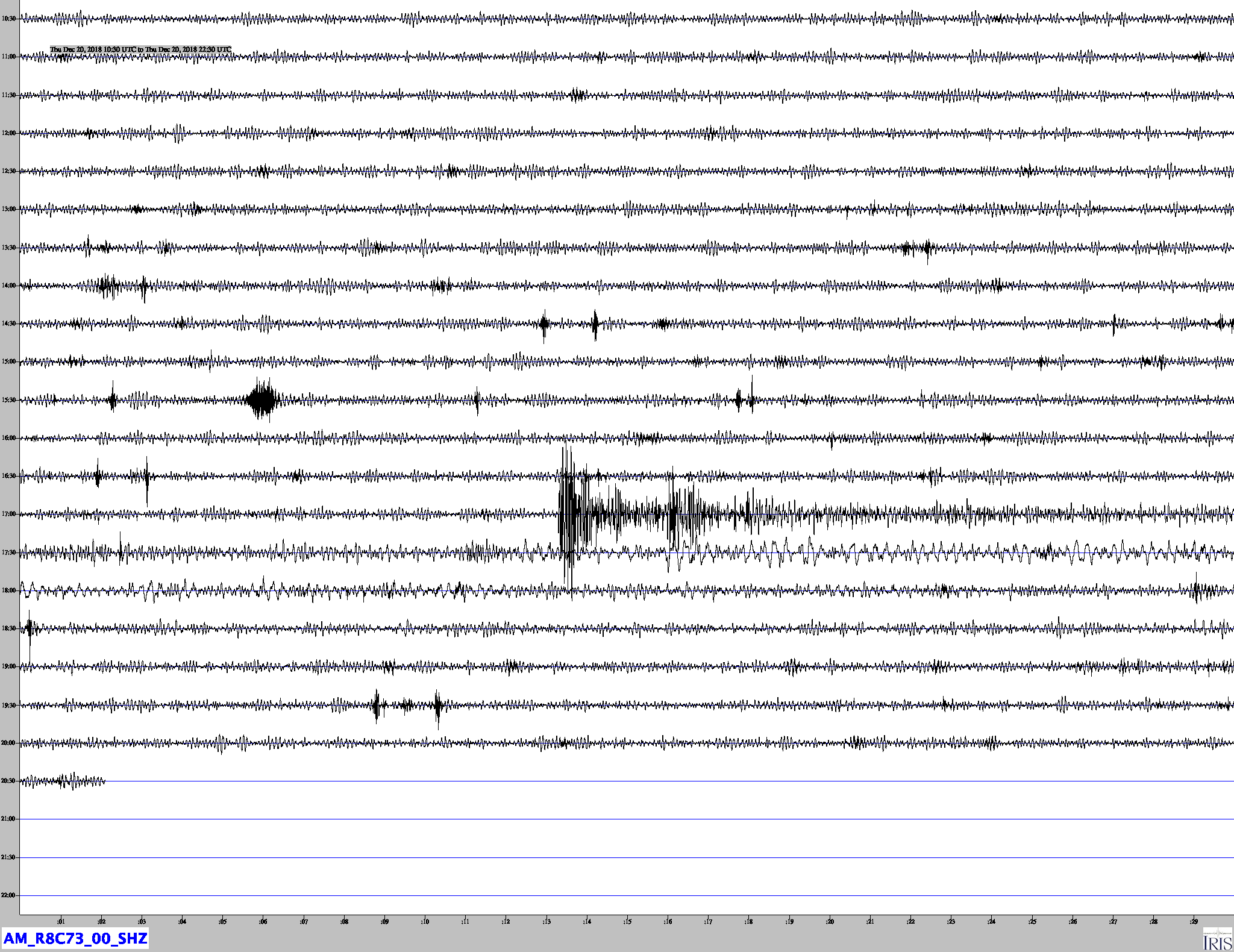
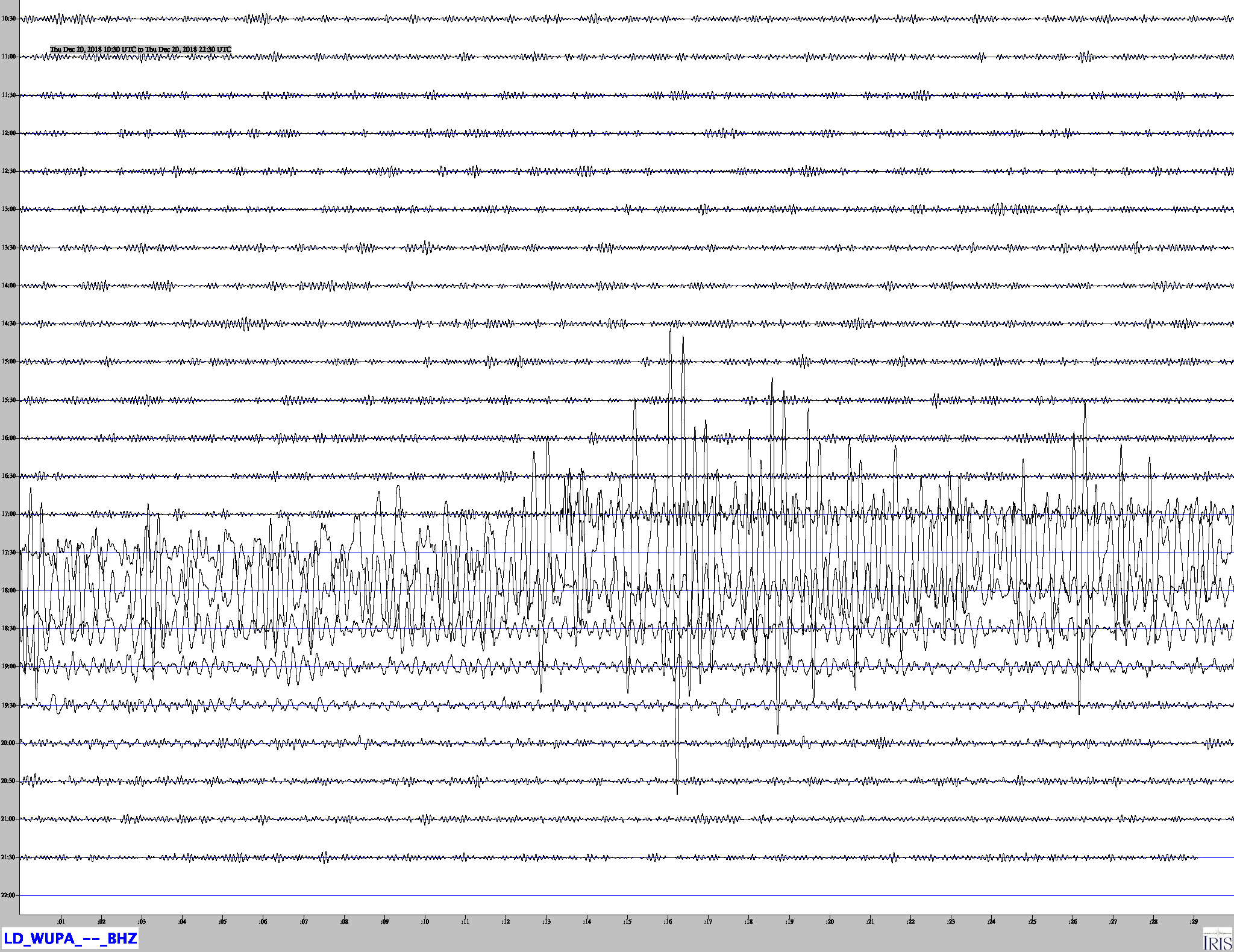
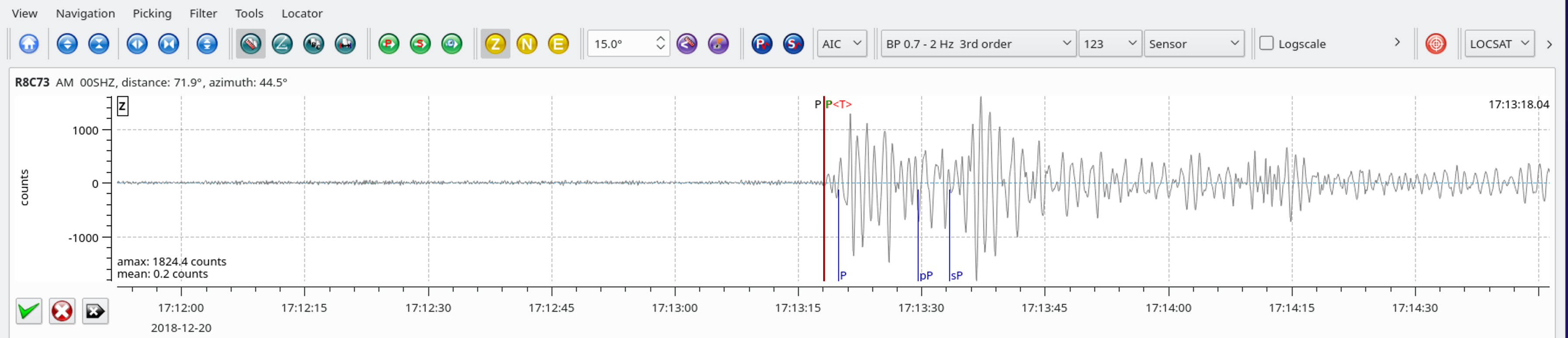
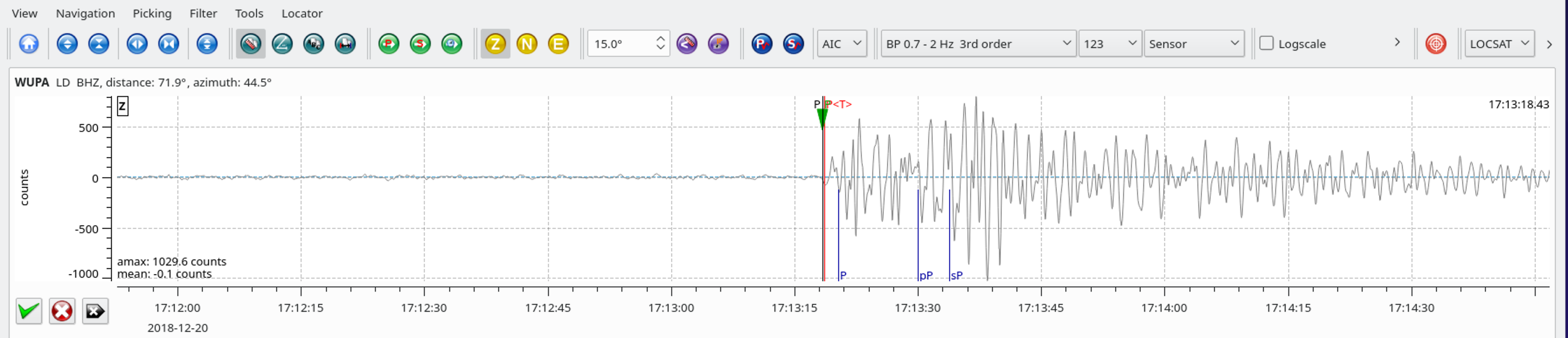
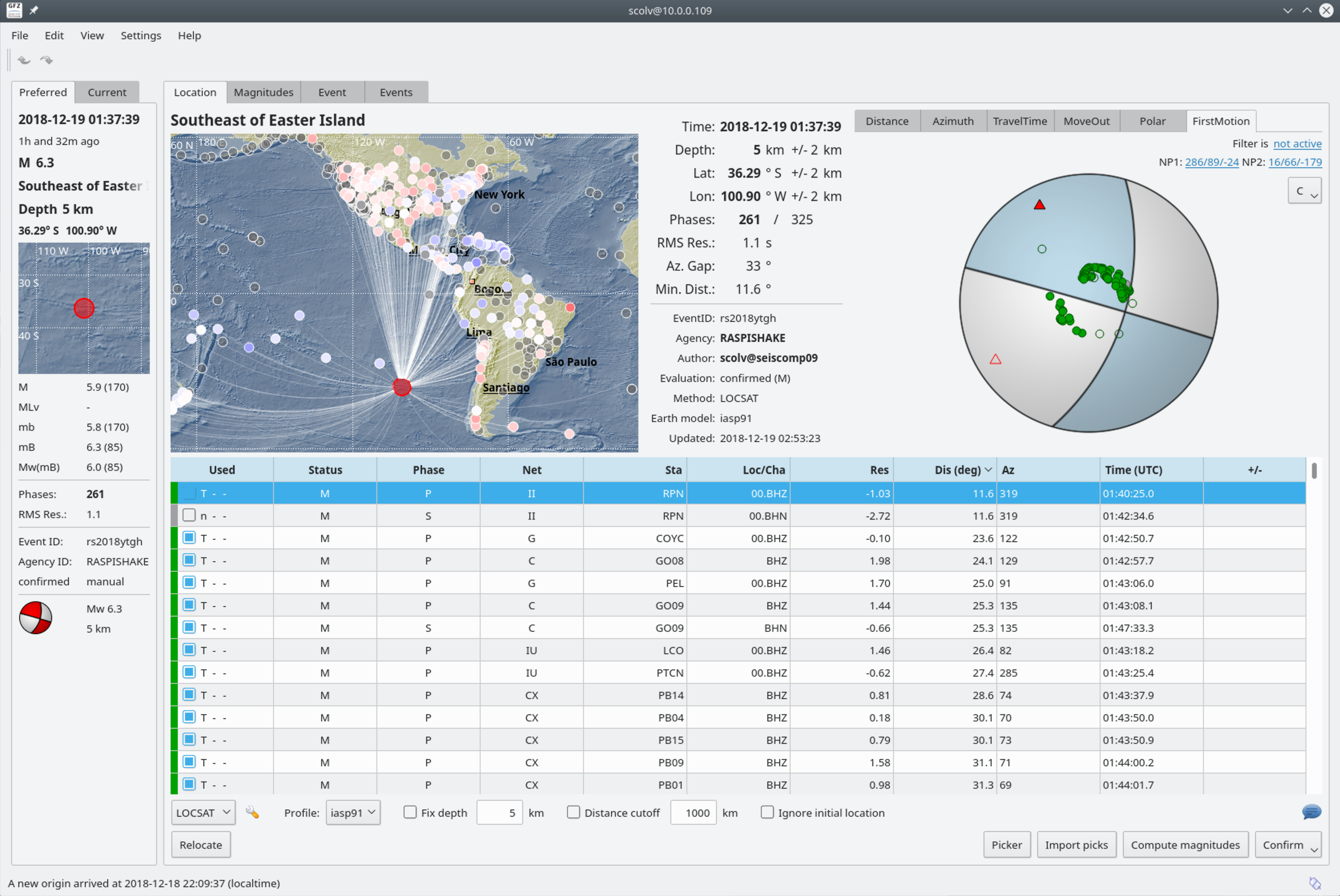
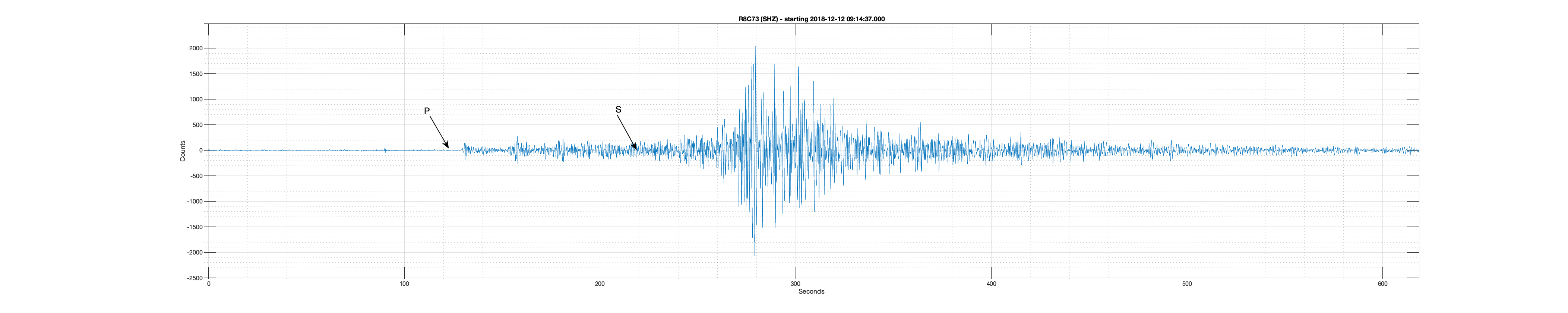
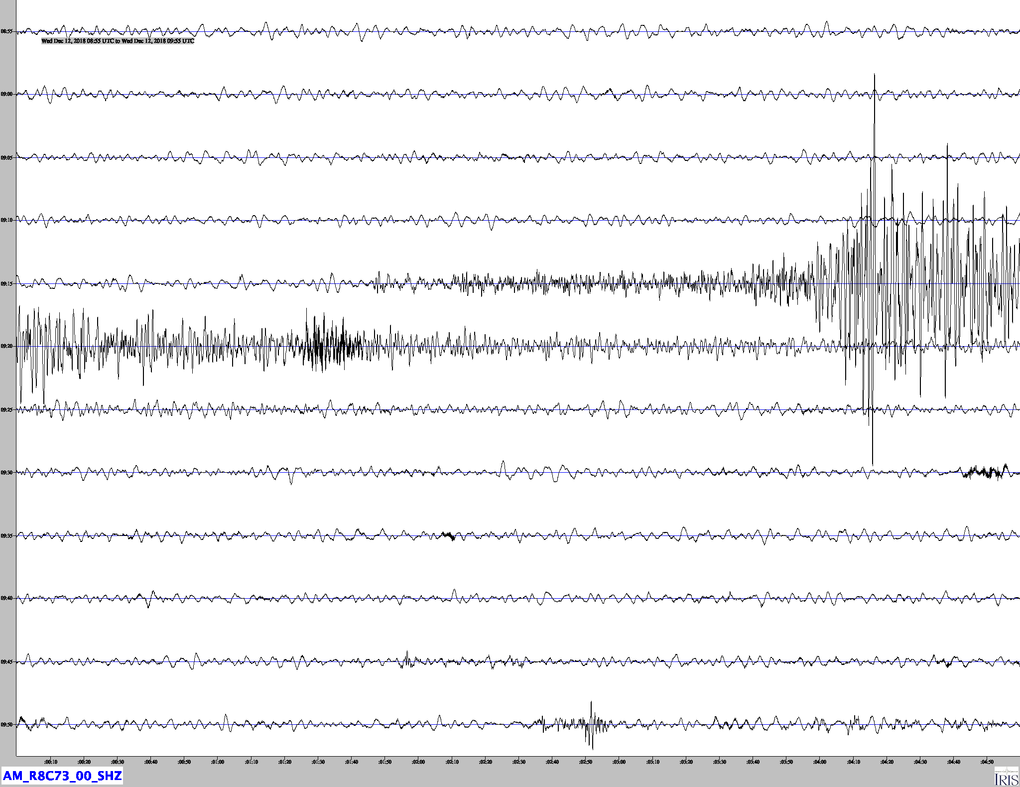
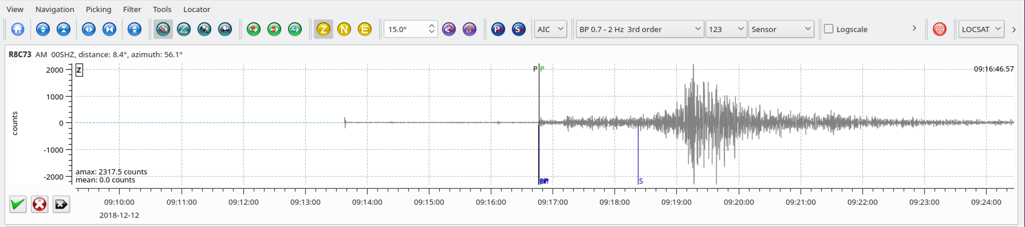
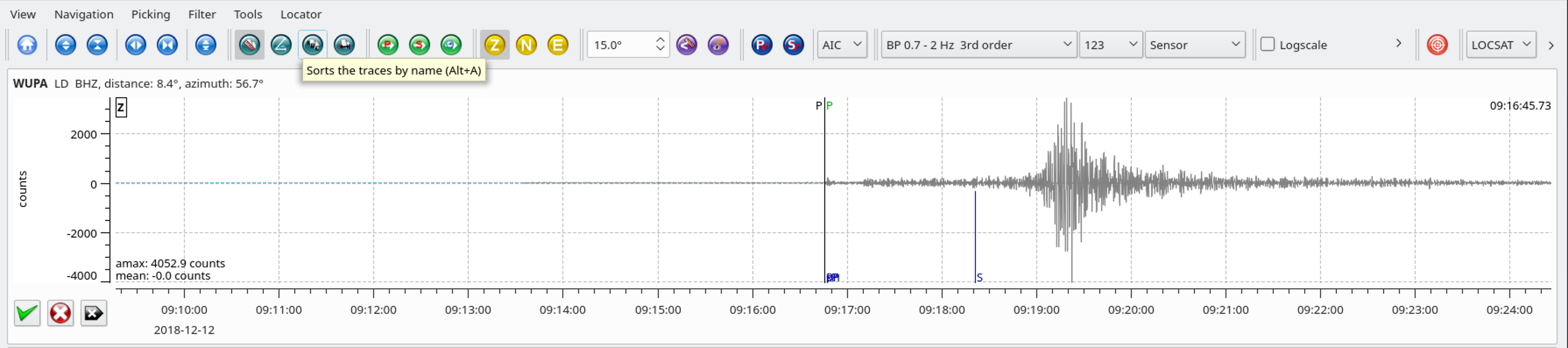
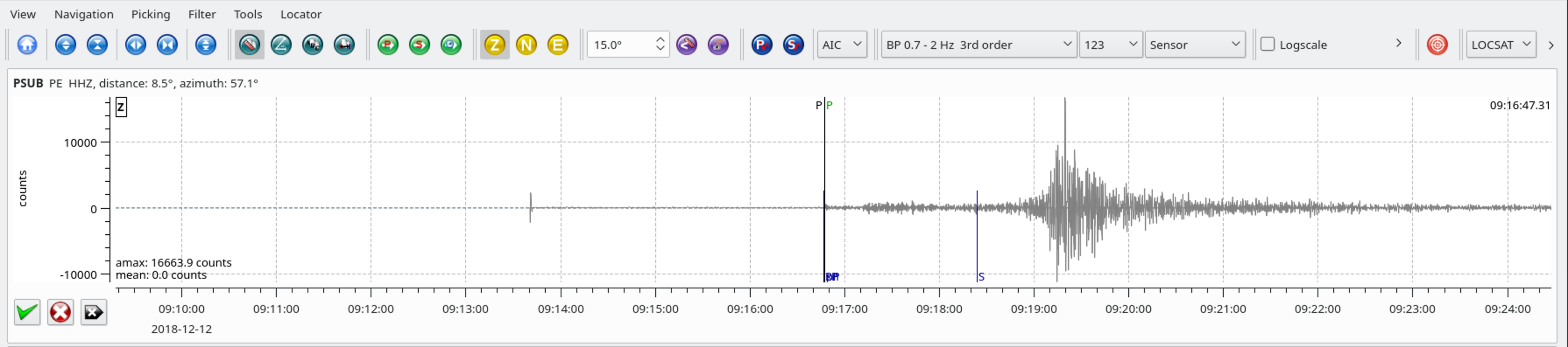
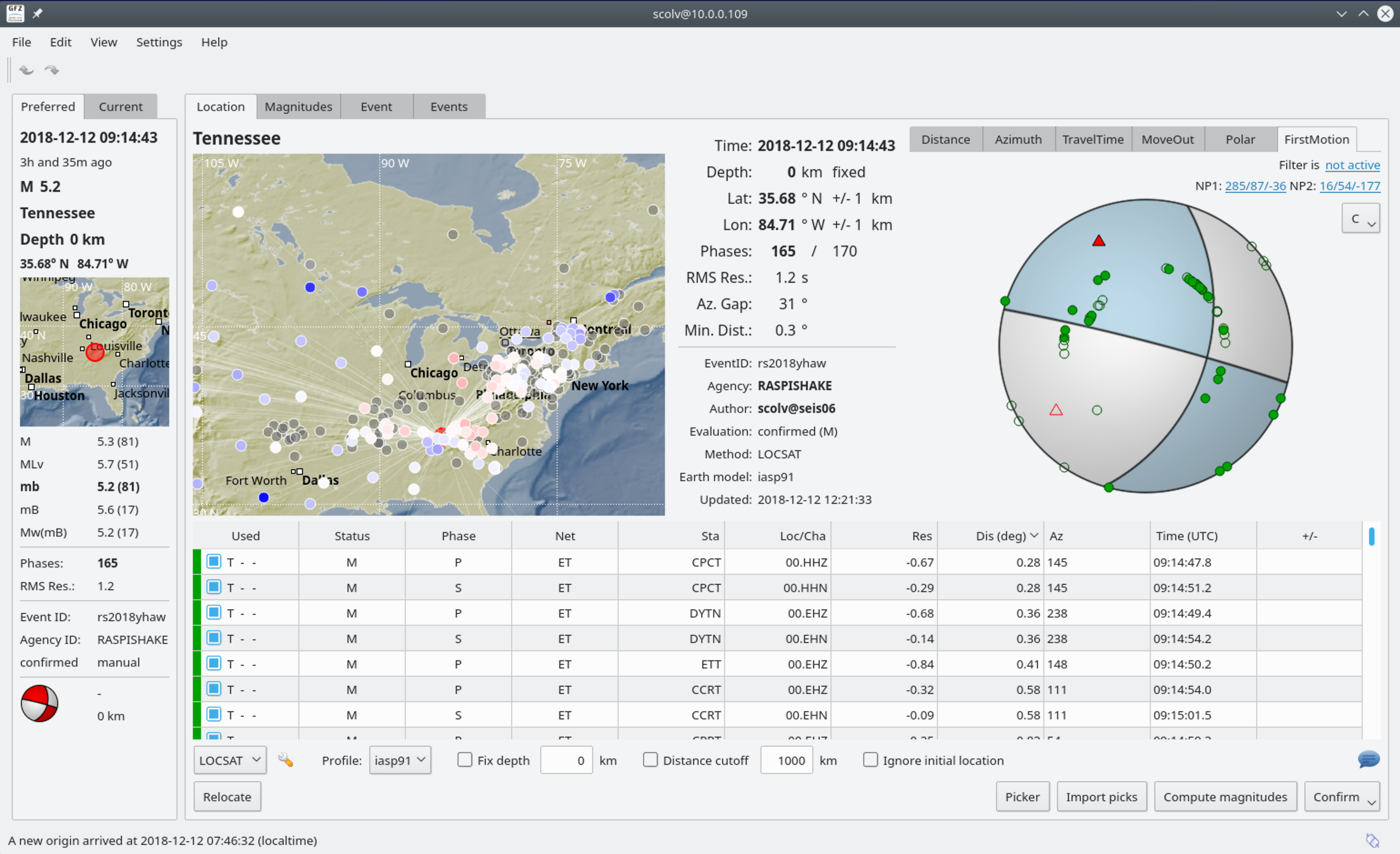
The December, 12, 2018 9:14 (UTC) Tennessee earthquake occurred in the Eastern Tennessee Seismic Zone (ETSZ). The ETSZ extends across eastern Tennessee and northwestern Georgia into northeastern Alabama. It is one of the most active earthquake areas in the Southeast. Although the zone is not known to have had a large earthquake, a few earthquakes in the zone have caused slight damage. Earthquakes too small to cause damage are felt about once a year. Earthquakes too small to be felt are abundant in the seismic zone, and seismographs record about 120 each year. Notable earthquakes in the region include the 2003-04-29 M 4.6 – 9km NE of Fort Payne, Alabama and the 1973-11-30 M 4.7 – eastern Tennessee earthquakes.


Earthquakes in the central and eastern U.S., although less frequent than in the western U.S., are typically felt over a much broader region. East of the Rockies, an earthquake can be felt over an area as much as ten times larger than a similar magnitude earthquake on the west coast. A magnitude 4.0 eastern U.S. earthquake typically can be felt at many places as far as 100 km (60 mi) from where it occurred, and it infrequently causes damage near its source. A magnitude 5.5 eastern U.S. earthquake usually can be felt as far as 500 km (300 mi) from where it occurred, and sometimes causes damage as far away as 40 km (25 mi). The December, 12, 2018 M4.4 Decatur, Tennessee earthquake was felt over a 500 km (310 mile) swath from Southern Kentucky to Fort Benning, Georgia. Reports of strong shaking capable of causing slight damage have been reported near the epicenter.

Earthquakes everywhere occur on faults within bedrock, usually miles deep. Most of eastern Tennessee’s bedrock originated several hundred million years ago, as the Appalachian Mountains were formed.

At well-studied plate boundaries like the San Andreas fault system in California, often scientists can determine the name of the specific fault that is responsible for an earthquake. In contrast, east of the Rocky Mountains this is rarely the case. The Eastern Tennessee seismic zone is far from the nearest plate boundaries, which are in the center of the Atlantic Ocean and in the Caribbean Sea. The Eastern Tennessee seismic zone is laced with known faults, but numerous smaller or deeply buried faults remain undetected. Even the known faults are poorly located at earthquake depths. Accordingly, few, if any, earthquakes in the Eastern Tennessee seismic zone can be linked to named faults. It is difficult to determine if a known fault is still active and could slip and cause an earthquake. As in most other areas east of the Rockies, the best guide to earthquake hazards in the seismic zone is the earthquakes themselves.

Jamaseis heliocoder trace of AM.RC8C73.00.SHZ. 
Distance: 8.5 Deg. 940 km
Azimuth: 55.9 Deg.

SeisComP3 waveform traces for AM.R8C73.00.SHZ (Exton PA), LD.WUPA.BHZ (West Chester University, West Chester PA), and PE.PSUB.HHZ (Media PA). 

SeisComP3 display showing the fault plane solution for this event.

Another Heliocoder trace of AM.R8C73.00.SHZ