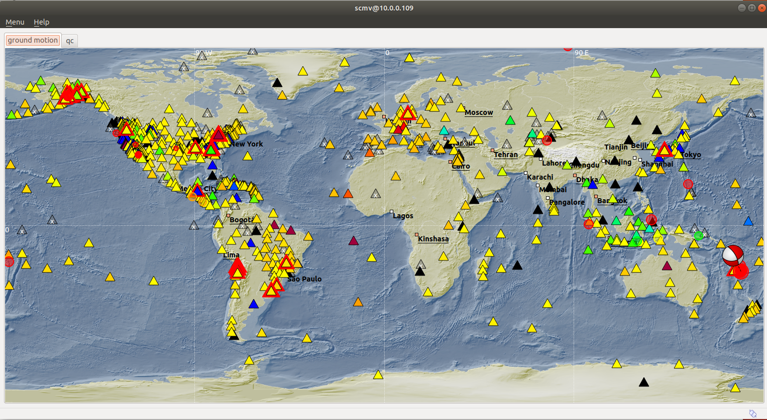
South Sandwich Islands – M7.1 – Dec 11, 2018 at 02:26:32 UTC
Position: 58.598°S 26.466°W – Depth: 164.7 Km
Tectonic Summary
From the USGS Information Page
The December 11, 2018 M 7.1 earthquake in the South Sandwich Islands occurred as the result of oblique-reverse faulting at an intermediate depth in the Scotia subduction zone. The focal mechanism solution indicates slip occurred on either a shallowly dipping fault striking southeast, or on a steep fault striking to the north. At the location of this earthquake, the South America plate moves to the west with respect to the South Sandwich plate at a rate of 73 mm/yr, subducting beneath the South Sandwich Islands at the oceanic trench about 140 km east of this earthquake. The depth and focal mechanism solution of this event indicate it occurred as the result of intraplate faulting within the lithosphere of the subducting South America plate, rather than on the shallower thrust faulting plate boundary between the two plates.
Earthquakes such as this event, with focal depths between 70 and 300 km, are commonly termed “intermediate-depth” earthquakes. Intermediate-depth earthquakes represent deformation within subducted slabs rather than at the shallow plate interface between subducting and overriding tectonic plates. They typically cause less damage on the ground surface above their foci than is the case with similar magnitude shallow-focus earthquakes, but large intermediate-depth earthquakes may be felt at great distance from their epicenters. Earthquakes have been reliably located to depths close to 300 km in this region. Over the previous century, there have been 14 M6+ earthquakes within 250 km of today’s event, and only 1 other M7+ event – a M 7.3 earthquake in September 1961, 75 km to the south of the December 11, 2018 event. None of these earthquakes are known to have caused fatalities, likely because of their remote location far from population centers that might be vulnerable to earthquake shaking.
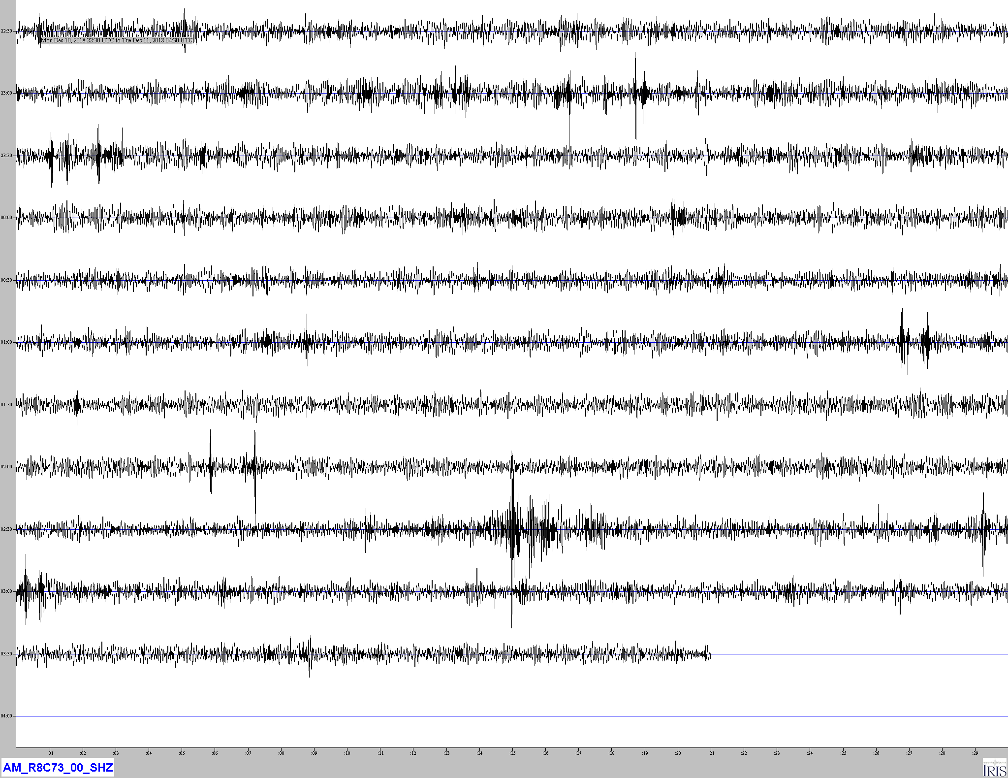
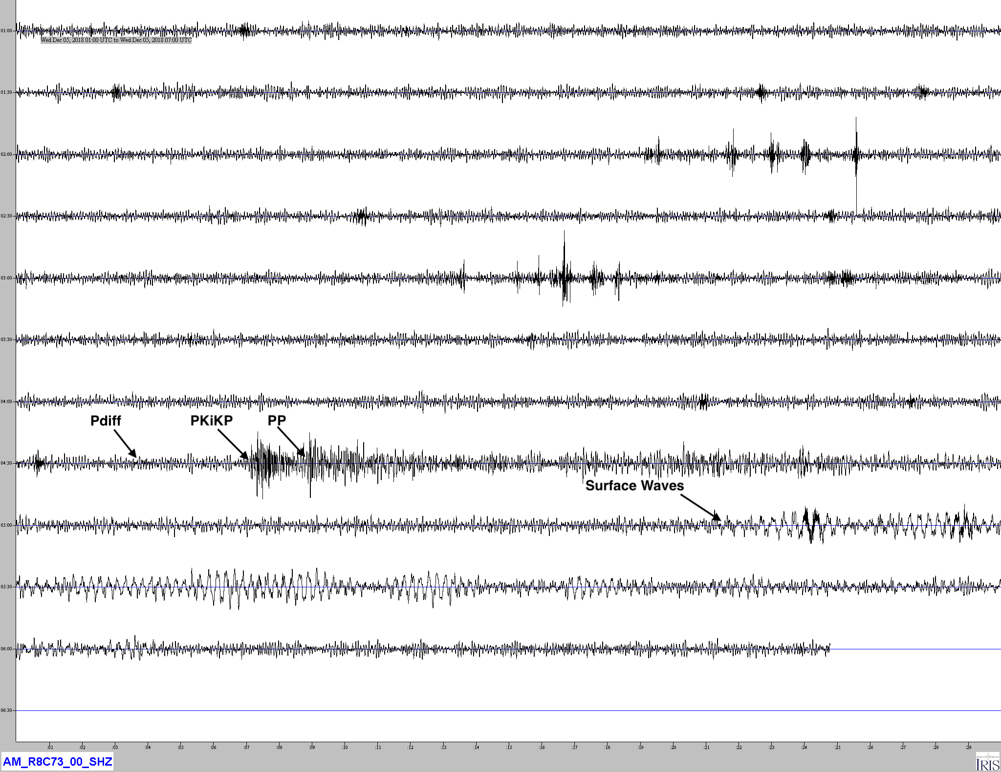
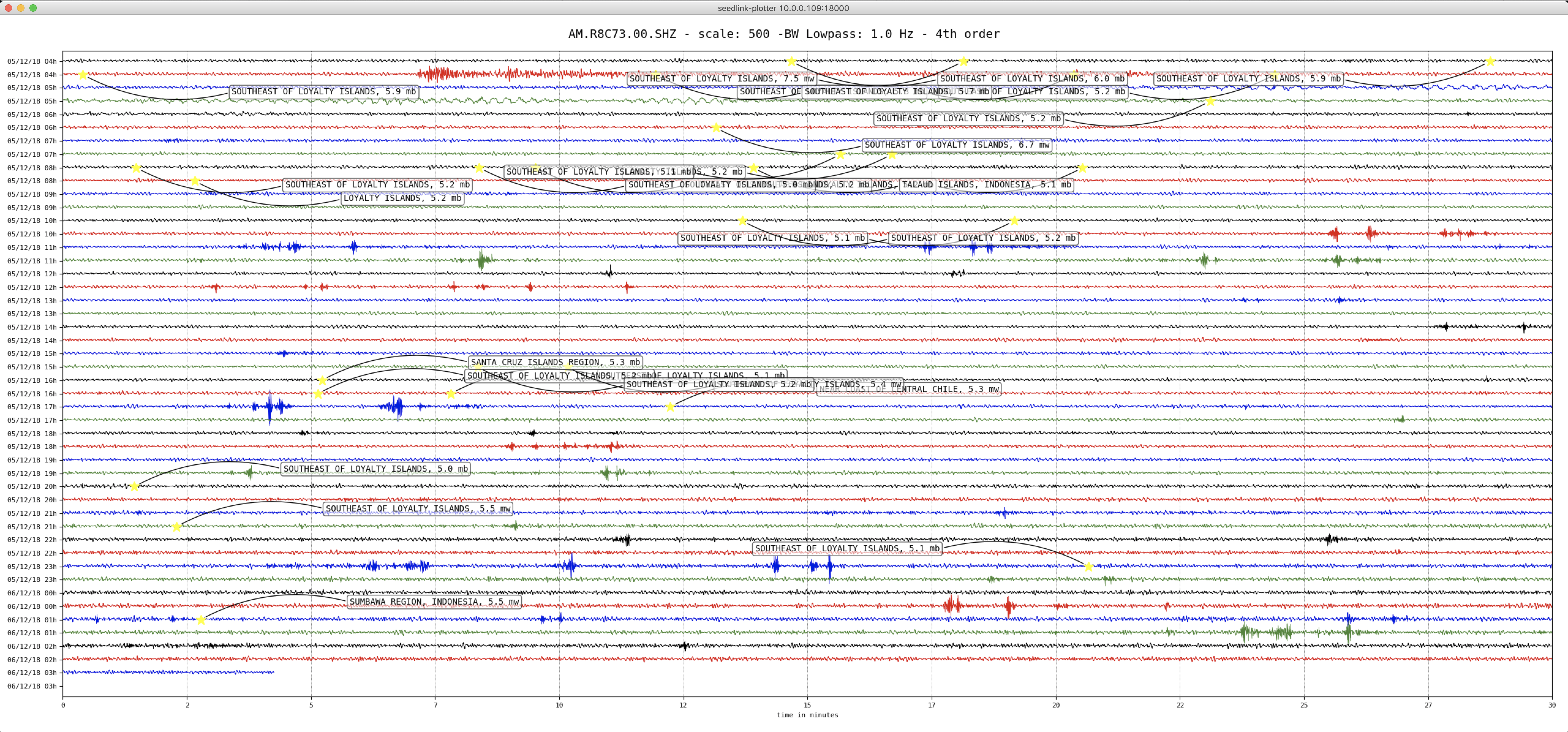
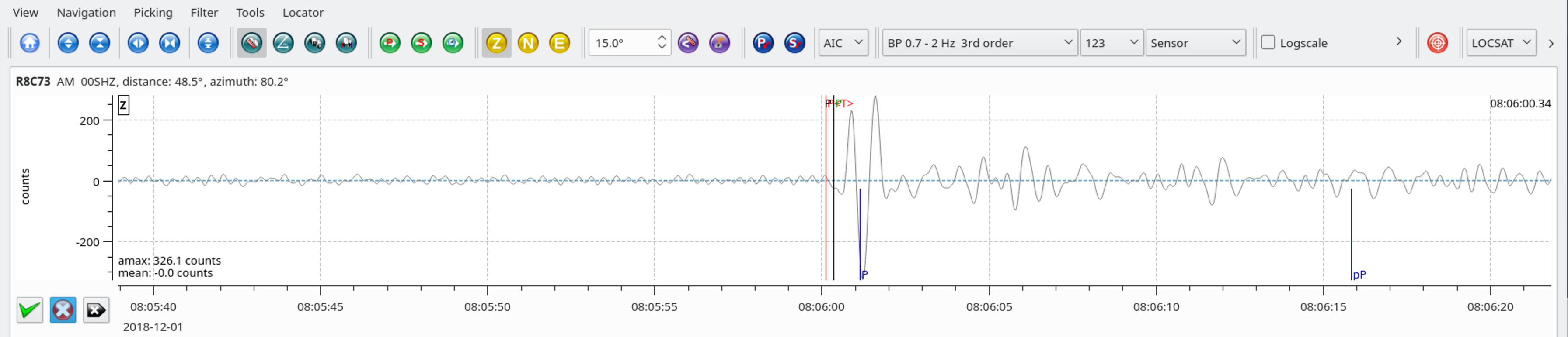
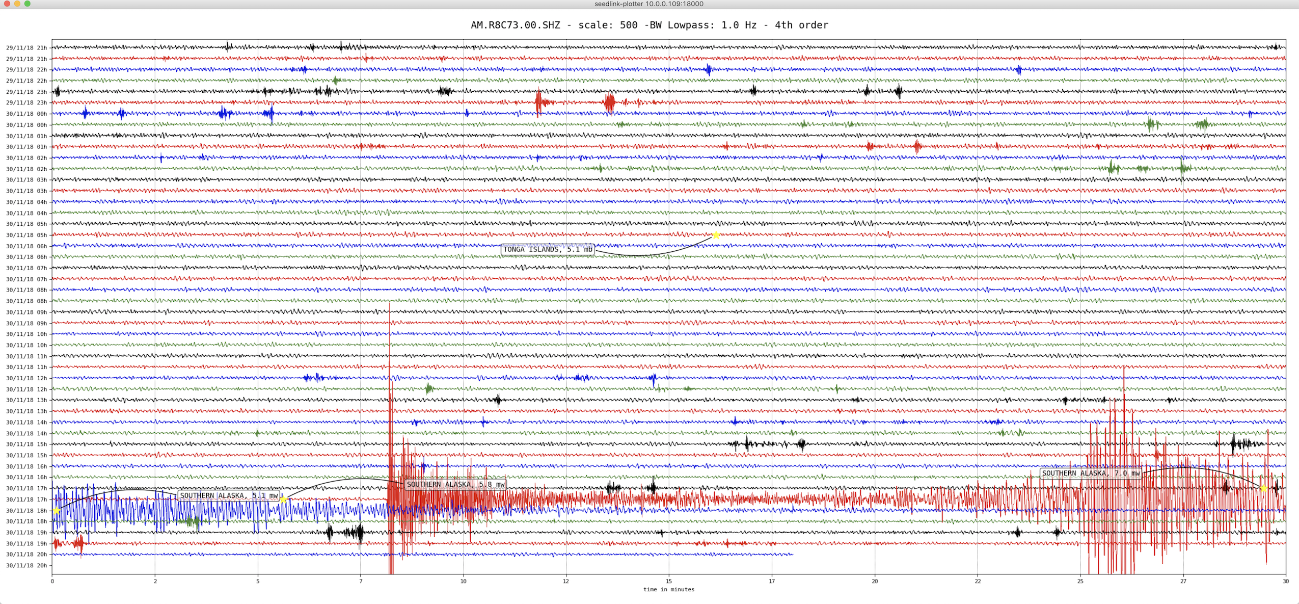
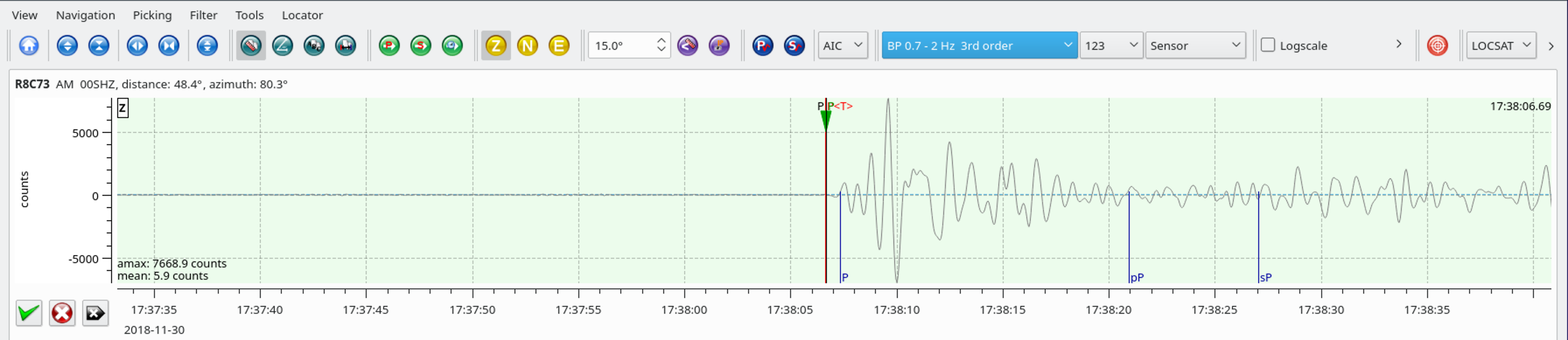
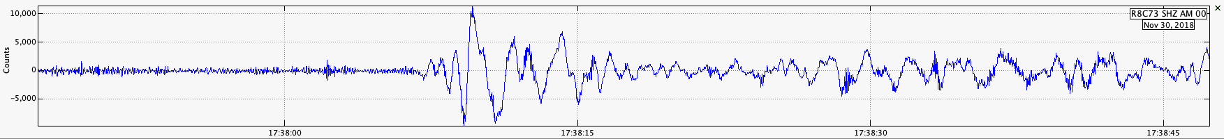
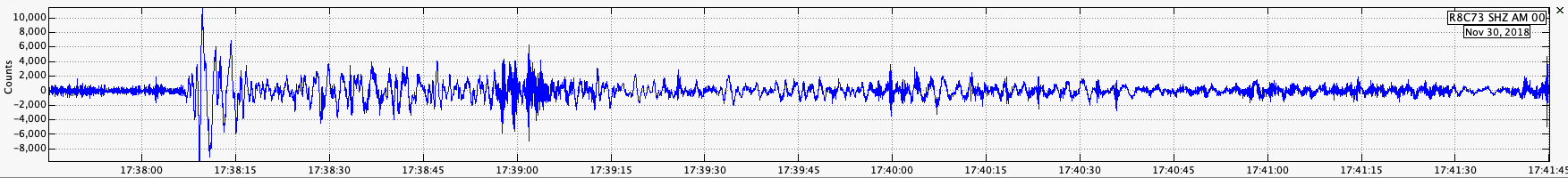
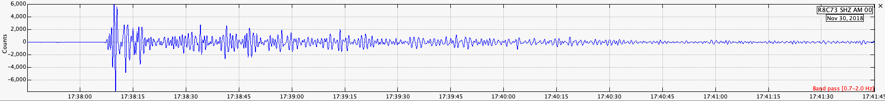
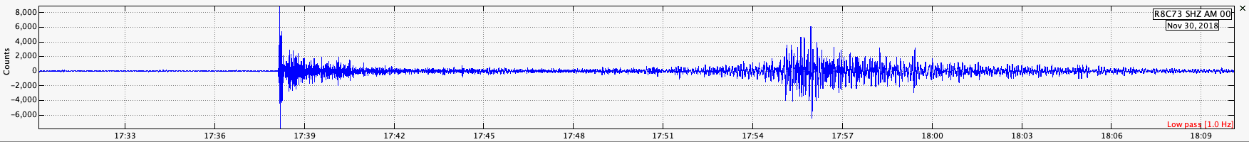
Jamaseis heliocoder trace of AM.RC8C73.00.SHZ.
Distance: 106.6 Deg. 11,837 Km
Azimuth: 322.7 Deg.
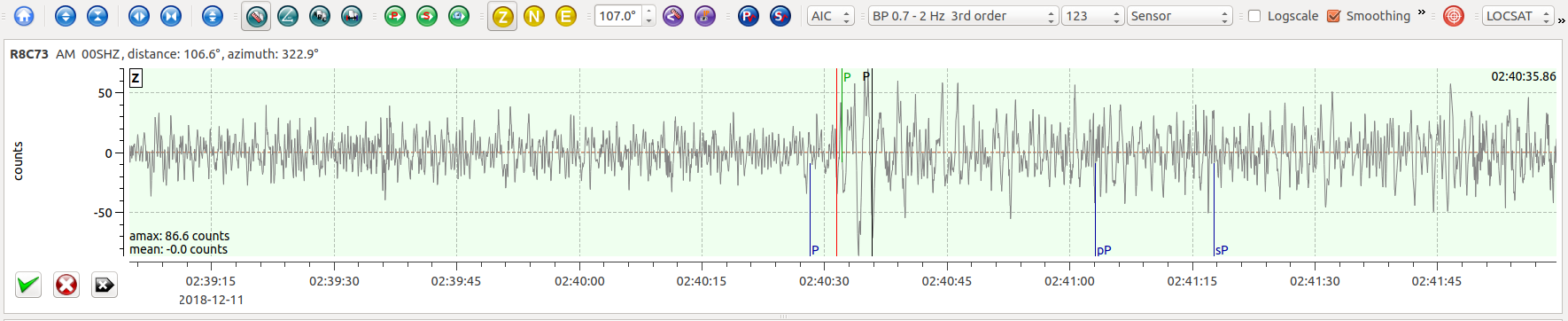
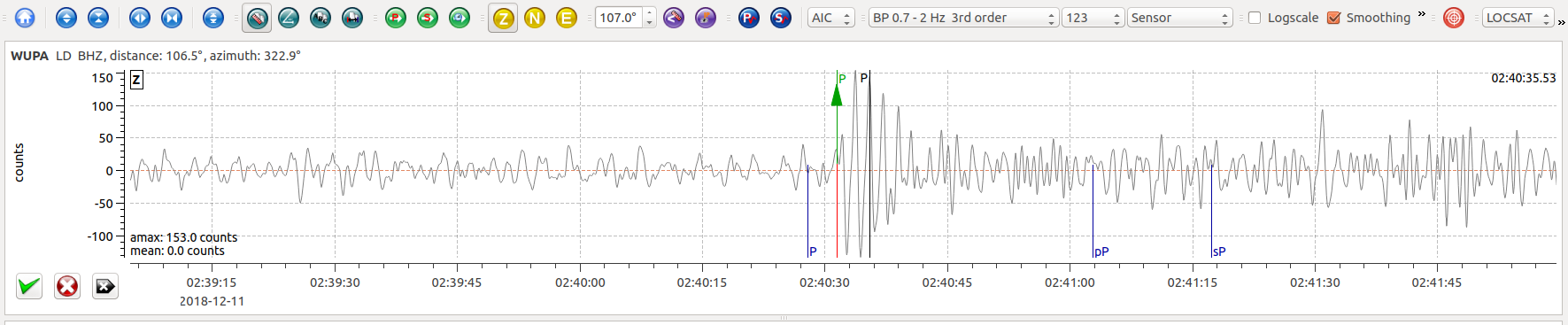
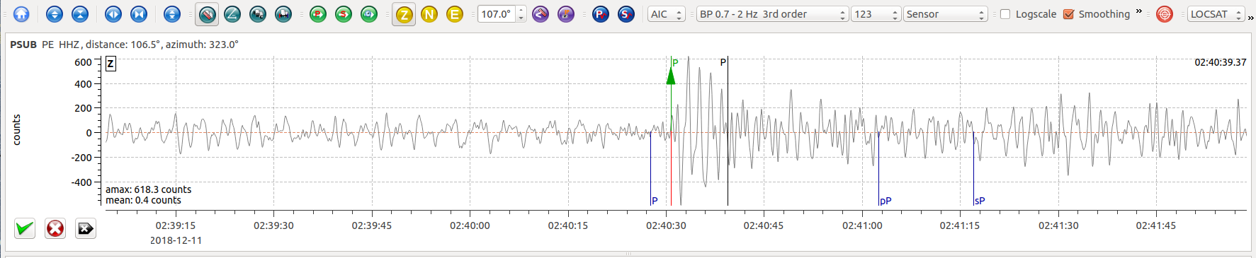
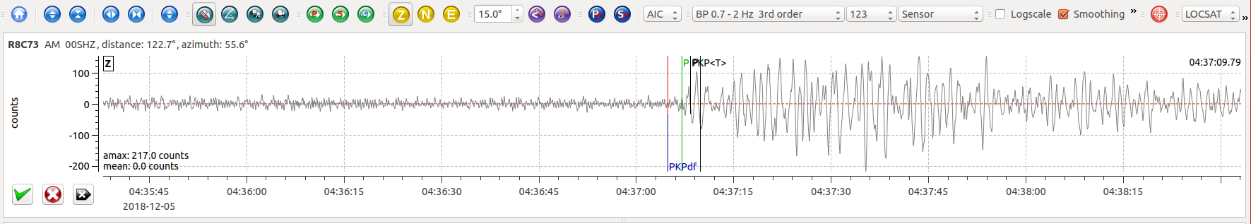
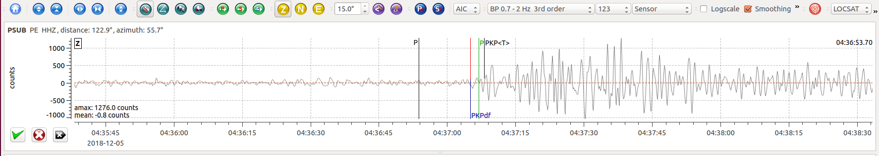
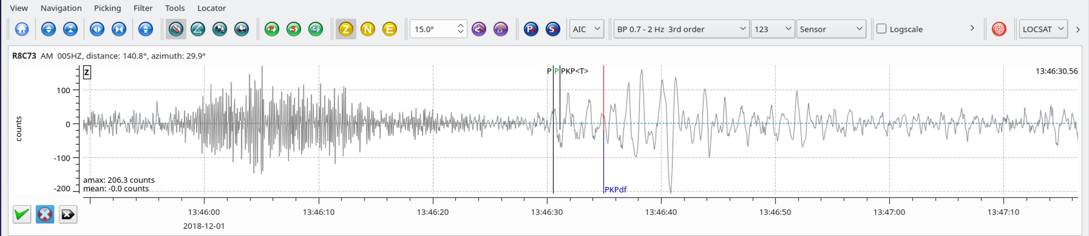
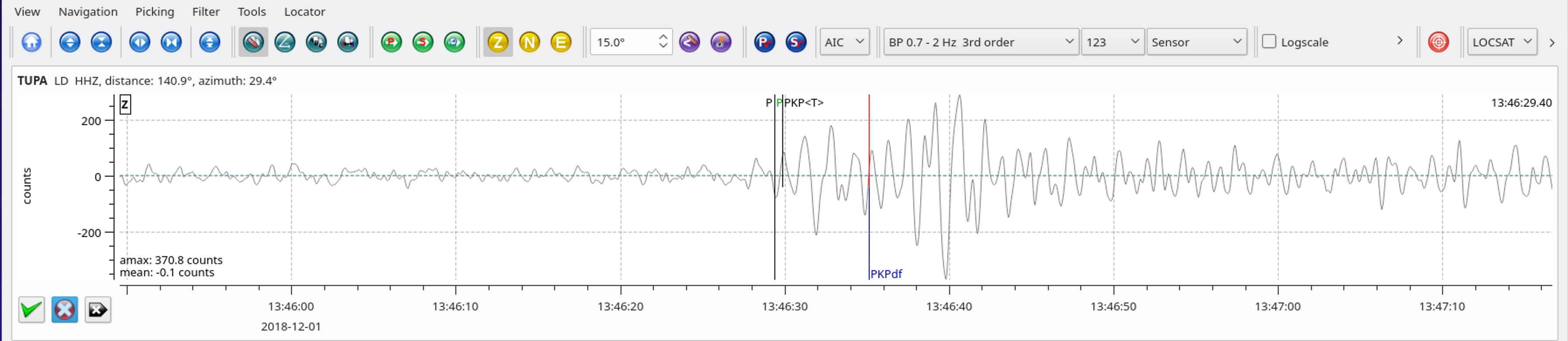
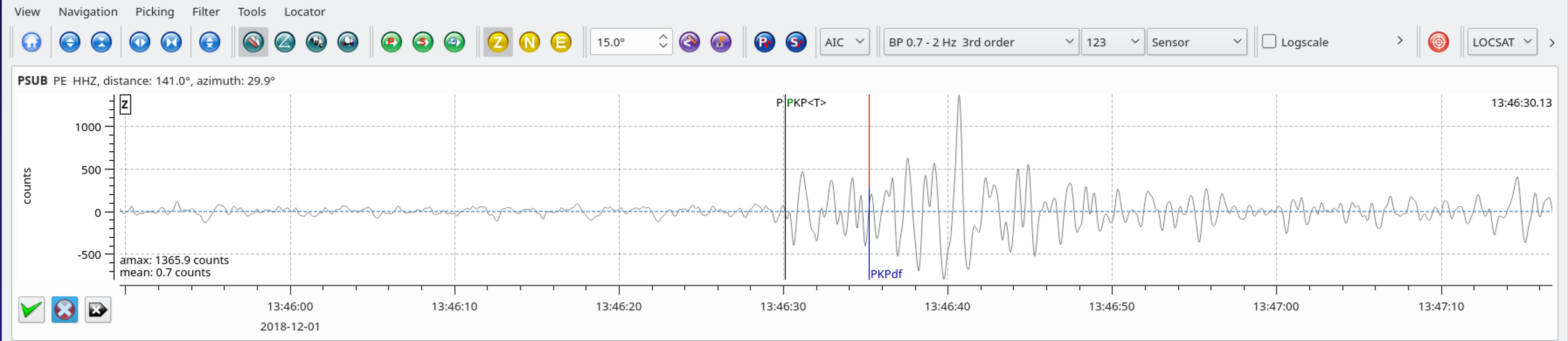
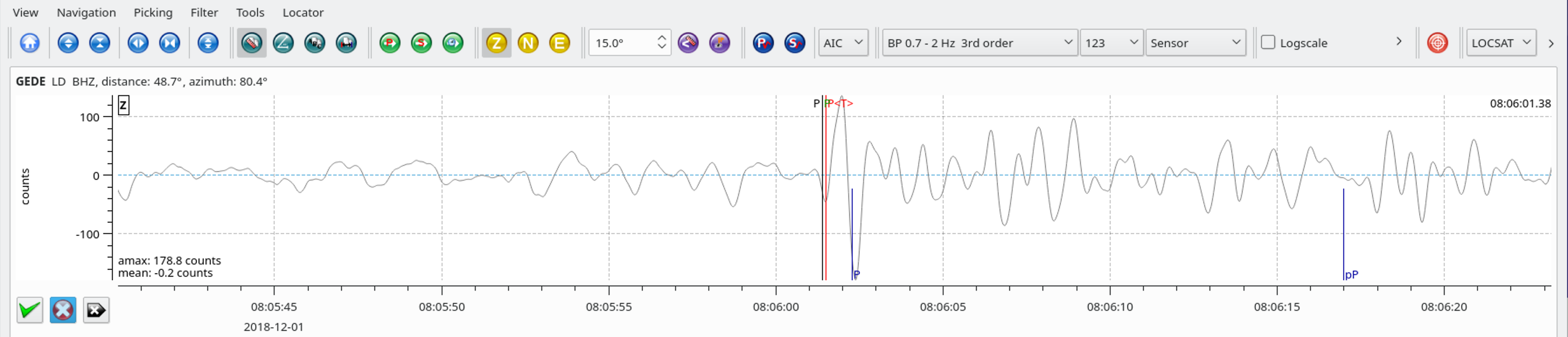
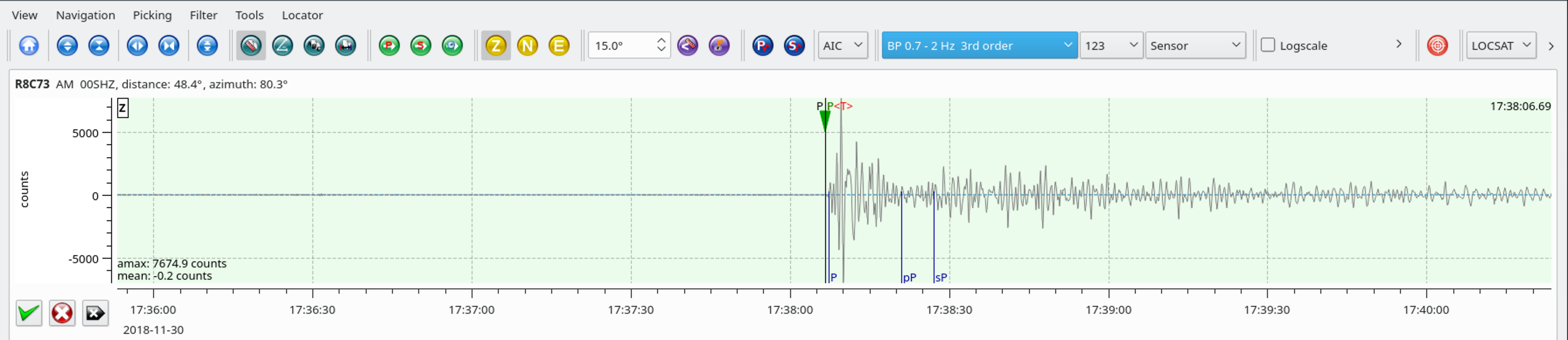
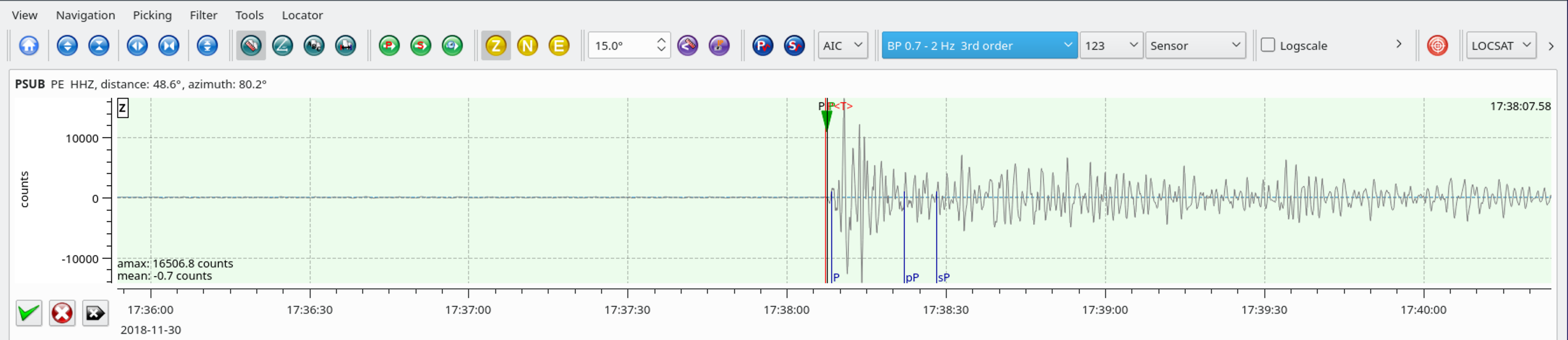
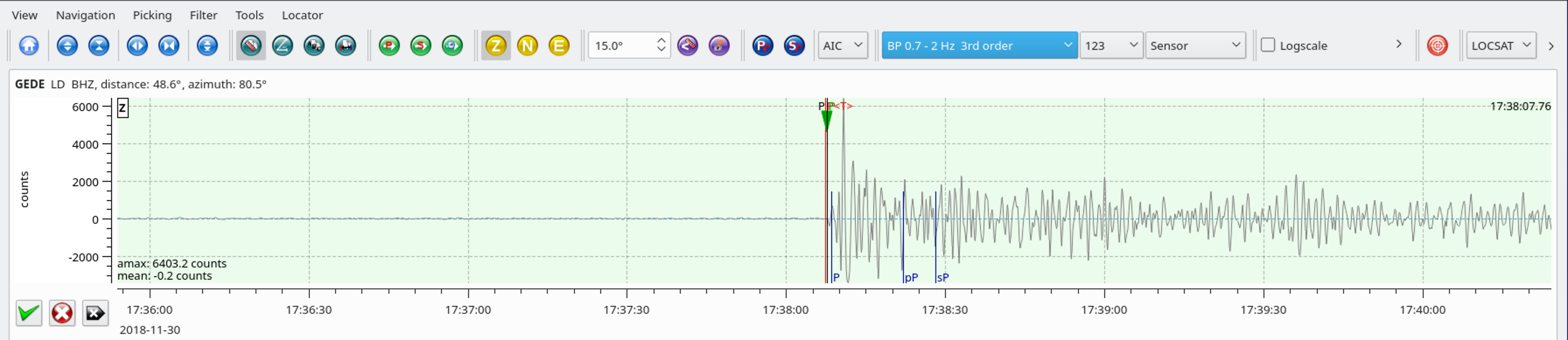
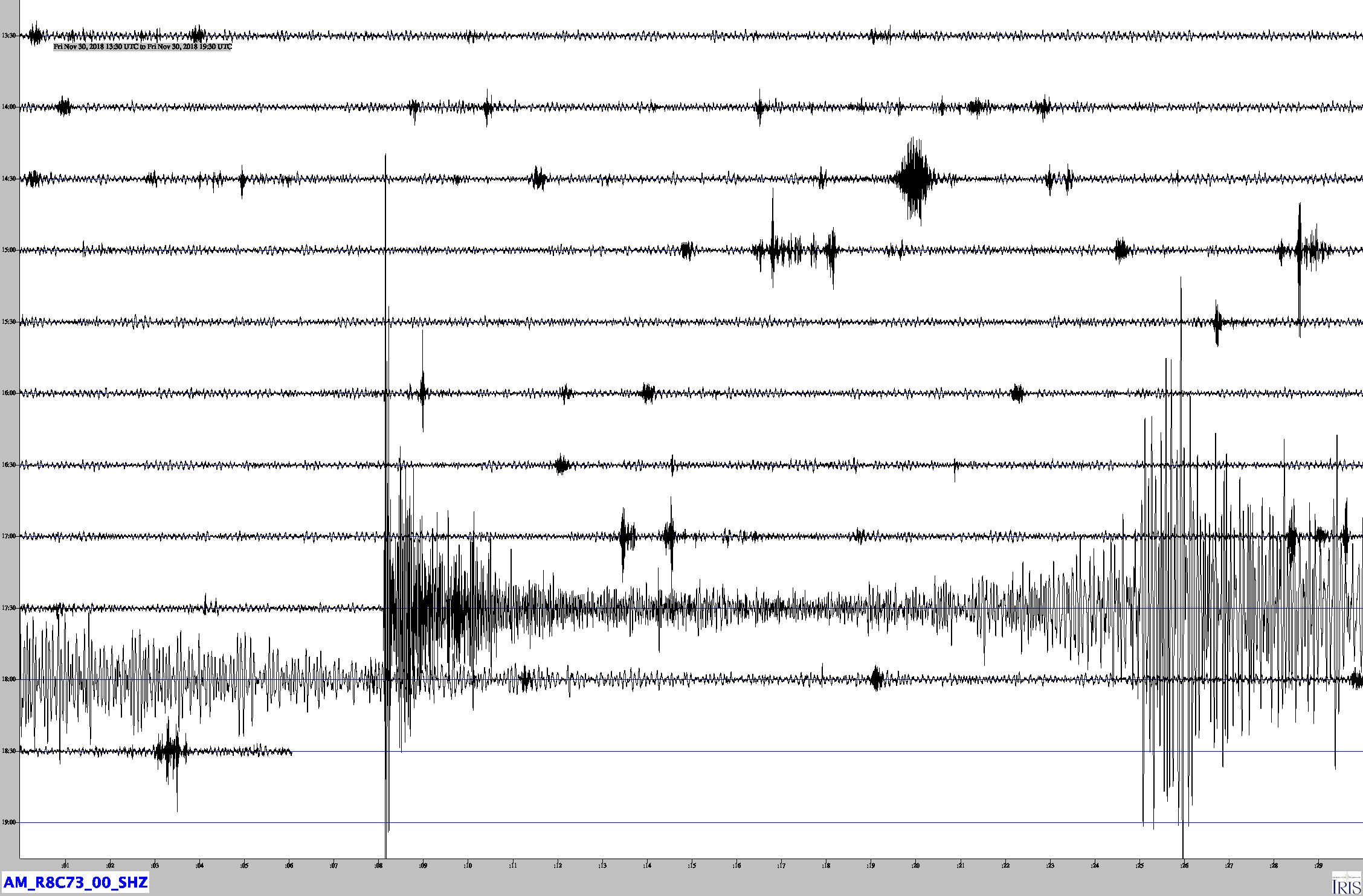
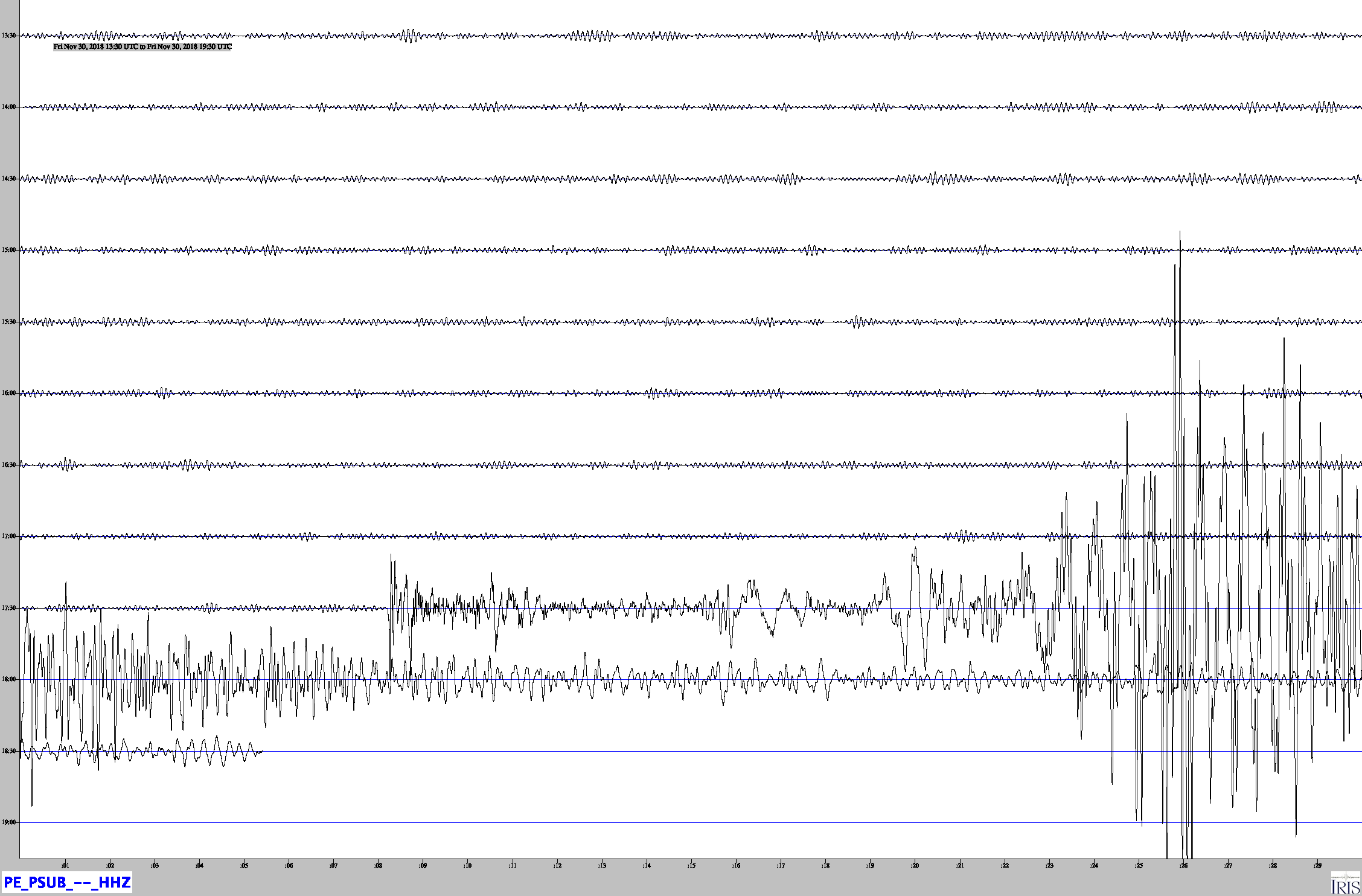
SeisComP3 traces for AM.R8C73.00.SHZ (Exton PA), LD.WUPA.BHZ (West Chester University, West Chester PA), and PE.PSUB.HHZ (Penn State Delaware County Campus, Media PA) showing the P wave arrivals.
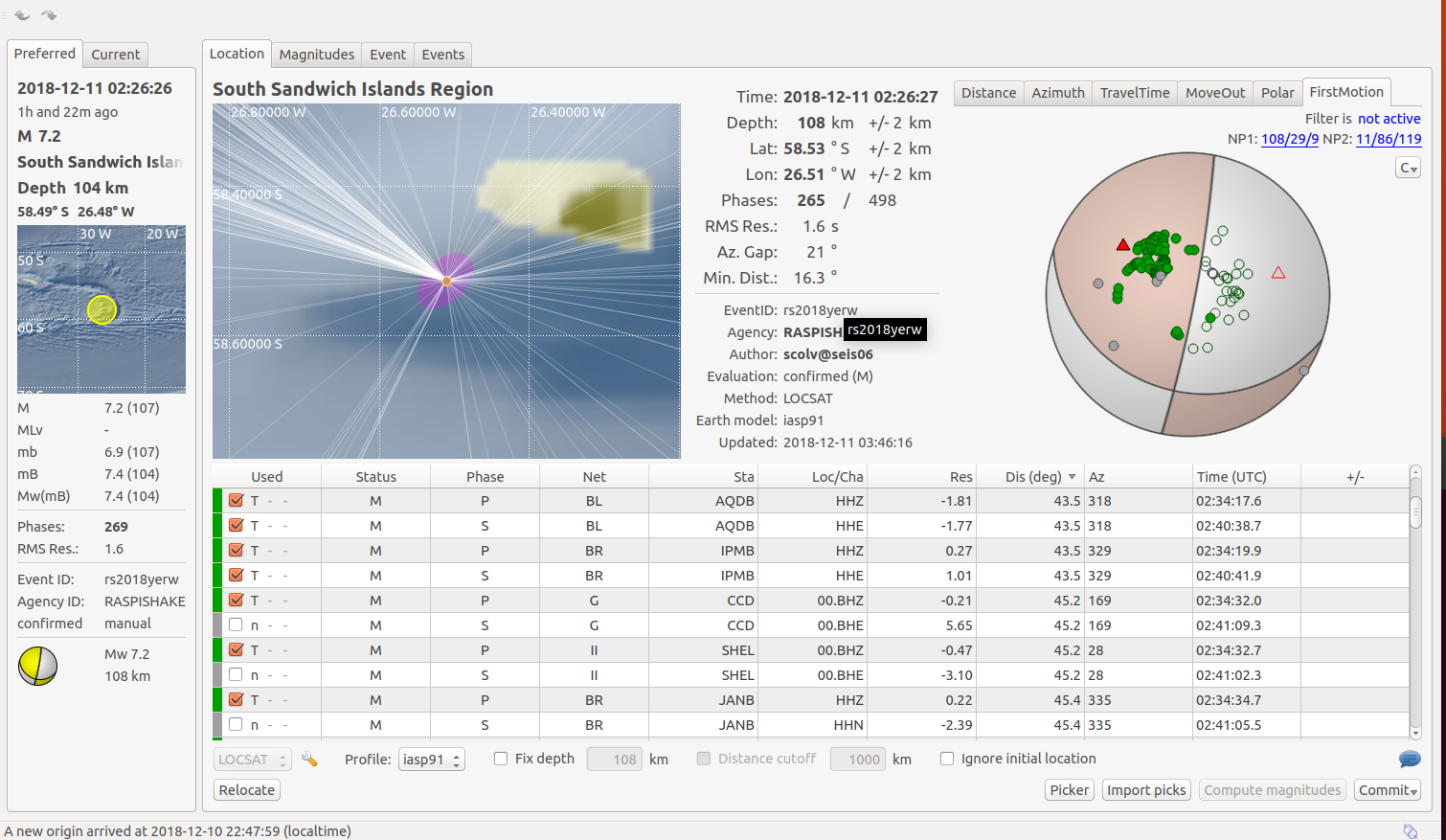
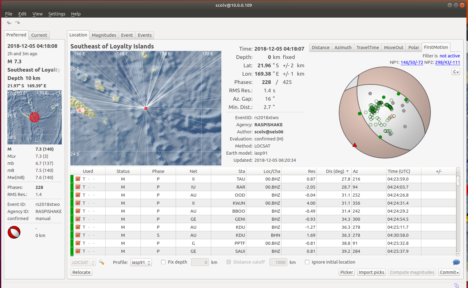
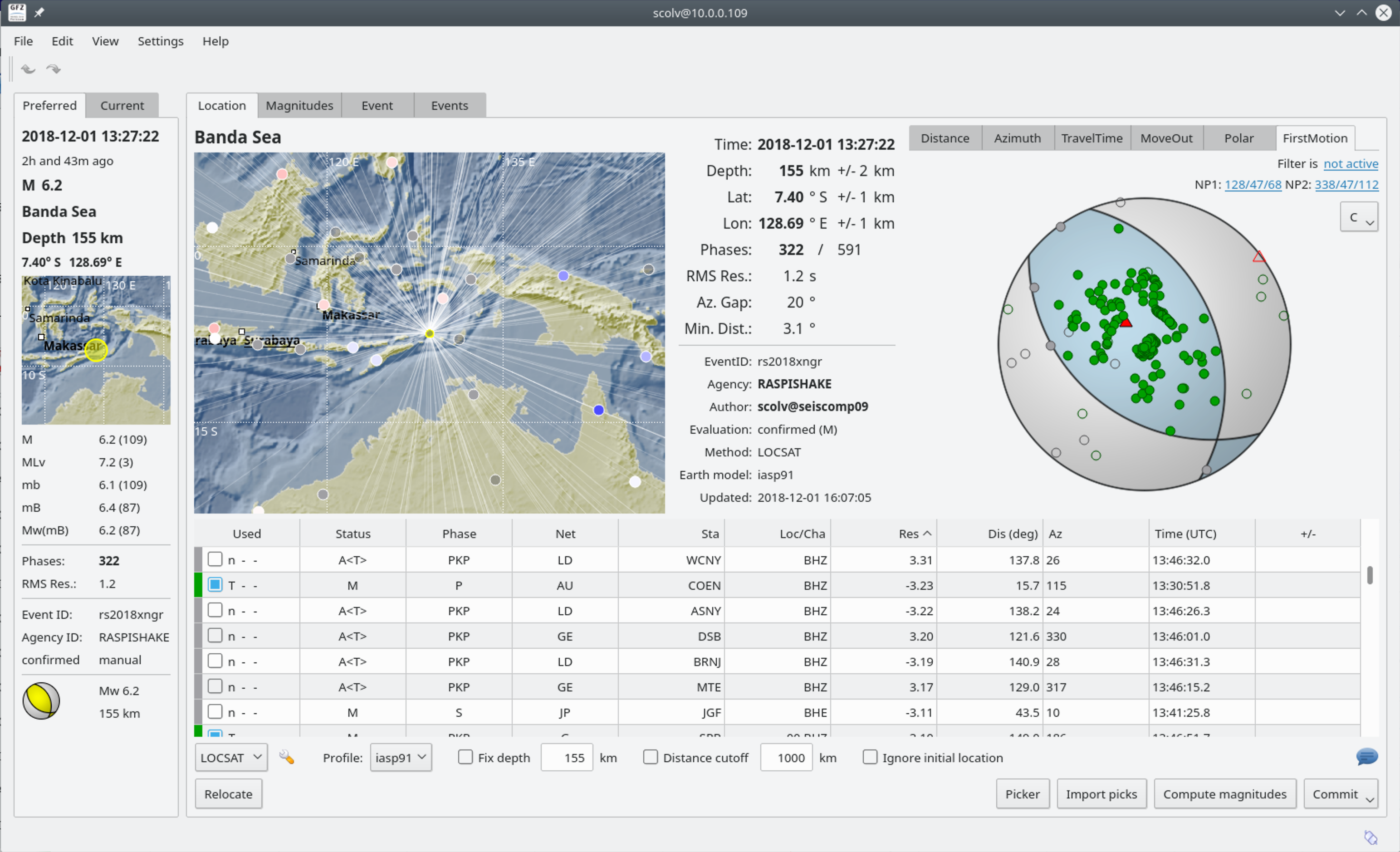
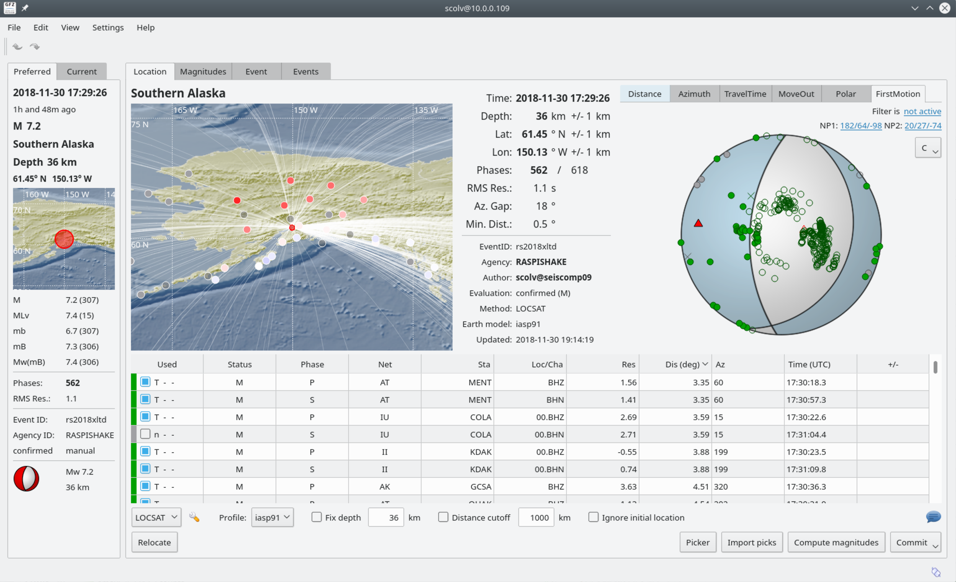
SeisComP3 display shwoing the focal plane solution for this Quake