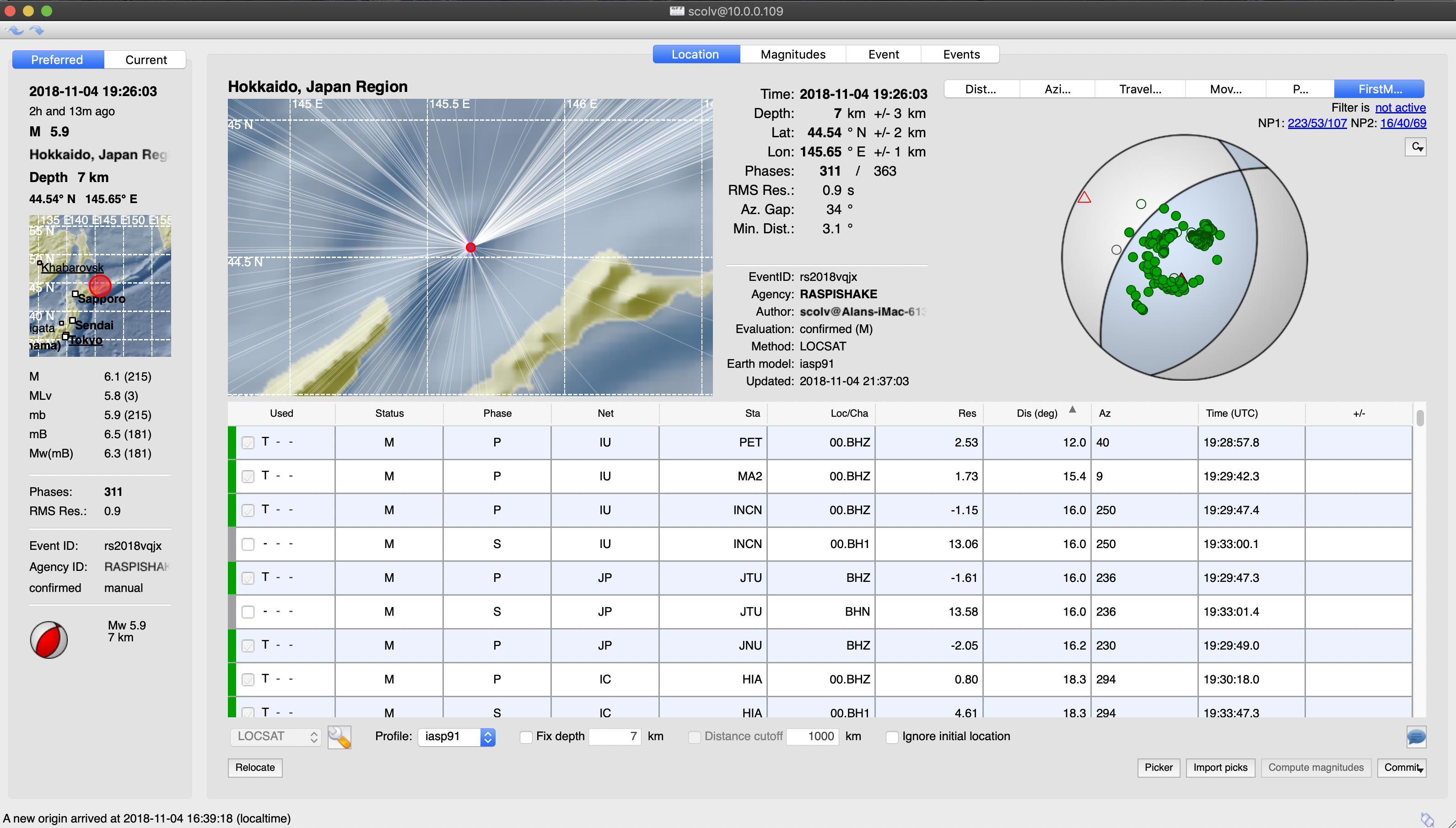
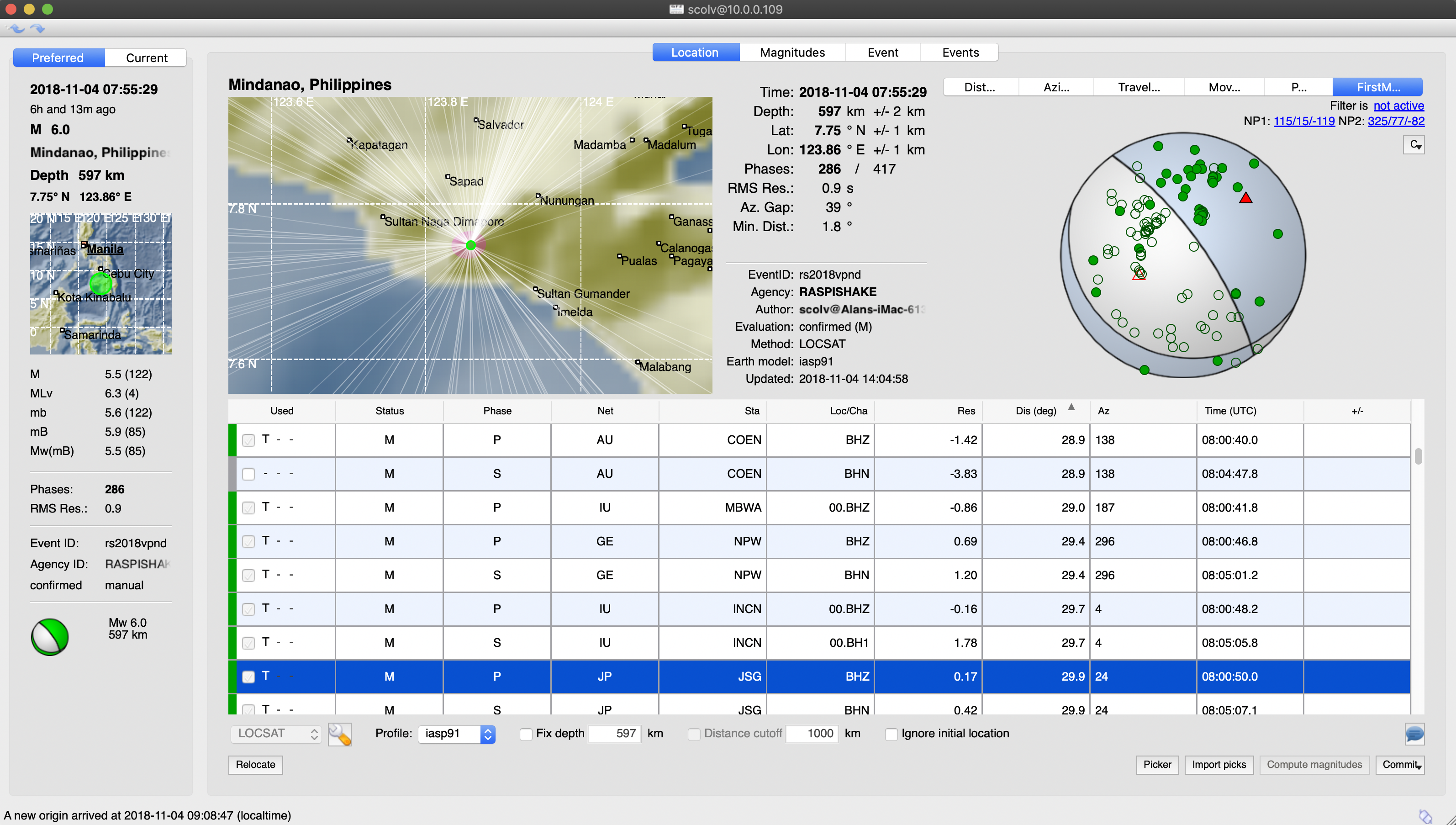
Greenland Sea – M6.8 – Nov 9, 2018 at 01:49:40 UTC
Position: 71.623°N 11.240°W – Depth: 10.0 km
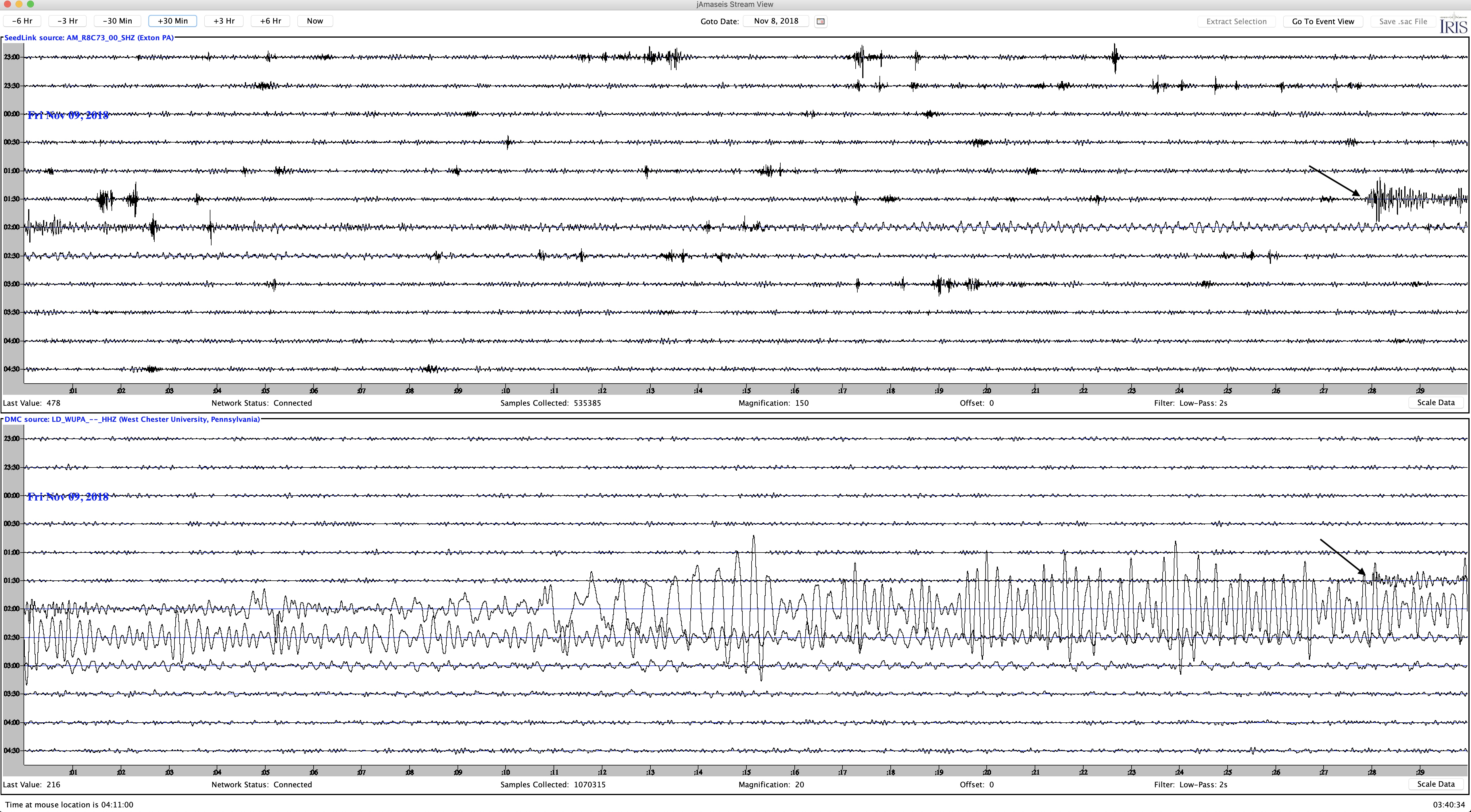
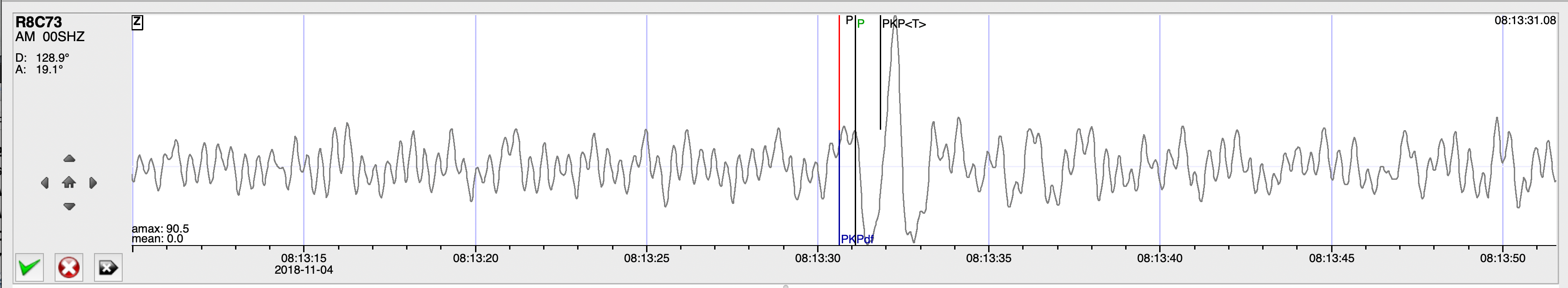
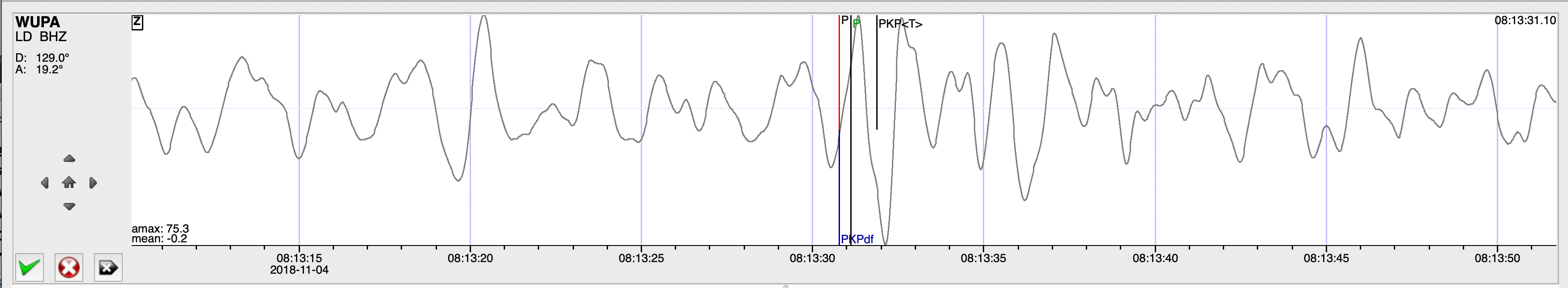
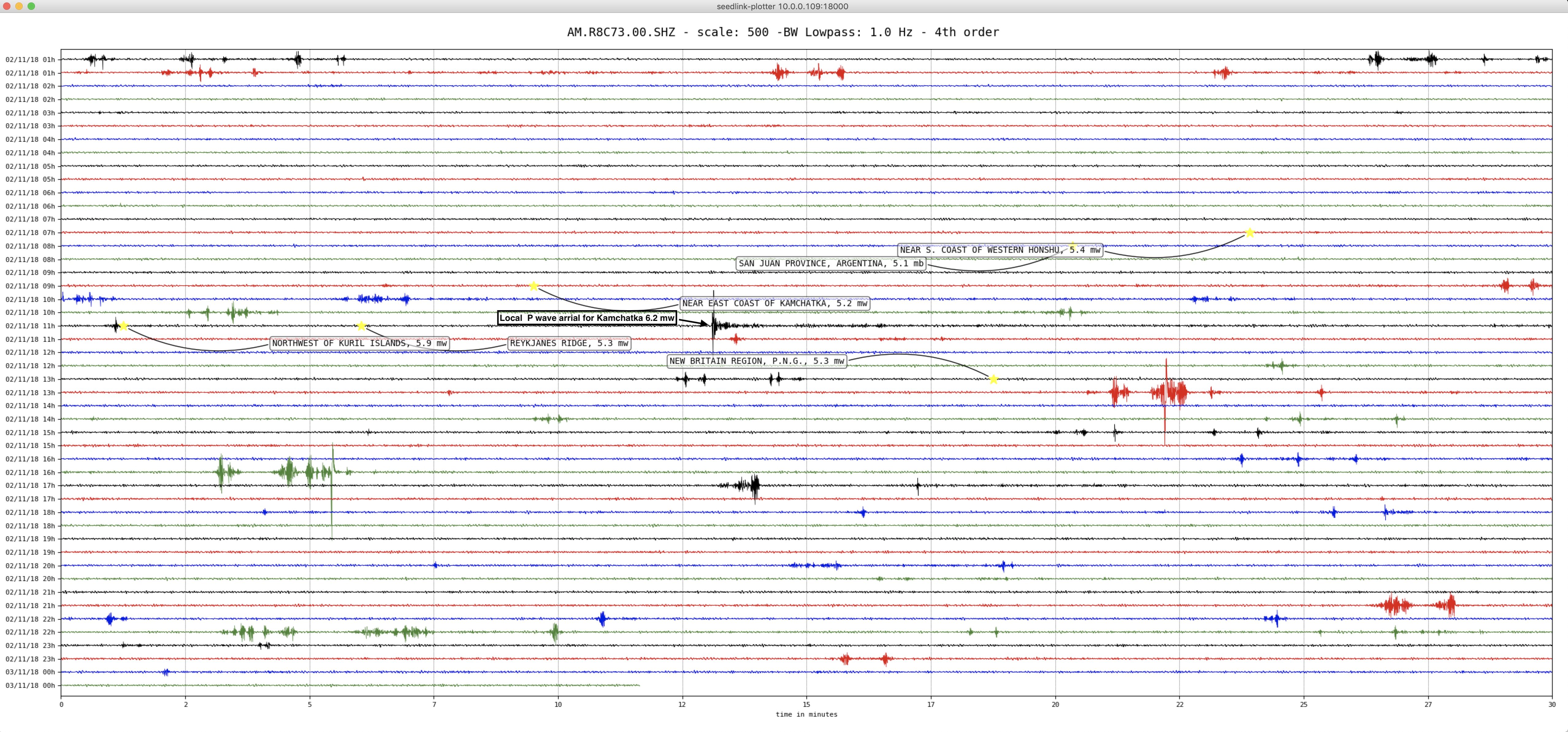
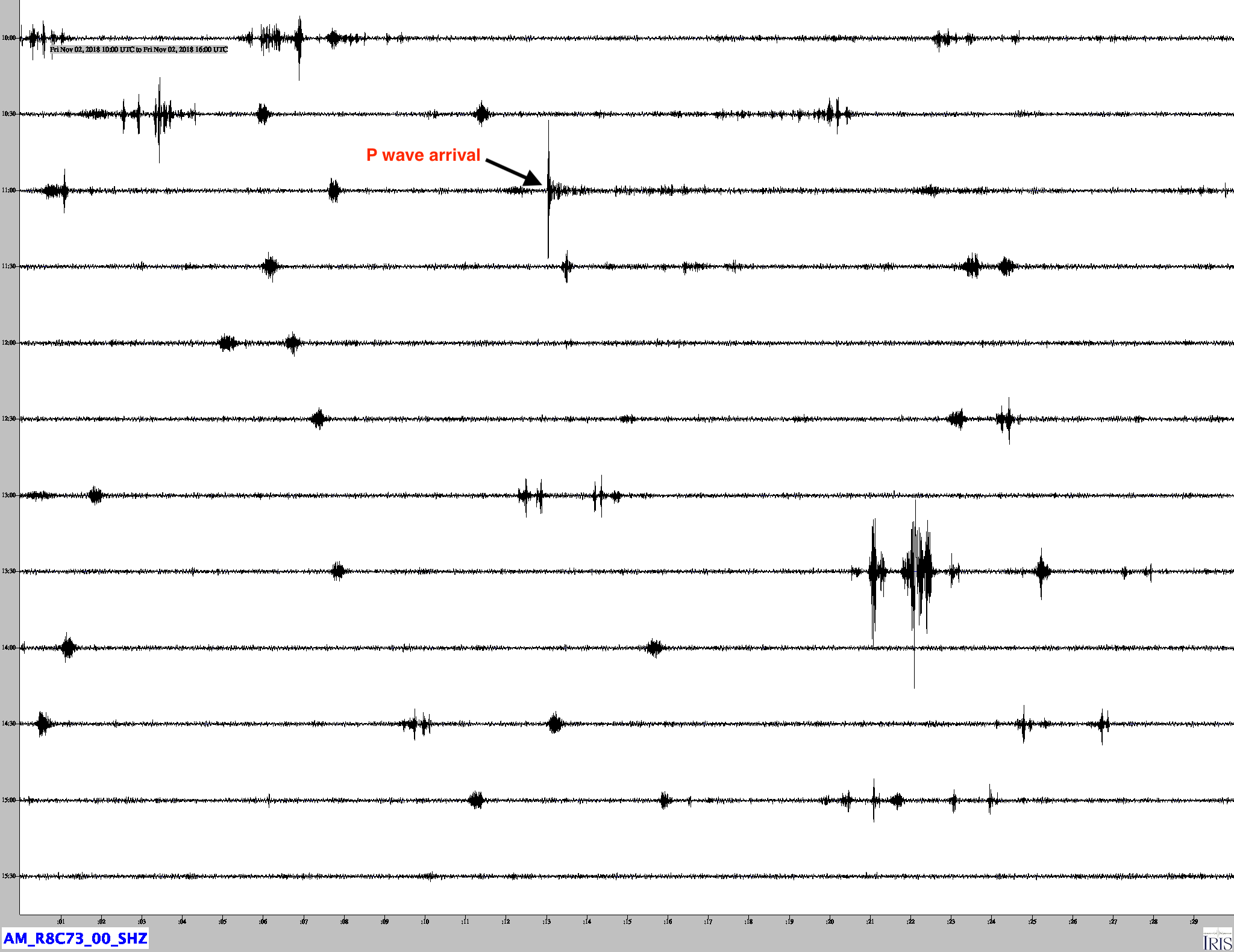
Jamaseis heliocoder trace of AM.RC8C73.00.SHZ (Exton PA), and LD.WUPA.BHZ (West Chester PA).
Distance: 44.5 Deg. 4,046 km
Azimuth: 260.8 Deg.
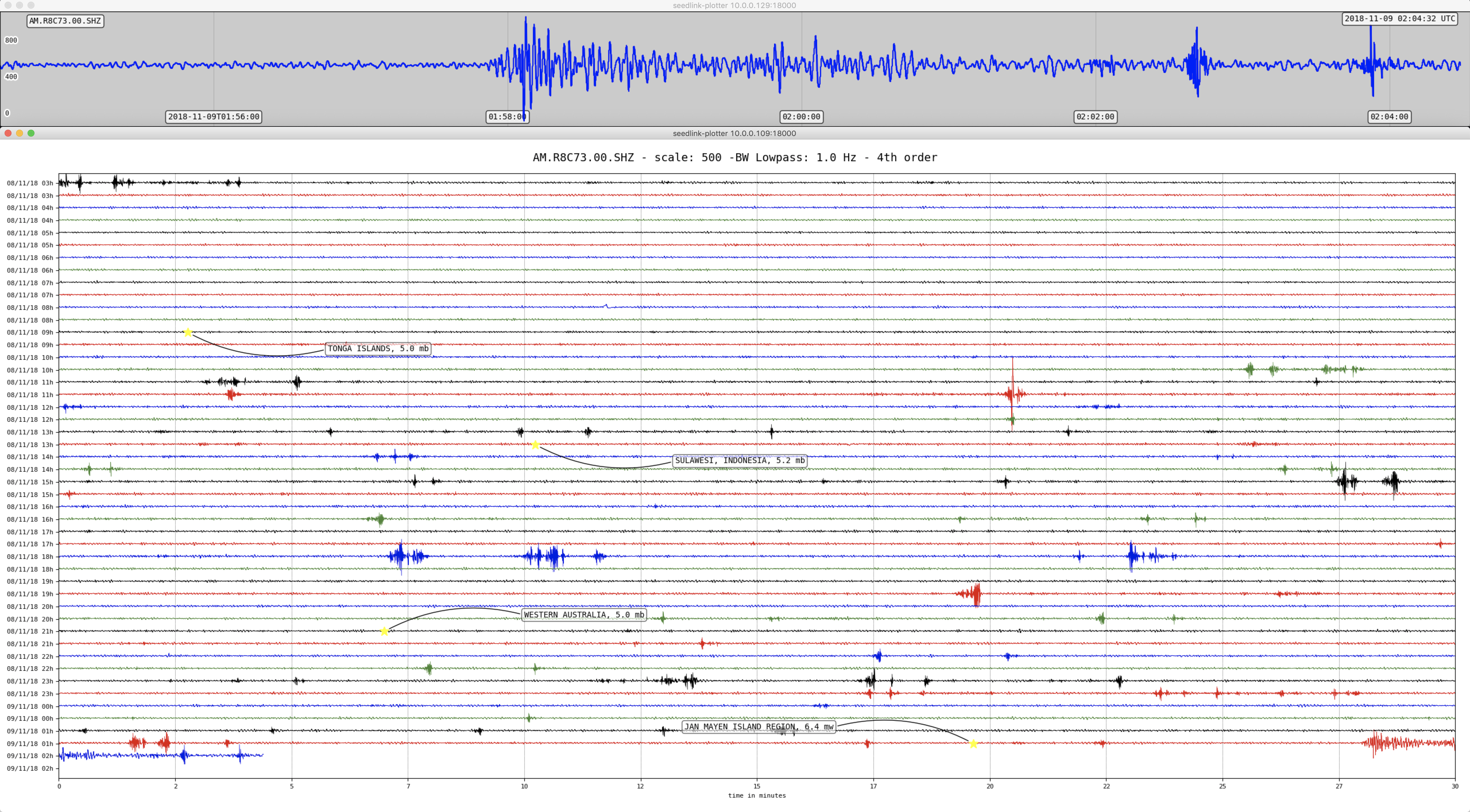
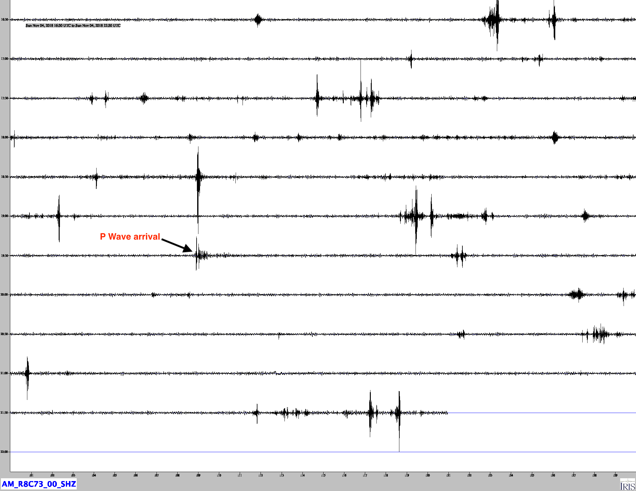
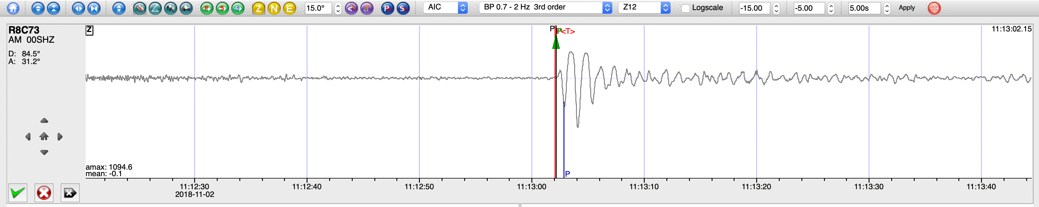
Another heliocorder image of R8C73 showing the event. Above the heliocorder is the real-time trace of the quake.
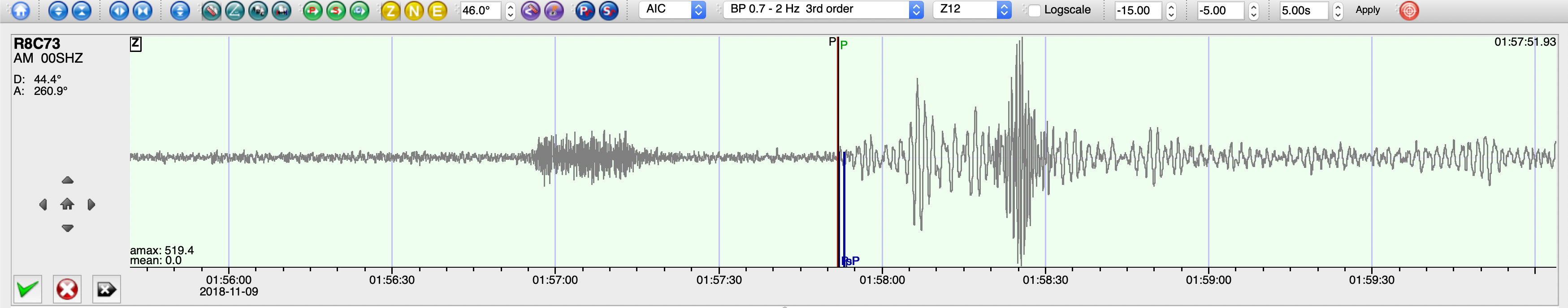
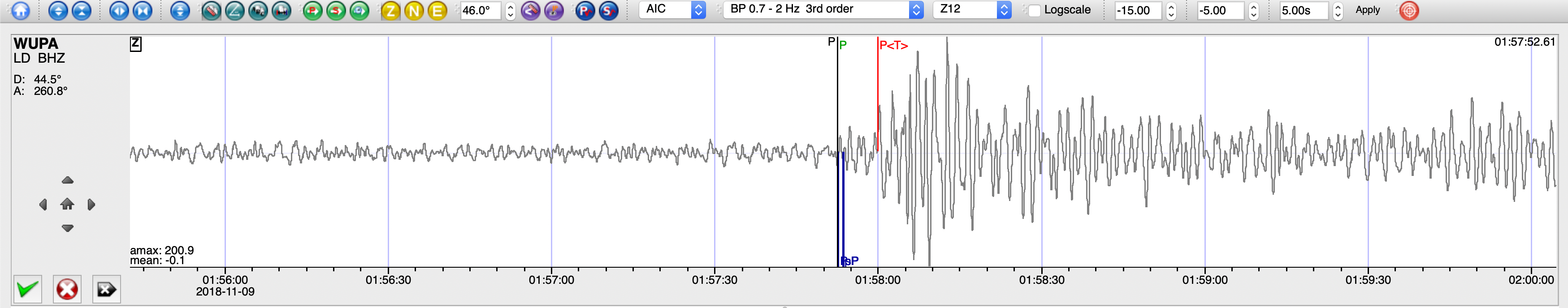
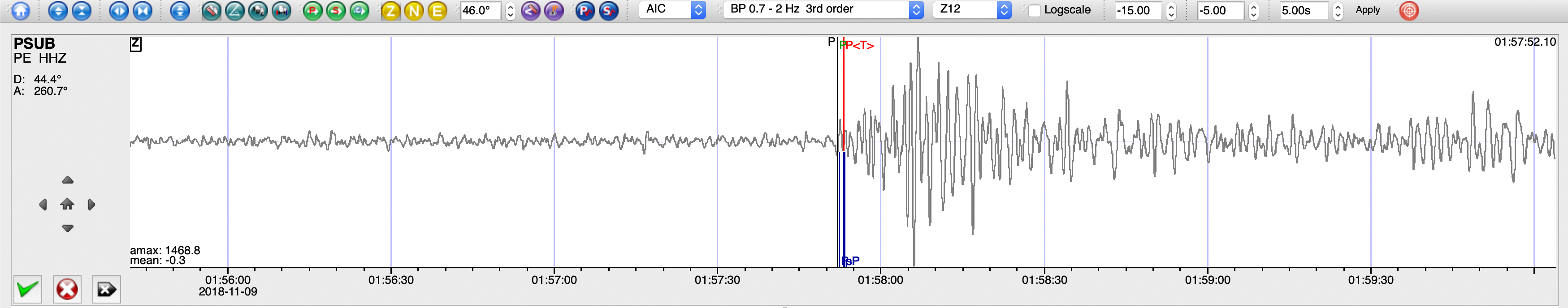
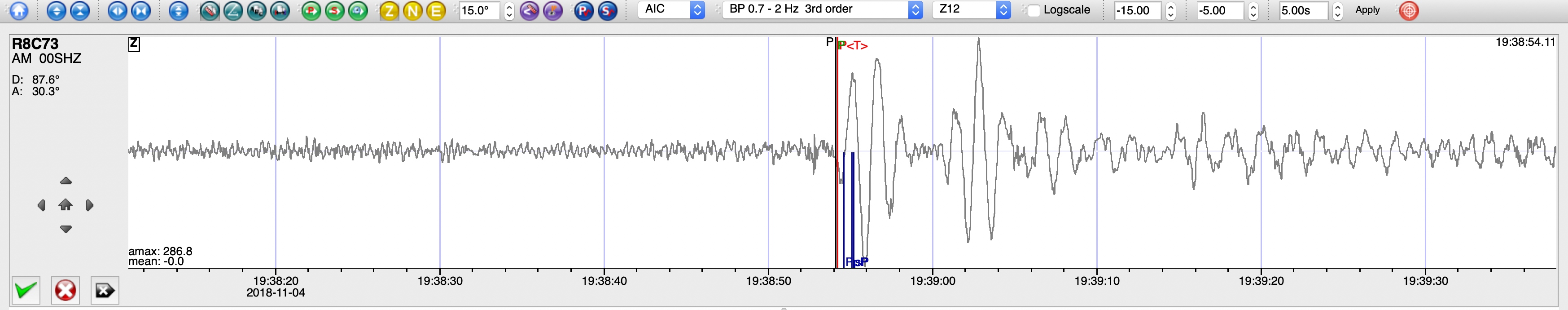
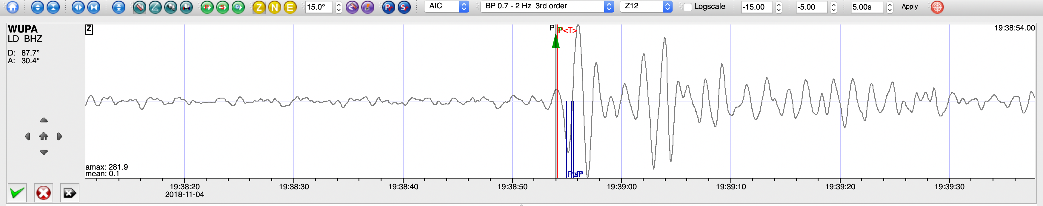
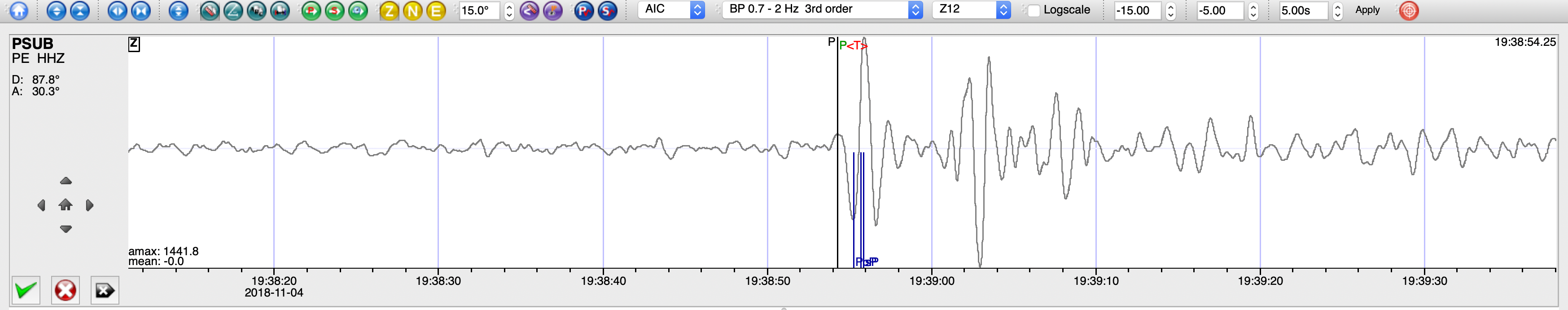
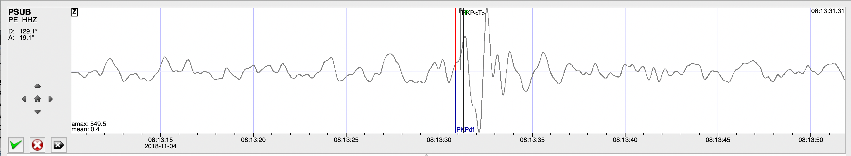
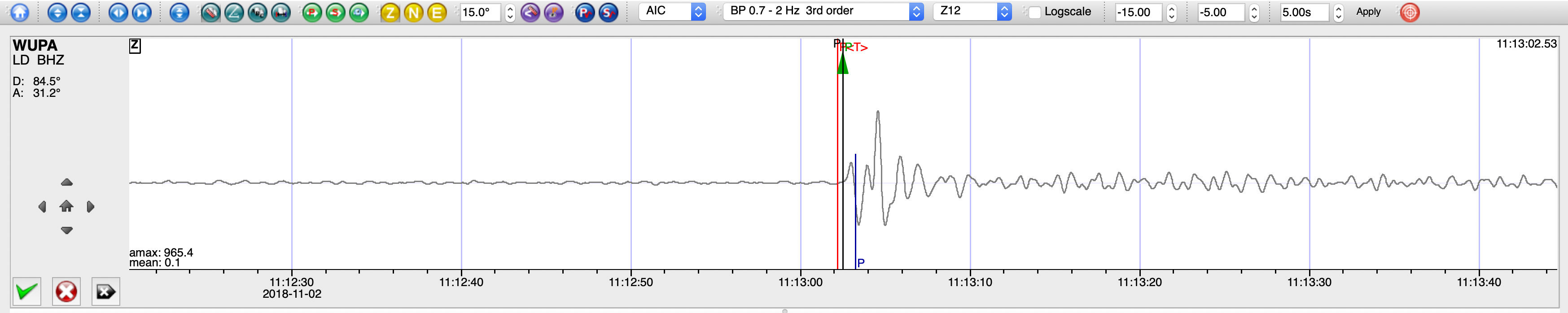
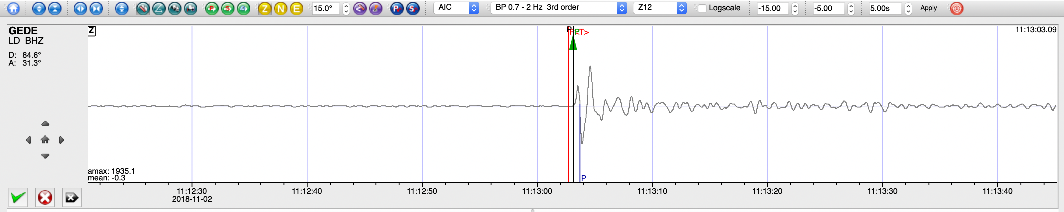
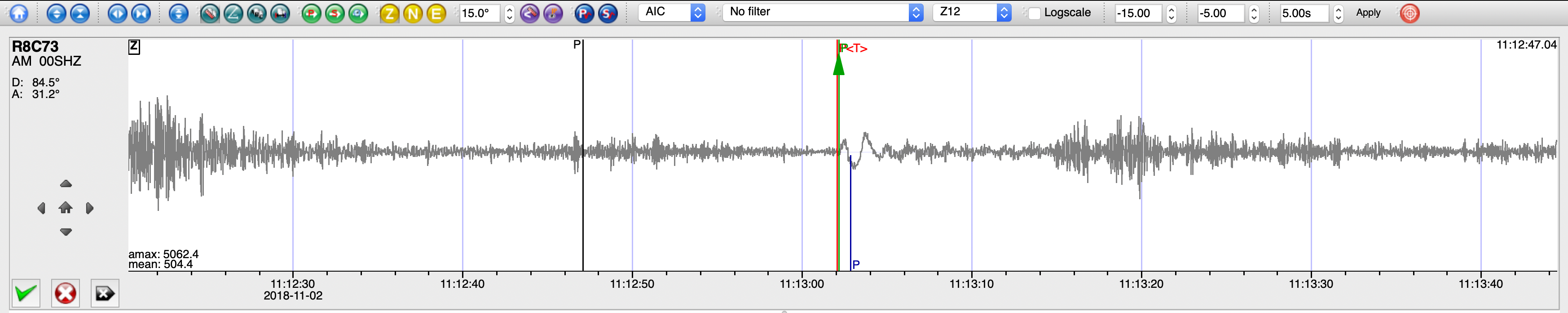
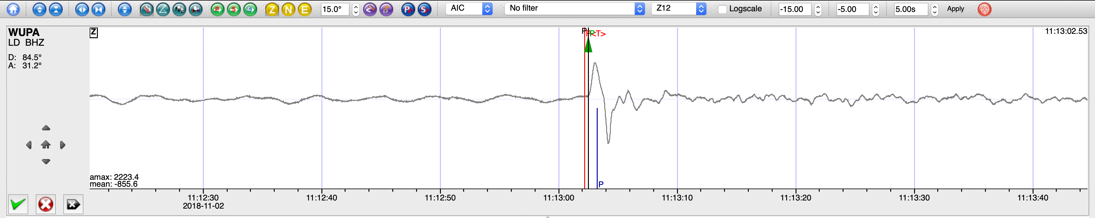
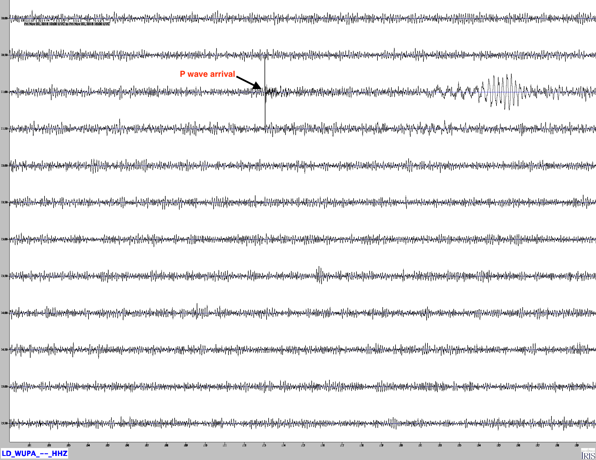
SeisComP3 traces for AM.R8C73.00.SHZ (Exton PA), LD.WUPA.BHZ (West Chester University, West Chester PA) , and PE.PSUB.HHZ (Media PA) showing the P wave arrivals.
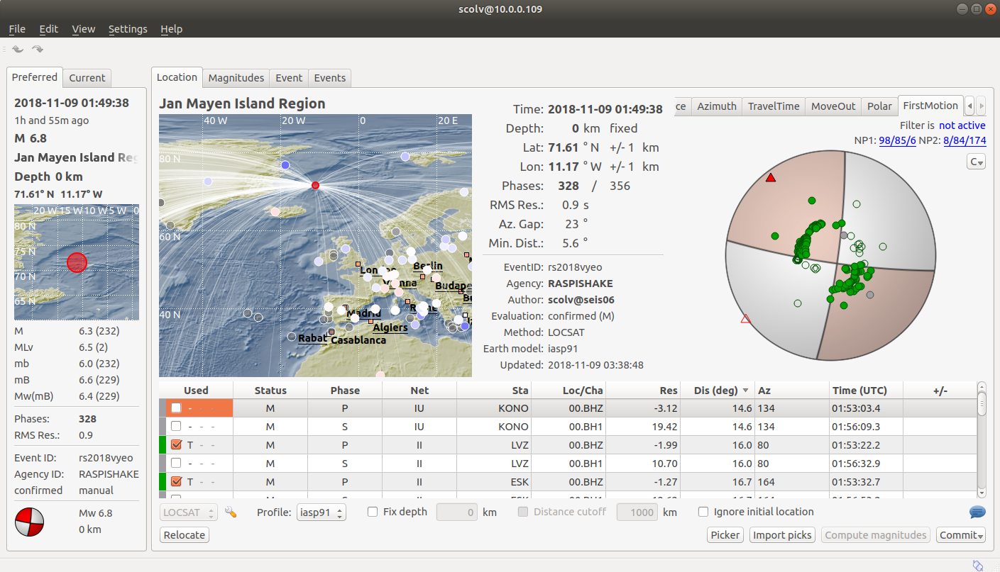
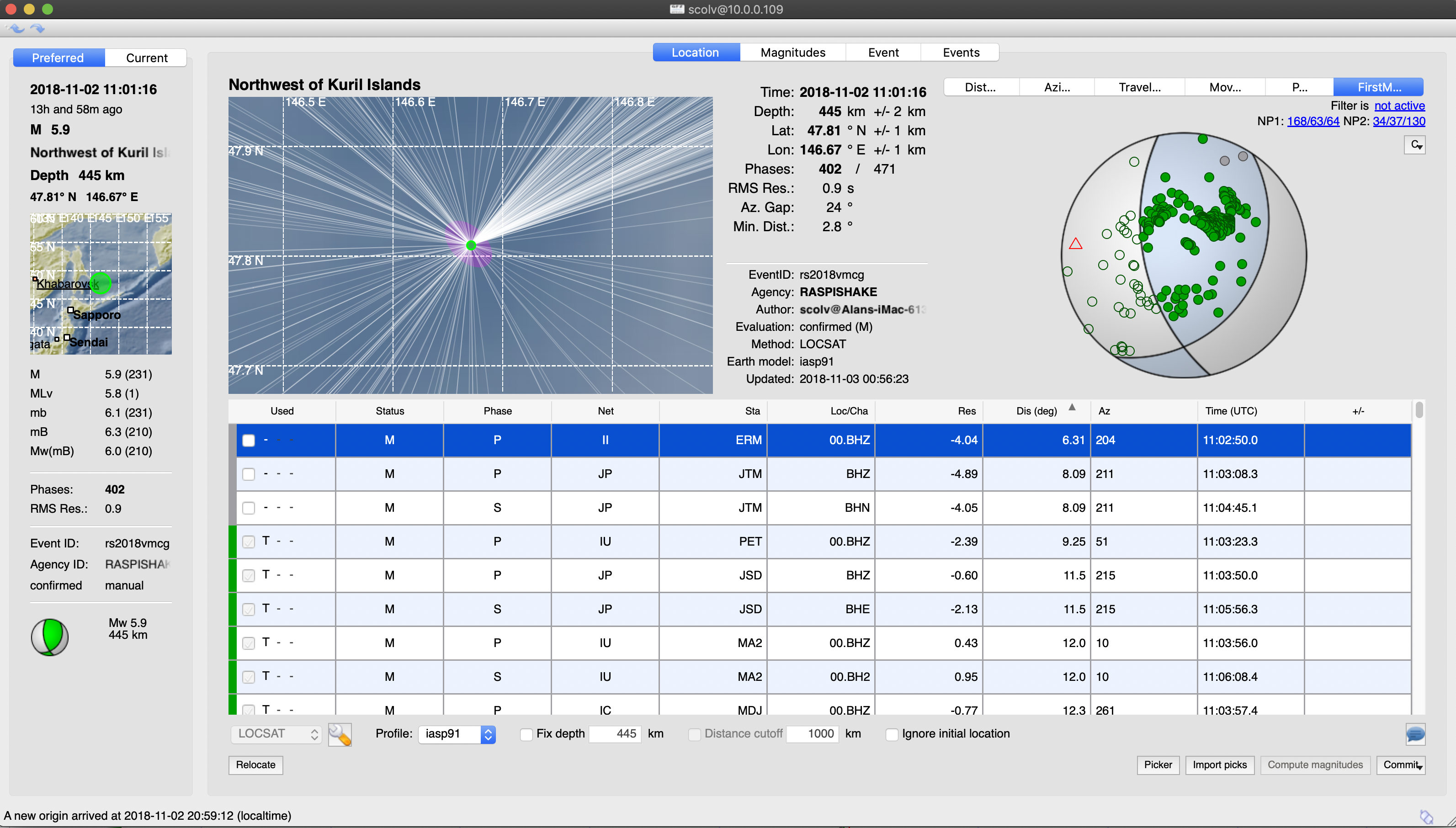
Fault Plane Solution for this event showing that the earthquake occurred along a north-south or east-west strike slip fault.
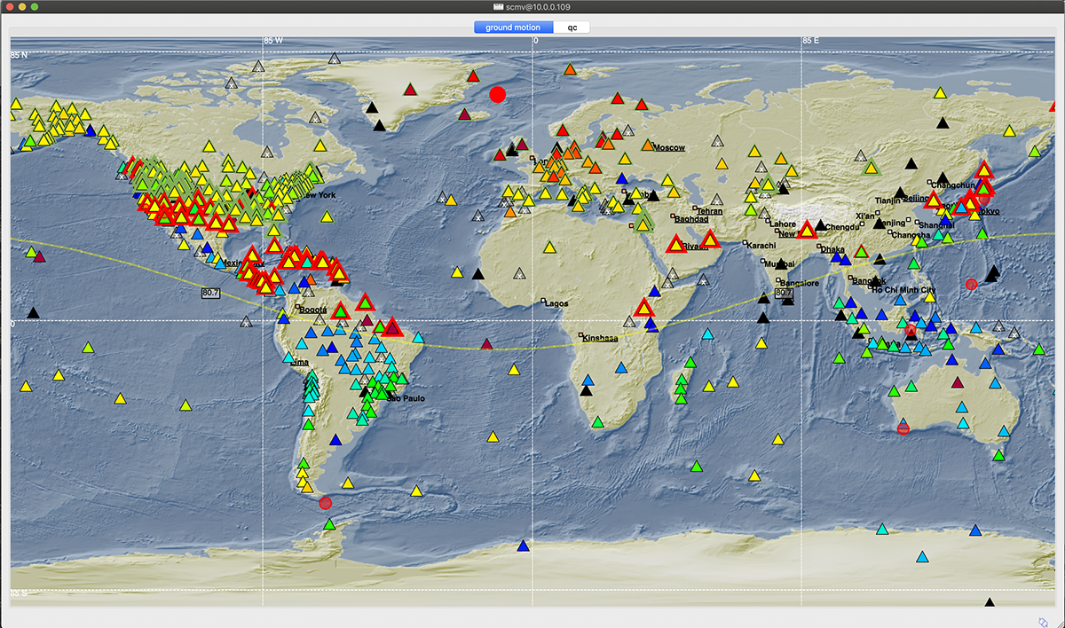
SeisComP3 scmv (map view) display as few minutes after the event. The triangles with red and green borders are stations where Seiscomp has detected and picked a P wave arrival. the color of each triangle indicates ground motion. Note the orange and red triangles in northern Europe and Greenland closest to the epicenter where the ground motion is highest.