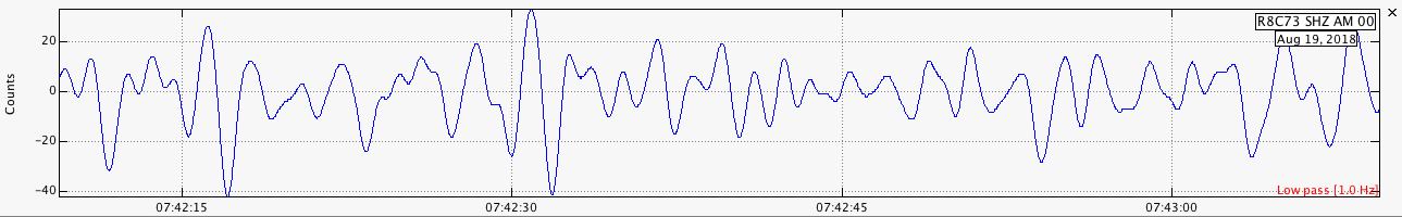
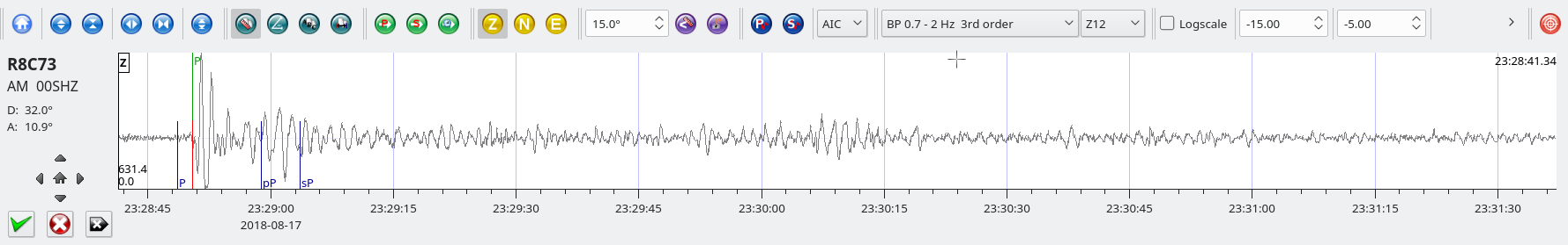
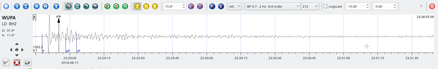
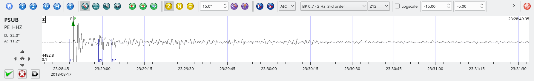
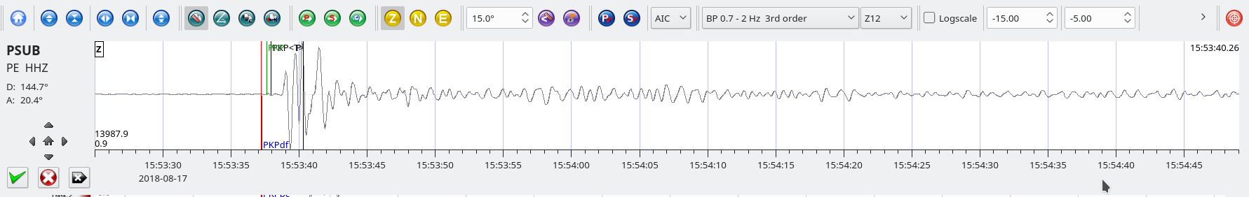
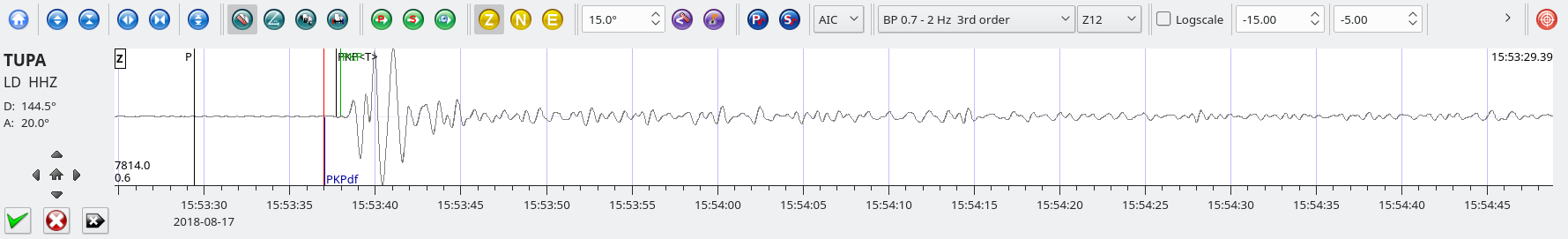
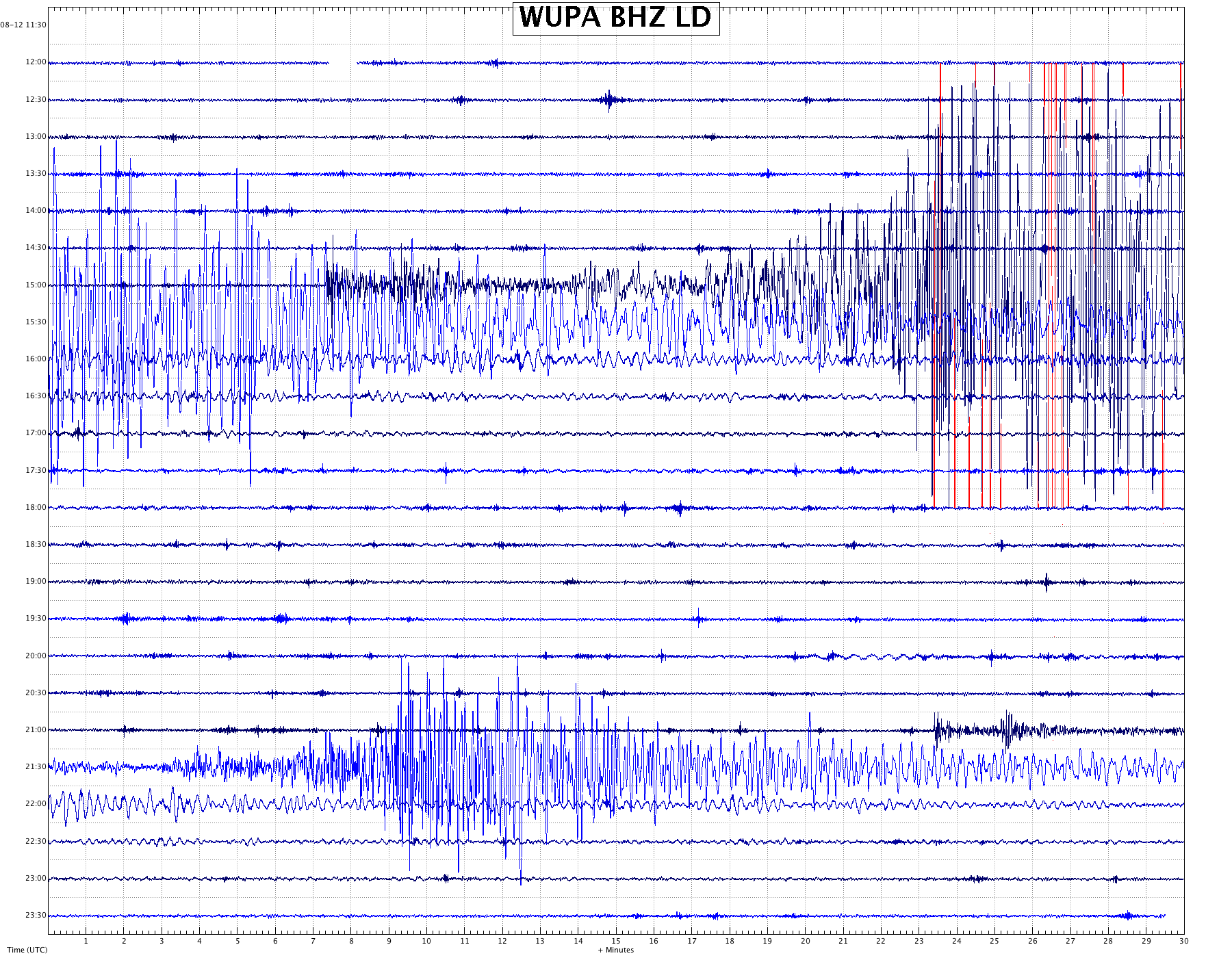
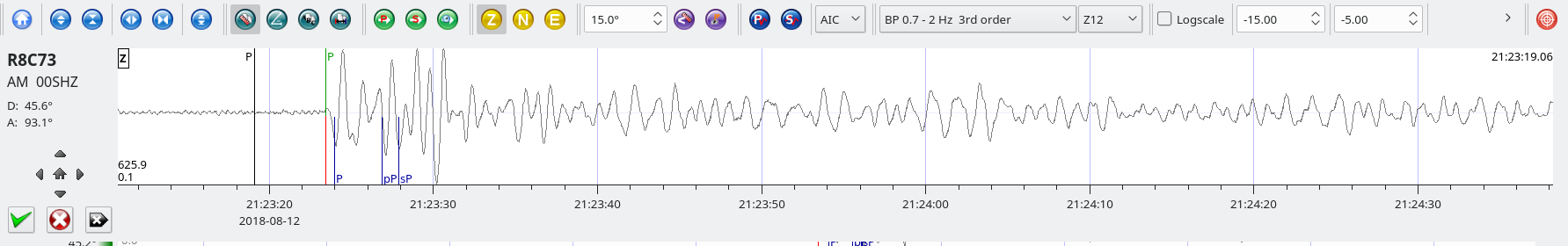
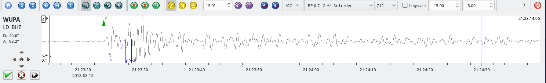
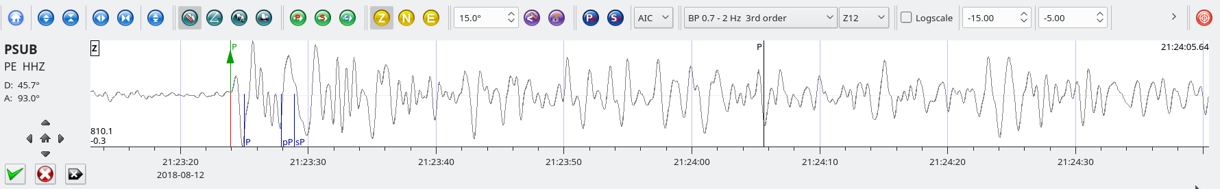
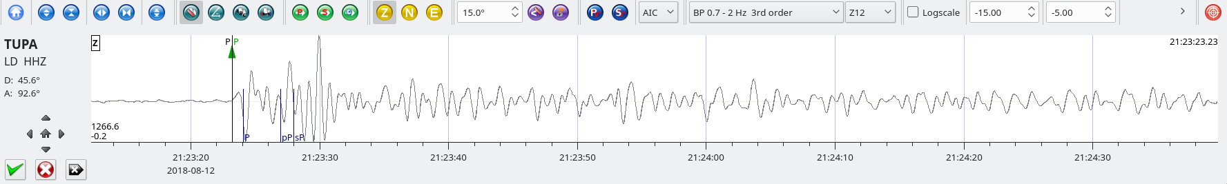
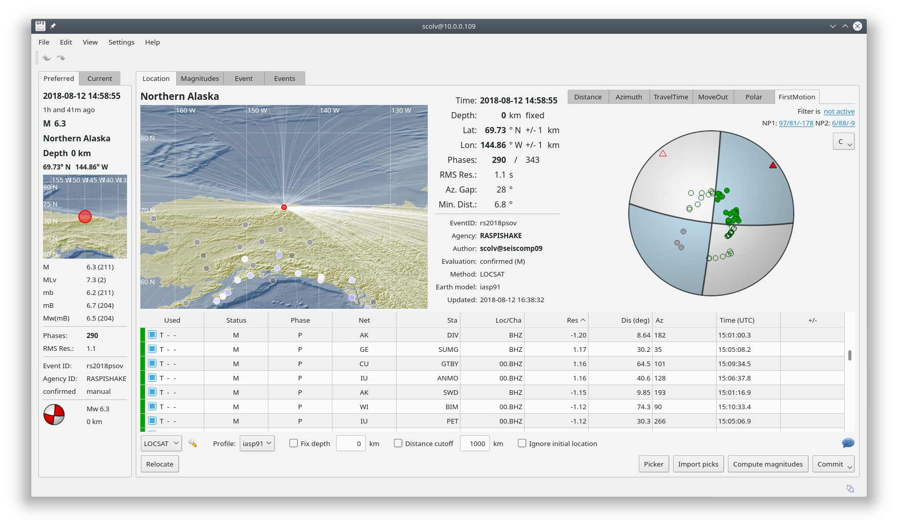
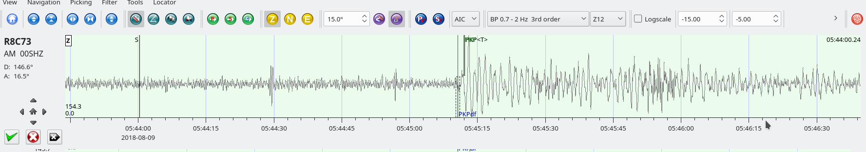
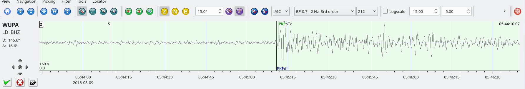
Fiji – M8.2 August 19, 2018 at 00:19:40 UTC

Position:18.113°S   178.153°W – Depth: 563km

USGS Information Page

IRIS Information Page

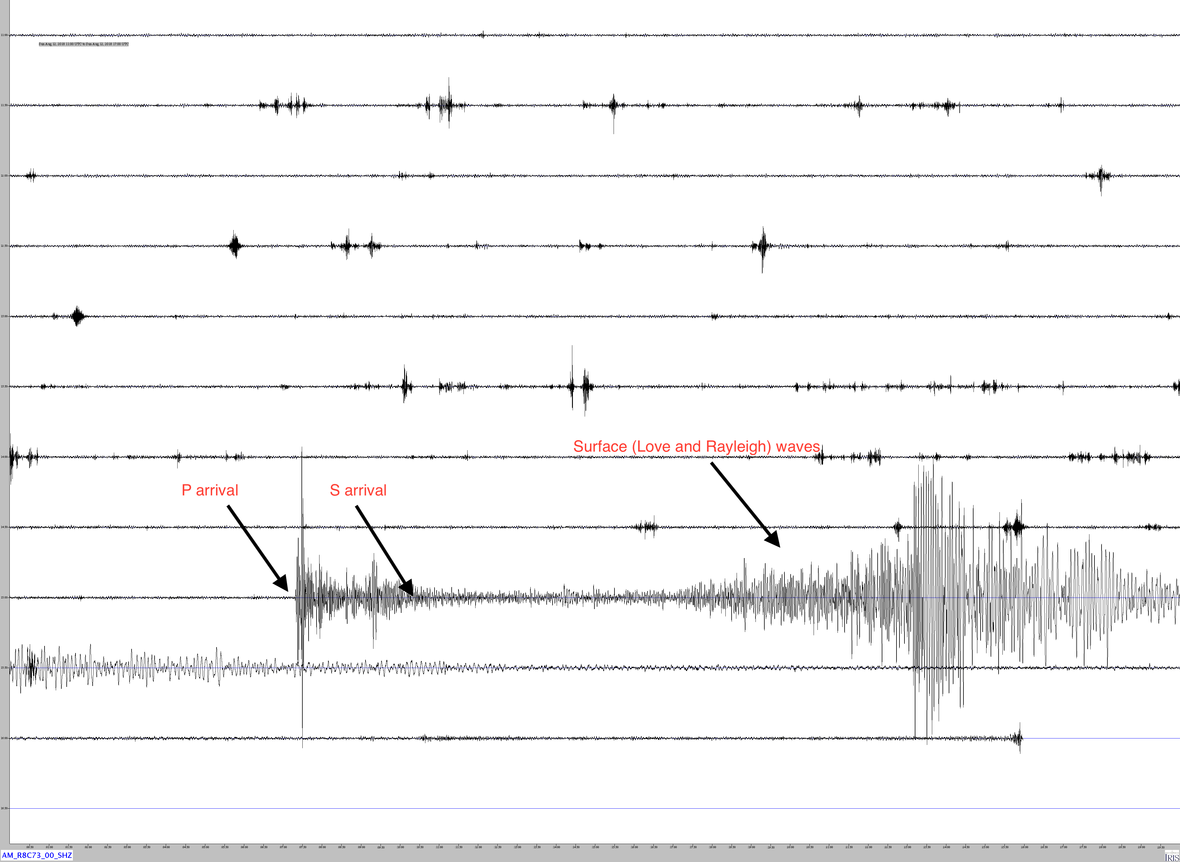
This earthquake was the first magnitude 8+ earthquake in 2018. Despite the intensity little damage occurred due the the extreme depth of the hypocenter.

From the USGS Summary of this event:

“The August 18, 2018, M 8.2 earthquake near Fiji occurred as the result of deep, normal faulting approximately 560 km beneath the South Pacific Ocean several hundred kilometers to the west of the Tonga Trench. Focal mechanism solutions indicate that rupture occurred on a moderately dipping normal fault striking to the west-northwest or the east-southeast. At the location of this earthquake, the Pacific plate moves approximately due west relative to the Australia plate at a velocity of about 81 mm/yr. The location, depth, and focal mechanism solutions of the August 18th event indicate that the earthquake is related to faulting within the subducted Pacific slab.

Earthquakes that have focal depths greater than 300 km are commonly termed “deep-focus” earthquakes. Deep-focus earthquakes cause less damage on the ground surface above their foci than similar-magnitude shallow-focus earthquakes, but large deep-focus earthquakes may be felt at great distance from their epicenters. This earthquake is similar in size to the largest observed deep-focus earthquakes. The largest recorded deep-focus earthquake to date was the M 8.3 event that occurred at a depth of 600 km within the subducted Pacific plate beneath the Sea of Okhotsk offshore of northeastern Russia in 2013. The M 8.3 Okhotsk earthquake was felt all over Asia, as far away as Moscow, and across the Pacific Ocean along the western seaboard of the United States (though at distant locations, individuals reporting having felt the event were likely very favorably situated for the perception of small ground motions). The M 8.2 Bolivian deep-focus earthquake in 1994 had similarly been reported by individuals in North America at great distance from the epicenter.

Deep focus earthquakes are common near this event. Over the past century, 9 earthquakes with a magnitude of M 7+ have occurred within 250 km of this event, all at depths greater than 300 km. The largest of these prior to this event was an M 7.8 earthquake in January 1919.”
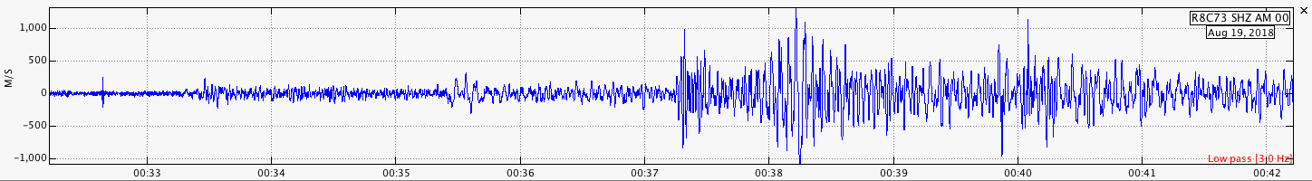
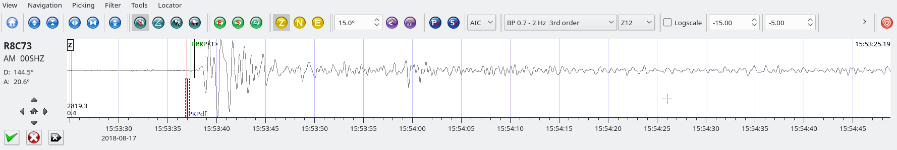
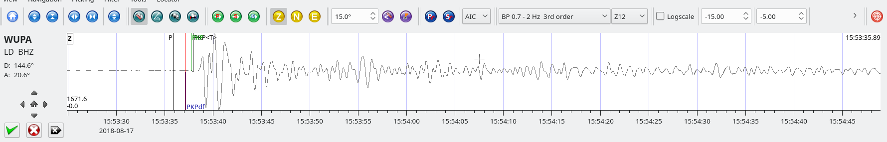
Trace of AM.RC8C73.00.SHZ (RaspberryShake 1D in Exton PA).
Distance: 12,653km
Azimuth: 53.4 Deg.
Large earthquakes such as this one produce surface waves that may travel around the world for hours or even days after the event. This image show surface waves recorded by AM.R8C73.00.SHZ 7 1/2 hours after the earthquake. As the RaspberryShake is a short period instrument, only the higher frequency waves (with a period of about 1 1/2 seconds) were recorded.

Costa Rica M6.0 August 17, 2018 at 23:22:24

Position:8.769°N   83.153°W – Depth: 15 km

SeisComP3 traces for AM.R8C73.00.SHZ (Exton PA), LD.WUPA.BHZ (West Chester University, West Chester PA), and PE.PSUB.HHZ (Penn State Delaware County Campus).

Distance: 32.0 deg. – 3,542 km

Azimuth: 10.9 deg.

SeisComP3 display showing the focal mechanism for this event.

Flores Sea – M6.5 Aug 17, 2018 at 15:35:01 UTC

Position: 7.426°S   119.834°E – Depth: 529km

Jamaseis heliocoder trace of AM.RC8C73.00.SHZ showing the main shock and an aftershock
Distance: 144.5 Deg. 16,100km
Azimuth: 20.6 Deg.
SeisComP3 traces for AM.R8C73.00.SHZ (Exton PA), LD.WUPA.BHZ (West Chester University, West Chester PA). PE.PSUB.HHZ (Penn State Delaware County Campus), and LD.TUPA.HHZ (Temple University Ambler Campus) showing the P wave arrivals.

Alaska M6.3 Aug, 12, 2018 at 14:58:54 UTC

Position:69.562°N   145.300°W – Depth: 2.2 km

From the USGS summary of this event:

“The August 12, 2018, M 6.4 earthquake southwest of Kaktovik, Alaska, occurred as the result of strike slip faulting in the North Slope of Alaska. Preliminary focal mechanism solutions indicate faulting occurred on a steeply dipping fault striking either north-northeast (left-lateral), or east-southeast (right-lateral). This earthquake occurred within the interior of the North America Plate, in the east-west striking Sadlerochit Mountains at the northeast end of the Brooks Range. This region is seismically active. Before this earthquake sequence, 34 magnitude 4 and larger earthquakes have been recorded within 100 km of the August 12th mainshock since 1990. The event of August 12, 2018, M 6.4 is the largest instrumentally recorded earthquake in Alaska’s North Slope.”

Jamaseis heliocoder trace of AM.RC8C73.00.SHZ. Notice the high amplitude surface waves in the image. These can be seen in the trace for almost two hours after onset.

Distance: 45.8 Deg. 5,159 km
Azimuth: 92.5 Deg.

Another Jamaseis image (AM.R8C73.00.SHZ, Exton) showing the initial earthquake as well as the magnitude 6.1 aftershock that occurred at 21:15:01 UTC
Here is the trace from LD.WUPA.BHZ at West Chester University about 10 km (6 miles) south of AM.R8C73.00.SHZ. WUPA is a broad-band seismometer which is sensitive down to about .01 Hz, i.e. a period of almost two minutes. Note that the surface waves are even stronger at these lower frequencies, particularly around 10 – 15 seconds per cycle.
SeisComP3 traces for AM.R8C73.00.SHZ (Exton PA), LD.WUPA.BHZ (West Chester University, West Chester PA), PE.PSUB.HHZ (Peen State Delaware County Campus), and LD.TUPA.HHZ (Temple University Ambler Campus) showing the P wave arrivals.
This SeisComP3 screenshot shows the focal mechanism which is typical of a strike-slip fault.

Lombok Indonesia M5.9 – Aug, 9, 2018 at 05:25:31 UTC

Position:8.315°S   116.233°E – Depth: 10.0 km
USGS Information Page

This earthquake is an aftershock to the 7.0 event on august 5th.

SeisComP3 traces for AM.R8C73.00.SHZ (Exton PA) and LD.WUPA.BHZ (West Chester University, West Chester PA) showing the P wave arrivals. This shows that under the right circumstances, even modest earthquakes can be detected over great distances (over 16,000 km in this case).

Distance: 146.6 deg, 16,301 km

Azimuth: 16.5 deg.