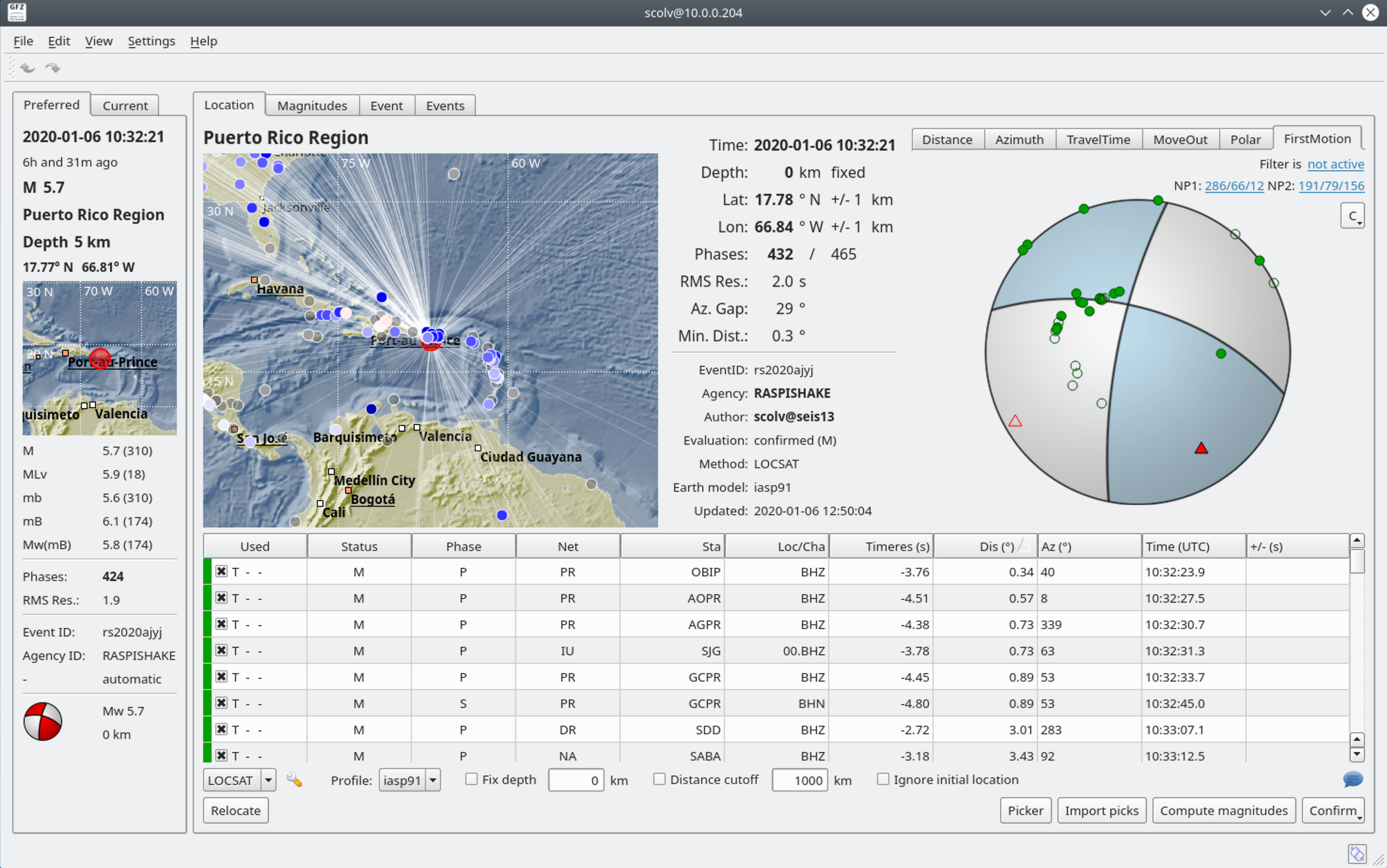
Puerto Rico – M5.2 – Jan 10, 2020 at 22:26:25 UTC
4km SSW of Indios, Puerto Rico
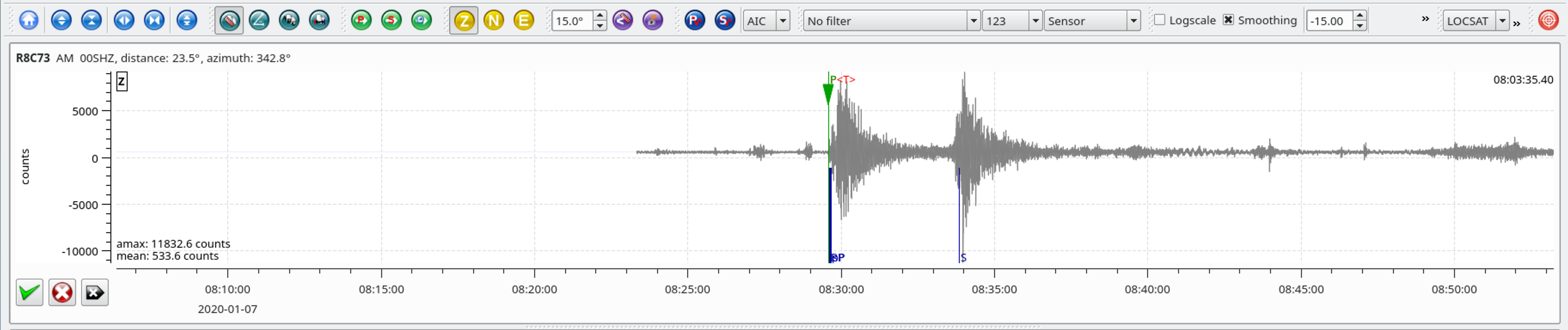
| Latitude | Longitude | Depth (km) | Dist (Deg) | Dist (Km) | Azimuth | |
|---|---|---|---|---|---|---|
| 17.935 | -66.883 | 9.0 | 23.3 | 2,588 | 342.9 |
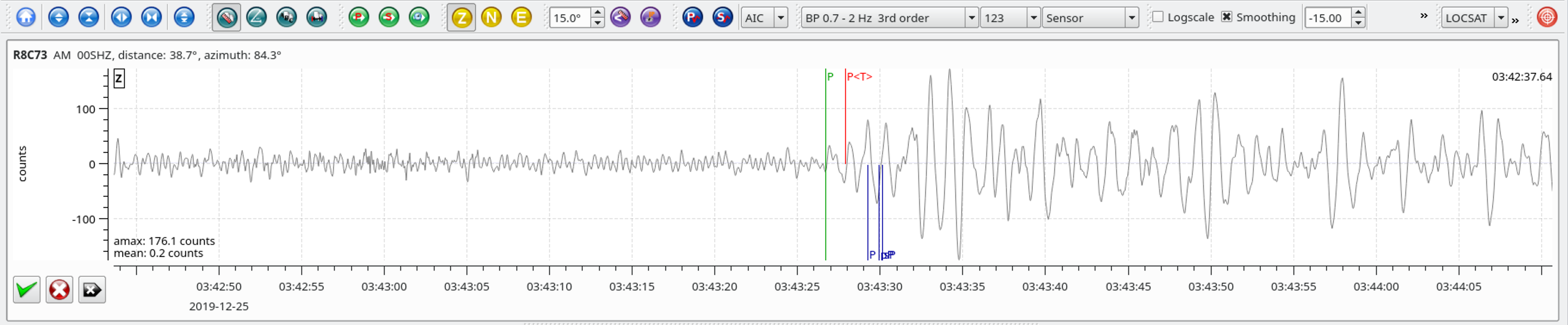
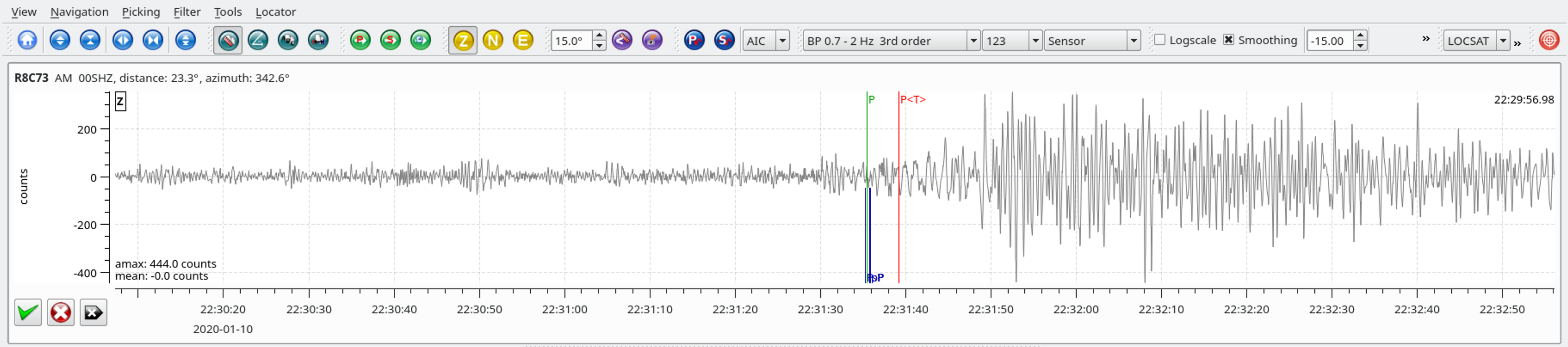
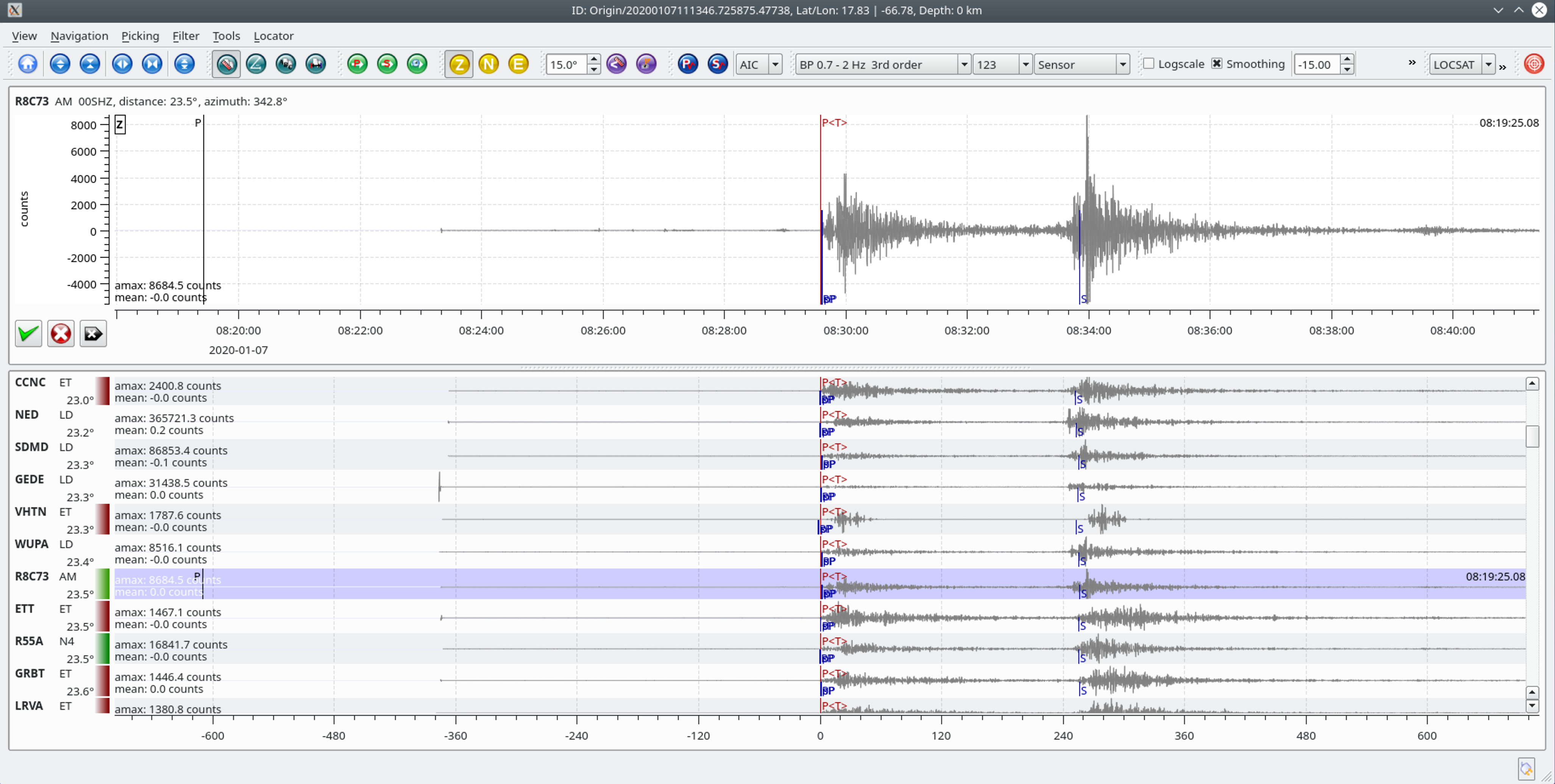
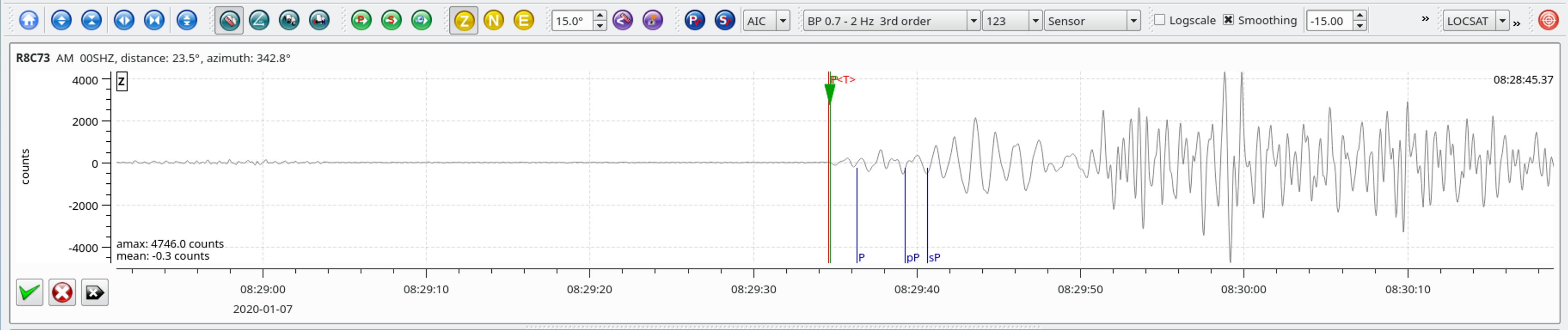
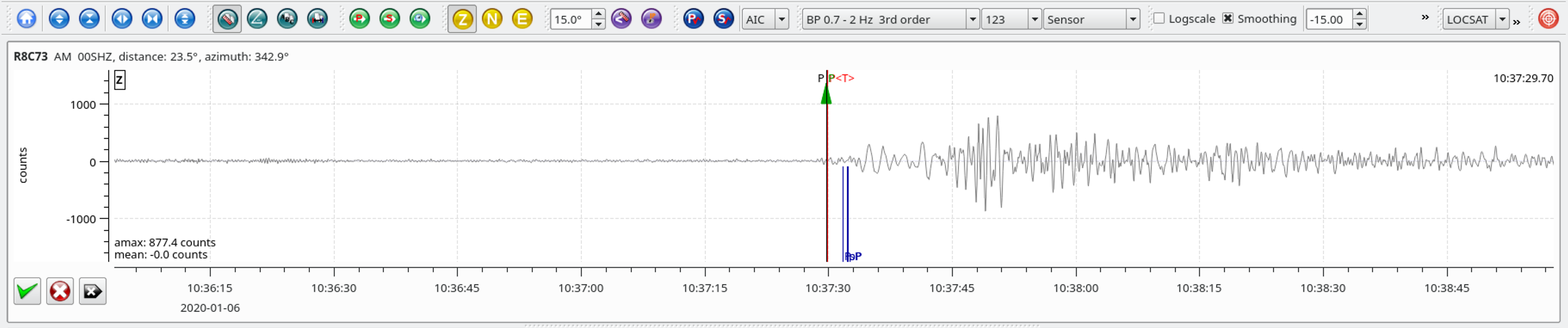
Local SeisComP3 P-wave Arrivals
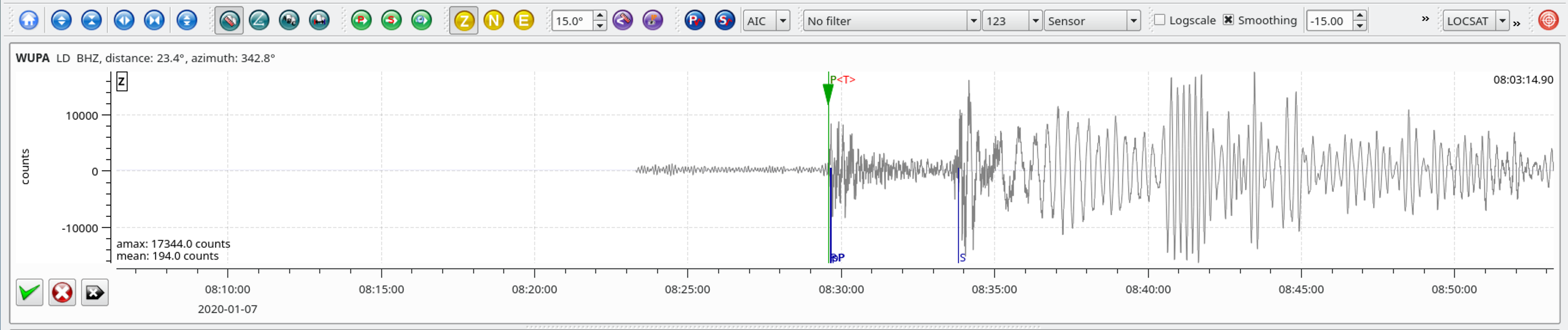
| Latitude | Longitude | Depth (km) | Dist (Deg) | Dist (Km) | Azimuth | |
|---|---|---|---|---|---|---|
| 17.935 | -66.883 | 9.0 | 23.3 | 2,588 | 342.9 |
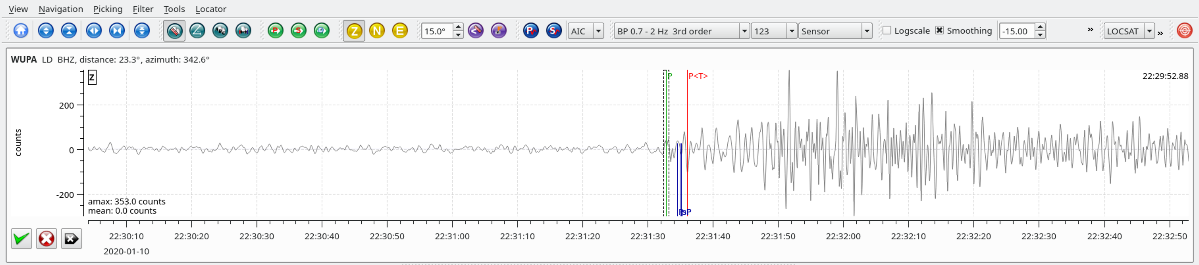
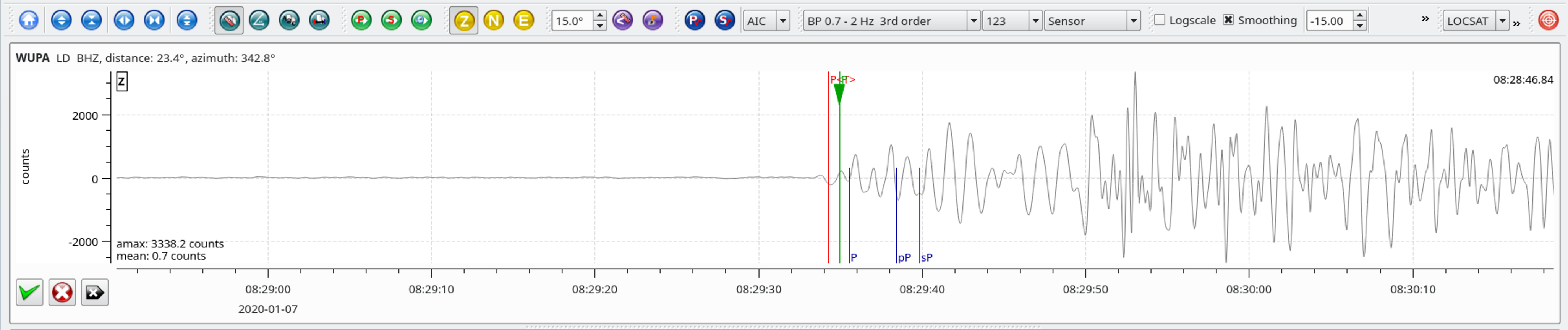
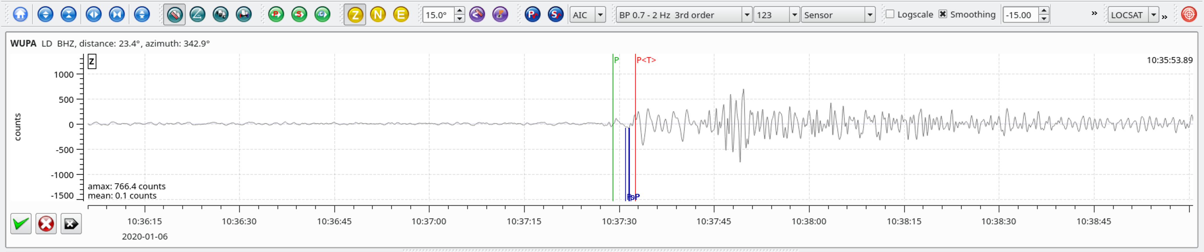
Local SeisComP3 P-wave Arrivals
| Latitude | Longitude | Depth (km) | Dist (Deg) | Dist (Km) | Azimuth | |
|---|---|---|---|---|---|---|
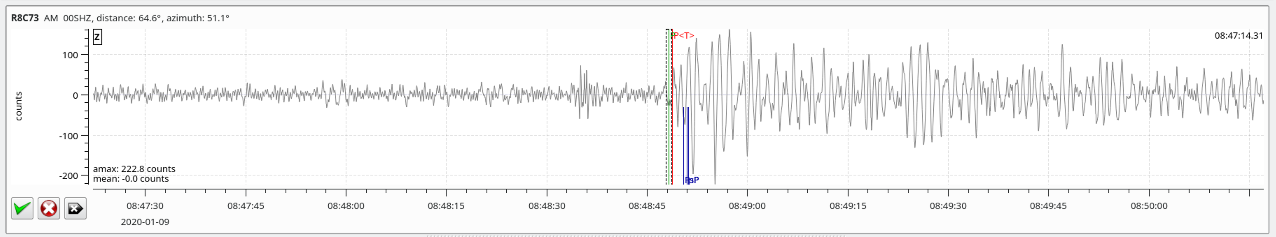
| 62.341 | 171.060 | 10.0 | 64.8 | 7,204 | 51.1 |
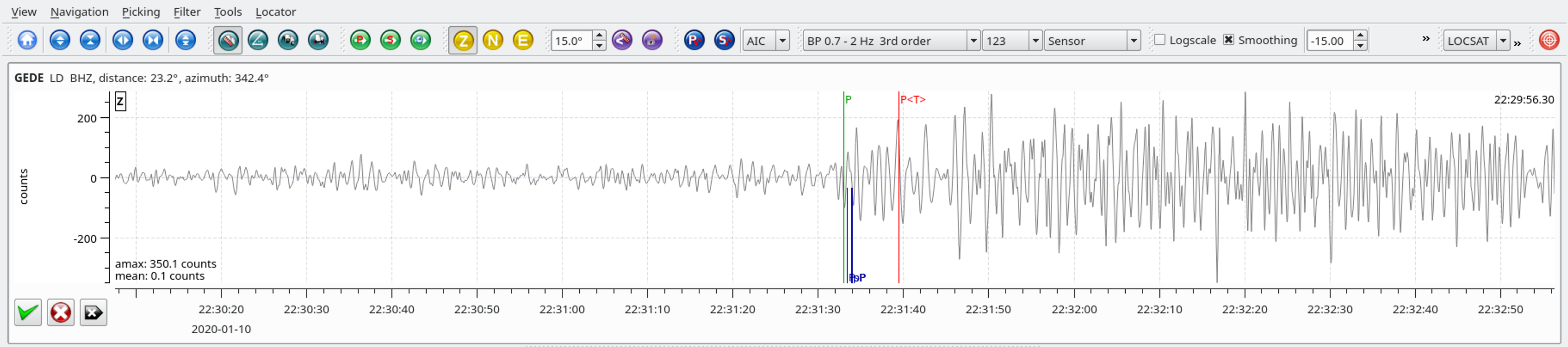
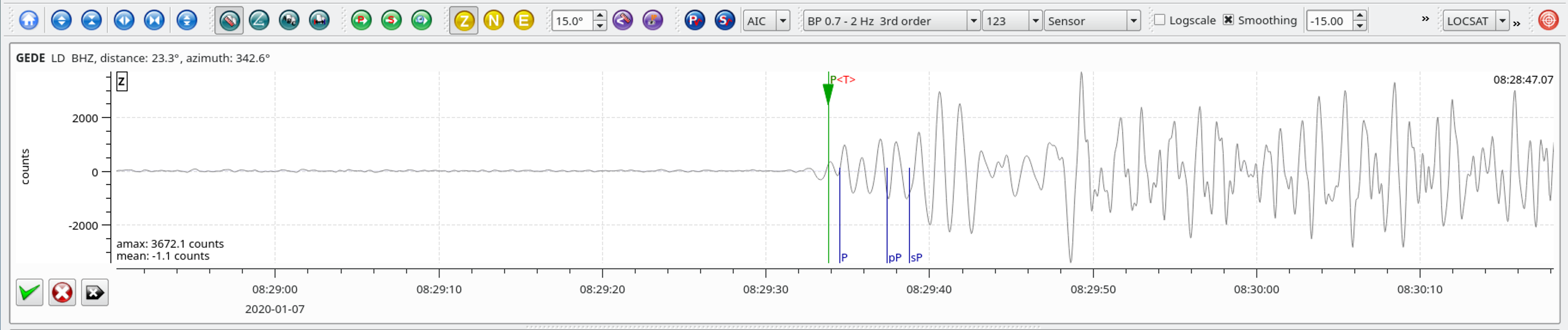
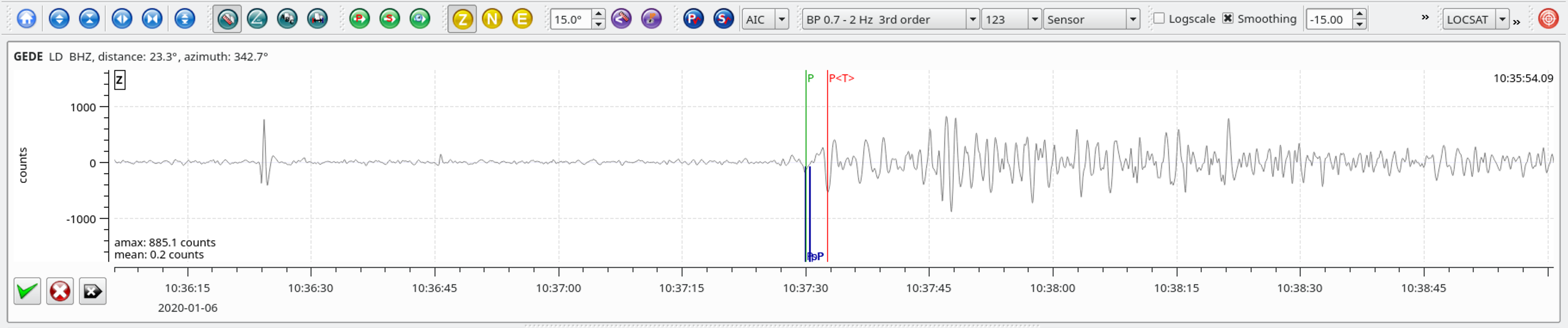
Local SeisComP3 P-wave Arrivals
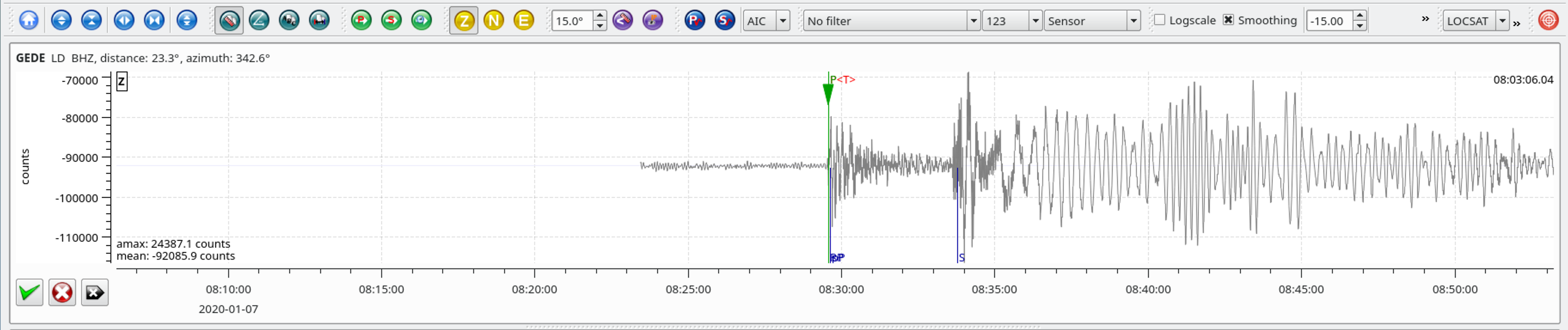
| Latitude | Longitude | Depth (km) | Dist (Deg) | Dist (Km) | Azimuth | |
|---|---|---|---|---|---|---|
| 17.916 | -66.813 | 10.0 | 23.3 | 2,592 | 342.7 |
The January 7, 2020, M 6.4 earthquake offshore of southwest Puerto Rico occurred as the result of oblique normal faulting at shallow depth. Preliminary focal mechanism solutions for the earthquake indicate faulting occurred as the result of slip on either a moderately dipping plane striking just north of west, or on a moderately dipping plane striking just west of south. At the location of this event, the North America plate converges with the Caribbean plate at a rate of about 20 mm/yr towards the west-southwest. The location and focal mechanism solution for the event are consistent with an intraplate tectonic setting within the lithosphere of the Caribbean plate, rather than on the plate boundary between the two plates.
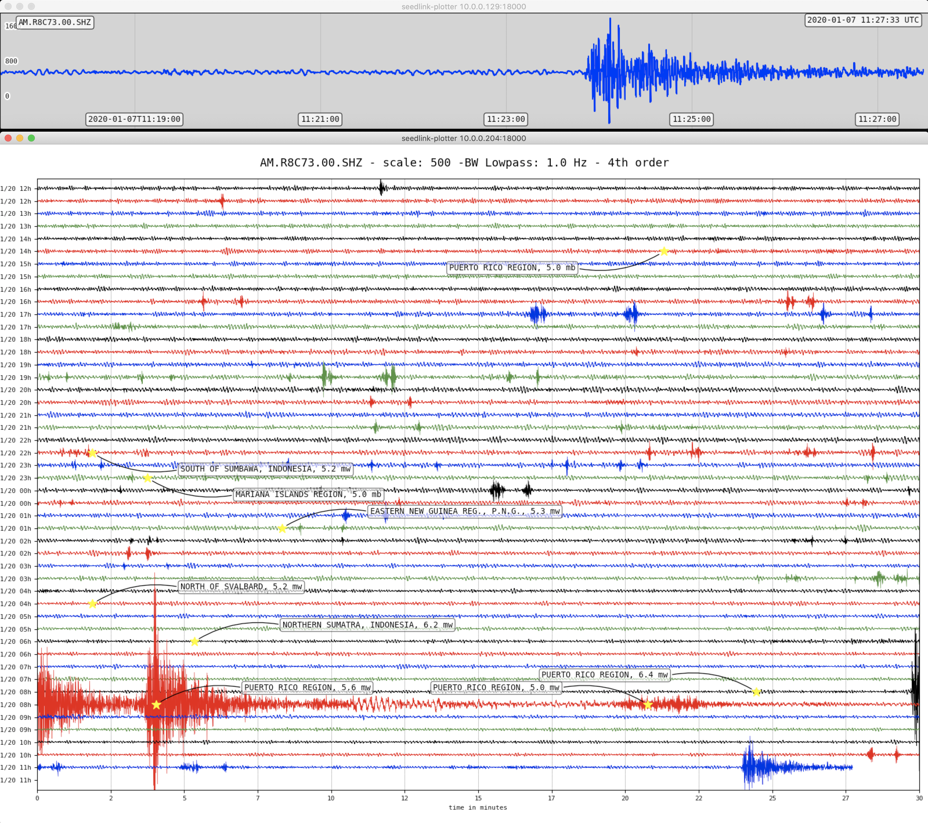
The preliminary location of this earthquake is within about 12 km of the January 6, 2020, M 5.8 earthquake. Over the past several weeks, hundreds of small earthquakes have occurred in this same region, beginning in earnest with a M 4.7 earthquake late on December 28 and a M 5.0 event a few hours later. Since the M 4.7 event, over 400 M 2+ earthquakes have occurred in this region, 11 of which were M 4+, including today’s M 6.4 event and the January 6th M 5.8. The proximity of these events to Puerto Rico, and their shallow depth, mean that dozens of these events have likely been felt on land, though with the exception of the M 5.8 earthquake and the latest M 6.4, none are likely to have caused significant damage.
Tectonics in Puerto Rico are dominated by the convergence between the North America and Caribbean plates, with the island being squeezed between the two. To the north of Puerto Rico, North America subducts beneath the Caribbean plate along the Puerto Rico trench. To the south of the island, and south of today’s earthquake, Caribbean plate lithosphere subducts beneath Puerto Rico at the Muertos Trough. The January 6 and 7 earthquakes, and other recent nearby events, are occurring in the offshore deformation zone bound by the Punta Montalva Fault on land and the Guayanilla Canyon offshore.
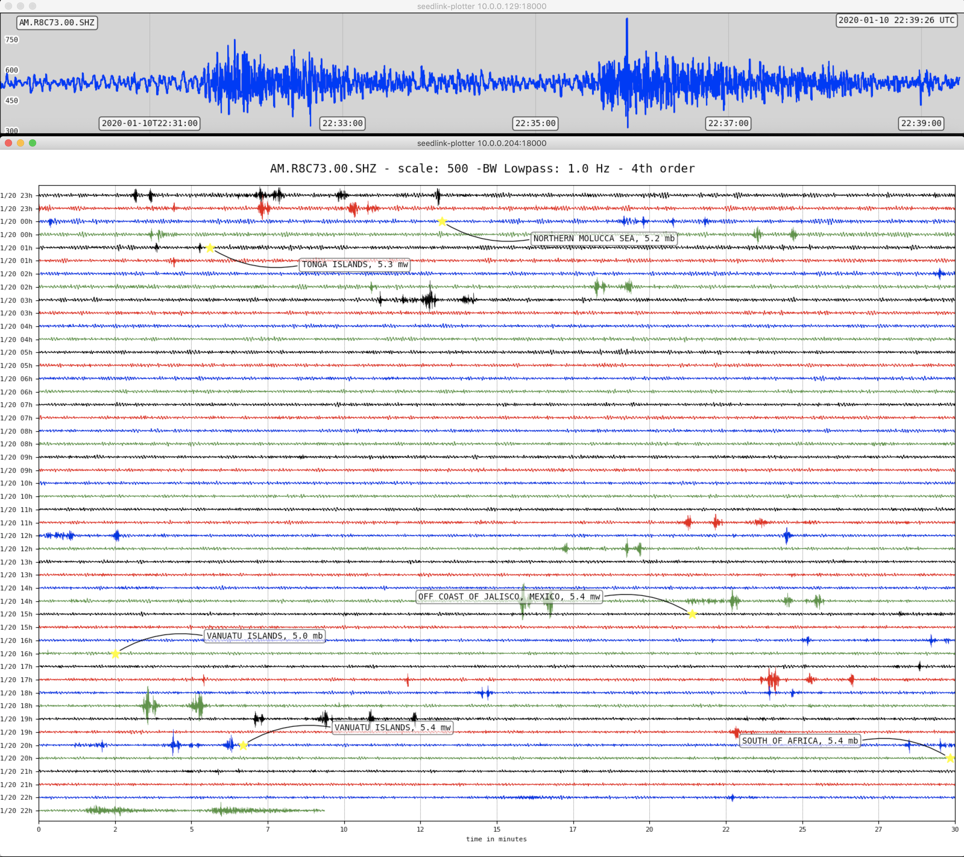
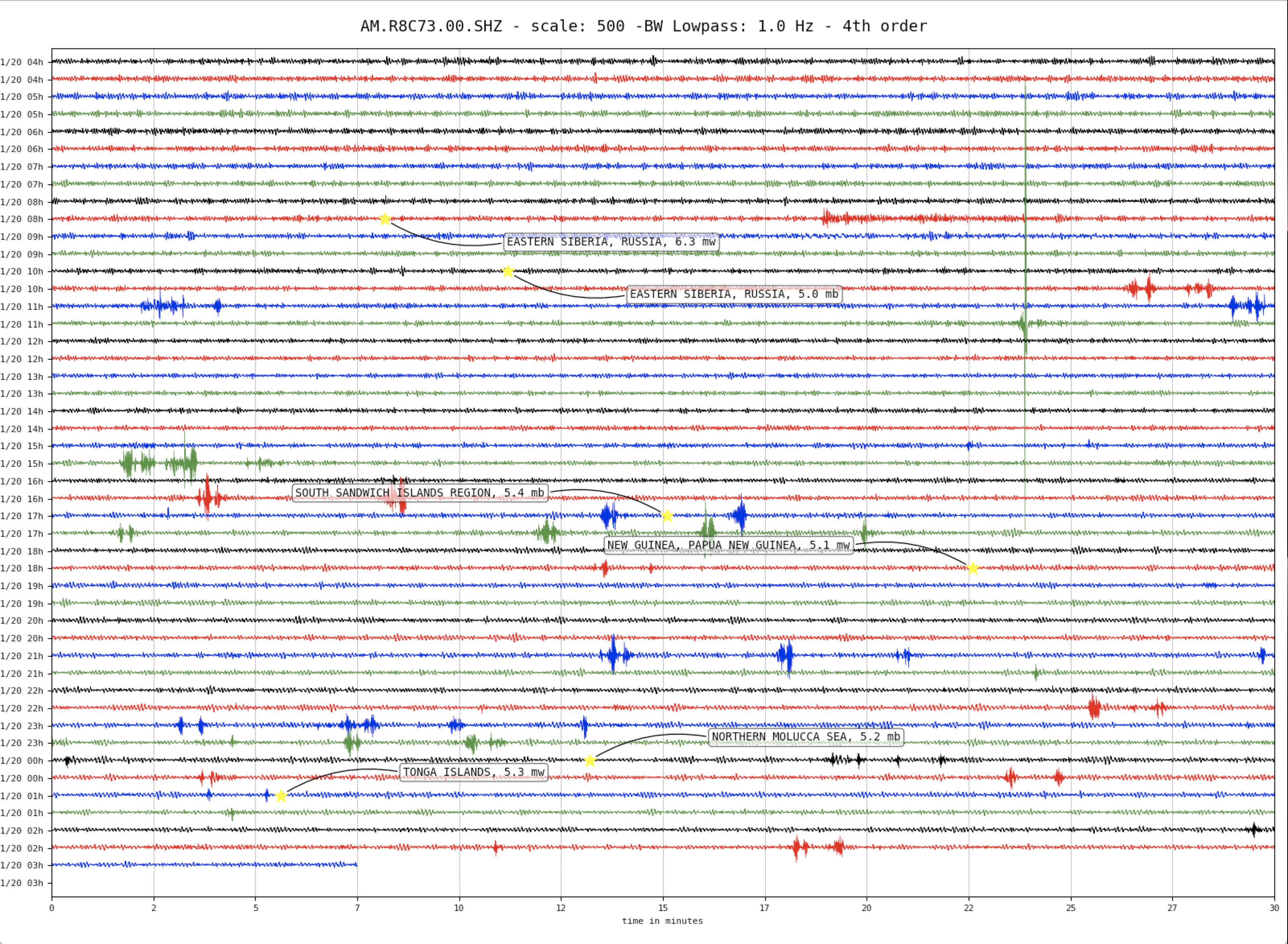
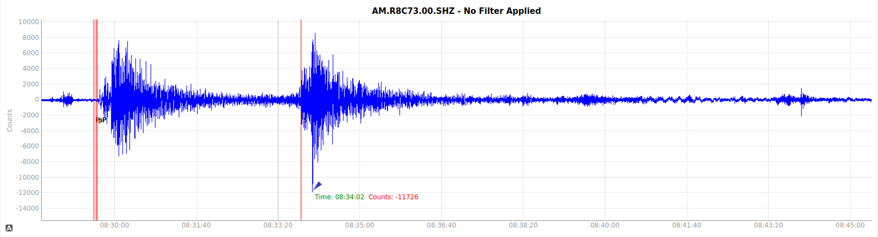
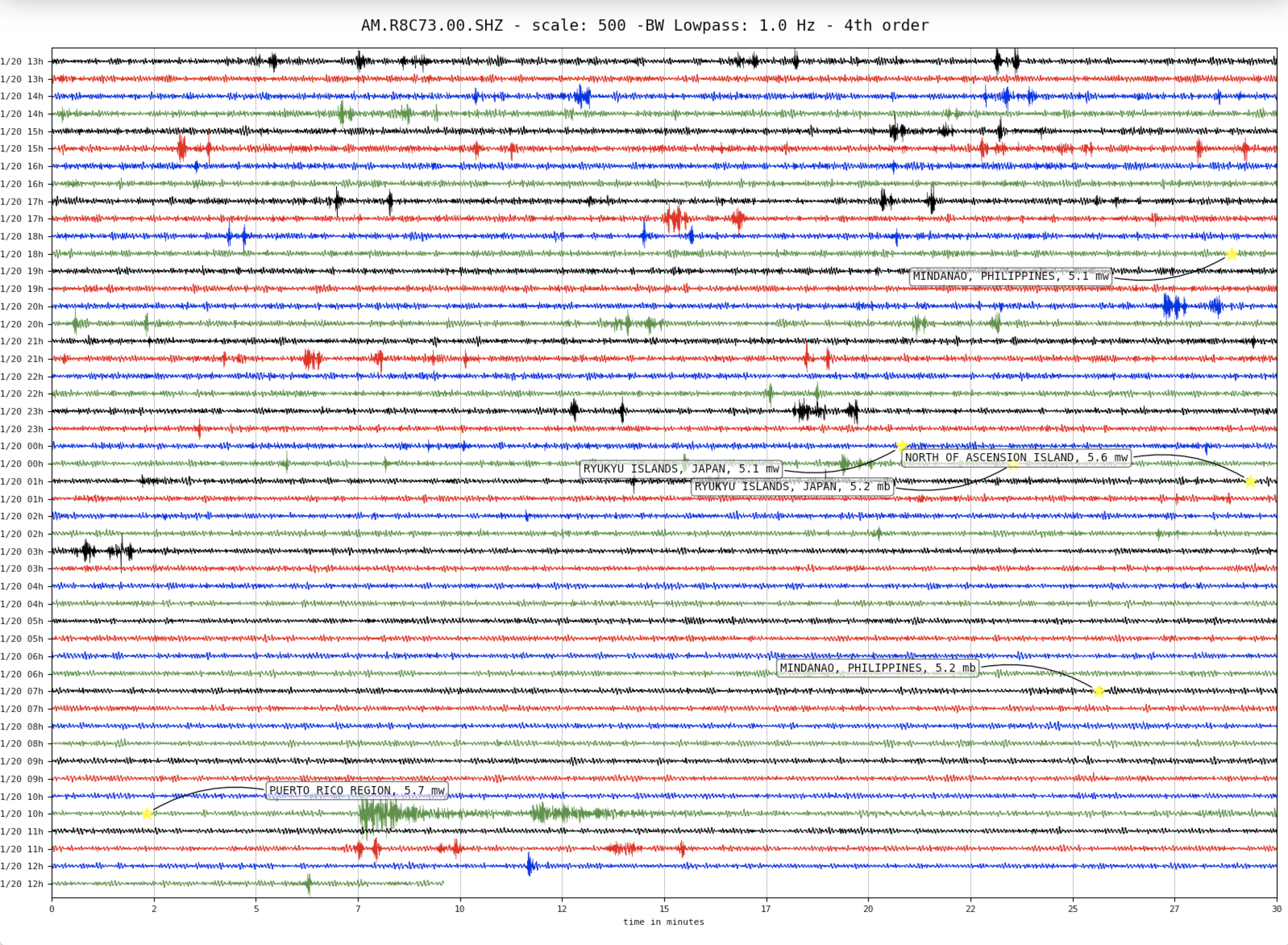
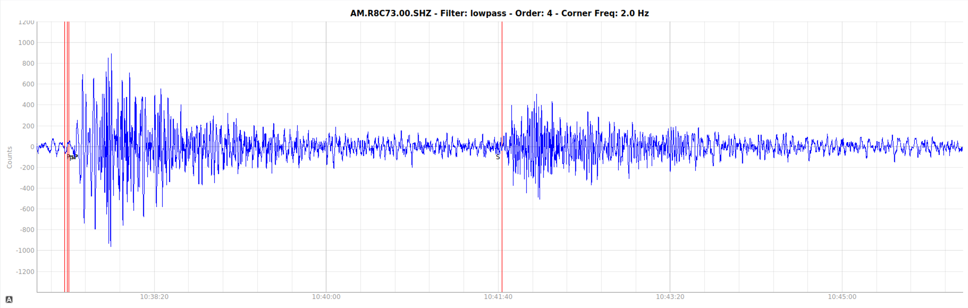
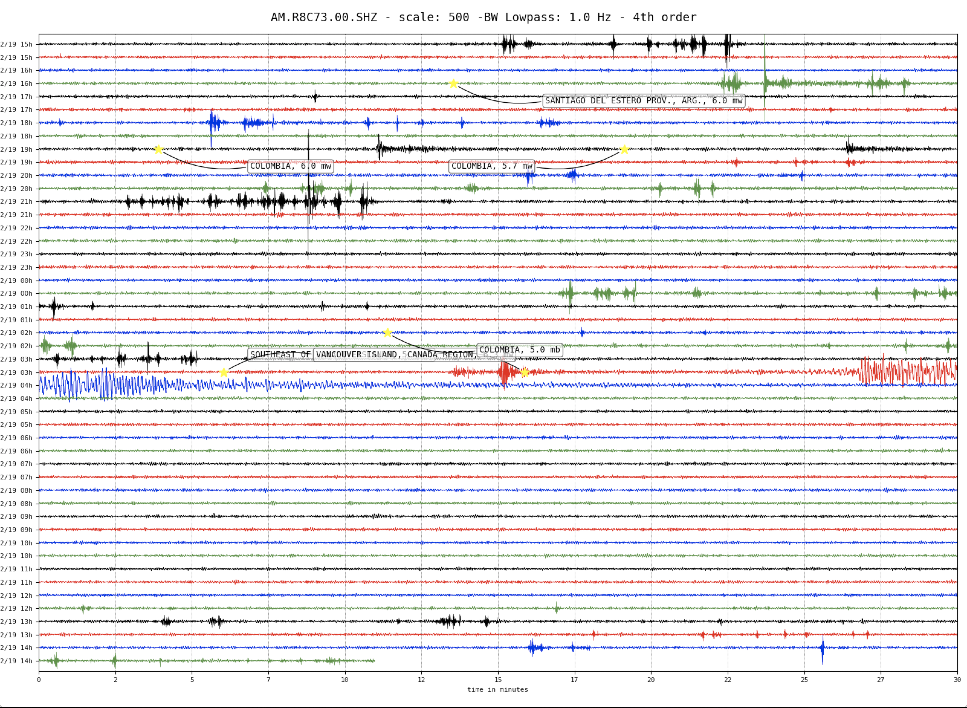
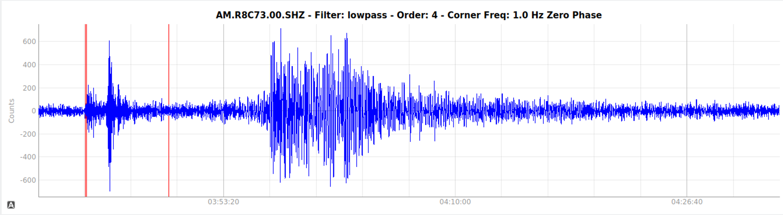
Trace showing the mainshock as well as the arrival of a M5.6 aftershock.
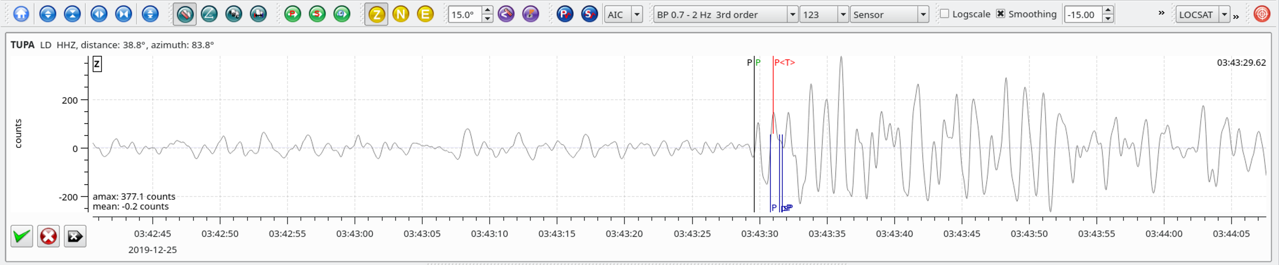
Local SeisComP3 P-wave Arrivals
Long period unfiltered local traces.
| Latitude | Longitude | Depth (km) | Dist (Deg) | Dist (Km) | Azimuth | |
|---|---|---|---|---|---|---|
| 17.868 | -66.819 | 6.0 | 23.4 | 2,597 | 342.8 |
The January 6, 2020, M 5.8 earthquake offshore of southwest Puerto Rico occurred as the result of oblique strike slip faulting at shallow depth. Preliminary focal mechanism solutions for the earthquake indicate faulting occurred as the result of slip on either a steeply dipping plane striking just north of west, or on a steeply dipping plane striking just west of south. At the location of this event, the North America plate converges with the Caribbean plate at a rate of about 20 mm/yr towards the west-southwest. The location and focal mechanism solution for the event are consistent with an intraplate tectonic setting within the lithosphere of the Caribbean plate, rather than on the plate boundary between the two plates.
Tectonics in Puerto Rico are dominated by the convergence between the North America and Caribbean plates, with the island being squeezed between the two. To the north of Puerto Rico, North America subducts beneath the Caribbean plate along the Puerto Rico trench. To the south of the island, and south of today’s earthquake, Caribbean plate lithosphere subducts beneath Puerto Rico at the Muertos Trough. The January 6 earthquake, and other recent nearby events, are occurring in the offshore deformation zone bound by the Punta Montalva Fault on land and the Guayanilla Canyon offshore. Over the past several weeks, hundreds of small earthquakes have occurred in this same region, beginning in earnest with a M 4.7 earthquake late on December 28 and a M 5.0 event a few hours later. Since the M 4.7 event, over 360 M 2+ earthquakes have occurred in this region, seven of which were M 4+, including today’s M 5.8 event. The proximity of these events to Puerto Rico, and their shallow depth, mean that dozens of these events have likely been felt on land, though with the exception of the latest M 5.8 earthquake, none are likely to have caused damage.
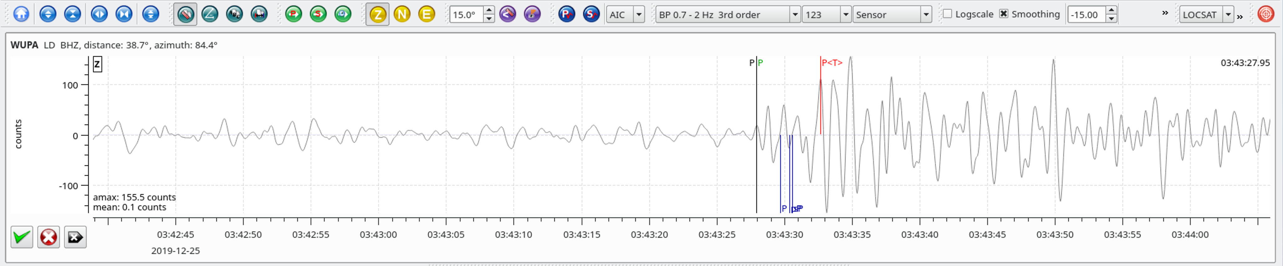
Local SeisComP3 P-wave Arrivals
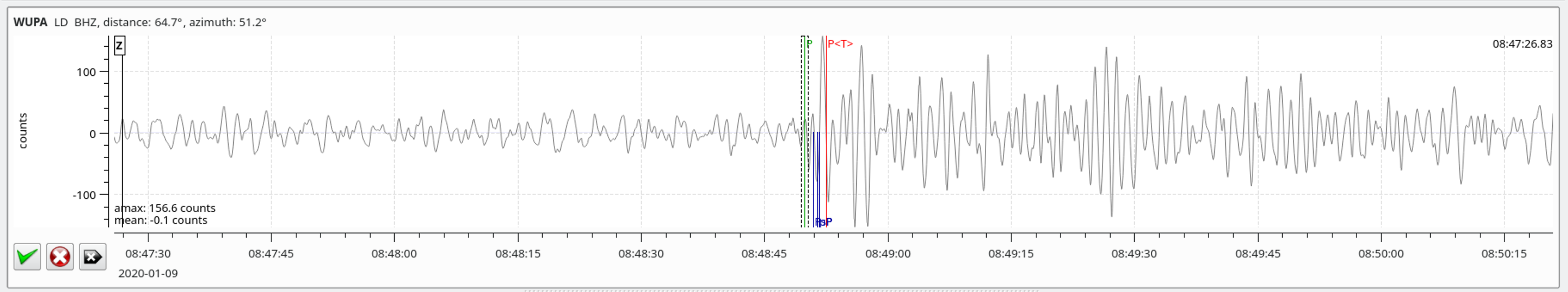
| Latitude | Longitude | Depth (km) | Dist (Deg) | Dist (Km) | Azimuth | |
|---|---|---|---|---|---|---|
| 50.583 | -129.999 | 10.0 | 38.9 | 4,319 | 84.1 |
Local SeisComP3 P-wave Arrivals