On March 13th a rapidly developing lo pressure system brought blizzard conditions to a large stretch of the Great Plains. Here are some AWIPS II screenshots:
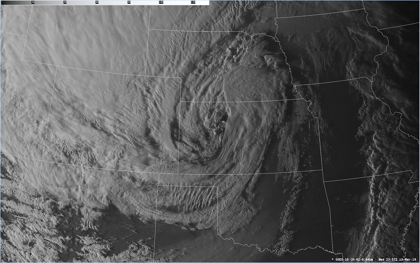
Dramatic GOES-16 images of the storm near sunset.
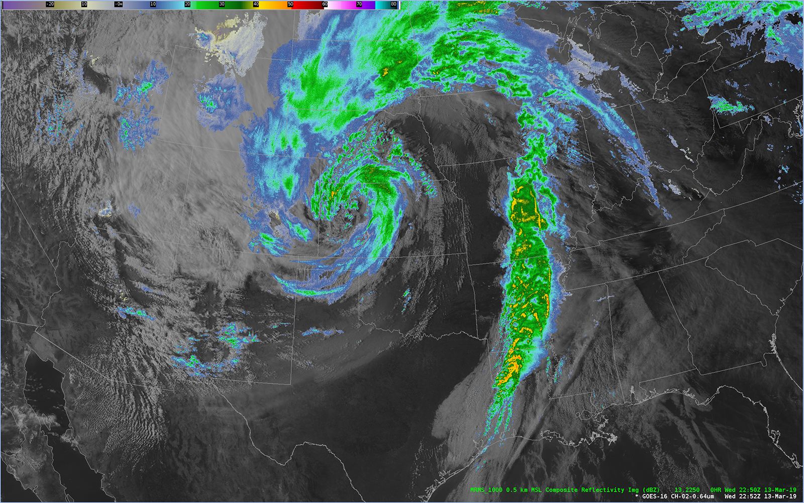
NEXRAD composite radar superimposed over the GOES-16 satellite image.
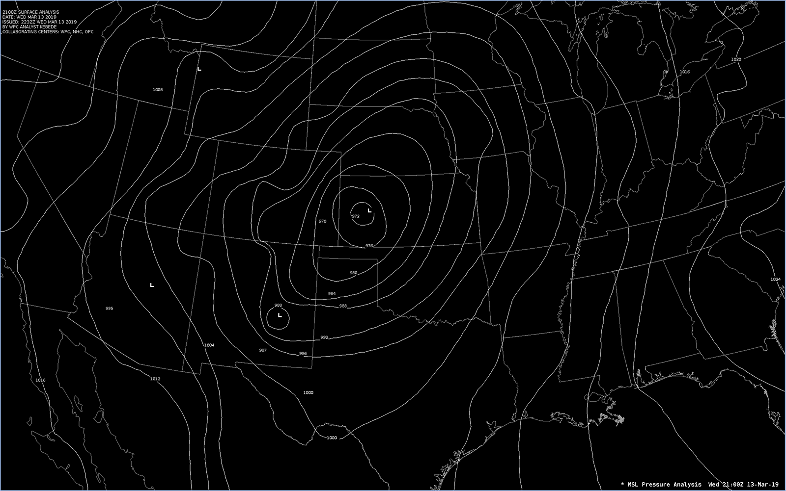
Surface isobars showing a central pressure below 972 hPa!