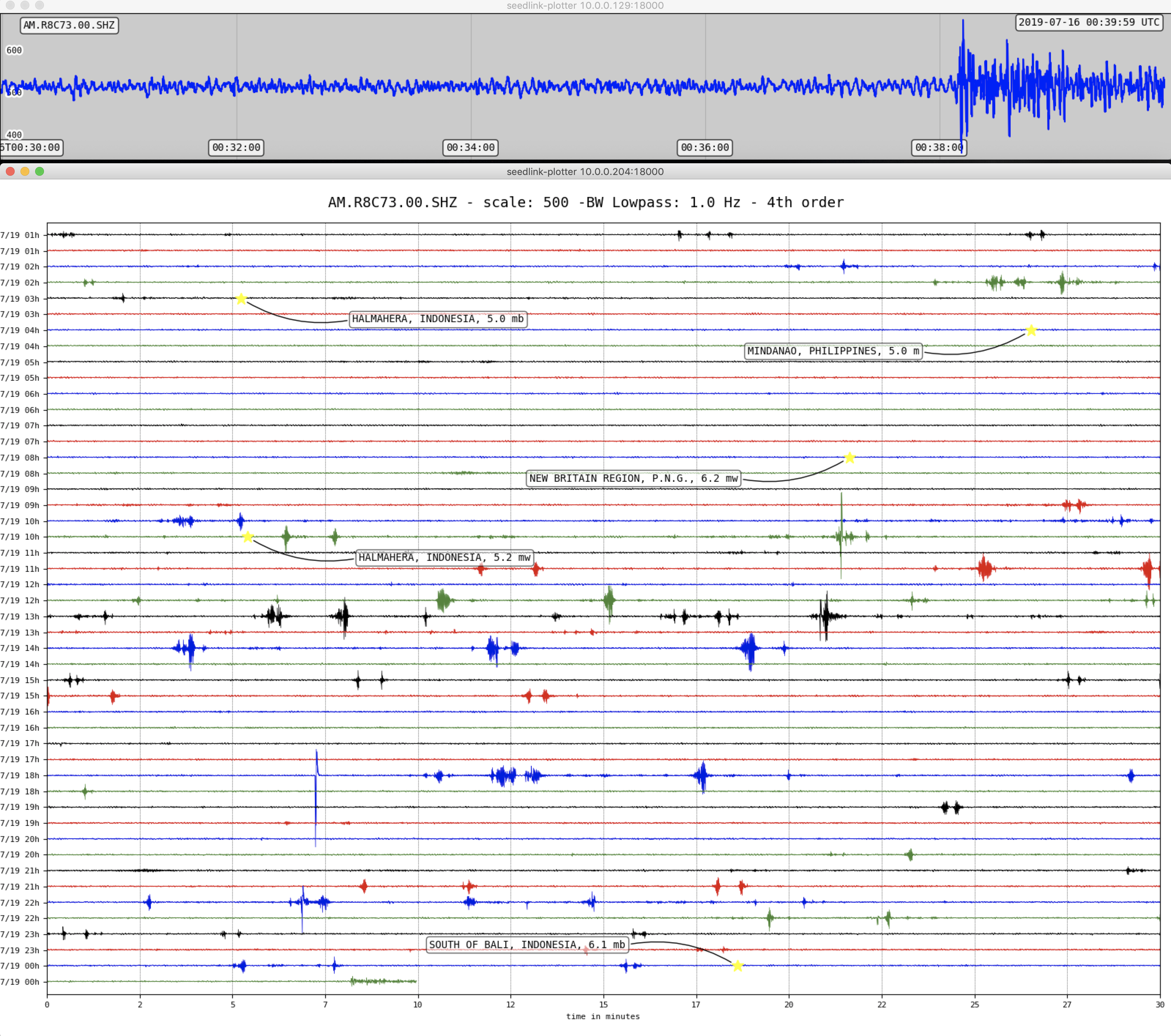
Indonesia – M5.7 – July 16, 2019 at 00:18:37 UTC
40km SSE of Kendalrejo, Indonesia
| Latitude | Longitude | Depth (km) | Dist (Deg) | Dist (Km) | Azimuth | |
|---|---|---|---|---|---|---|
| -8.867 | 114.503 | 91.6 | 147.7 | 16,412 | 14.4 |
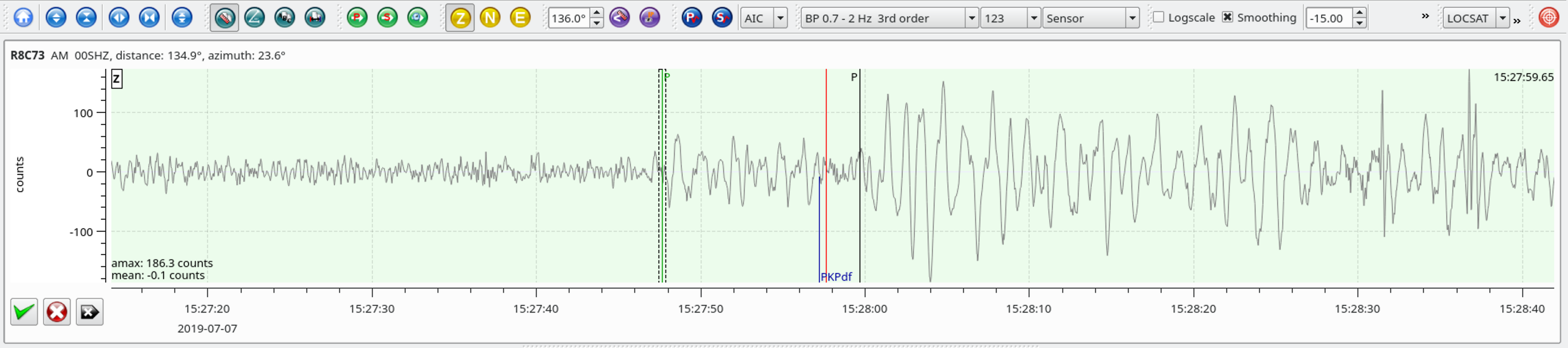
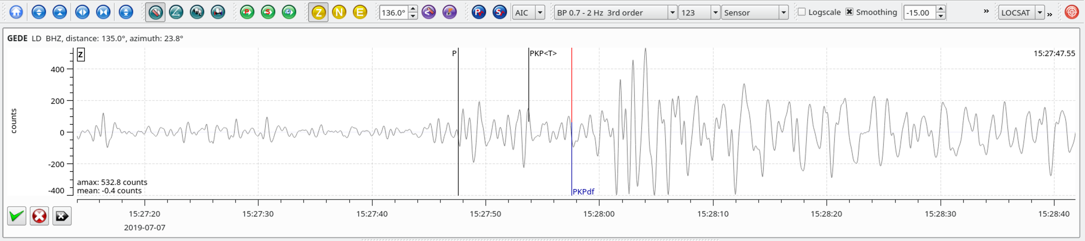
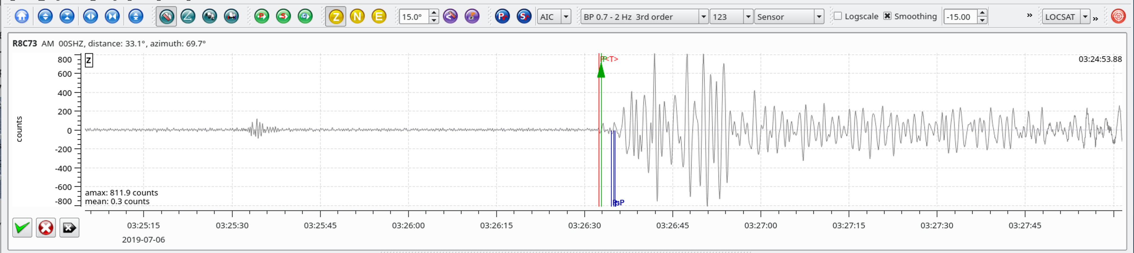
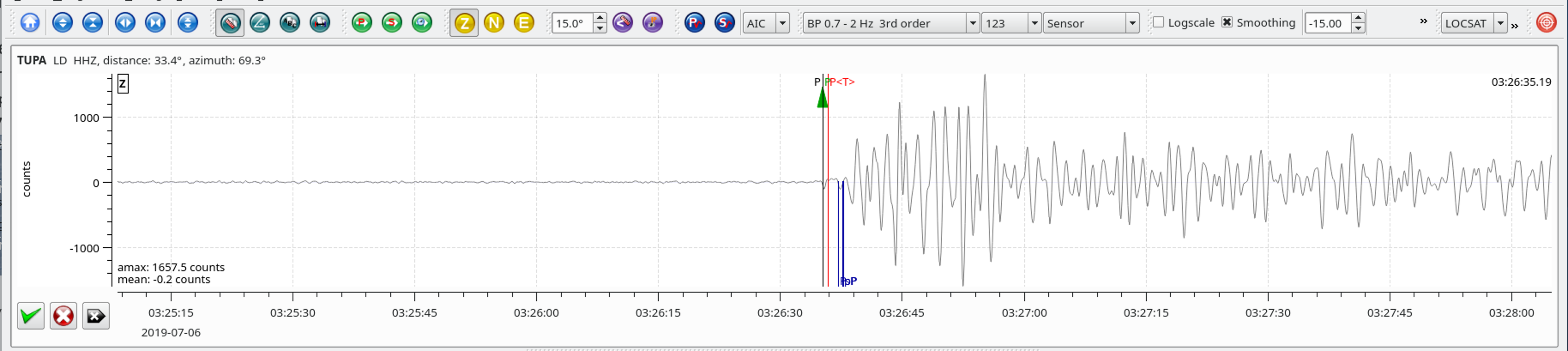
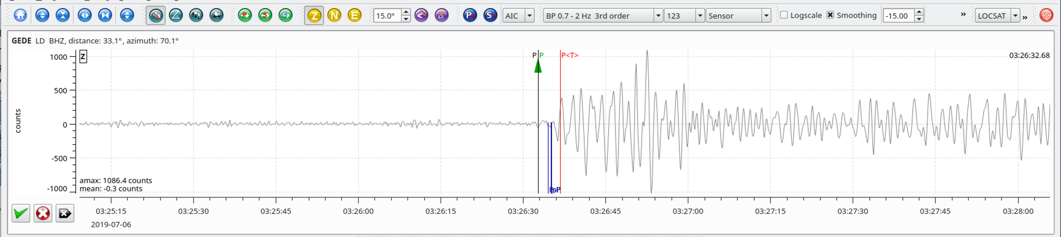
Local SeisComP3 P-wave Arrivals
| Latitude | Longitude | Depth (km) | Dist (Deg) | Dist (Km) | Azimuth | |
|---|---|---|---|---|---|---|
| -8.867 | 114.503 | 91.6 | 147.7 | 16,412 | 14.4 |
Local SeisComP3 P-wave Arrivals
| Latitude | Longitude | Depth (km) | Dist (Deg) | Dist (Km) | Azimuth | |
|---|---|---|---|---|---|---|
| -0.529 | 128.093 | 10.0 | 135.2 | 15,020 | 25.7 |
From the USGS Information Page:
The July 14, 2019, M 7.3 earthquake near the southern end of the island of Halmahera, Indonesia, occurred as the result of shallow strike slip faulting in the complex plate boundary region of eastern Indonesia, within the oceanic lithosphere of the Sunda plate. Faulting mechanism solutions for the event indicate that slip occurred on a steeply dipping structure striking either southwest (right lateral faulting) or southeast (left lateral faulting). Aftershocks since the M 7.3 event have generally aligned with the plane striking southeast.
Tectonics in eastern Indonesia are extremely complex and are dominated by the mostly convergent interactions of the Pacific, Australia, Philippine Sea, and Sunda plates. The edges of the Sunda and Australia plates are also often subdivided into smaller tectonic blocks, including the Molucca Sea and Birds Head microplates in the region of the July 2019 earthquake. In this context, the July 2019 event most closely aligns with the boundary between the Birds Head and Molucca Sea microplates, about 130 km to the southeast. At depth beneath this earthquake and the Molucca Sea in general (predominantly to the north and west of this event), the inverted-U-shaped Halmahera plate, which has no surface expression, also plays a role in regional tectonics. At the location of the July 14th earthquake, the Sunda and Philippine Sea plates are converging in an east-west direction at a rate of approximately 110 mm/yr, and the Sunda and Pacific plates are converging in an east-west direction at a rate of approximately 96 mm/yr.
This area of the Halmahera Sea has hosted 35 M 6+ events within 250 km of the July 14, 2019, earthquake in the last half-century. None of these were M 7+. Within the first three hours of the July 14th, 2019 earthquake, the USGS has recorded 17 aftershocks, distributed in an approximate northwest-southeast direction about the M 7.3 shock. The largest of these was a M 5.8, 33 minutes after the M 7.3 earthquake.
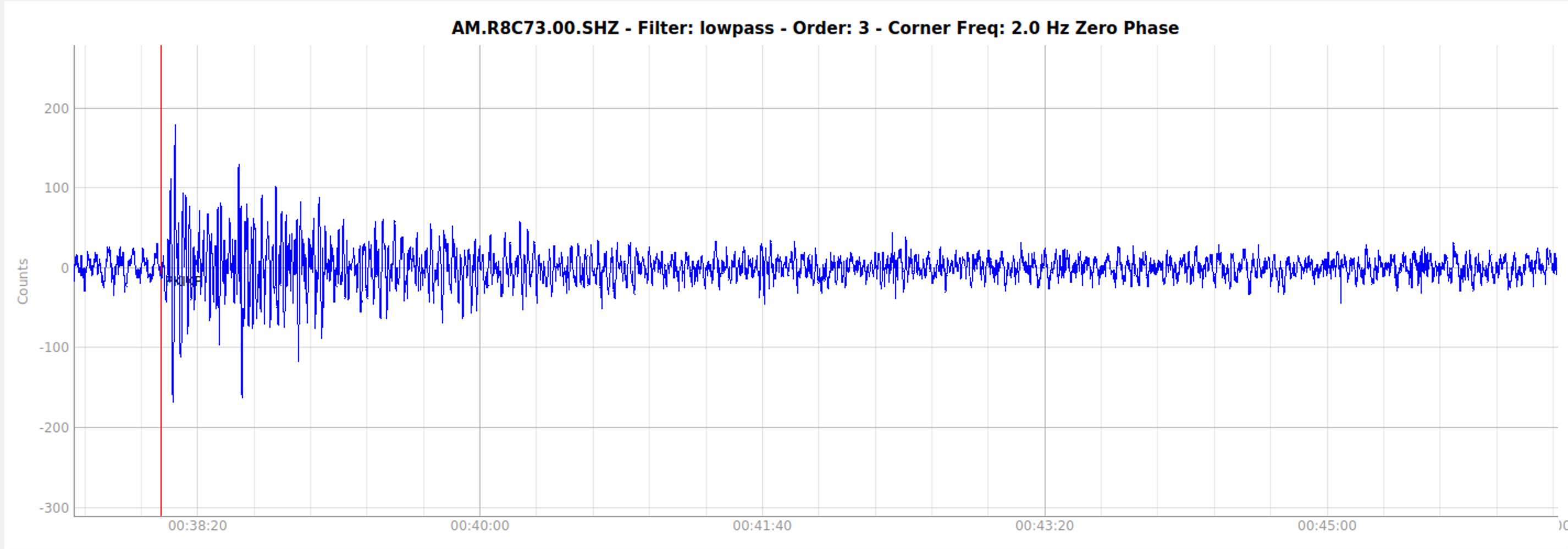
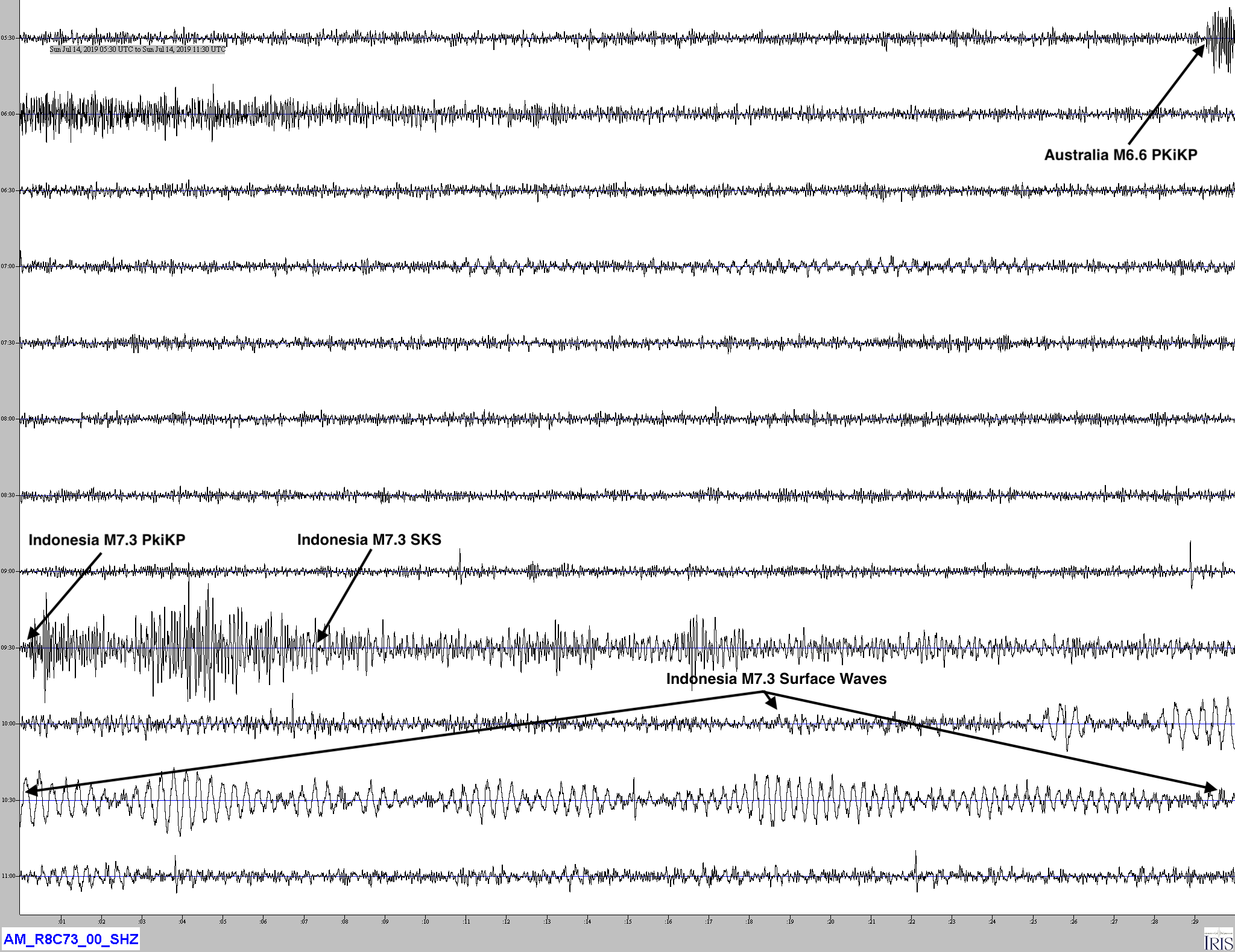
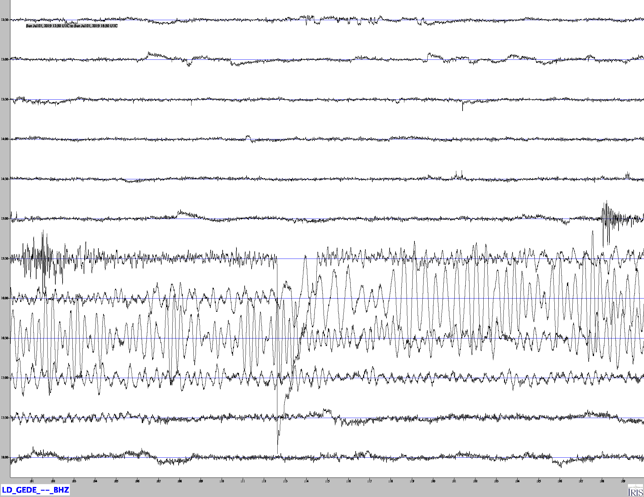
Heliocorder trace showing both this event and the M6.6 quake off the northwest coast of Australia.
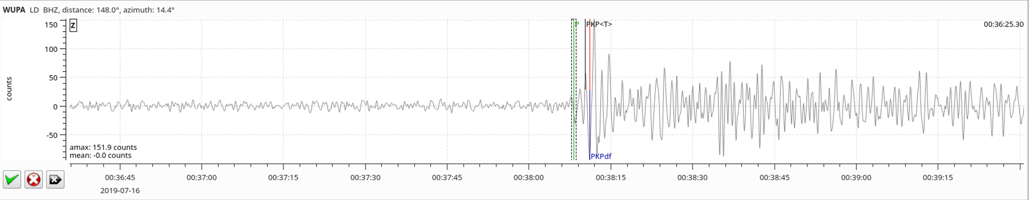
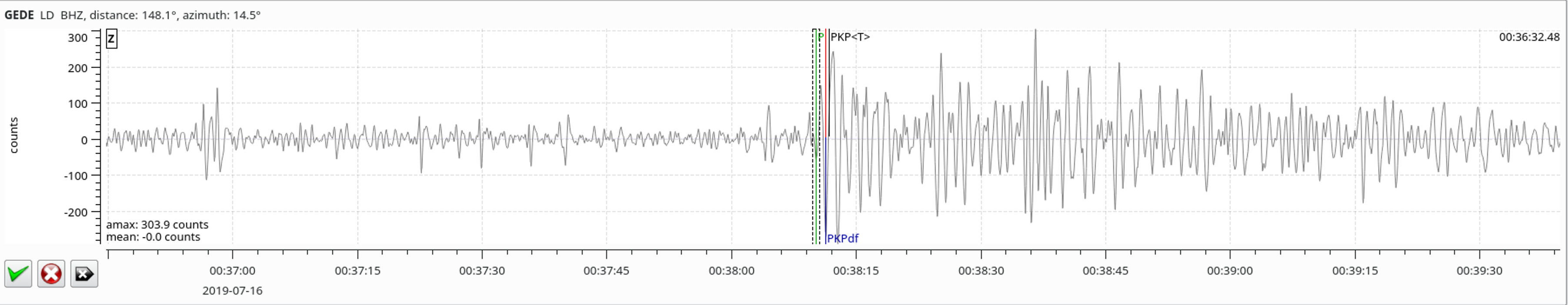
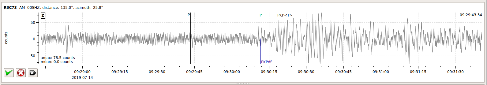
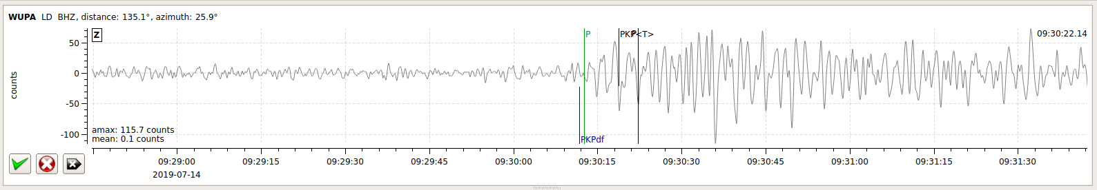
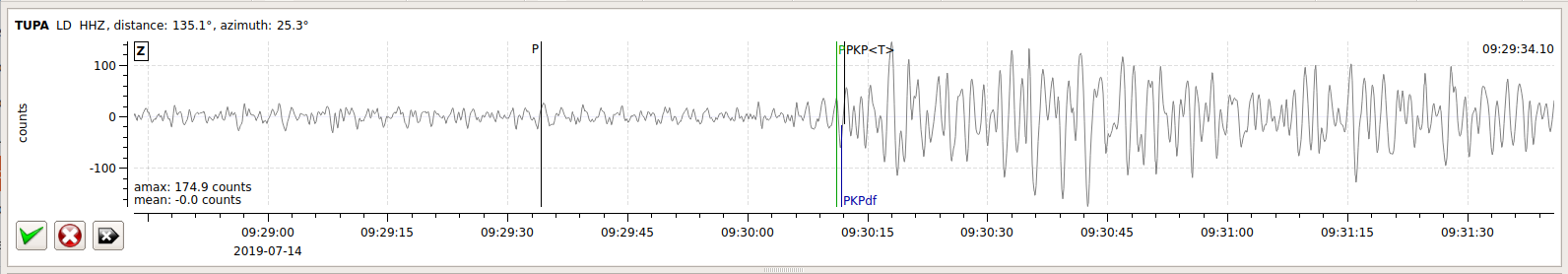
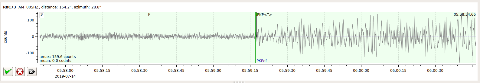
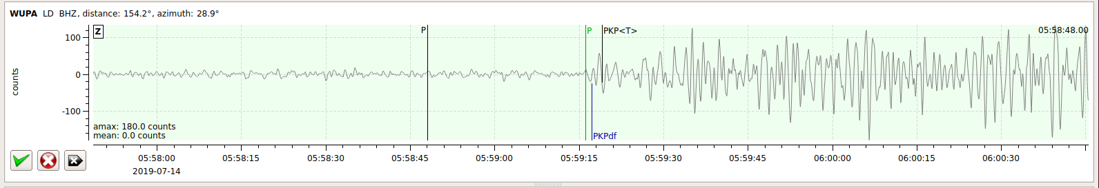
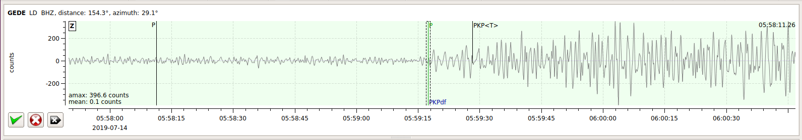
Waveforms
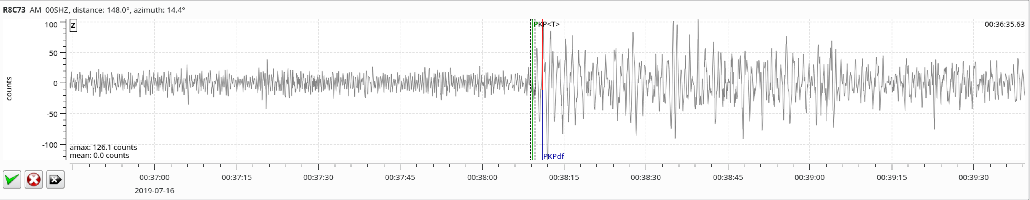
Local SeisComP3 P-wave Arrivals
| Latitude | Longitude | Depth (km) | Dist (Deg) | Dist (Km) | Azimuth | |
|---|---|---|---|---|---|---|
| -18.202 | 120.337 | 10.0 | 154.3 | 17,148 | 28.7 |

Local SeisComP3 P-wave Arrivals
| Latitude | Longitude | Depth (km) | Dist (Deg) | Dist (Km) | Azimuth | |
|---|---|---|---|---|---|---|
| 0.523 | 126.199 | 36.3 | 135.0 | 15,003 | 23.6 |
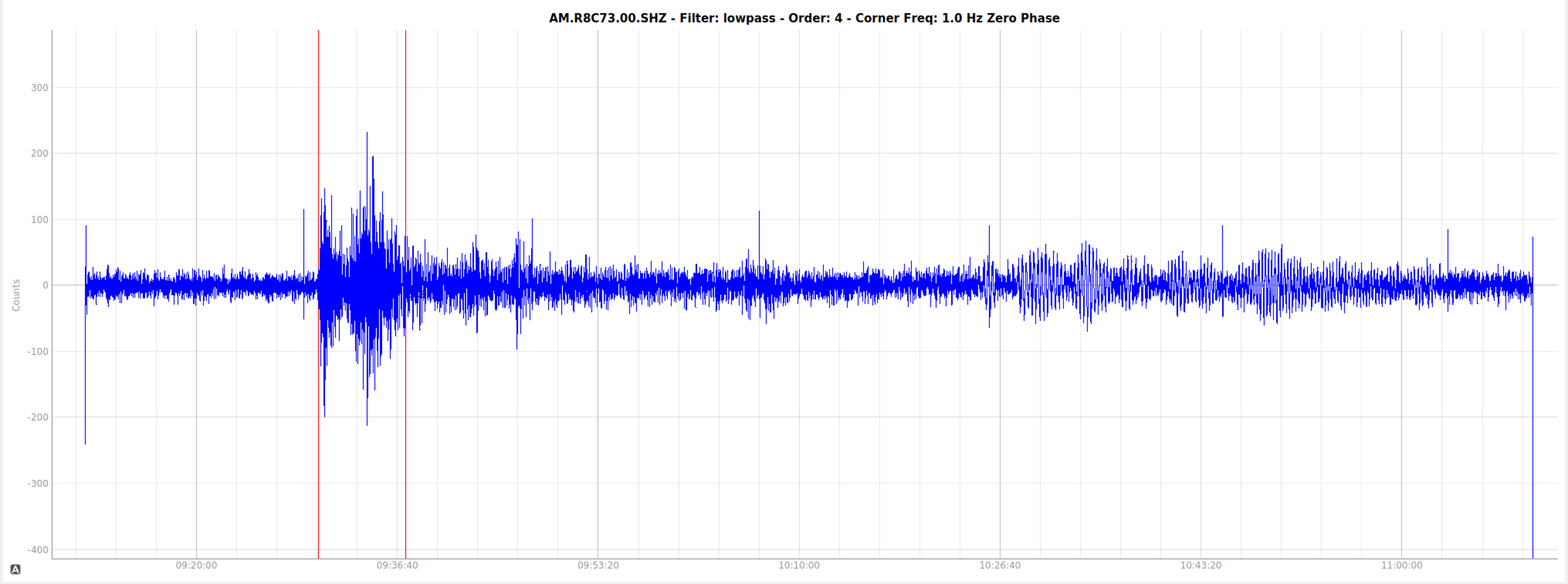
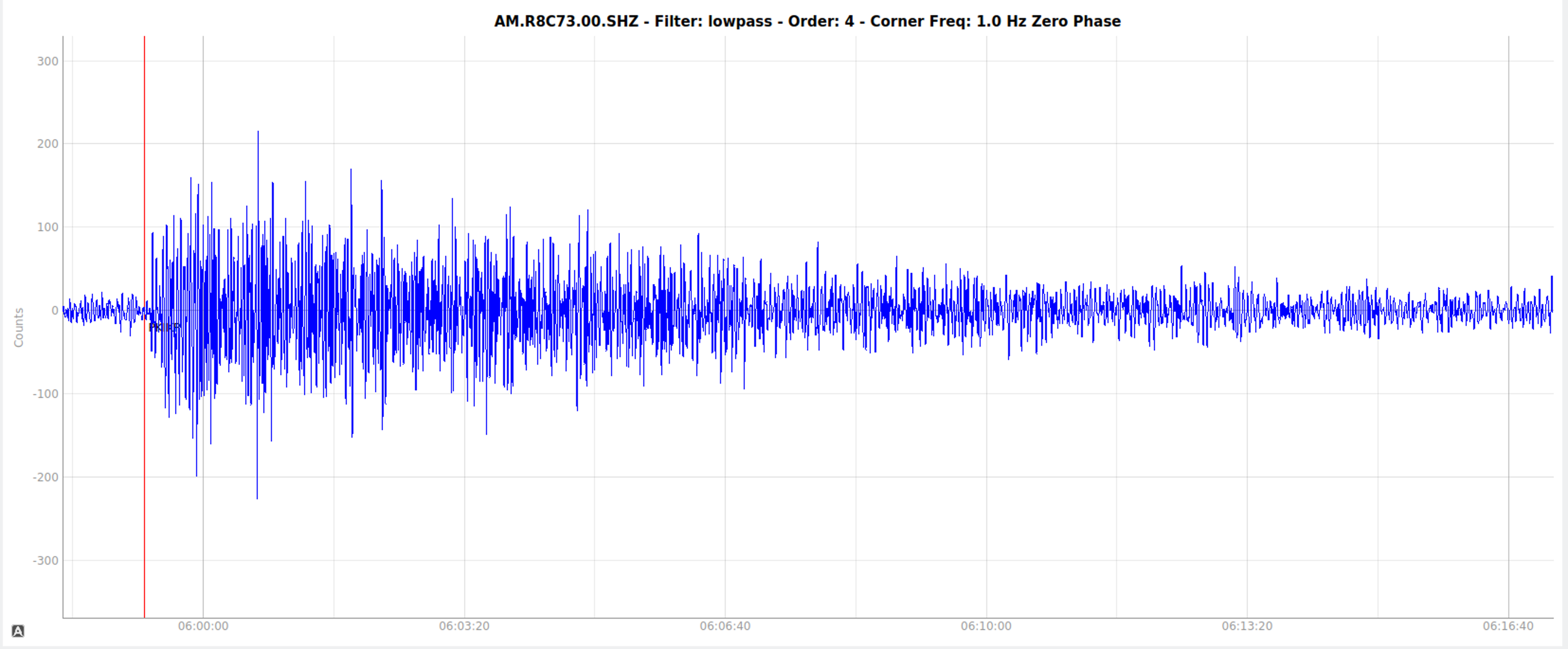
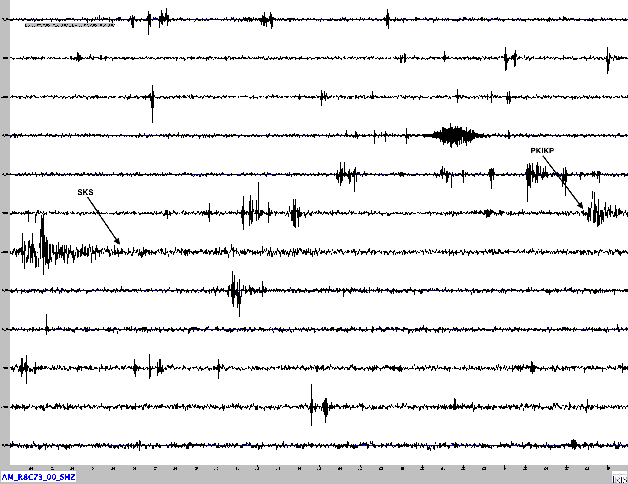
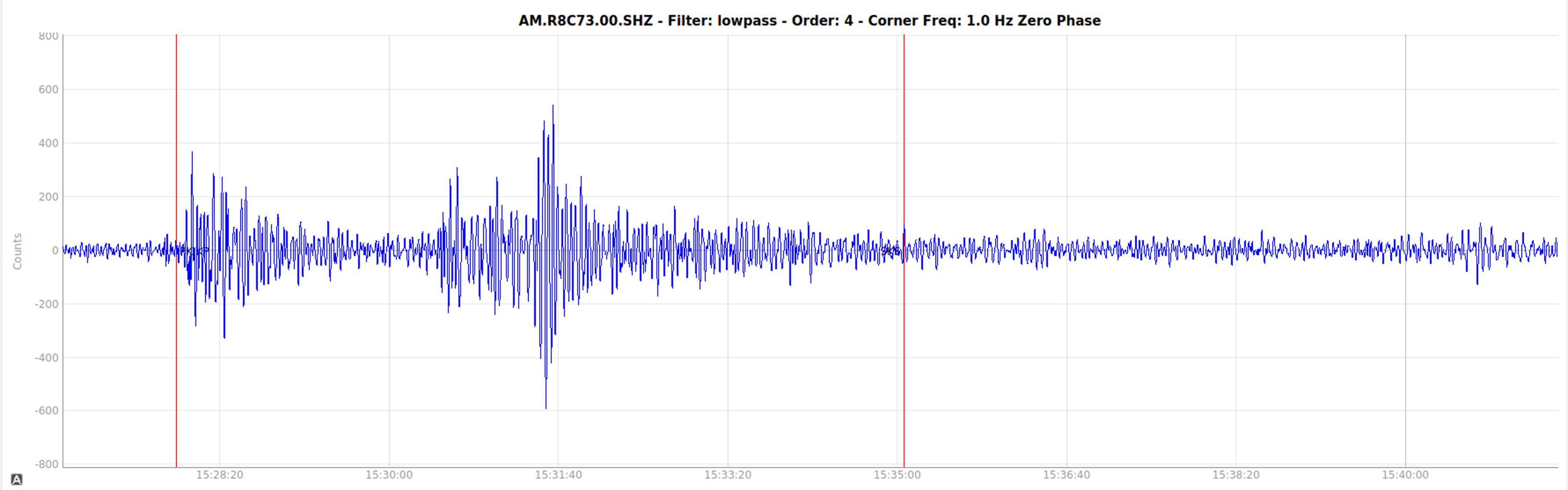
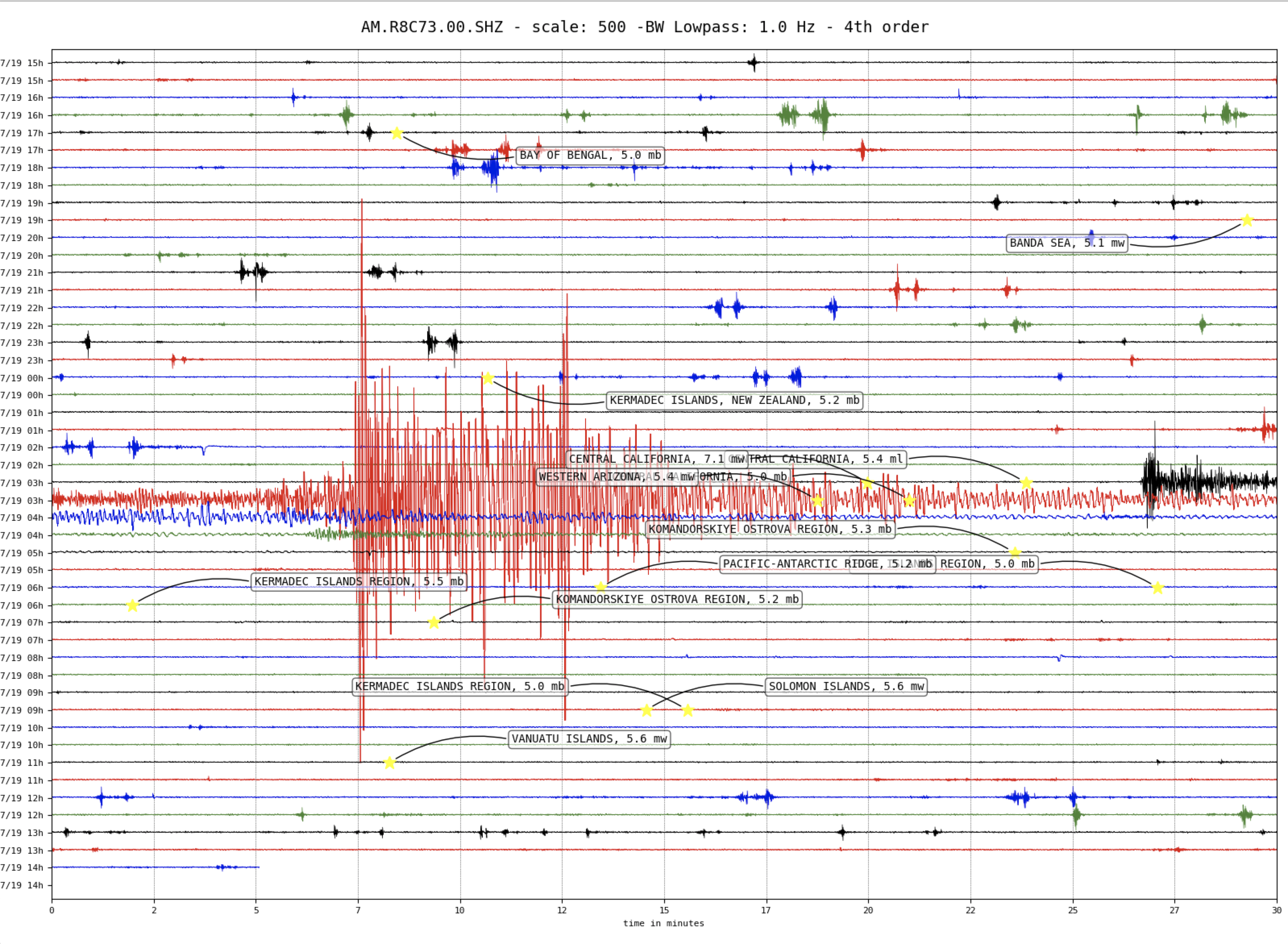
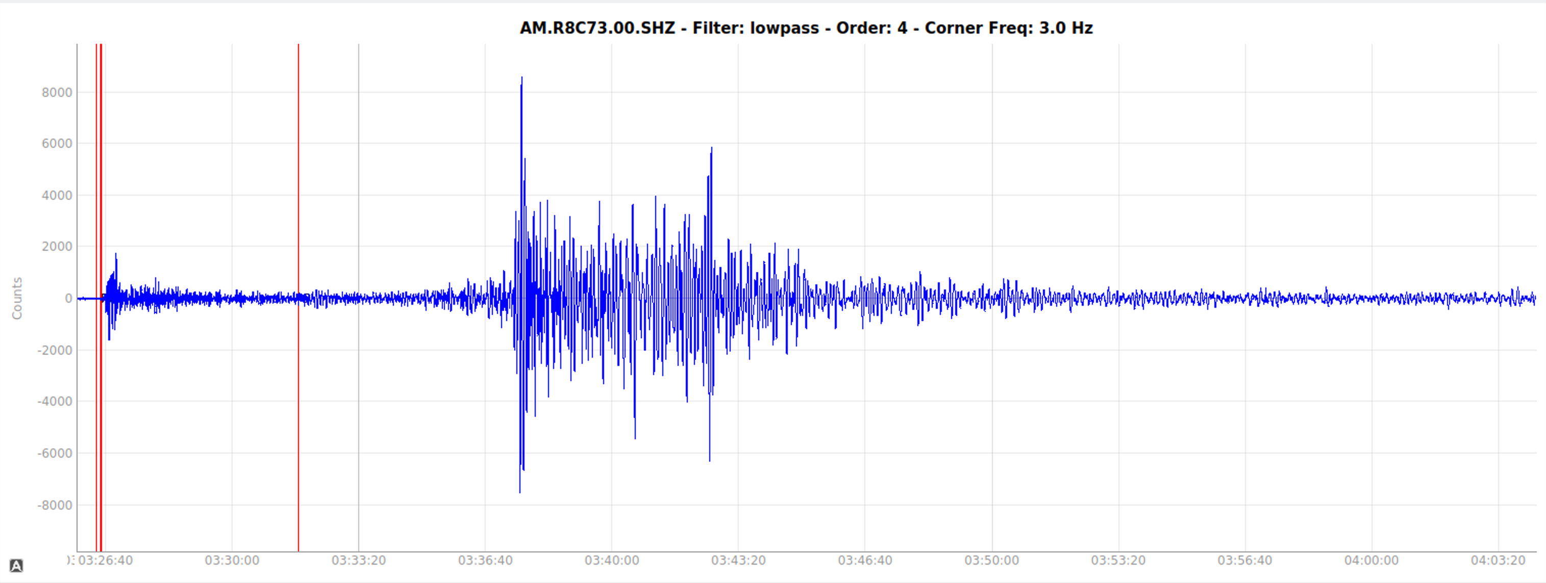
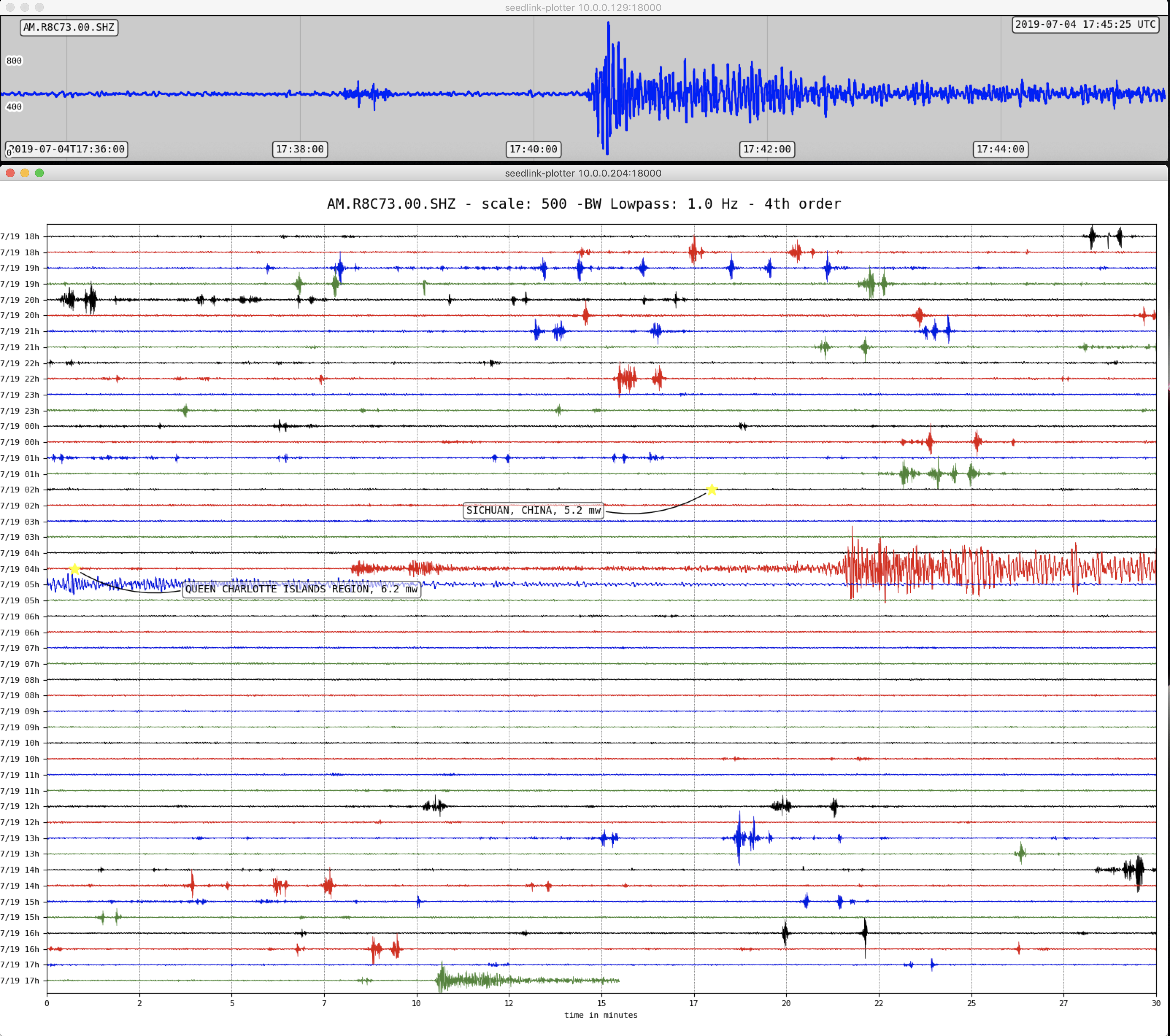
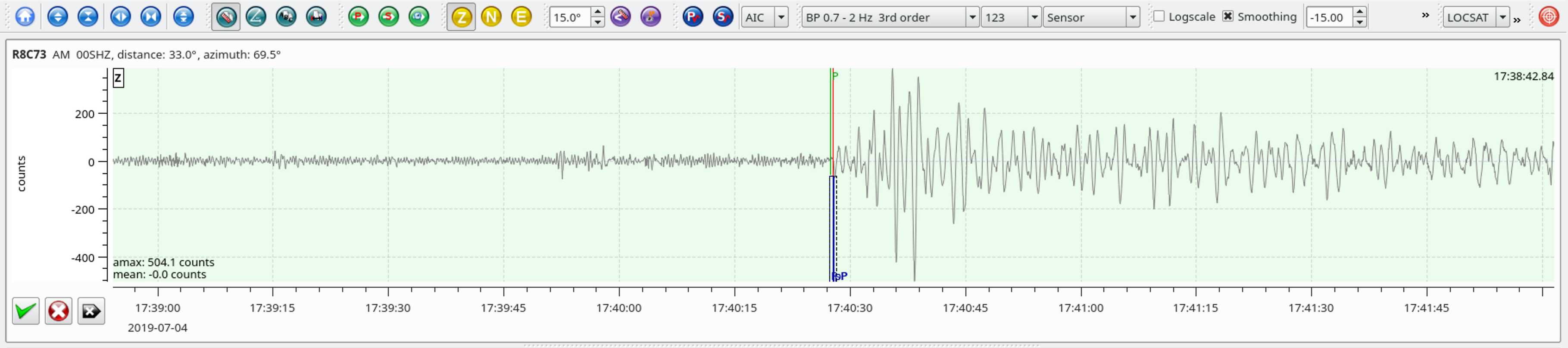
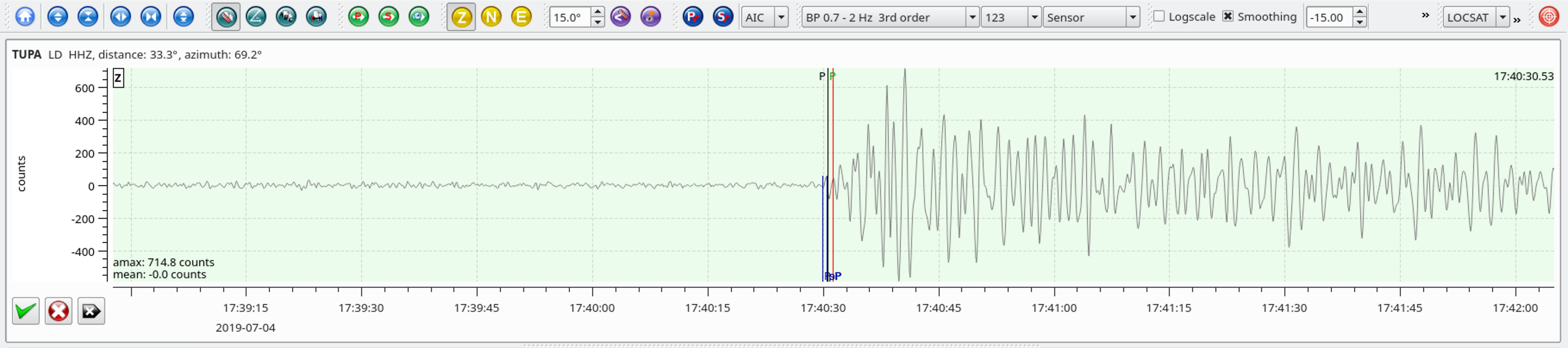
Heliocorder traces of AM.R8C73.00.SHZ (Exton PA) and LD.TUPA.BHZ (Ambler PA)
Local SeisComP3 P-wave Arrivals
| Latitude | Longitude | Depth (km) | Dist (Deg) | Dist (Km) | Azimuth | |
|---|---|---|---|---|---|---|
| 35.766 | -117.605 | 17.0 | 33.2 | 3,690 | 69.8 |
From the USGS Information Page:
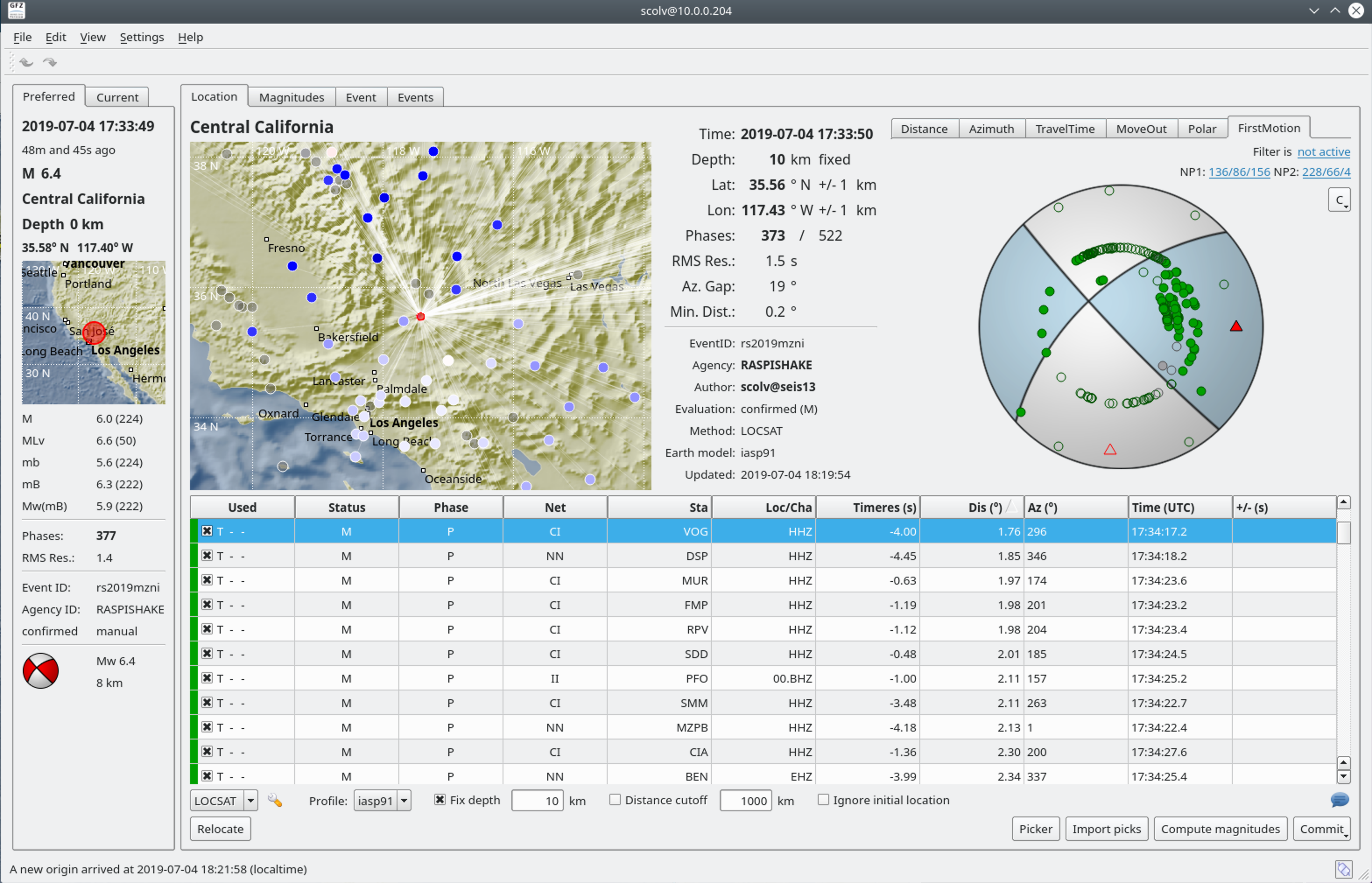
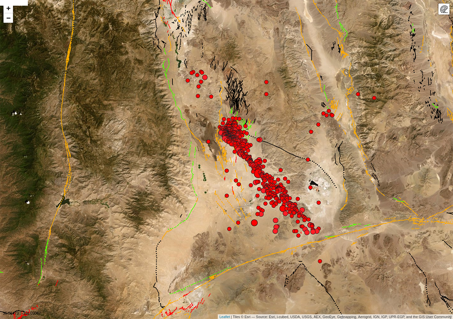
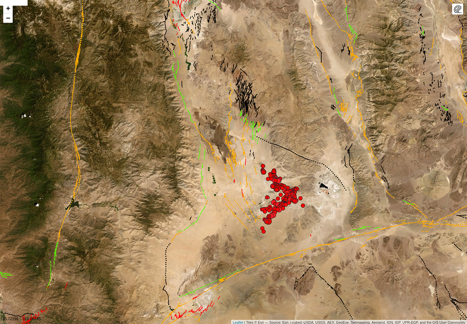
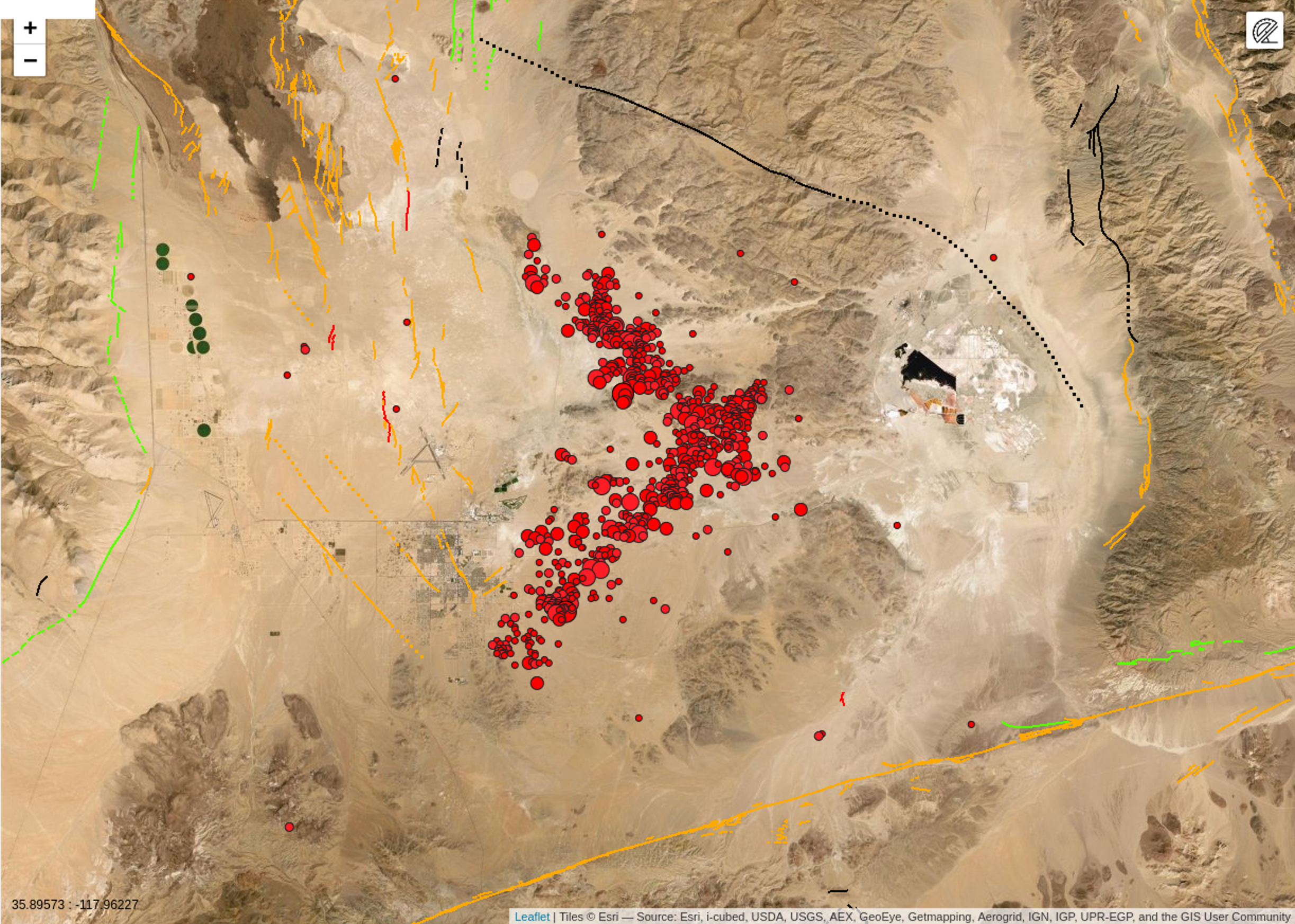
The July 6th, 2019, 03:19 UTC (July 5th 20:19 locally) Mw 7.1 earthquake in eastern California, southwest of Searles Valley, occurred as the result of shallow strike slip faulting in the crust of the North America plate. Focal mechanism solutions for the earthquake indicate rupture occurred on a steeply dipping fault as the result of either right lateral slip on a plane striking NW-SE, or as left lateral slip on a plane striking SW-NE. At the location of this earthquake, approximately 150 km northeast of San Andreas Fault – the major plate boundary in the region – the Pacific plate moves to the northwest with respect to the North America plate at a rate of approximately 48 mm/yr. The location of the earthquake falls within the Eastern California shear zone, a region of distributed faulting associated with motion across the Pacific:North America plate boundary, and an area of high seismic hazard. More detailed studies will be required to precisely identify the causative fault associated with this event, though seismic activity over the past 2 days has been occurring on two conjugate fault structures in the Airport Lake Fault Zone.
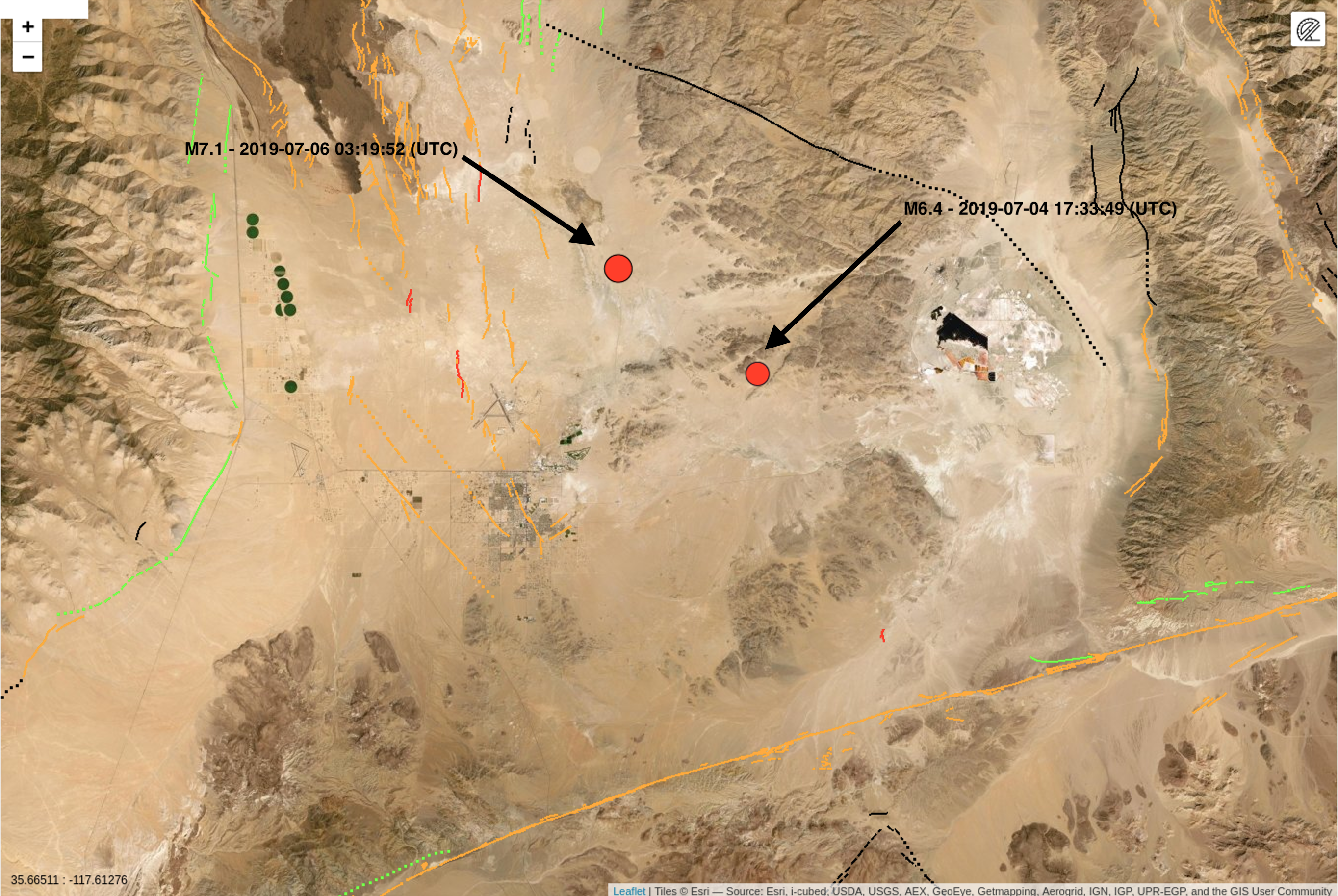
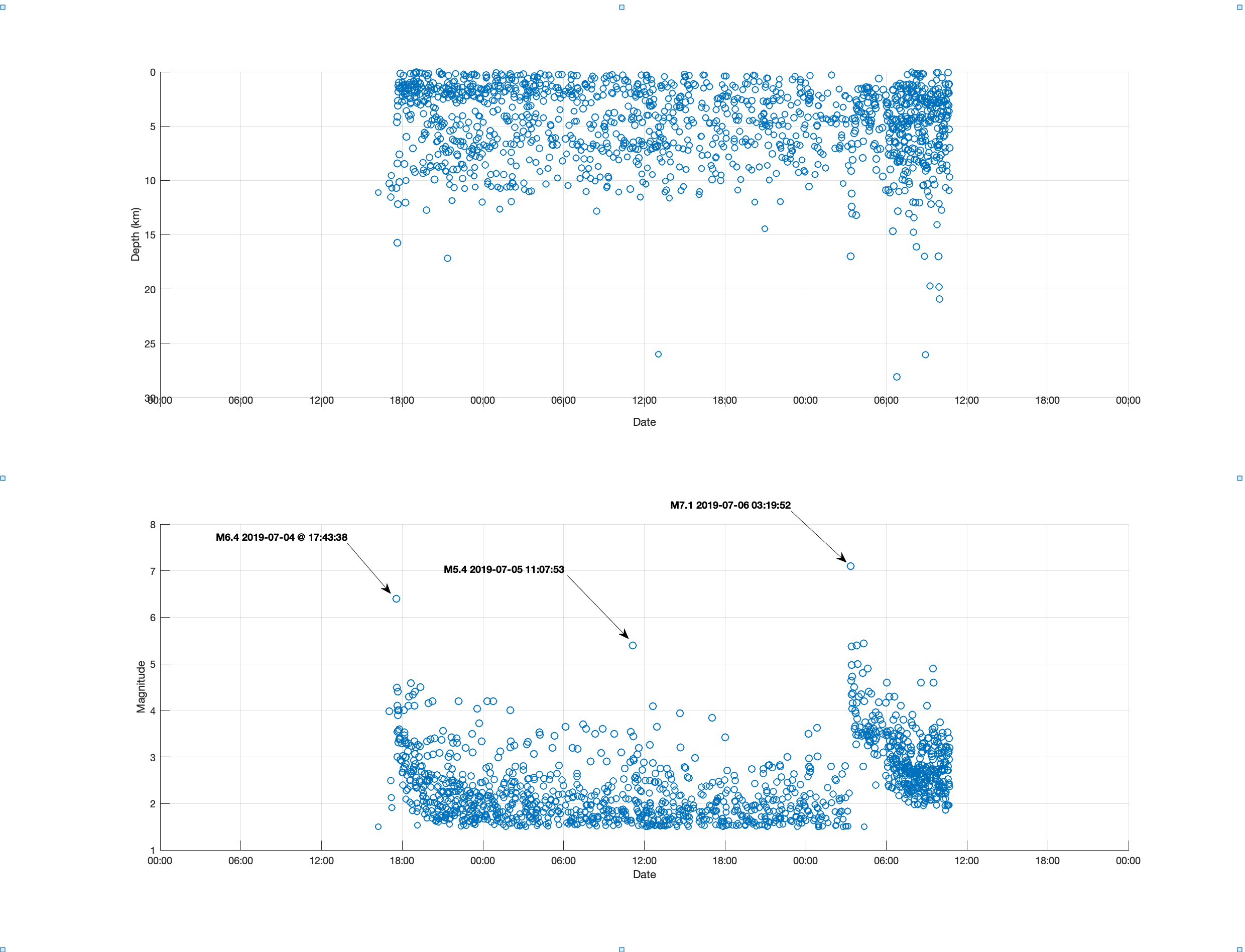
This earthquake occurs approximately 34 hours after and 11 km northwest of a M 6.4 event in the same region, on July 4th, 2019, at 17:33 UTC. The July 4th event was preceded by a short series of small foreshocks (including a M4.0 earthquake 30 minutes prior), and was followed by a robust sequence of aftershocks, including almost 250 M 2.5+ earthquakes (up until the M 7.1 event). Those events aligned with both nodal planes (NE-SW and NW-SE) of the focal mechanism solution of the M 6.4 event, which was very similar in faulting style to today’s M 7.1 earthquake. The sequence includes two other M5+ earthquakes, one of which occurred 20 seconds before the M 7.1 event. The M 7.1 earthquake occurred at the NW extension of the prior sequence.
While commonly plotted as points on maps, earthquakes of this size are more appropriately described as slip over a larger fault area. Strike-slip-faulting events of the size of the July 6, 2019, earthquake are typically about 70×15 km (length x width).
This region of eastern California has hosted numerous moderate sized earthquakes. Over the past 40 years, prior to the July 4th event, 8 other M5+ earthquakes have occurred within 50 km of the July 6th, 2019 earthquake. The largest of these was a M 5.8 event on September 20, 1995, just 3 km to the west of today’s event, which was felt strongly in the China Lake-Ridgecrest area, and more broadly from Los Angeles to Las Vegas.
Heliocorder Traces
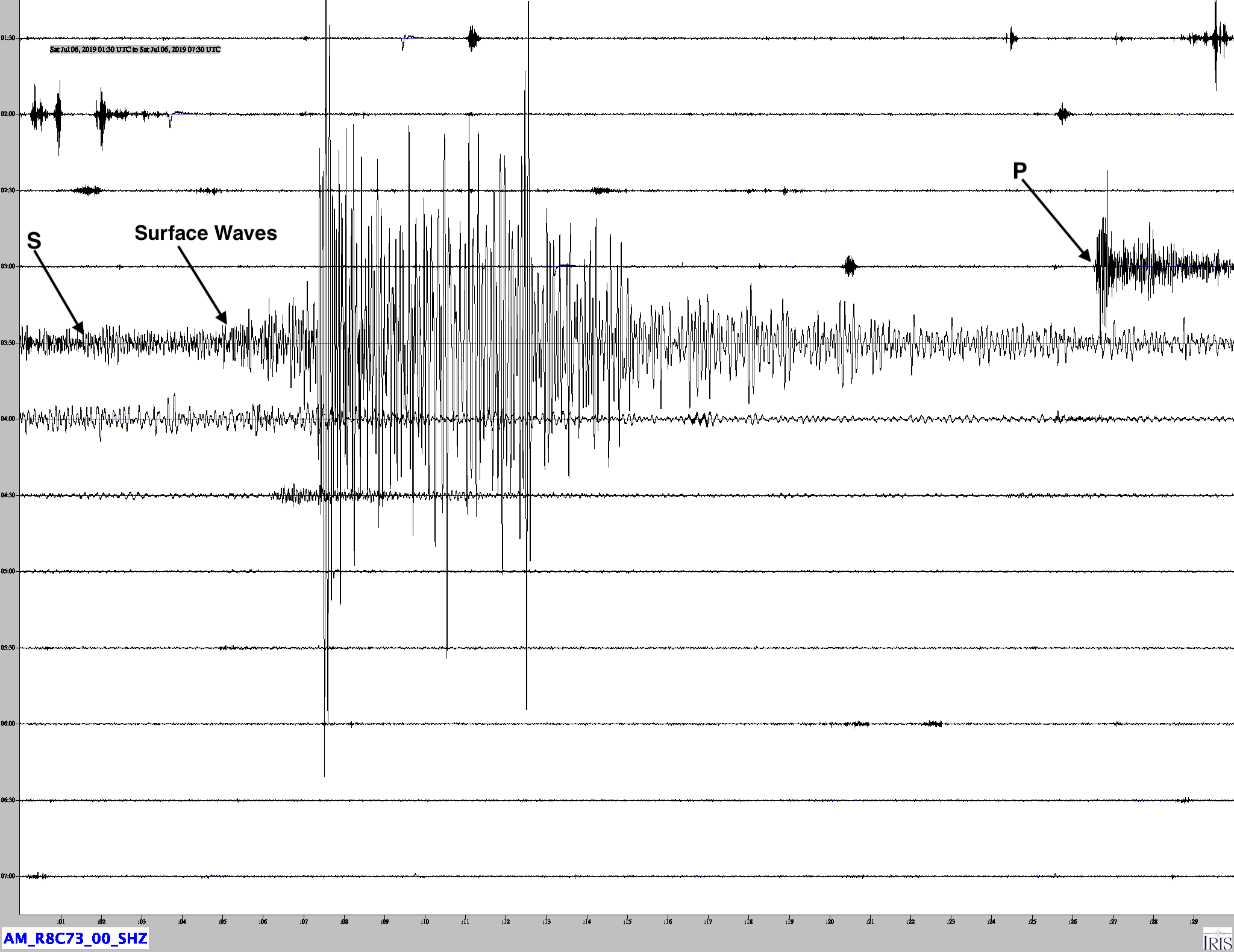
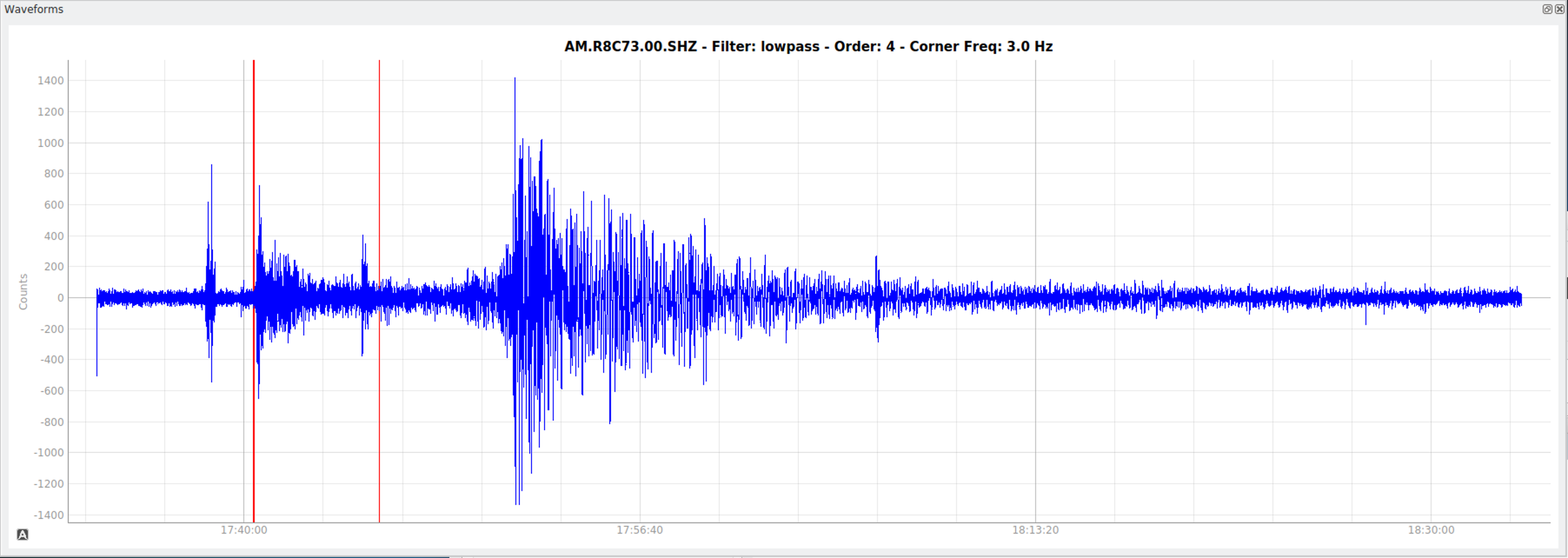
Trace from CI.LRL.HNZ as strong motion seismometer only 0.2 degs from the epicenter. This recording shows the mainshock and four hours of aftershocks.
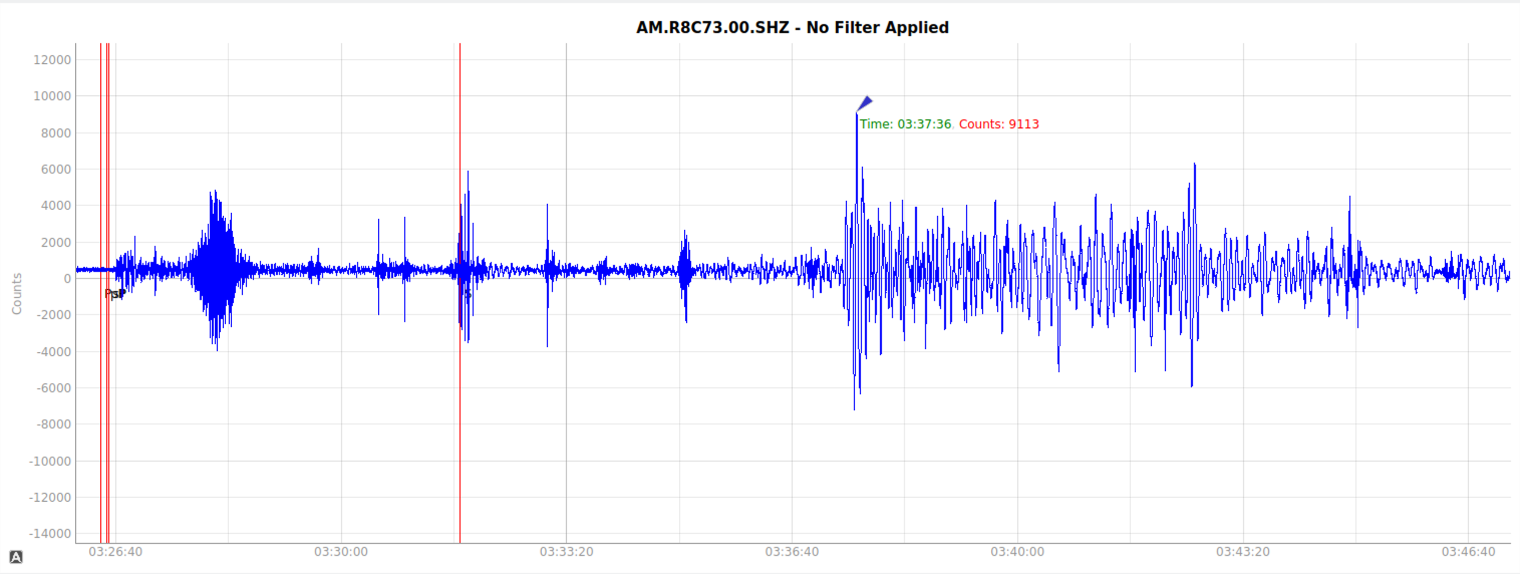
Waveforms
Local SeisComP3 P-wave Arrivals
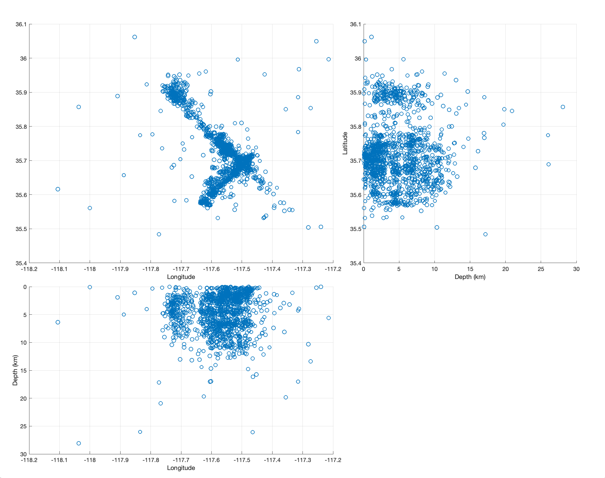
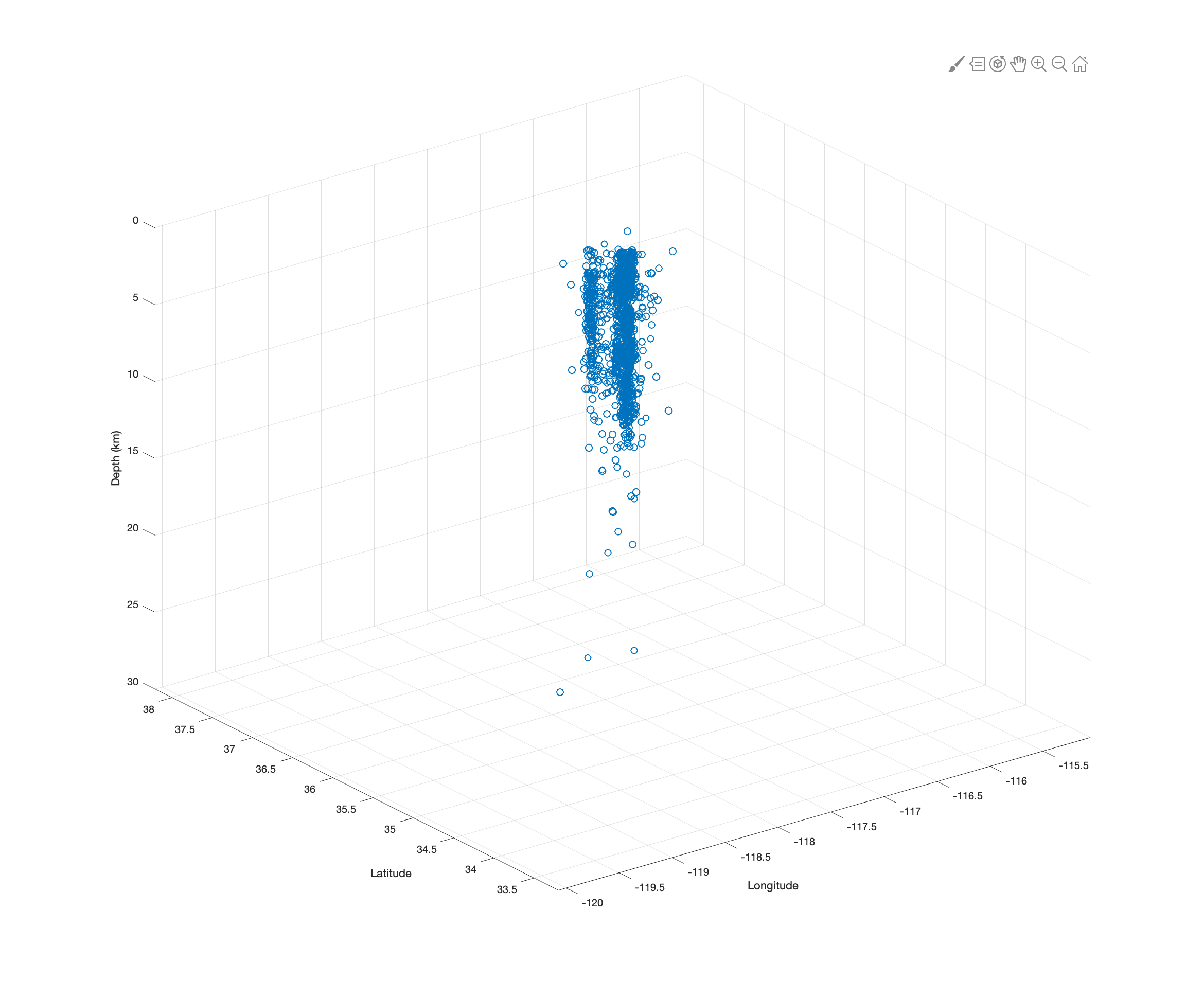
Aftershocks for the July 6th earthquake (Top), compared to the July 4th quake (bottom). Note that the second event’s aftershocks are largely aligned in a NW / SE direction, while the earlier quake’s aftershocks are both NW/SE and SW / NE.
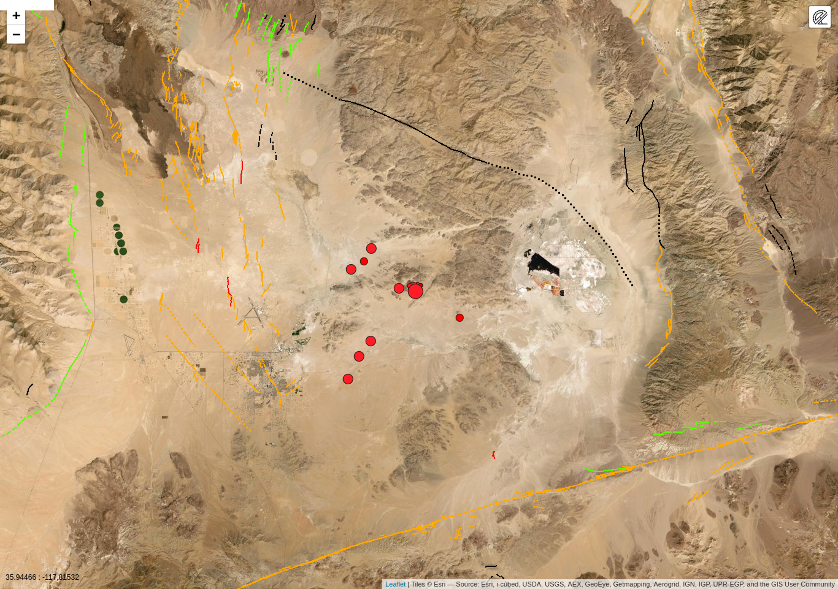
The map below shows the the mainshock (M7.1) on July 6th, as well as the M6.4 foreshock on July 4th.
MatLab plots of the earthquake sequence.
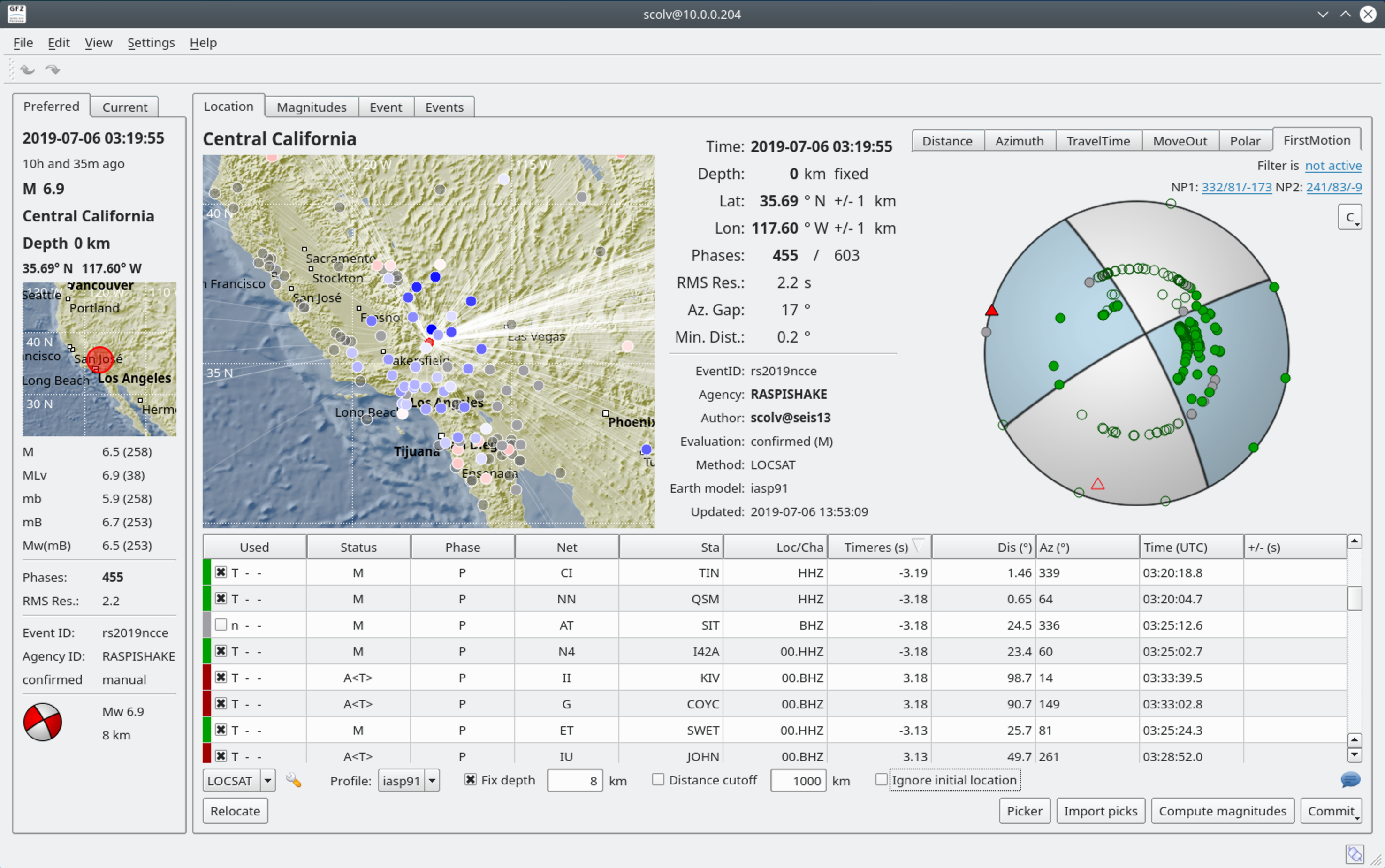
Fault Plane Solution
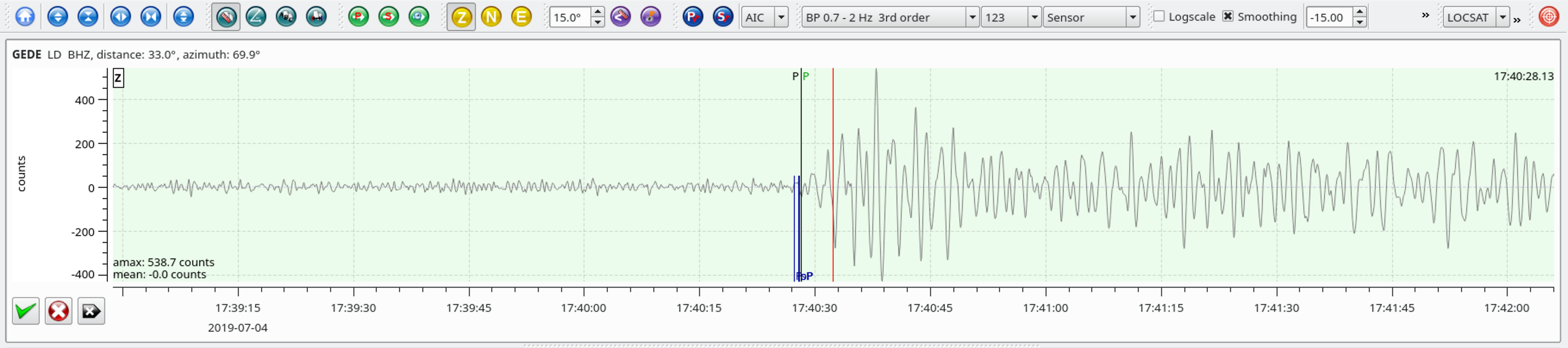
| Latitude | Longitude | Depth (km) | Dist (Deg) | Dist (Km) | Azimuth | |
|---|---|---|---|---|---|---|
| 35.705 | -117.506 | 10.7 | 33.2 | 3,684 | 69.7 |
From the USGS Information Page:
The July 4th, 2019 Mw 6.4 earthquake in eastern California, southwest of Searles Valley, occurred as the result of shallow strike slip faulting in the crust of the North America plate. Focal mechanism solutions for the earthquake indicate rupture occurred on a steeply dipping fault as the result of either right lateral slip on a plane striking NW-SE, or as left lateral slip on a plane striking SW-NE. The earthquake was located approximately 150 km northeast of San Andreas Fault – the major plate boundary in the region. At this latitude, the Pacific plate is moving to the northwest with respect to the North America plate at a rate of approximately 48 mm/yr. The location of the earthquake falls within the Eastern California shear zone, a region of distributed faulting associated with motion across the Pacific:North America plate boundary, and an area of high seismic hazard. More detailed studies will be required to precisely identify the causative fault associated with this event.
This region of eastern California has hosted numerous moderate sized earthquakes. Over the past 40 years, 8 other M5+ earthquakes have occurred within 50 km of the July 4th, 2019 earthquake. The largest of these was a M 5.8 event on September 20, 1995, about 13 km to the west-northwest of today’s event, which was felt strongly in the China Lake-Ridgecrest area, and more broadly from Los Angeles to Las Vegas. As of 1 hour after the event the July 4th, 2019 earthquake has been followed by numerous aftershocks, the largest of which was a M 4.7 earthquake 2 minutes after the M 6.4 event. Most aftershocks align in a SW-NE trend around the M 6.4 earthquake, though some also align on a NW-SE trend. The M 6.4 event was also preceded by a series of very small earthquakes (foreshocks) over the previous hour, including a M 4.0 event about 30 mins earlier.
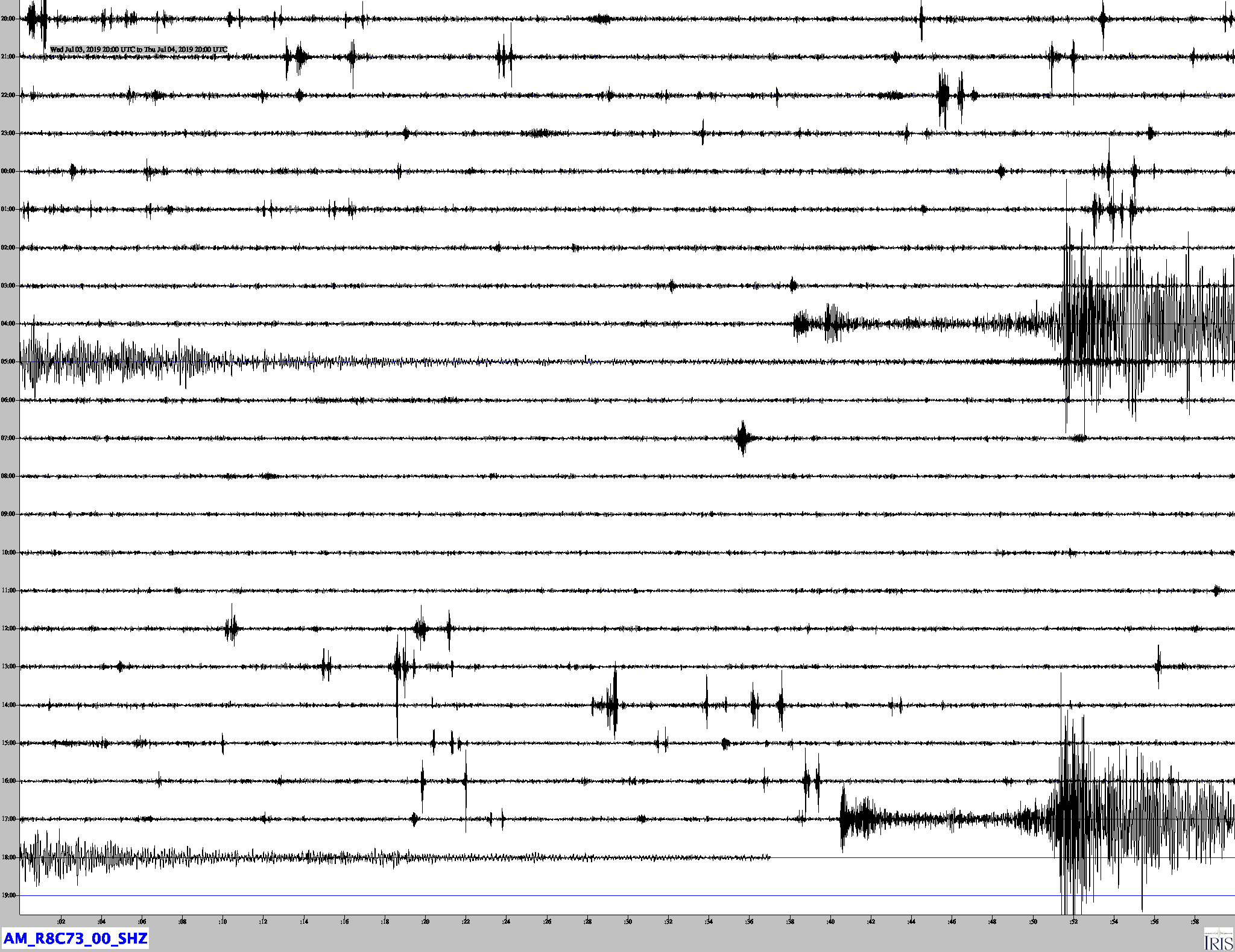
Heliocorder Traces from Exton PA
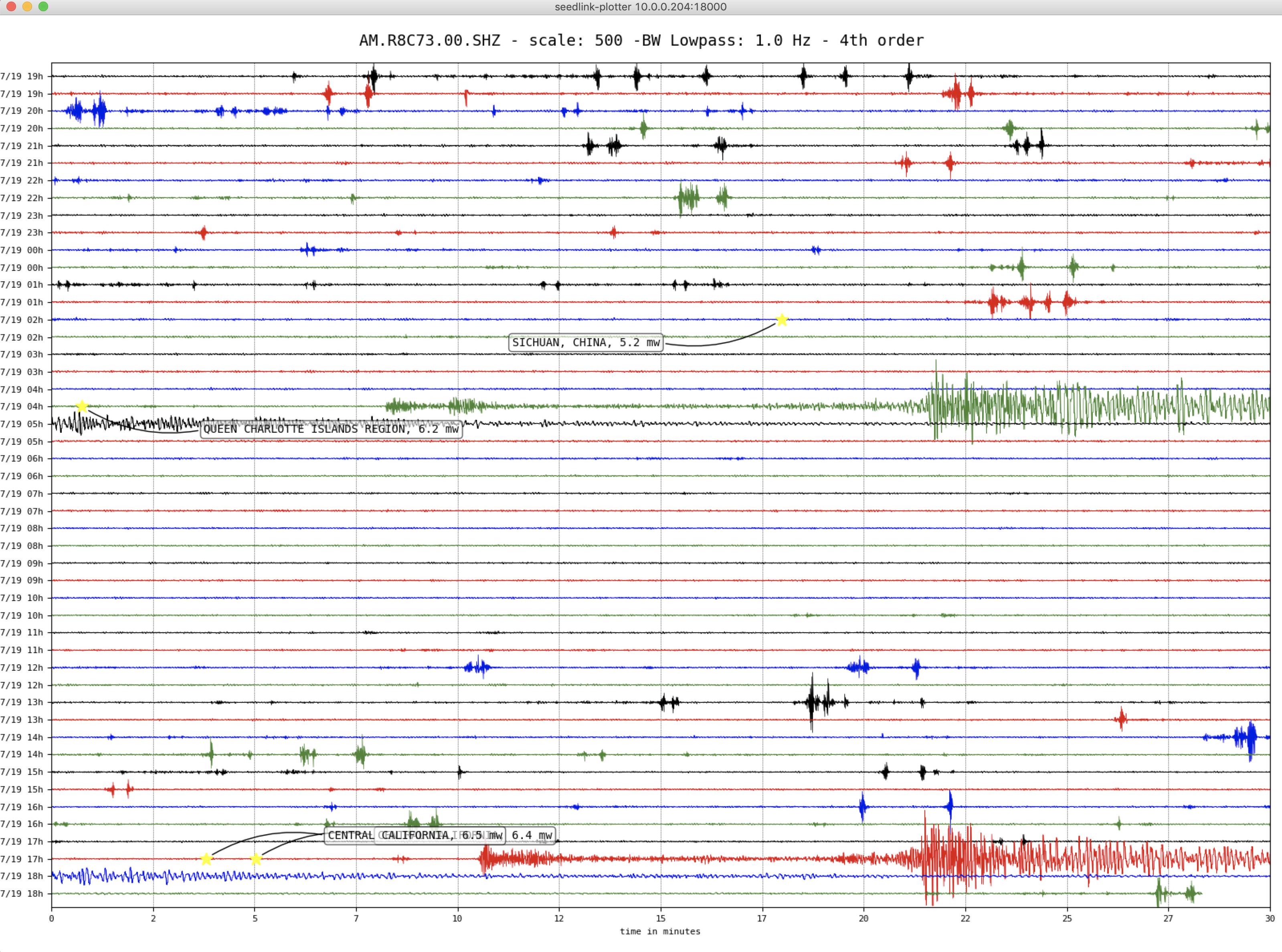
There are two earthquakes here, The California Quake (at the bottom), as well as an earthquake earlier today in British Columbia.
24 hour foreshock and mainshock sequence
24 hour aftershock sequence
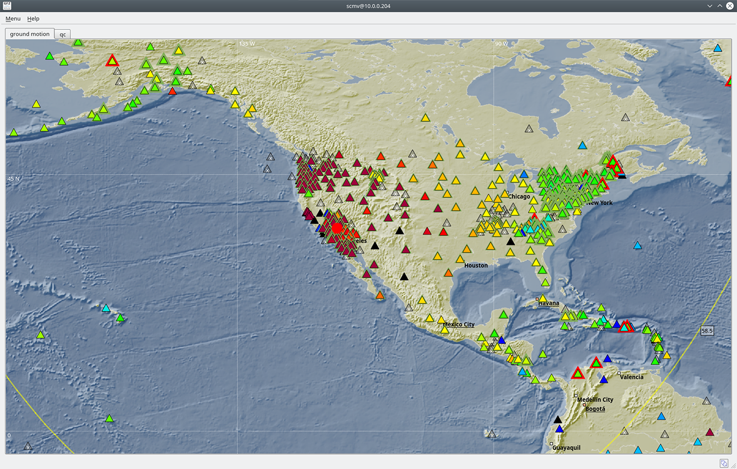
Seismometers all over the US were showing high ground motions (red, orange and yellow) during the event as seen in this map.
Local SeisComP3 P-wave Arrivals
Fault Plane Solution for this event