Queen Charlotte Islands Canada – M6.2 – July 4, 2019 at 04:30:44 UTC
196km WSW of Bella Bella, Canada
Latitude | Longitude | Depth (km) | Dist (Deg) | Dist (Km) | Azimuth | |
---|---|---|---|---|---|---|
51.222 | -130.515 | 10.0 | 39.1 | 4,348 | 84.5 |
Latitude | Longitude | Depth (km) | Dist (Deg) | Dist (Km) | Azimuth | |
---|---|---|---|---|---|---|
51.222 | -130.515 | 10.0 | 39.1 | 4,348 | 84.5 |
Latitude | Longitude | Depth (km) | Dist (Deg) | Dist (Km) | Azimuth | |
---|---|---|---|---|---|---|
8.449 | -82.768 | 26.2 | 32.2 | 3,569 | 10.4 |
From the USGS Information Page:
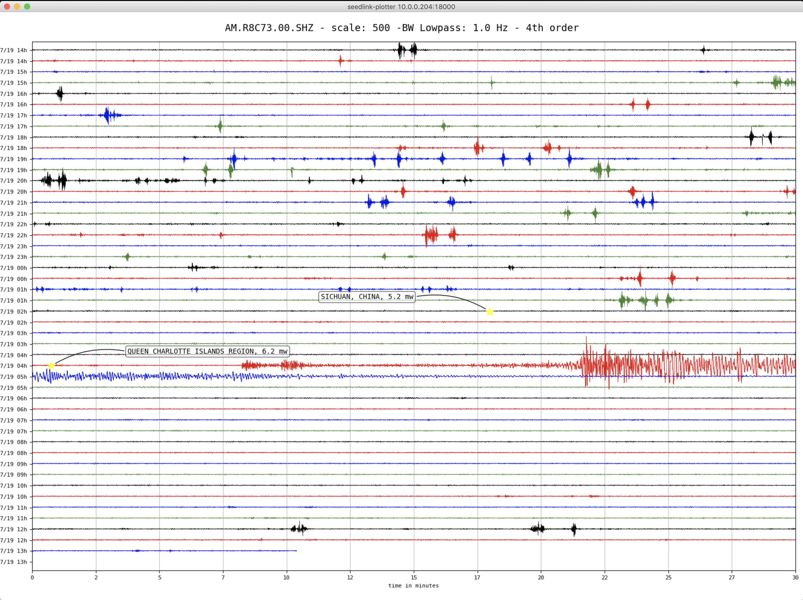
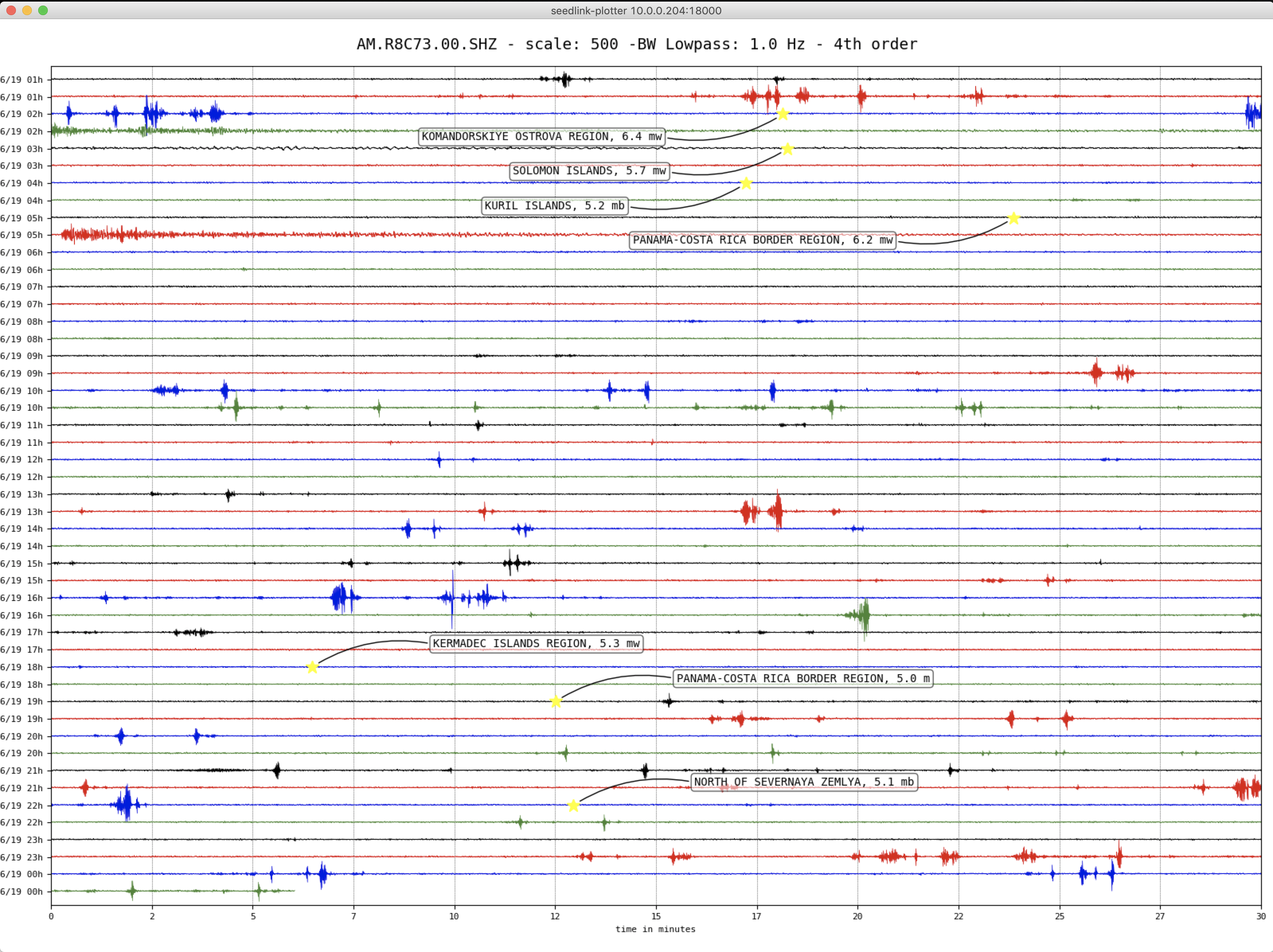
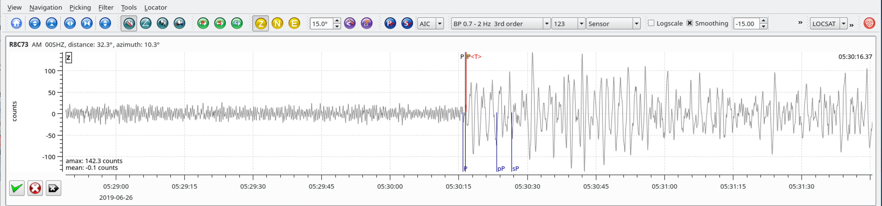
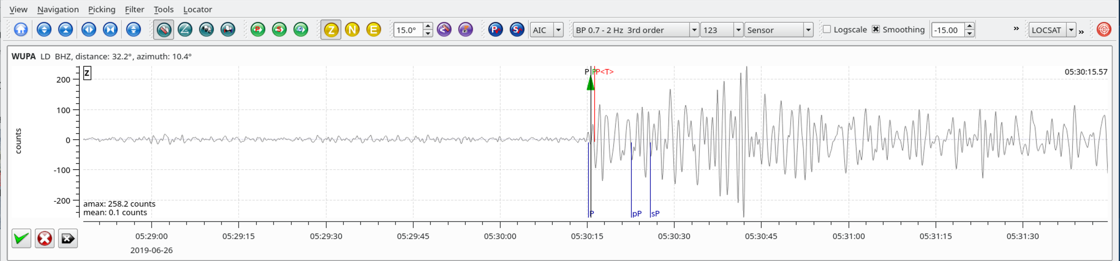
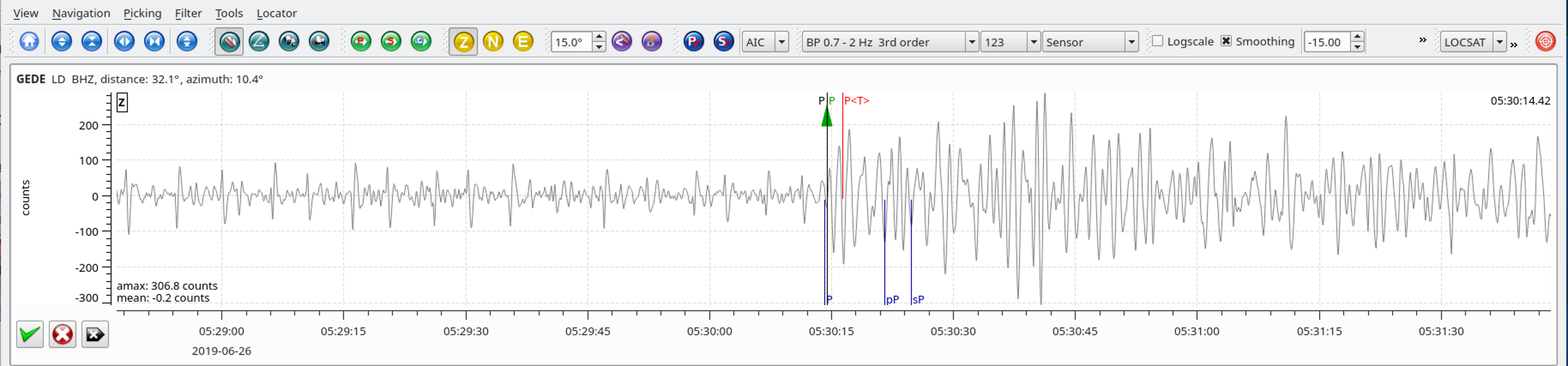
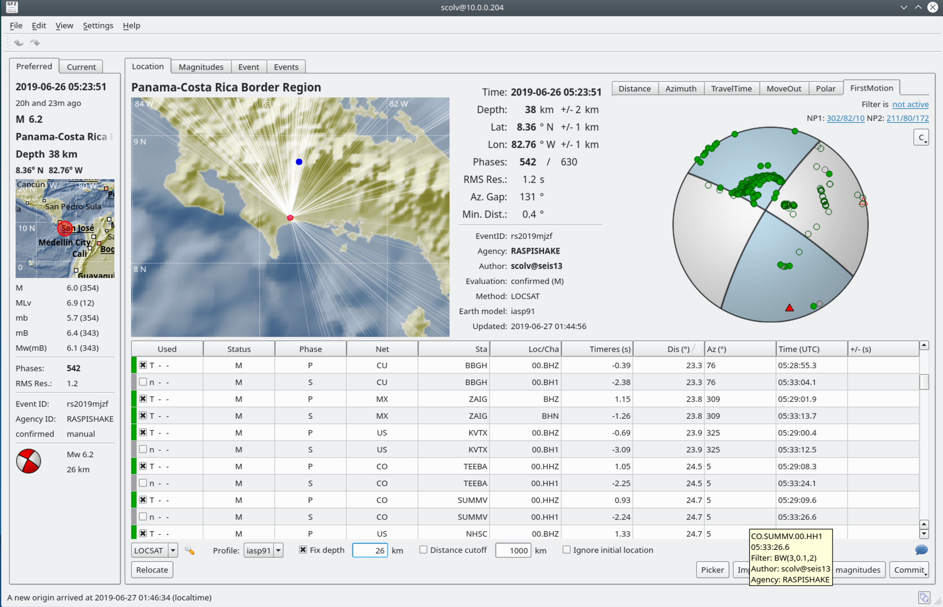
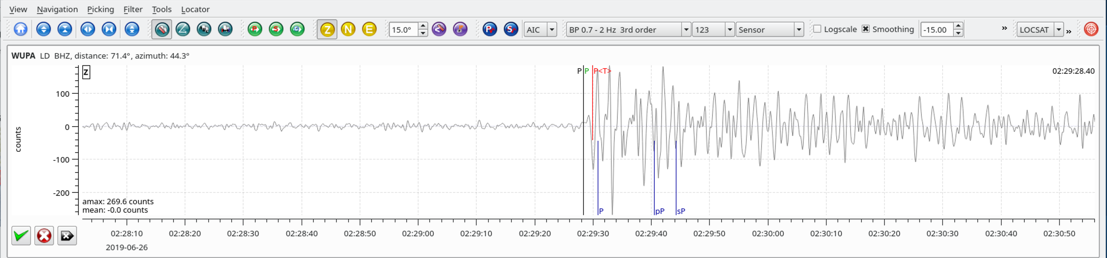
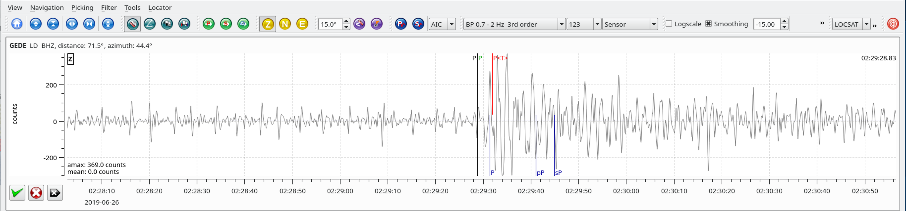
The June 26, 2019, M 6.2 earthquake west of David, Panama, occurred as a result of strike-slip faulting in the crust at a depth of ~25 km. Focal mechanism solutions indicate that rupture occurred on either a steeply dipping left-lateral northwest-striking fault or right-lateral southwest-striking fault. The June 26th earthquake likely represents faulting within the crust of the Caribbean Plate. The region is tectonically complex. To the northwest of this event, the Cocos plate subducts beneath the Caribbean Plate. South of this event, a transform boundary marks the border between the Cocos Plate and the Nazca Plate. Moderate to large earthquakes are relatively common in this region. In the past 100 years, 29 other earthquakes M 6.0 and larger have occurred within 100 km of this June 26th event. The largest was a M 7.5 earthquake that occurred on July 18, 1934, offshore and to the southeast of this event. A similar M 6.5 earthquake to this June 26 event occurred on December 25, 2003, and resulted in at least two fatalities. More recently, on May 12th, 2019, a M 6.0 earthquake occurred with a similar mechanism and at a similar depth to the June 26 earthquake.
Latitude | Longitude | Depth (km) | Dist (Deg) | Dist (Km) | Azimuth | |
---|---|---|---|---|---|---|
56.208 | 164.184 | 10.0 | 71.5 | 7,953 | 44.3 |
Latitude | Longitude | Depth (km) | Dist (Deg) | Dist (Km) | Azimuth | |
---|---|---|---|---|---|---|
56.194 | 164.134 | 10.0 | 71.5 | 7,956 | 44.2 |
These two earthquakes occurred close to each other within a 24 hour period.
Latitude | Longitude | Depth (km) | Dist (Deg) | Dist (Km) | Azimuth | |
---|---|---|---|---|---|---|
-6.389 | 129.220 | 208.3 | 139.8 | 15,527 | 29.7 |
From the USGS Information Page:
The June 24, 2019, M 7.3 earthquake northwest of Saumlaki, Indonesia, occurred as a result of strike-slip faulting at intermediate depth, 210 km beneath the southeastern Banda Sea near the complex plate boundary between the Australia and Sunda plates. Focal mechanism solutions indicate that rupture occurred on either a left-lateral northeast-striking fault or a right-lateral northwest-striking fault. At the location of this earthquake, the Australia plate moves towards the north-northeast with respect to Sunda at a velocity of about 76 mm/yr. Motion between the two plates is dominantly convergent, and sections of the Australia plate have subducted beneath Sunda; the June 24th earthquake likely represents faulting within the interior of that subducted slab. Slip on a fault aligned with either nodal plane of the focal mechanism solution is consistent with this intraplate setting.
Earthquakes like this event, with focal depths between 70 and 300 km, are commonly termed “intermediate-depth” earthquakes. Intermediate-depth earthquakes represent deformation within subducted slabs rather than at the shallow plate interface between subducting and overriding tectonic plates. They typically cause less damage on the ground surface above their foci than is the case with similar-magnitude shallow-focus earthquakes, but large intermediate-depth earthquakes may be felt at great distance from their epicenters. “Deep-focus” earthquakes, those with focal depths greater than 300 km, also occur beneath the Banda Sea to the northwest. Earthquakes have been reliably located to depths of about 500 km in this region.
Eastern Indonesia and the islands of the Banda Sea host frequent moderate to large earthquakes—the region within 250 km of the June 24th event has hosted close to 50 M 6+ intermediate depth earthquakes over the past 50 years. Six of those events have been greater than M 7, including a M 7.1 earthquake in December 2012 with a very similar focal mechanism solution, less than 100 km to the east of today’s event. None of these M 7+ earthquakes are known to have caused significant damage or fatalities. In November 1963, a M 8.1 earthquake occurred 60 km to the southeast of the June 24th, 2019 event, at a depth of 65 km.
Latitude | Longitude | Depth (km) | Dist (Deg) | Dist (Km) | Azimuth | |
---|---|---|---|---|---|---|
39.219 | 99.431 | 3.0 | 18.4 | 2,041 | 79.9 |
Latitude | Longitude | Depth (km) | Dist (Deg) | Dist (Km) | Azimuth | |
---|---|---|---|---|---|---|
38.646 | 139.472 | 12.0 | 95.2 | 10,592 | 26.2 |