Papua New Guinea – M7.1 – May 6, 2019 at 21:19:37 UTC
33km NW of Bulolo, Papua New Guinea
| Latitude | Longitude | Depth (km) | Dist (Deg) | Dist (Km) | Azimuth | |
|---|---|---|---|---|---|---|
| -6.975 | 146.449 | 146.0 | 130.2 | 14,460 | 42.0 |
Tectonic Summary
From the USGS Website:
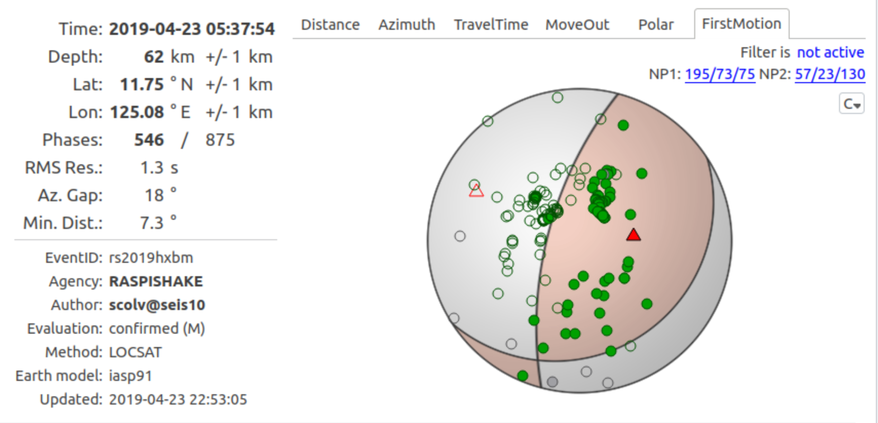
The May 6, 2019, M 7.2 Papua New Guinea earthquake occurred as a result of normal faulting at an intermediate depth, approximately 127 km beneath eastern Papua New Guinea, near the northern edge of the Australia plate. Focal mechanism solutions indicate that rupture occurred on an east-southeast striking steeply dipping fault or a west-northwest shallowly dipping fault. At the location of the earthquake, the Australia plate moves towards the east-northeast relative to the Pacific plate at a velocity of about 100 mm/yr. Earthquakes in this geographical region are generally associated with the large-scale convergence of these two major plates and with the complex interactions of several associated microplates, most notably the South Bismarck plate, the Solomon Sea microplate, and the Woodlark plate.
The depth of the May 6th earthquake implies that it occurred in subducted or foundered lithosphere. Although there is still not complete geophysical consensus on the location and configuration of subducted plates in the region, the location of the earthquake is consistent with it occurring in a subducted fragment of the Australia plate (Solomon Sea microplate) that is bent about an approximately east-west axis and subducting both to the north and to the south or southwest. In northern Papua New Guinea, approximately 50 km to the north of the May 6th event, clear north-directed subduction of Australia beneath Pacific (and the South Bismarck microplate) occurs, with the associated Wadati-Benioff zone active to depths of more than 600 km beneath the Bismarck Sea to the northeast of New Guinea. The location of the May 6th earthquake places it in the gently south-southwest-dipping segment of the Solomon Sea microplate. Slip on a fault aligned with either nodal plane of the focal mechanism solution is consistent with this intraplate setting.
Papua New Guinea experiences a high rate of seismic activity, with almost 61 events of M 6+ occurring within 250 km of the May 6 event since 1973. Nearby (within 100 km), five large earthquakes have occurred at depths greater than 100 km.
Earthquakes like the May 6 event, with focal depths between 70 and 300 km are commonly termed “intermediate-depth” earthquakes. Intermediate-depth earthquakes represent deformation within subducted slabs rather than at the shallow plate interface between subducting and overriding tectonic plates. They typically cause less damage on the ground surface above their foci than is the case with similar-magnitude shallow-focus earthquakes, but large intermediate-depth earthquakes may be felt at great distances from their epicenters. “Deep-focus” earthquakes, those with focal depths greater than 300 km, also occur in beneath Papua New Guinea and the Bismarck Sea to the northeast.
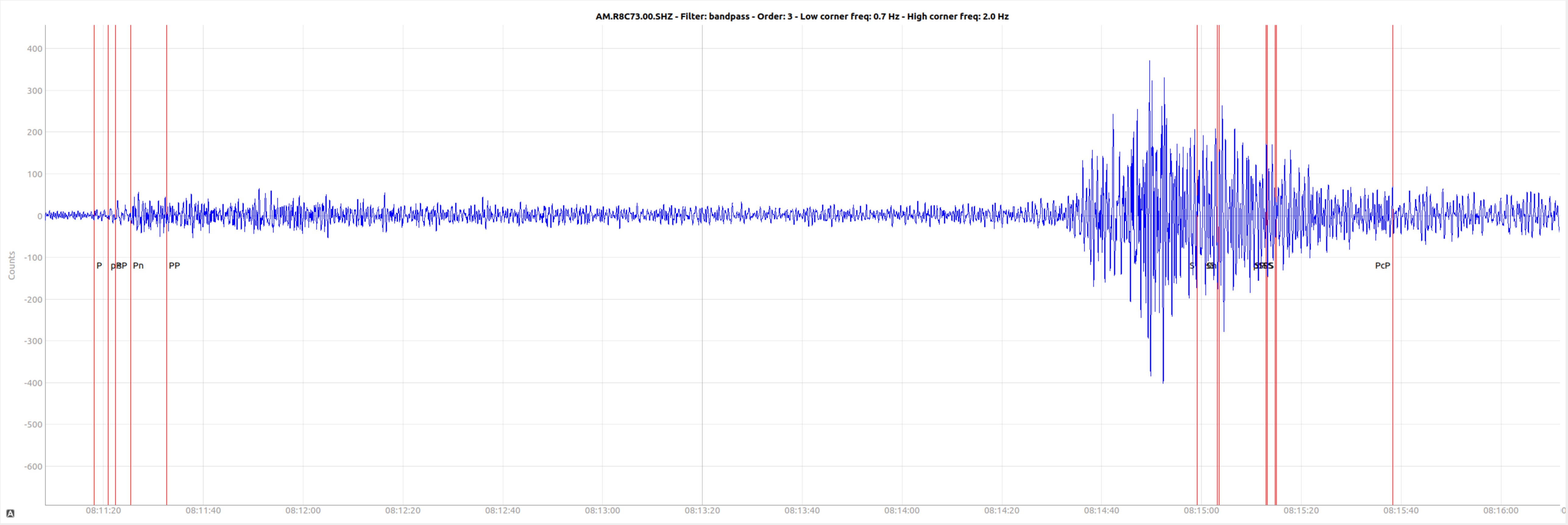
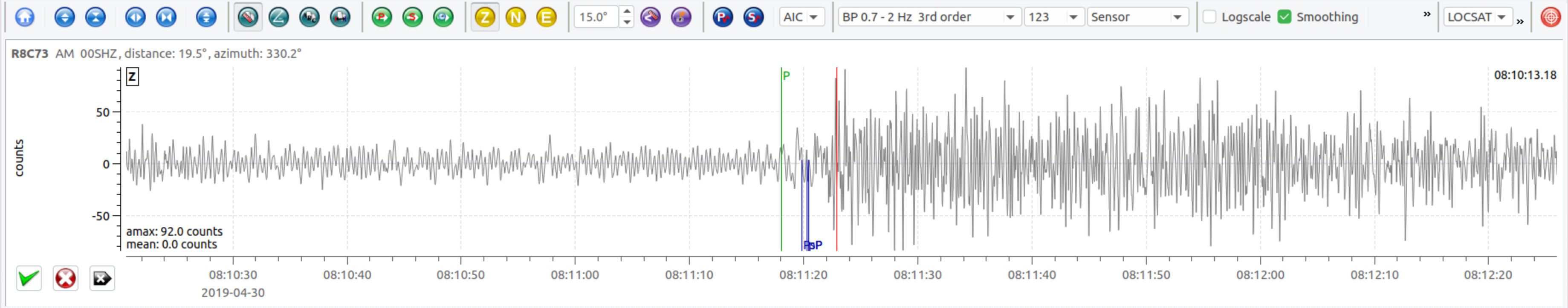
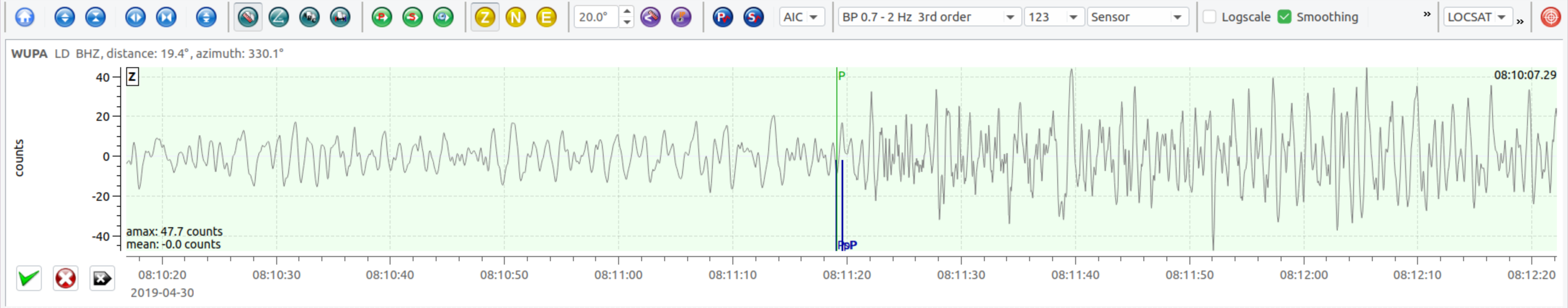
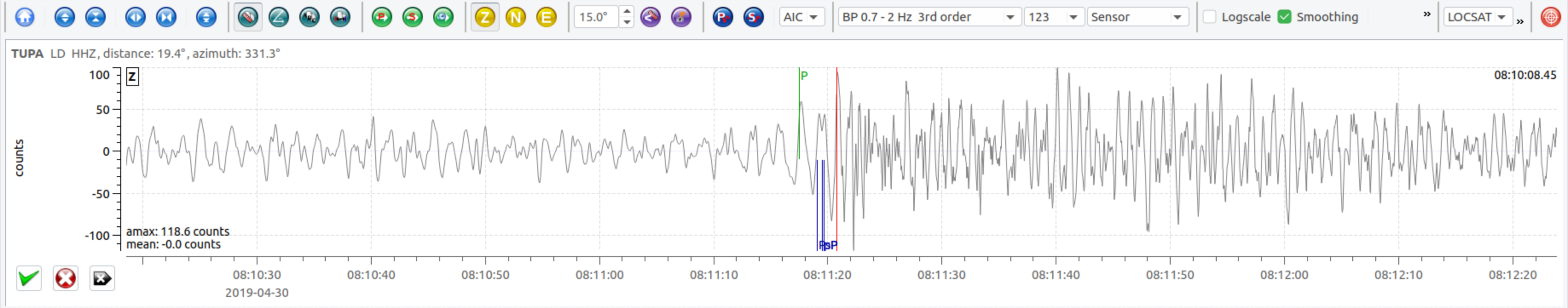
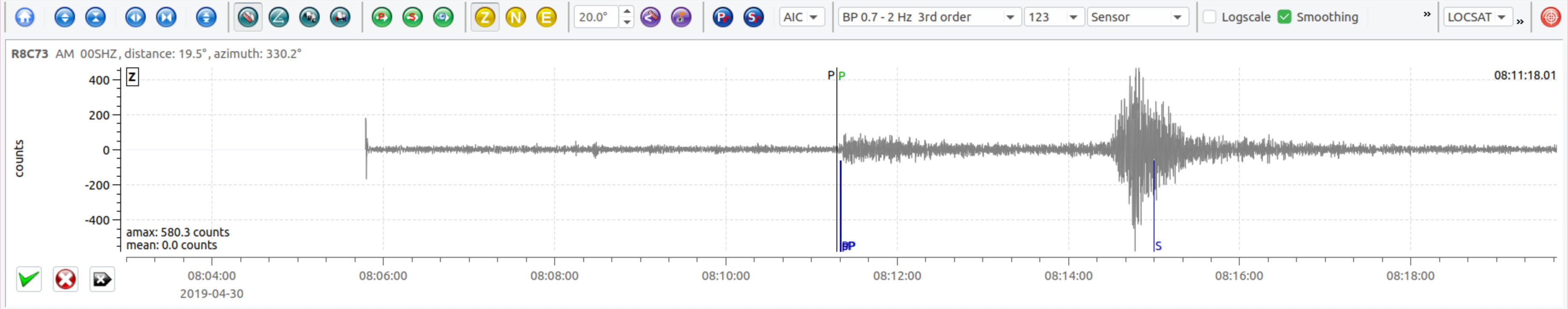
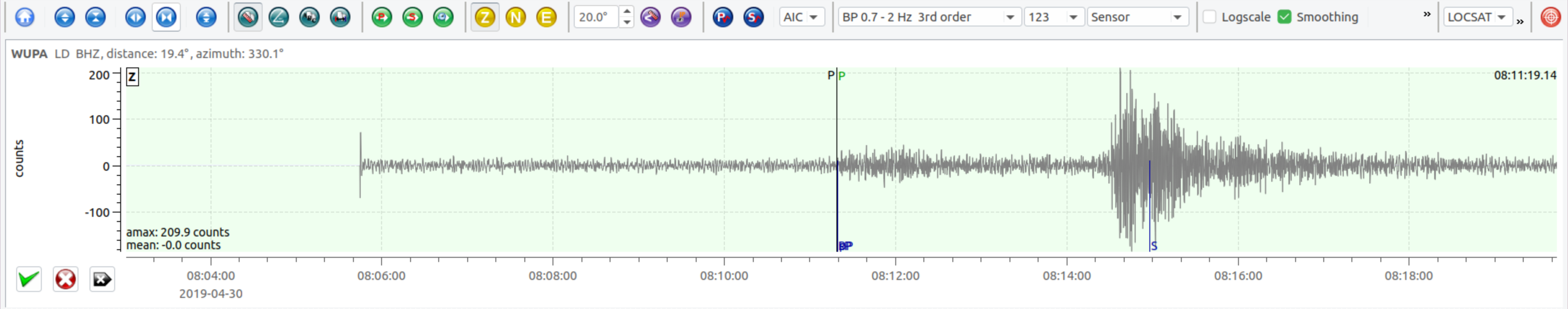
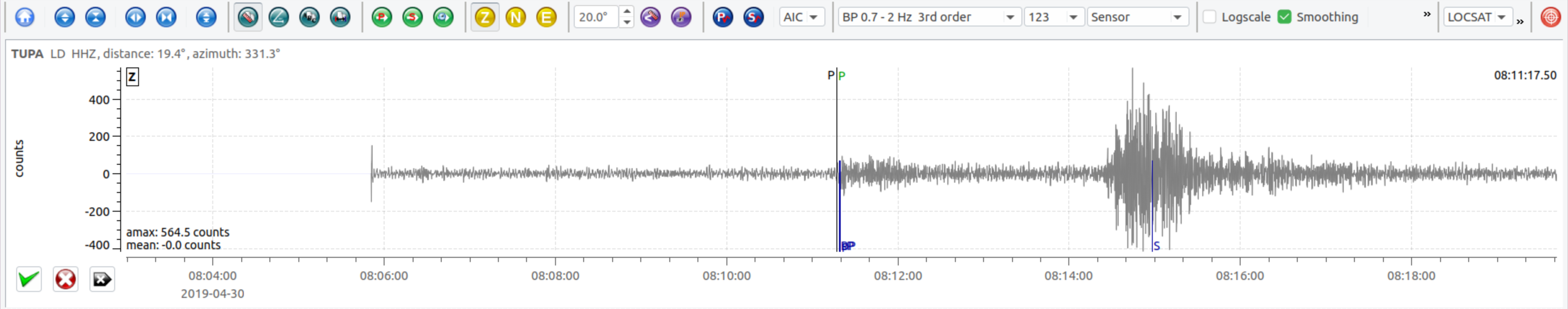
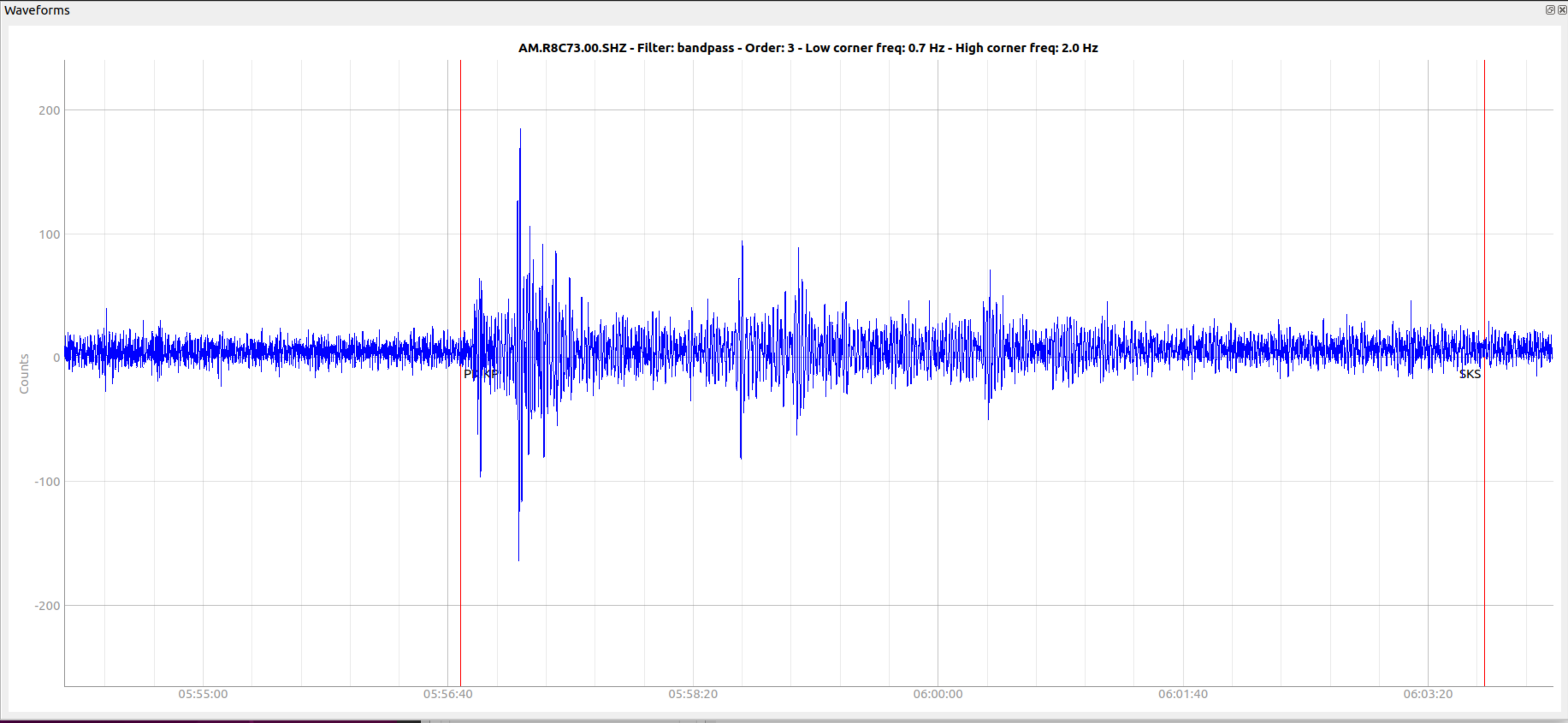
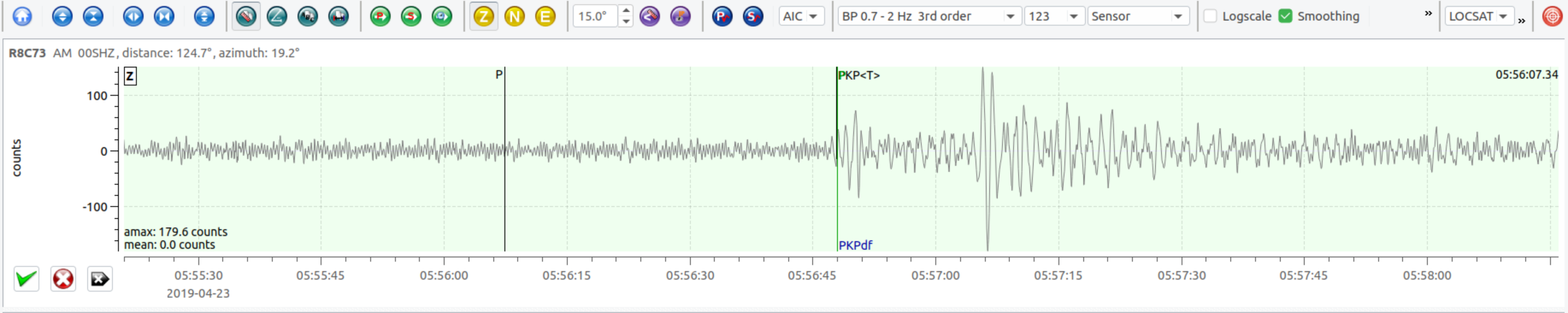
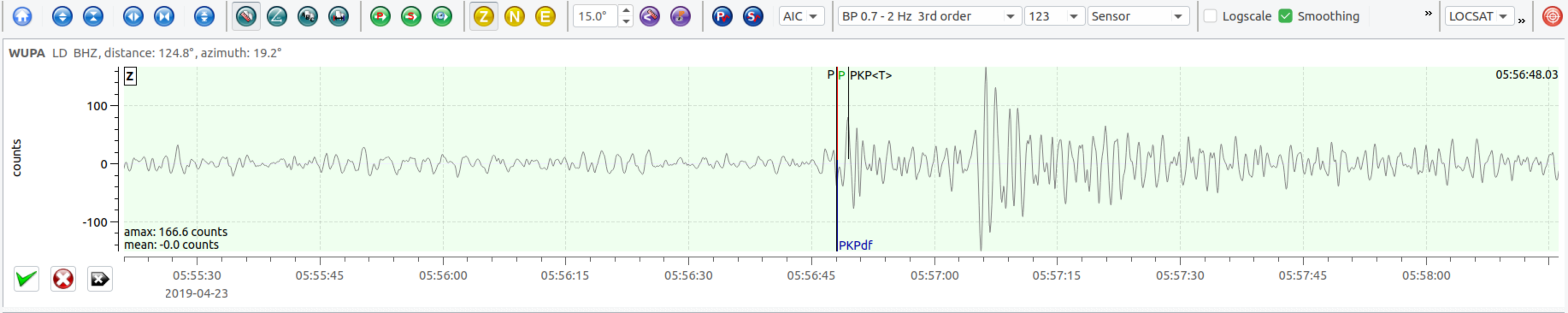
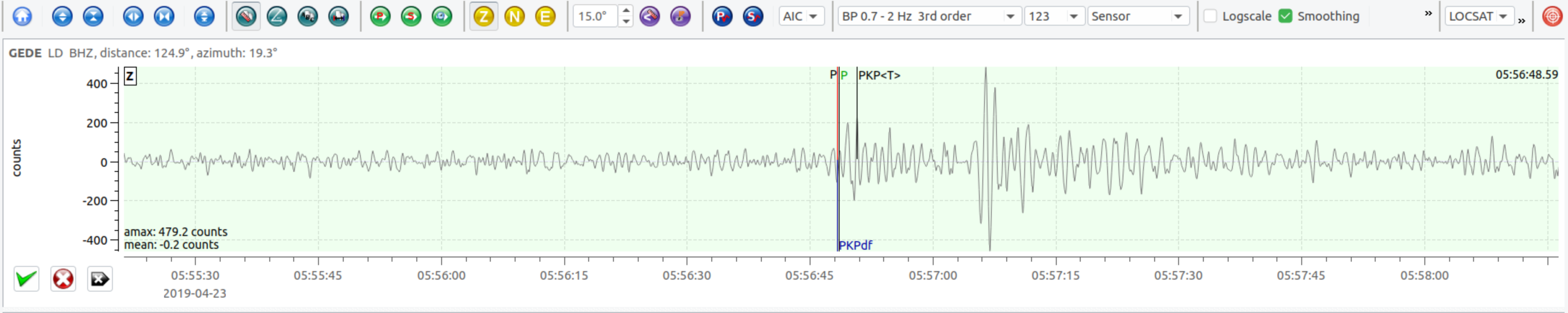
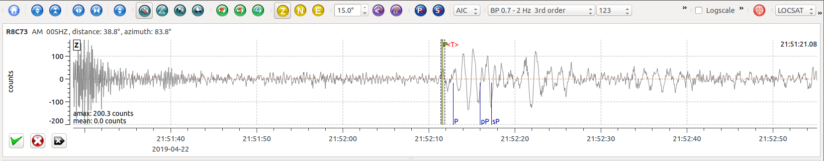
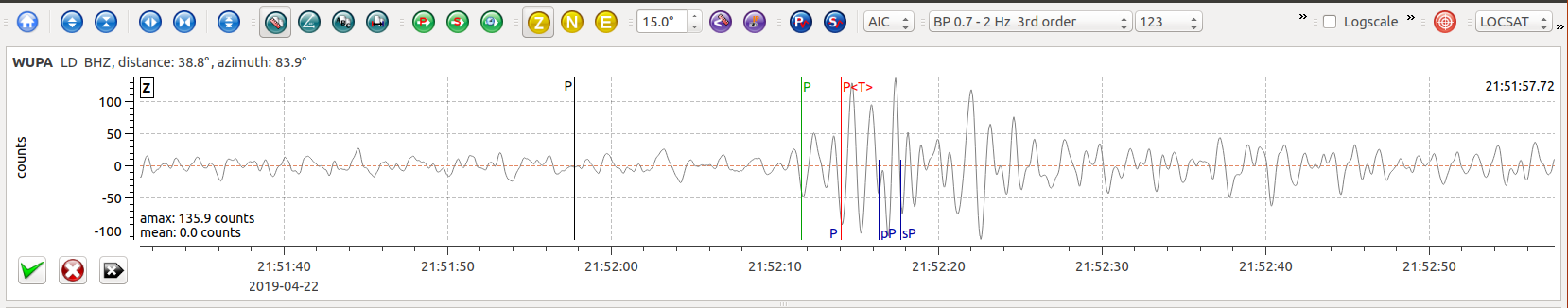
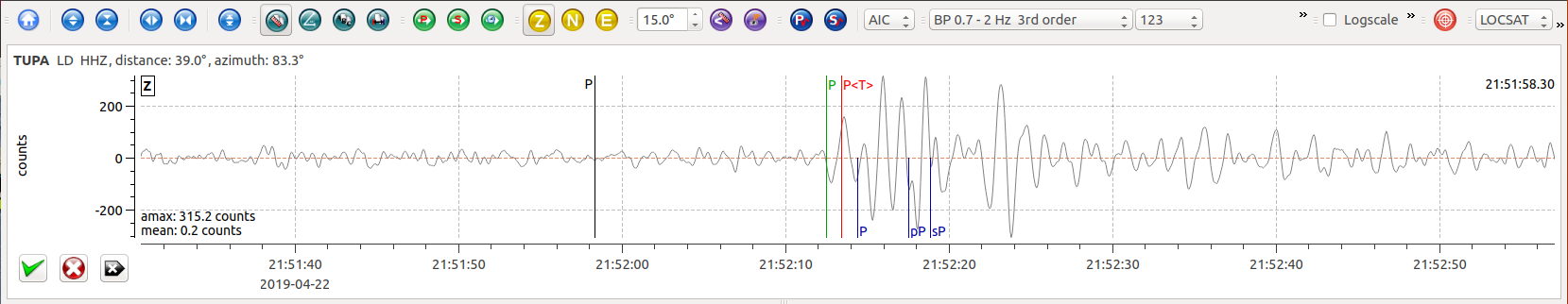
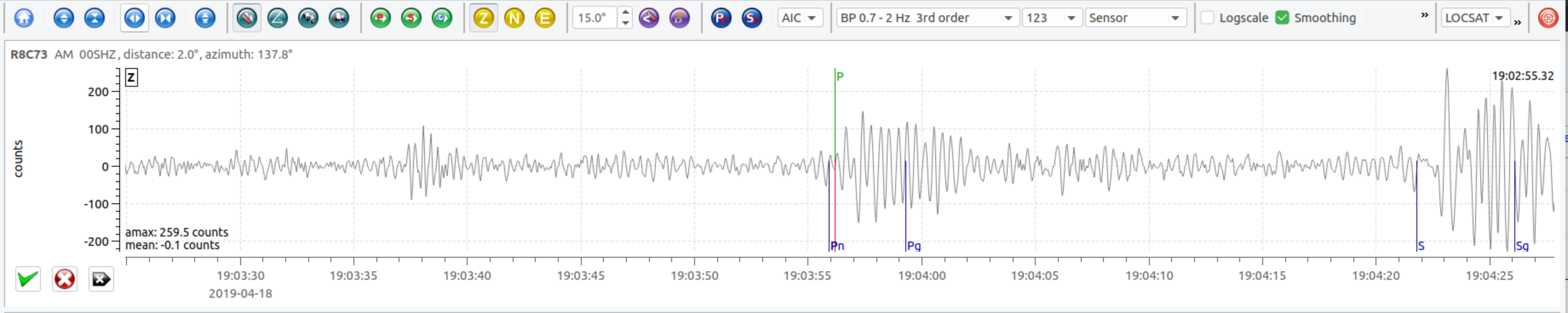
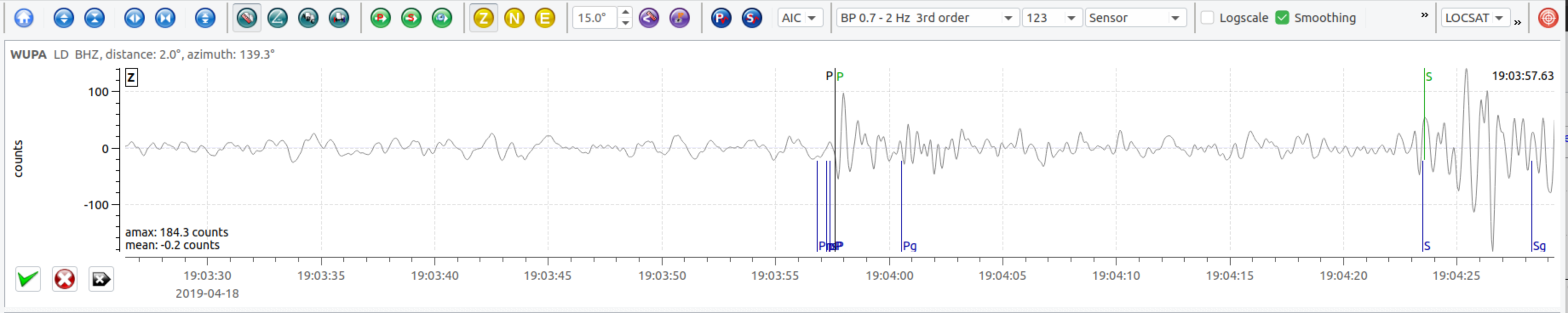
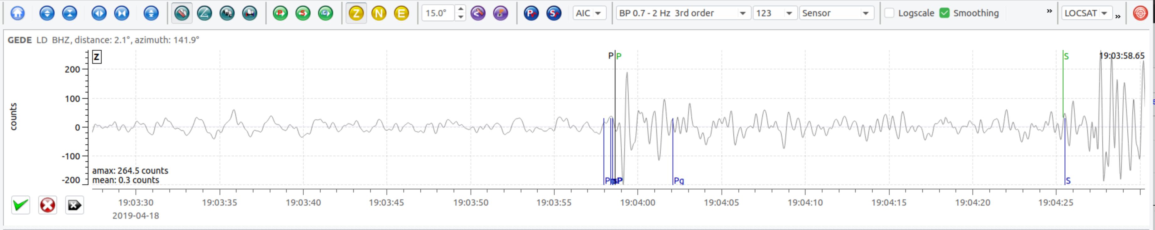
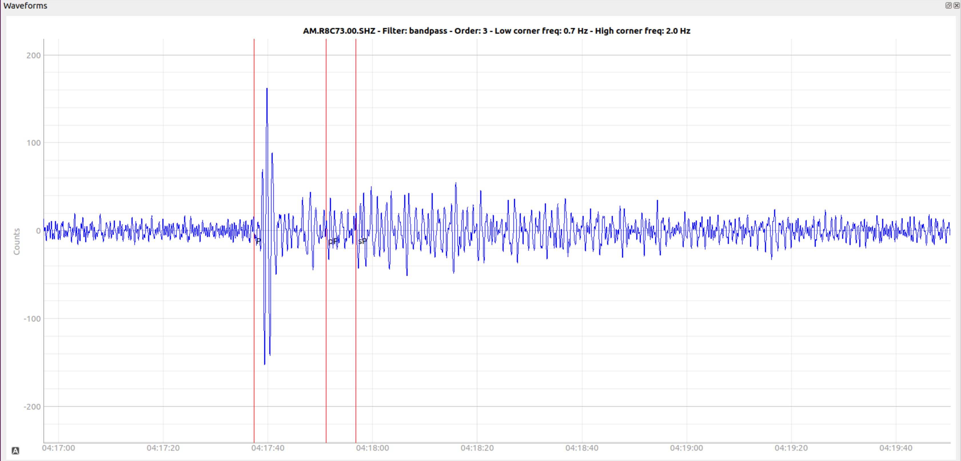
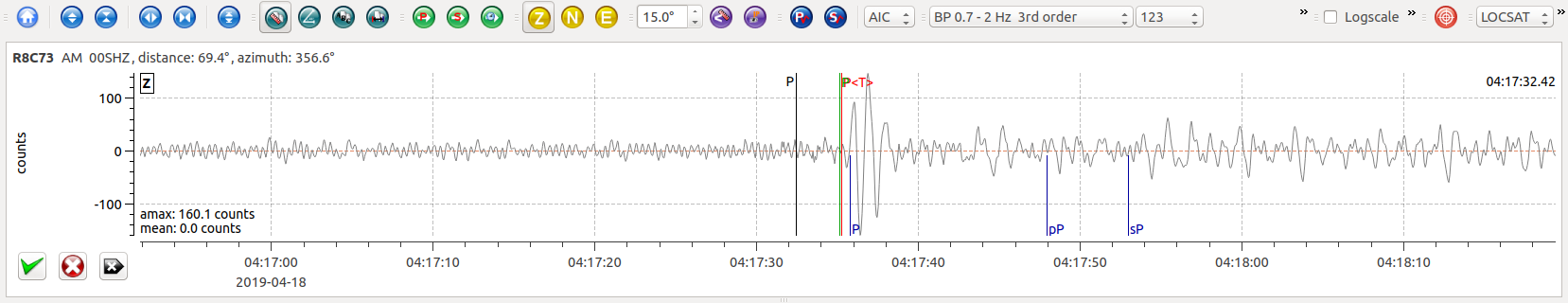
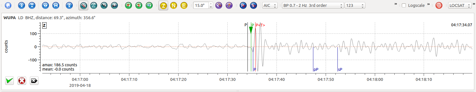
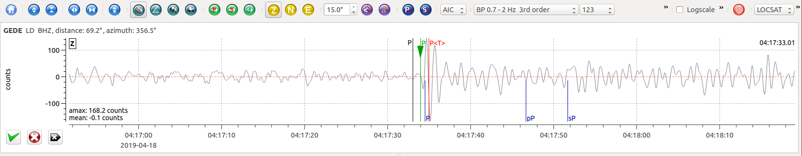
Waveform between the P and S wave arrivals (0.7 – 2.0 hz Butterworth bandpass filter).