North Island, New Zealand – M 6.1 – Oct 30, 2018 at 02:13:39 UTC

Position: 39.054°S 174.977°E – Depth: 227.3 km

SeisComP3 traces for AM.R8C73.00.SHZ (Exton PA), LD.WUPA.BHZ (West Chester University, West Chester PA), and LD.GEDE.SHZ (Greenville DE) showing the initial arrivals which at this distance (127.1 deg) are PKPdf waves (P waves passing through and diffracted by the Earth’s core). 

Distance: 127.2 deg. – 14,121 km

Azimuth 65.1 deg


SeisComP3 display showing the focal mechanism for this event.

Drake Passage – M6.3 – Oct 29, 2018 at 06:54:21 UTC

Position: 57.405°S 66.409°W – Depth 10.0 km

Heliocoder trace of LD.WUPA.SHZ (West Chester PA) showing earthquakes for the previous 24 hours including this event.

SeisComP3 traces for AM.R8C73.00.SHZ (Exton PA), LD.WUPA.BHZ (West Chester University, West Chester PA), and LD.GEDE.SHZ (Greenville DE) showing the P wave arrivals.

Distance: 97.8 deg, 10,853 km

Azimuth: 352.9 deg


SeisComp3 display with fault plane solution for this event.

El Salvador – M6.1 – Oct 28, 2018 at 22:23:54

Position: 12.949°N   90.385°W – Depth: 24.7 km

Seedlink Plotter heliocoder traces of AM.RC8C73.00.SHZ (Exton PA) and LD_WUPA.SHZ (West Chester PA).  This event is annotated as “Near Coast of Guatemala, 6.1 Mw”. The body waves are not visible on either trace, but WUPA shows the quake’s surface waves.

Distance: 30.2 Deg. 3,350 km
Azimuth: 22.9 Deg.

SeisComP3 traces for AM.R8C73.00.SHZ (Exton PA), LD.WUPA.BHZ (West Chester University, West Chester PA), and LD.GEDE.BHZ (Greenville DE) showing the P wave arrivals. All three show that the arrival’s are buried in noise. Despite the distance and magnitude, this earthquake barely registered on seismometers in the Philadelphia area.

Greece – M6.8 – Oct 25, 2018 at 22:54:51 UTC

Position: 37.506°N   20.563°E – Depth: 14 km

Tectonic Summary

From the USGS Information Page:

The October 25th, 2018, M 6.8 earthquake southwest of Lithakia, Greece, occurred as the result of rupture on or near the plate boundary between the Nubia (Africa) and the Eurasia plates. At the location of this earthquake, Nubia converges with Eurasia at a rate of roughly 28 mm/yr, subducting beneath Eurasia. Preliminary focal mechanisms for the earthquake indicate oblique slip on a near-vertical west-northwest striking fault or a moderately dipping north striking fault.

The region surrounding this event is seismically active and earthquakes of this size are not uncommon. Since 1900, 13 other earthquakes M 6.5 and larger have occurred within 200 km of this October 25, 2018, M 6.8 event. The largest was a M 7.3 on October 6, 1947, which occurred 145 km southeast of this event. On June 15th, 1995, a M 6.5 earthquake, 180 km inland to the northeast, resulted in 26 fatalities. On November 17, 2015, a M 6.5 earthquake occurred 130 km to the north, closer to the coast of Greece, resulting in two fatalities.


Jamaseis heliocoder trace (1) and Swarm trace (2) of AM.RC8C73.00.SHZ. The P wave arrival is annotated
Distance: 71.1 Deg. 7,899 km
Azimuth: 306.5 Deg.


Jamaseis trace of LD.WUPA.BHZ (West Chester University, West Chester PA).


SeisComP3 traces for AM.RC8C73.00.SHZ (Exton PA), LD.WUPA.BHZ (West Chester PA), and LD.GEDE.BHZ (Greenville DE).

SeisComp3 screenshot showing the focal mechanism.

West of Vancouver Island, British Columbia, Canada – M 6.6, 6.8, and 6.5 Oct 22, 2018 from 05:39:40 to 06:22:28 UTC

Position: 49.250°N 129.478°W, 11.0 km depth at 05:39:40 UTC, Magnitude 6.6
               49.347°N 129.214°W, 10.0 km depth at 06:16:28 UTC, Magnitude 6.8
               49.314°N 129.673°W, 10.0 km depth at 06:22:48 UTC, Magnitude 6.5


USGS Information Pages:
https://earthquake.usgs.gov/earthquakes/eventpage/us1000hfgn/executive
https://earthquake.usgs.gov/earthquakes/eventpage/us1000hfgv/executive
https://earthquake.usgs.gov/earthquakes/eventpage/us1000hfh3/executive

This is a sequence of earthquakes occurring in the Pacific ocean approximately  200 – 225 km southwest of Port Hardy B.C.

Tectonic Summary

From the USGS information page

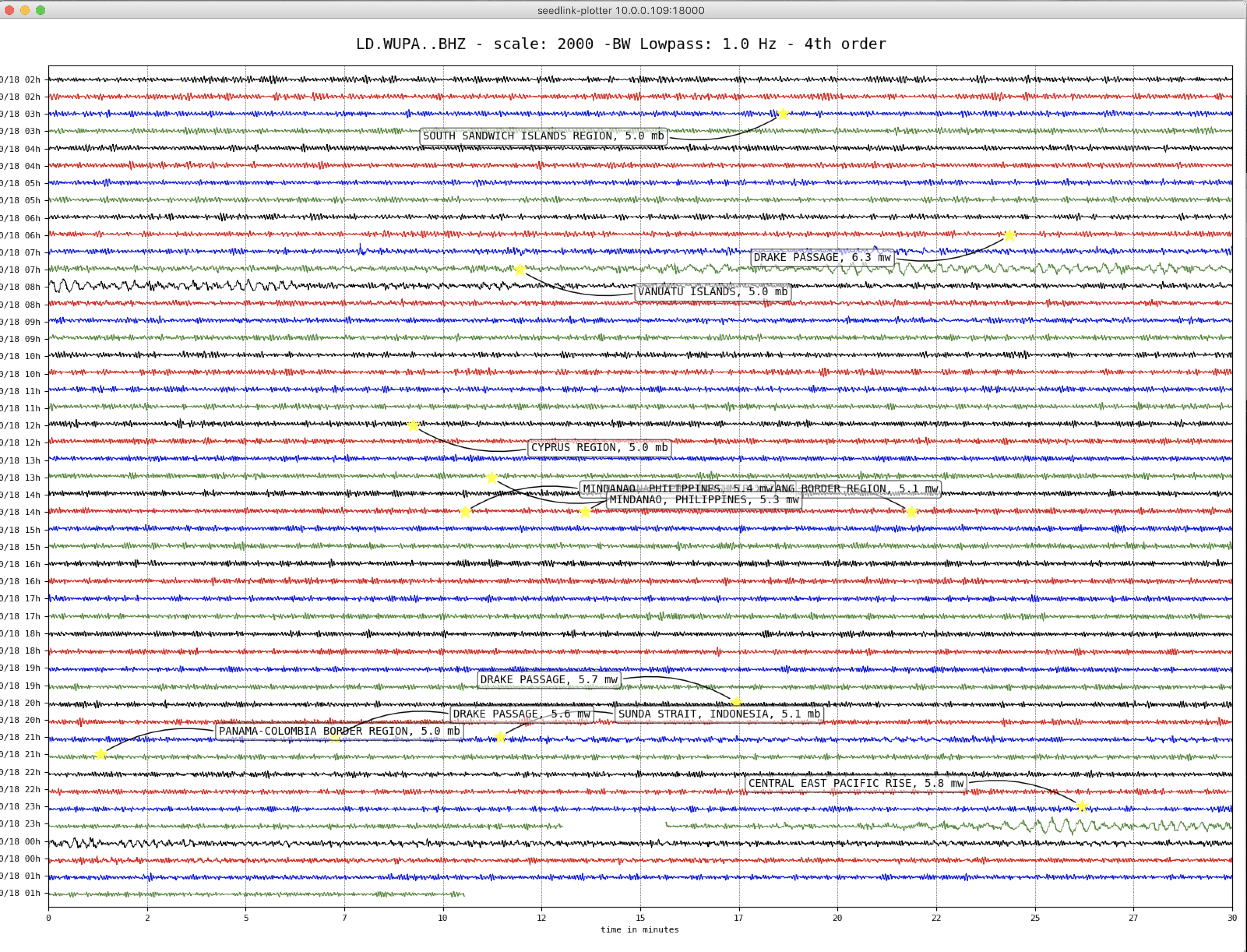
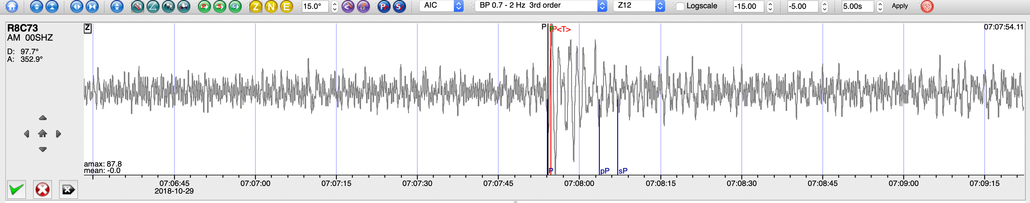
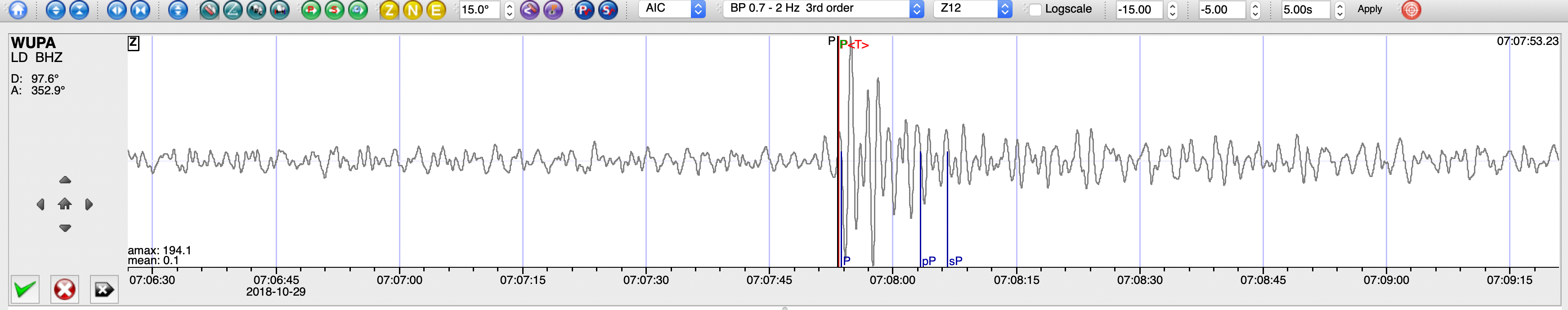
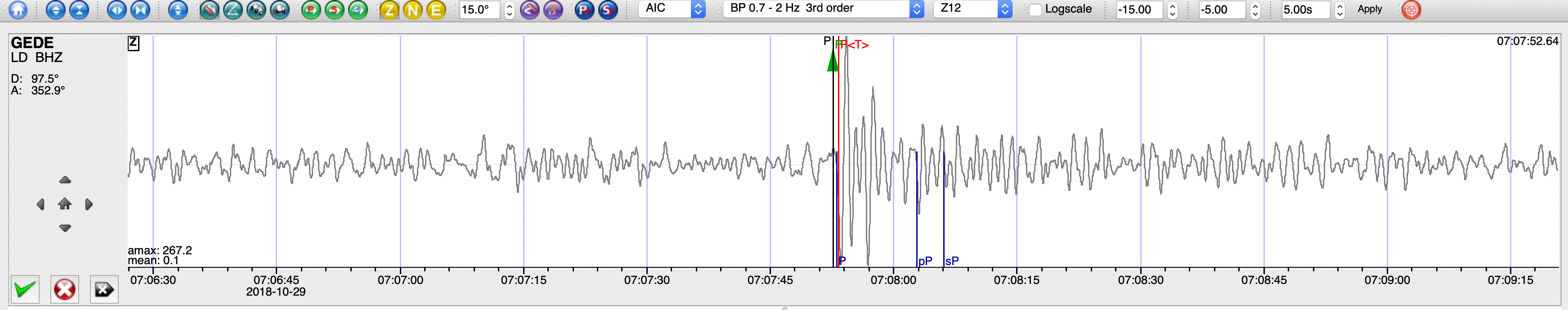
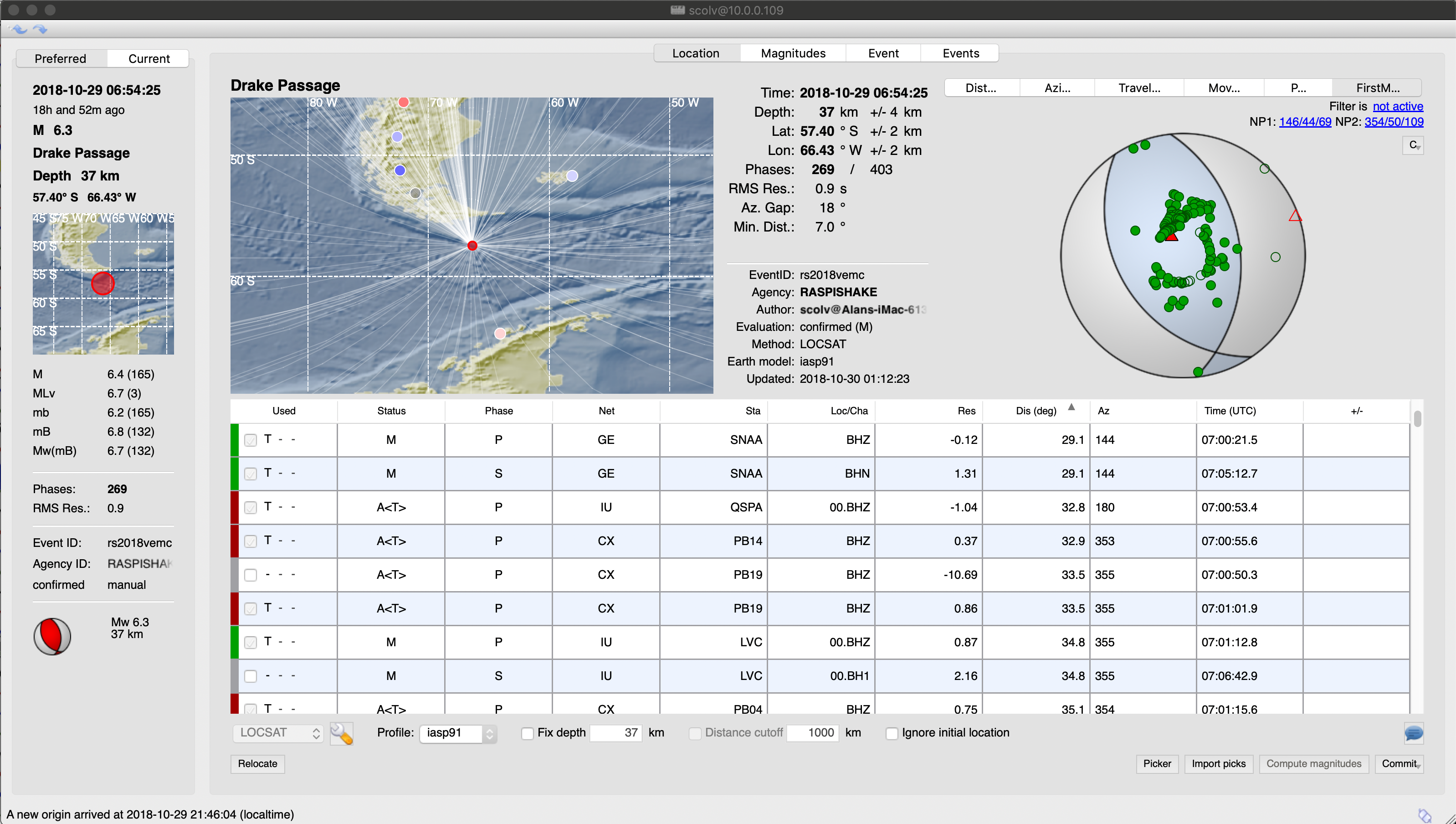
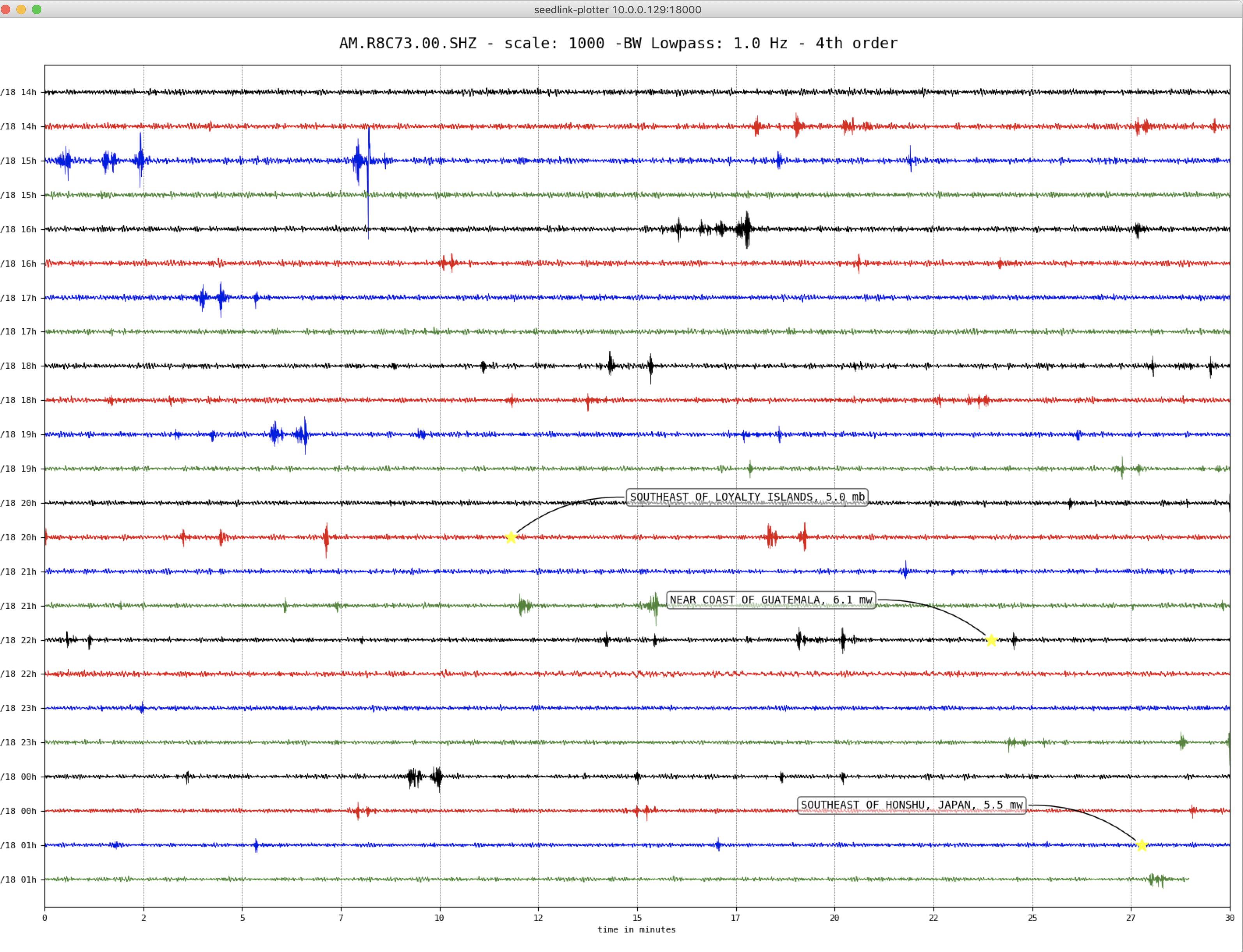
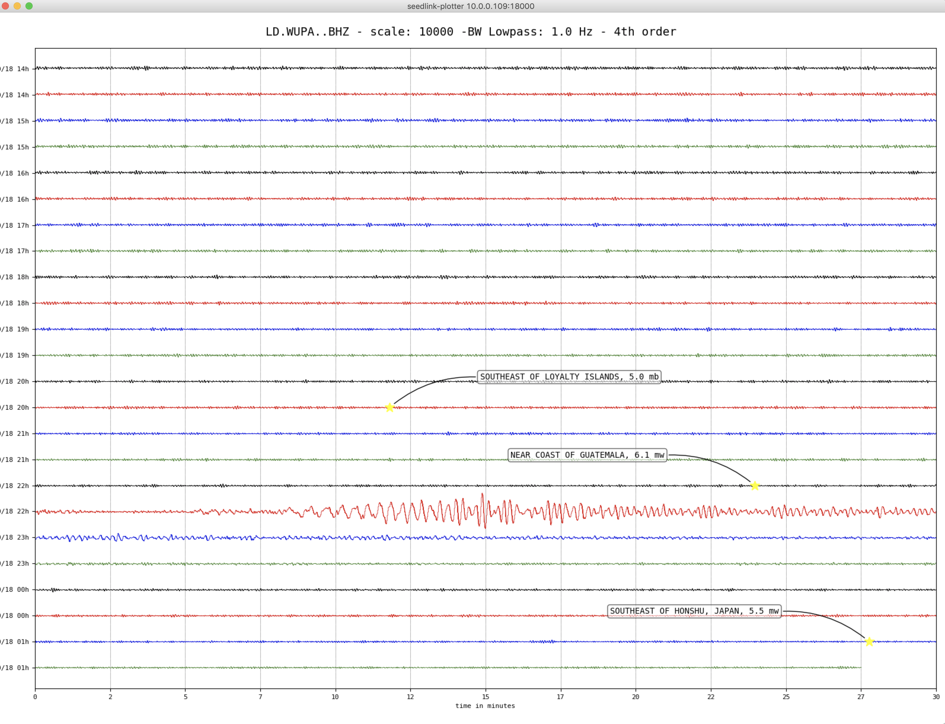
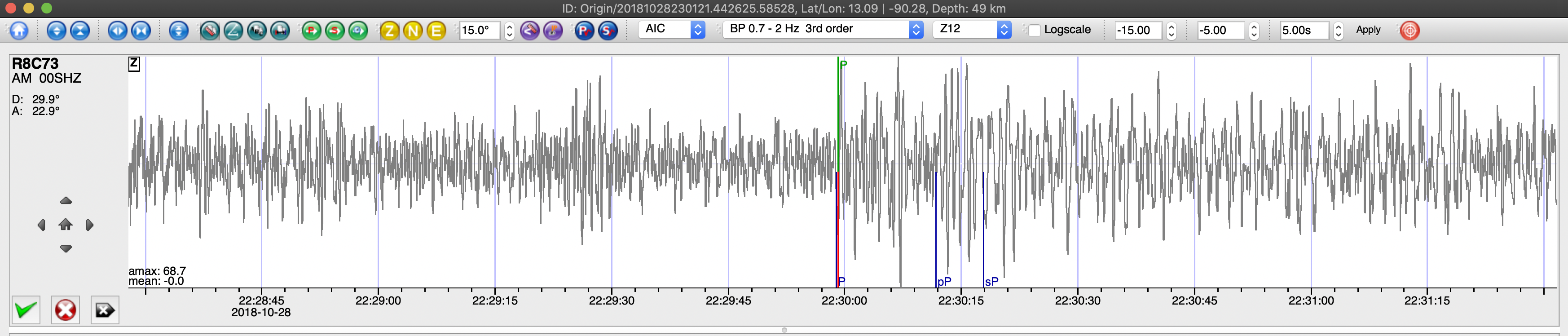
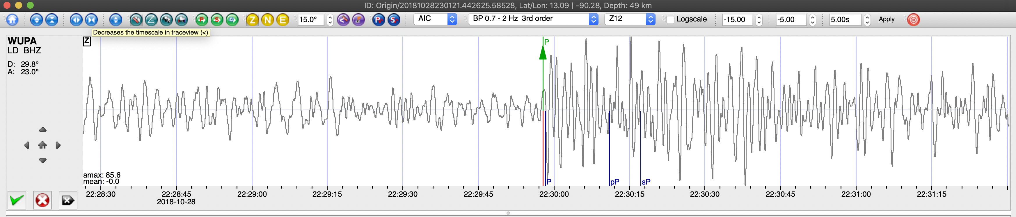
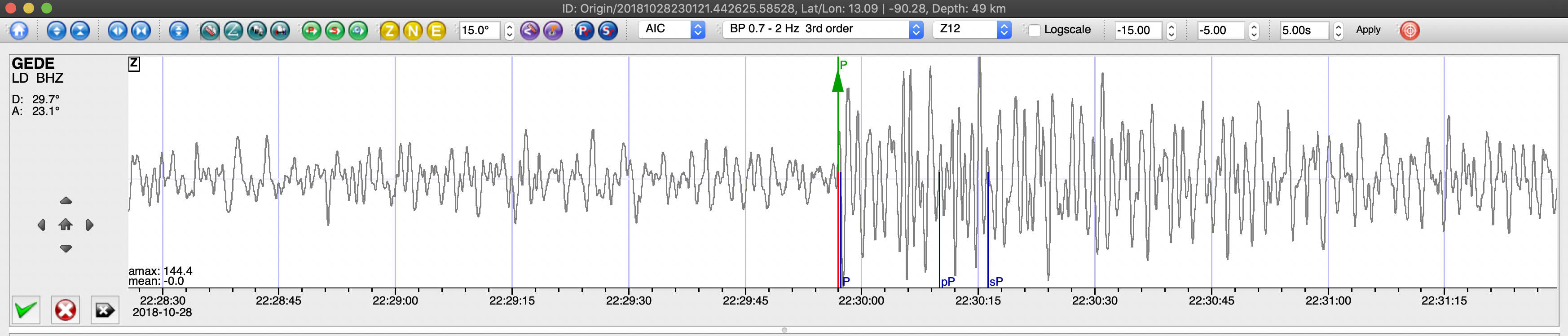
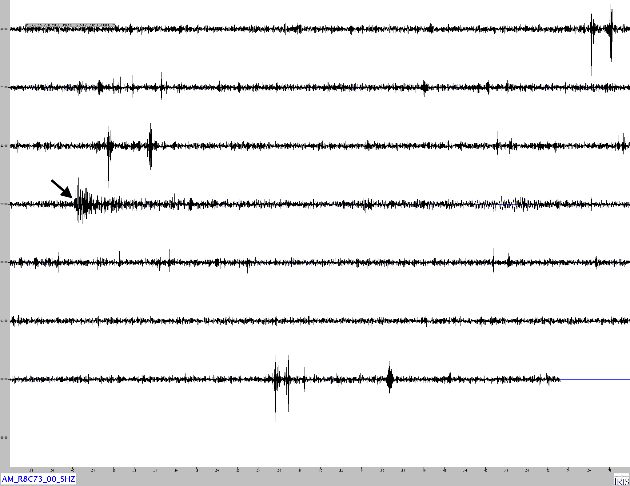
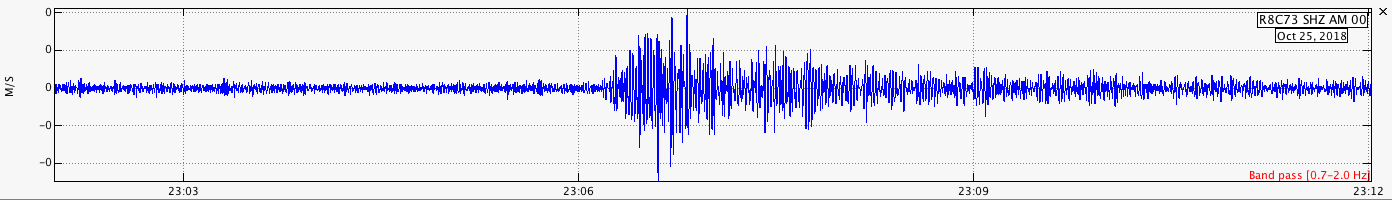
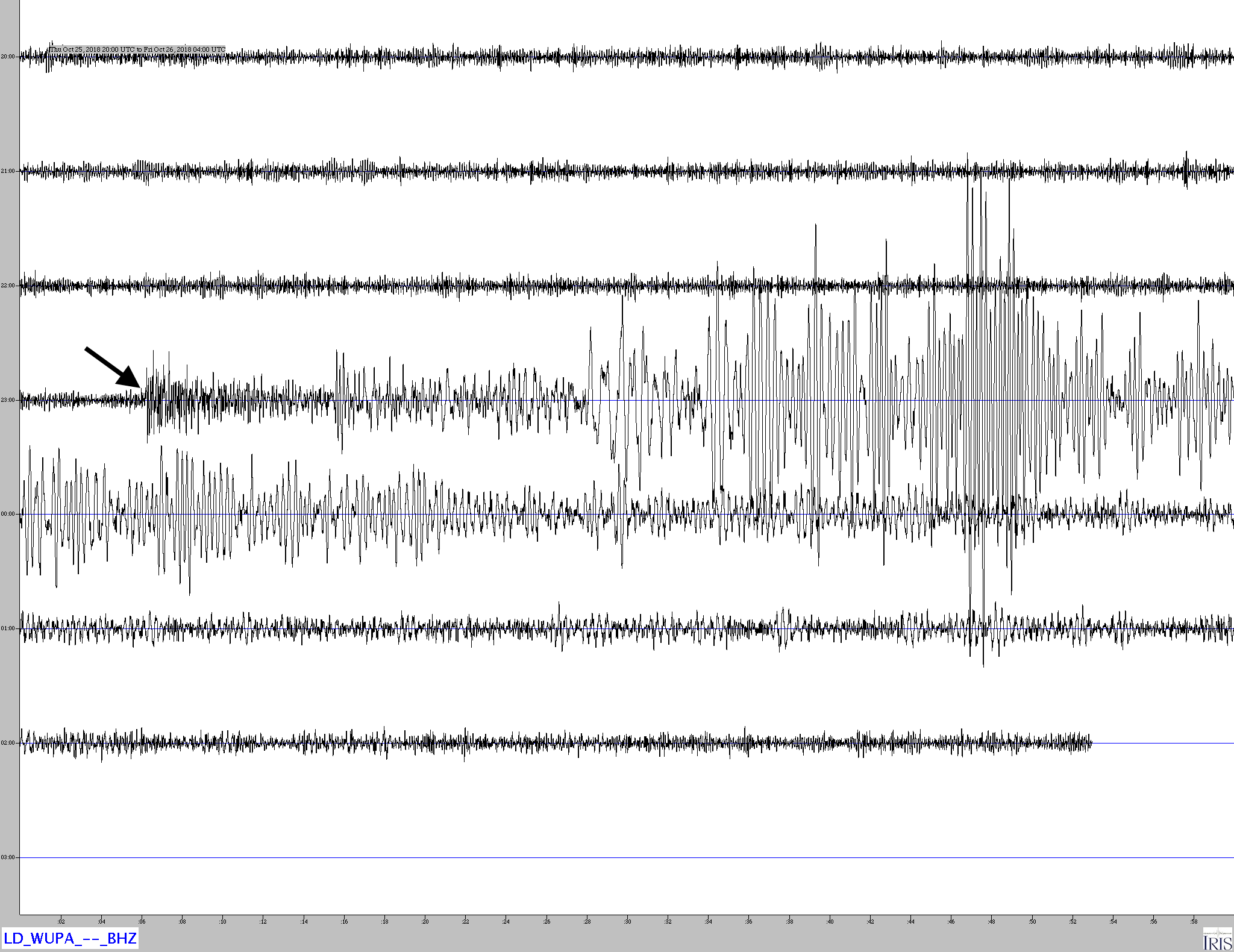
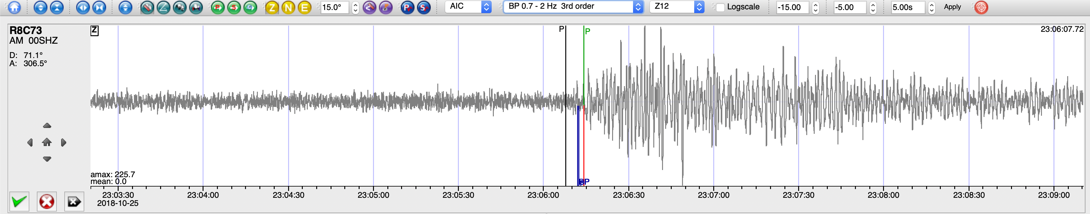
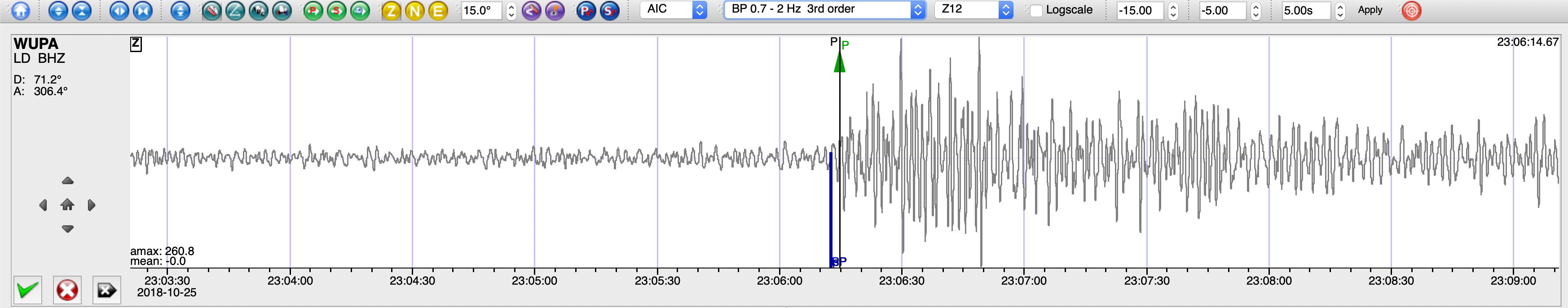
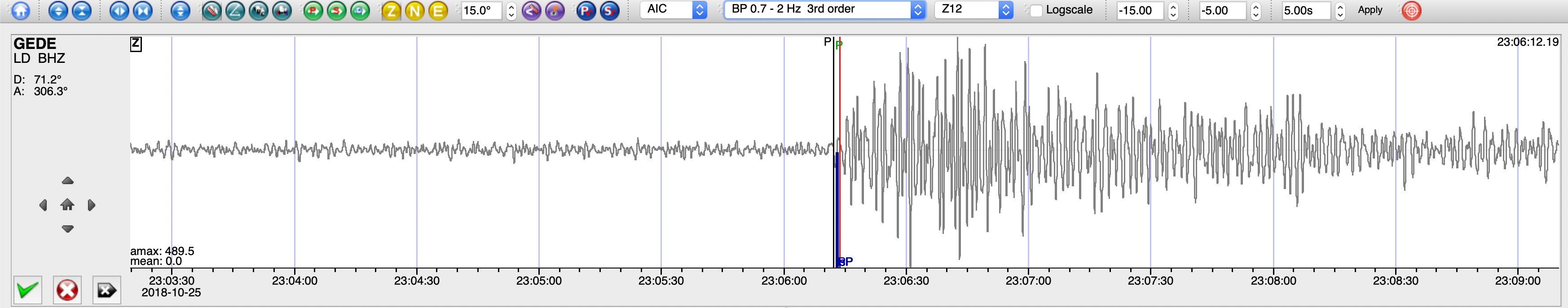
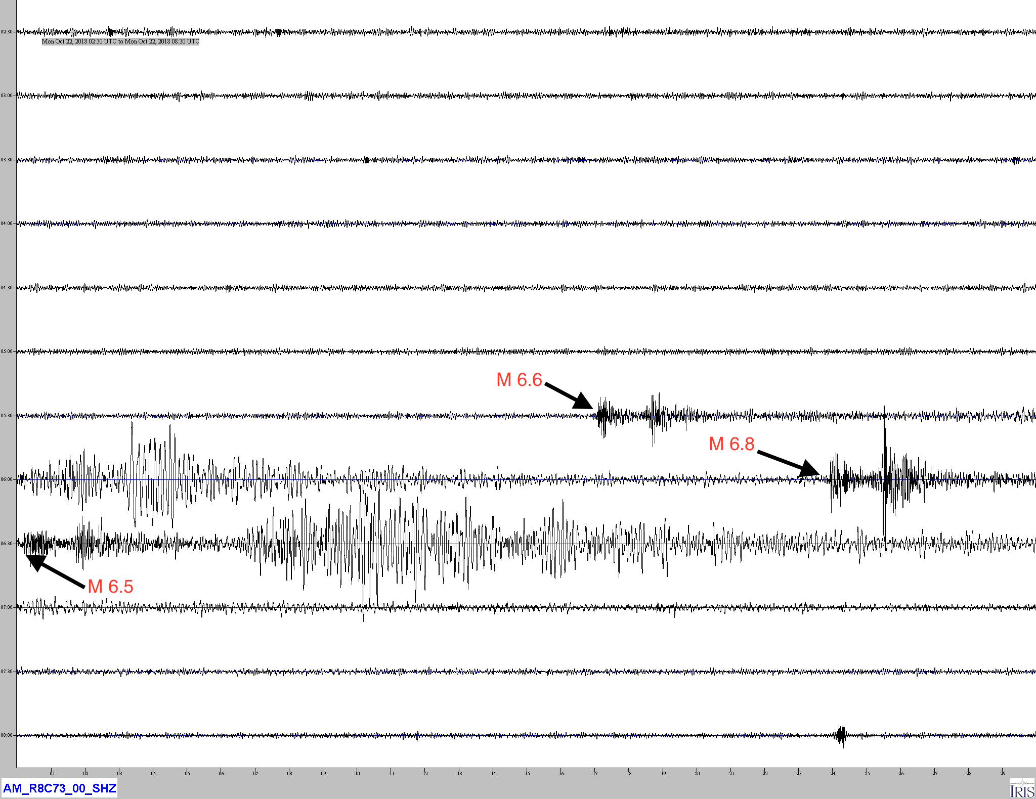
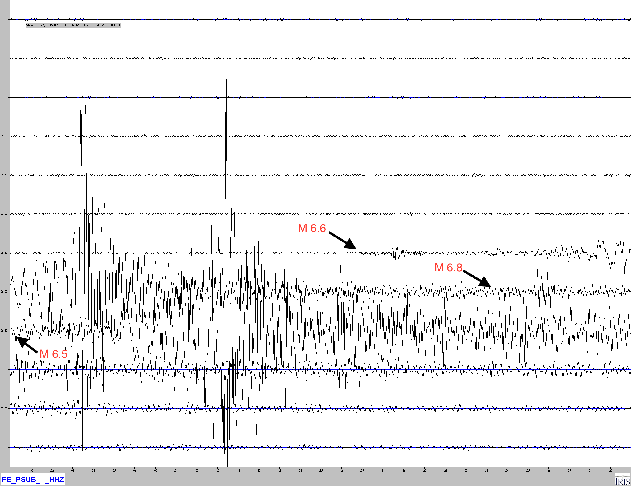
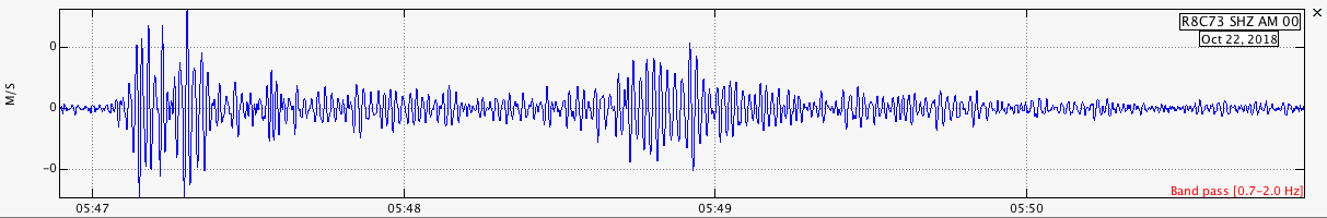
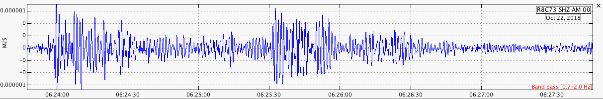
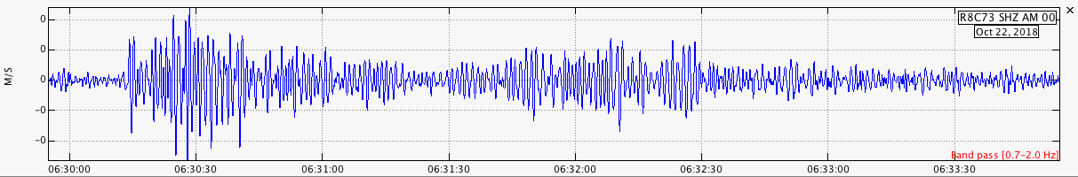
Over the course of 43 minutes on October 22, 2018 a series of M6.6, M6.8 and M6.5 earthquakes occurred off of Vancouver Island, Canada. These earthquakes occurred as a result of strike-slip faulting at shallow depths on the boundary or within the interior of the Explorer microplate. Focal mechanism solutions for the earthquakes indicate rupture occurred on either a near-vertical right-lateral northwest-southeast striking fault, or along a near-vertical left-lateral northeast-southwest striking fault. The tectonics of the Pacific margin of North America between Vancouver Island and south-central Alaska are dominated by the northwest motion of the Pacific plate with respect to the North America plate at a velocity of approximately 50 mm/yr. Convergence between the northern extent of the Juan de Fuca plate (also known as the Explorer microplate) and North America plate dominate the regional tectonics. The Explorer Ridge along the western side of the Explorer plate and the Sovanco Fracture Zone to the south define the boundary between the Pacific and Explorer plates. To the east, the Explorer plate subducts beneath the North American Plate. Eastward of the Sovanco Fracture Zone the Nootka fault separates the Explorer plate from the Juan de Fuca plate. As a result of these forces the Explorer plate is internally deformed and faulted and can produce diffuse seismicity away from its boundaries. Although a larger earthquake cannot be ruled out, previous sequences of large, closely spaced events in this region have not resulted in larger events, including a M 6.6 and M 6.4 in 2008 that were separated by an hour.The Explorer microplate is heavily deformed by internal dextral faulting, experiencing frequent moderate-sized earthquakes. Within approximately 70 km of these earthquakes, 11 earthquakes of M 6 or greater have occurred since 1951. The largest previous recorded earthquake in this region was a M 6.8 event that occurred on December 17, 1980.

Jamaseis heliocoder trace of AM.RC8C73.00.SHZ. The P wave arrival times are annotated for the three quakes in the sequence. Notice that there are very large surface waves visible, even though this is a short period seismometer. This may be due to waves from the first earthquake reinforcing the amplitude of Love and Rayleigh wave from the subsequent events.

Distance: 4272 km

Similar trace from PE.PSUB.HHZ located at the Penn State University Brandywine Campus in Media PA. As this is a broadband instrument, the surface waves are much larger. Both this and the AM.R8C73 traces are filtered with a 1Hz low pass filter.

Swarm traces of the P wave arrivals for each of the three earthquakes in this sequence recorded by AM.R8C73.00.SHZ.

Sea of Okhotsk, Kuril Islands – M6.7 – Oct 13, 2018 at 11:10:23 UTC

Position: 52.861°N   153.379°E – Depth: 470.1 km

Jamaseis heliocoder trace of AM.RC8C73.00.SHZ of this earthquake.
Distance: 77.9 Deg. 8,668 km
Azimuth: 36.1 Deg.

SeisComP3 traces for AM.R8C73.00.SHZ (Exton PA) and LD.WUPA.BHZ (West Chester University, West Chester PA) showing the P wave arrivals.

SeisComP3 display showing the focal mechanism for this earthquake.