Kuril Islands – M6.5 – Oct 10, 2018 at 23:16:02 UTC

Position: 49.348°N   156.213°E – Depth: 17.5 km

SeisComP3 scmv (Map View) showing the day’s earthquakes. The three with “beachball” diagrams are the events detailed here.

SeisComP3 traces for AM.R8C73.00.SHZ (Exton PA) and LD.WUPA.BHZ (West Chester University, West Chester PA) showing the P wave arrivals.

Distance: 79.7 Deg, 8862 km

Azimuth: 37.6 Deg.

New Britain, Papua New Guinea – M7.0 Oct 10, 2018 at 20:48:20 UTC

Position: 5.678°S   151.198°E – Depth: 40.3 km

Tectonic Summary

From the USGS Information Page:

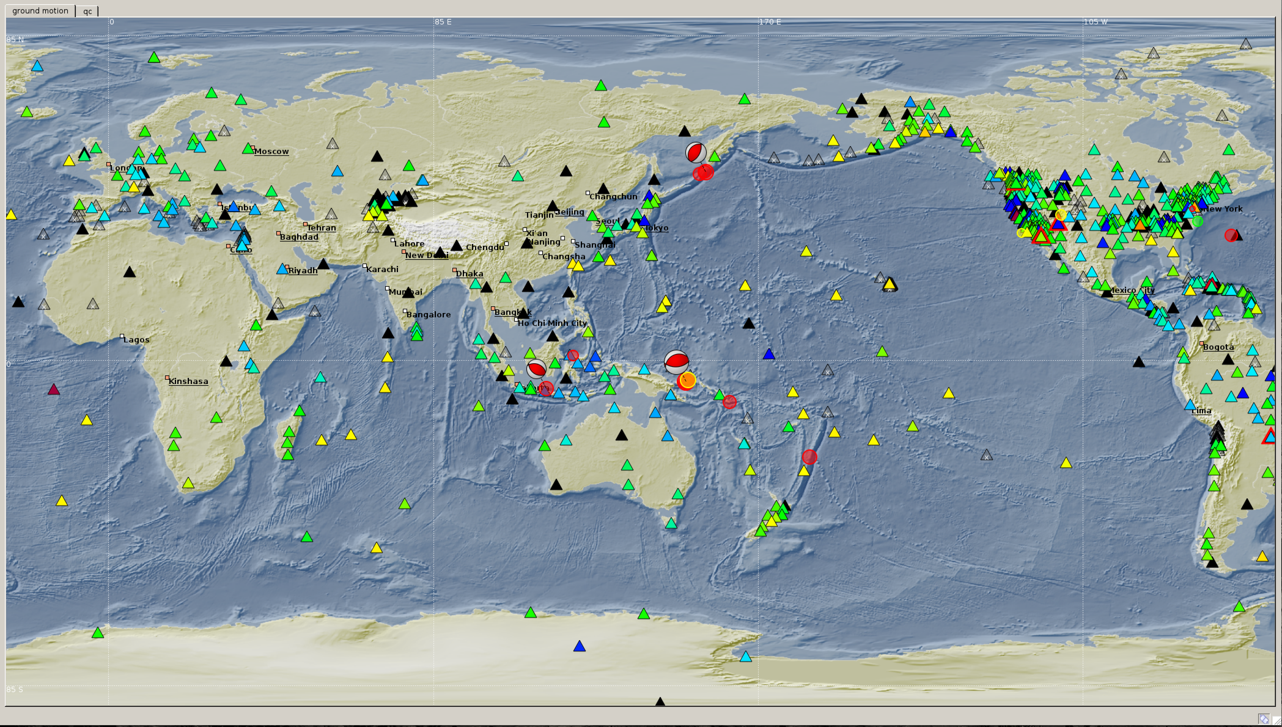
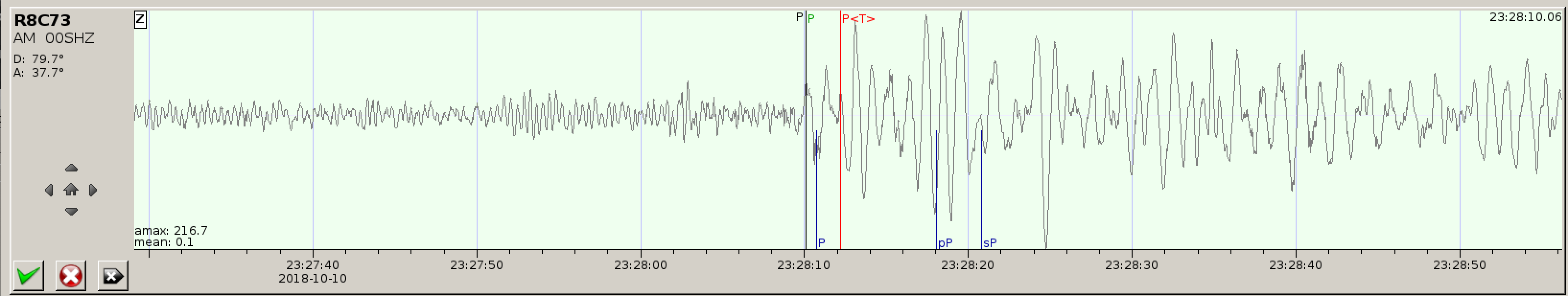
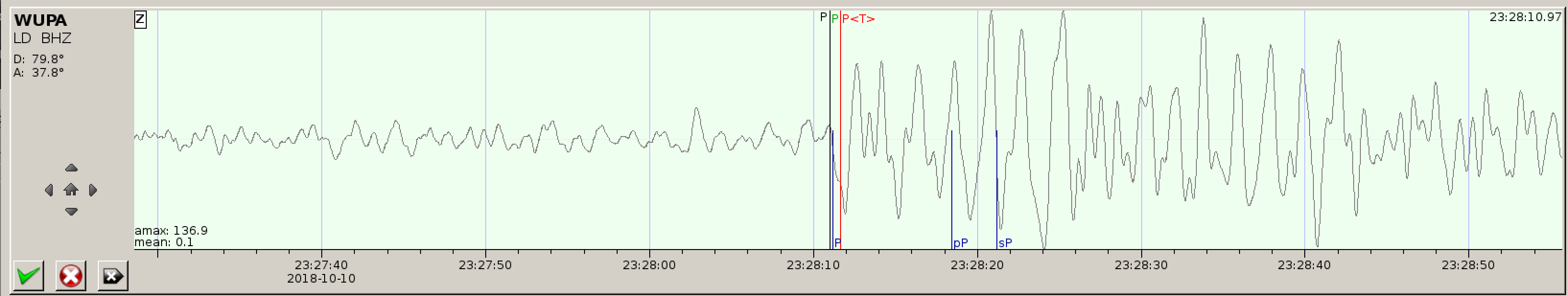
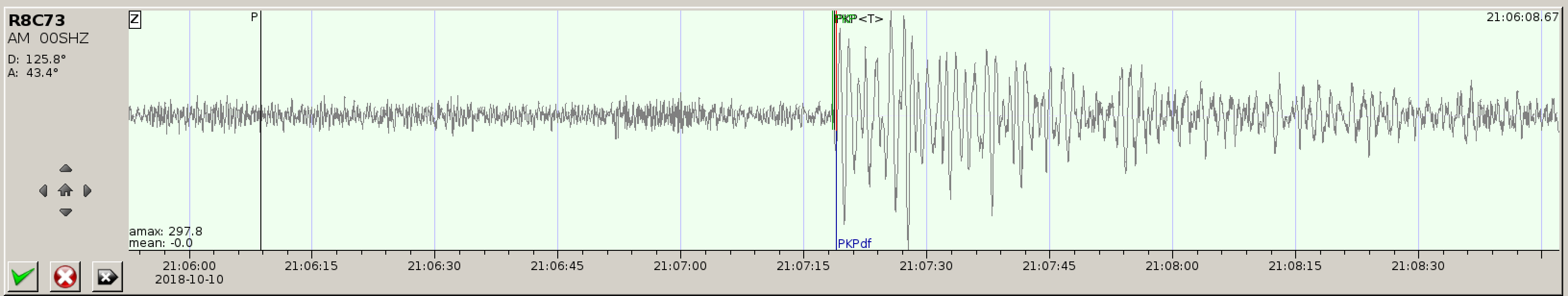
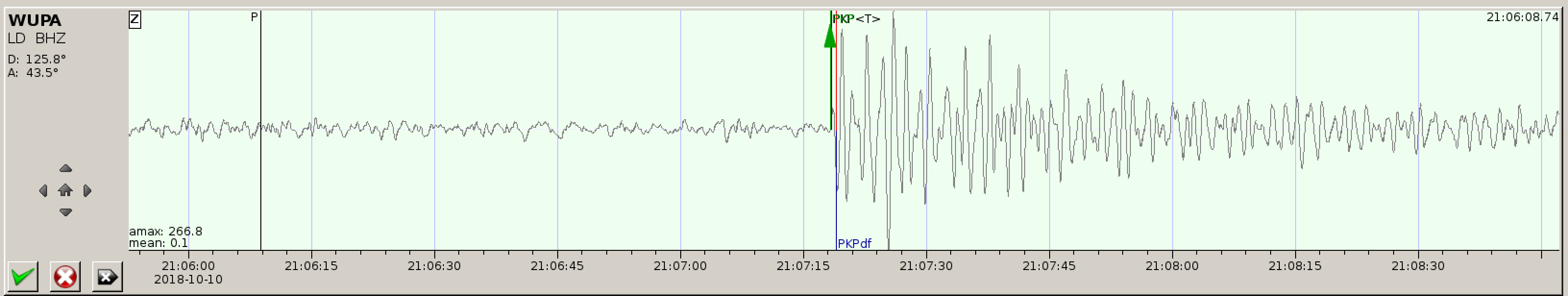
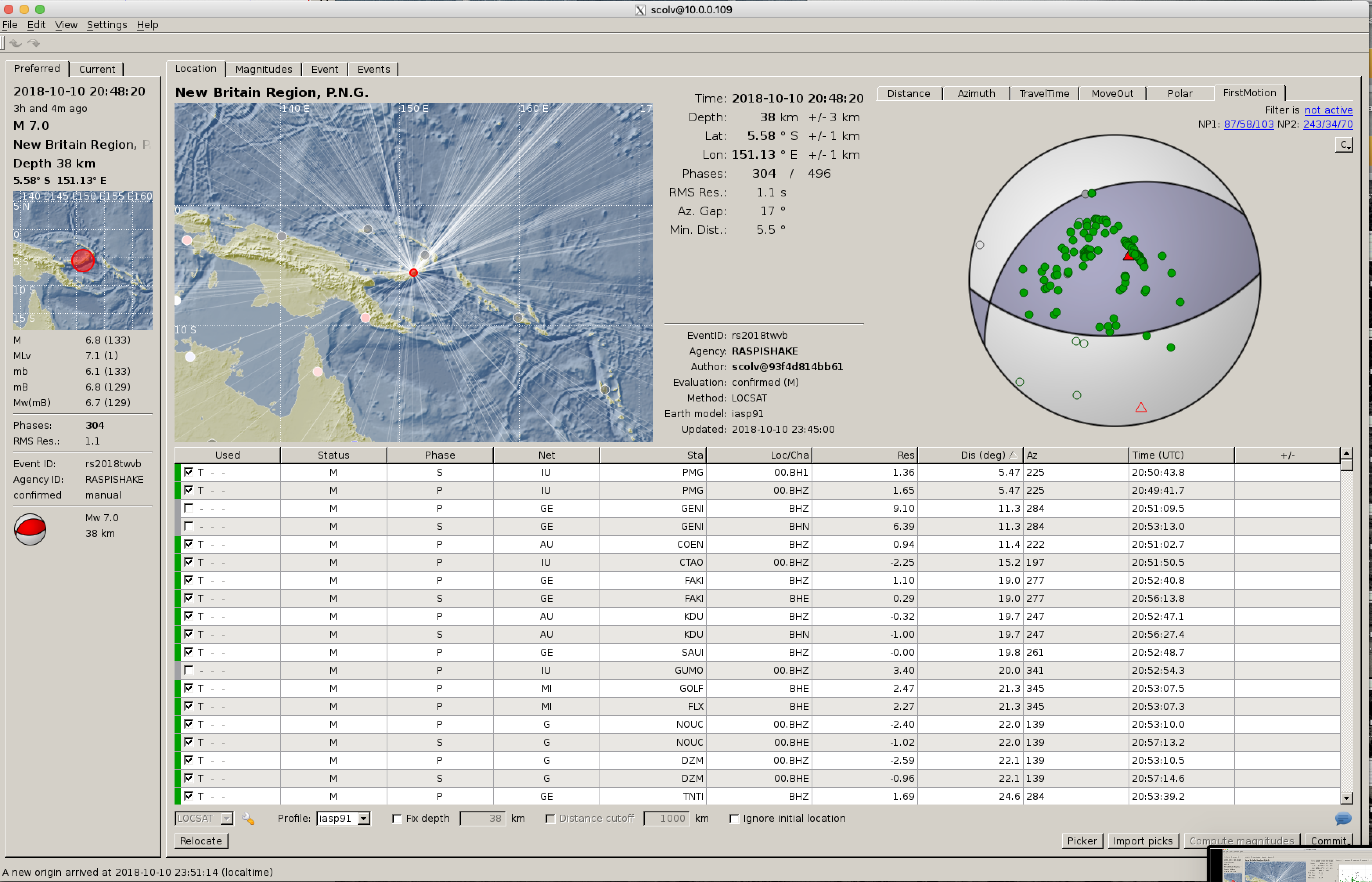
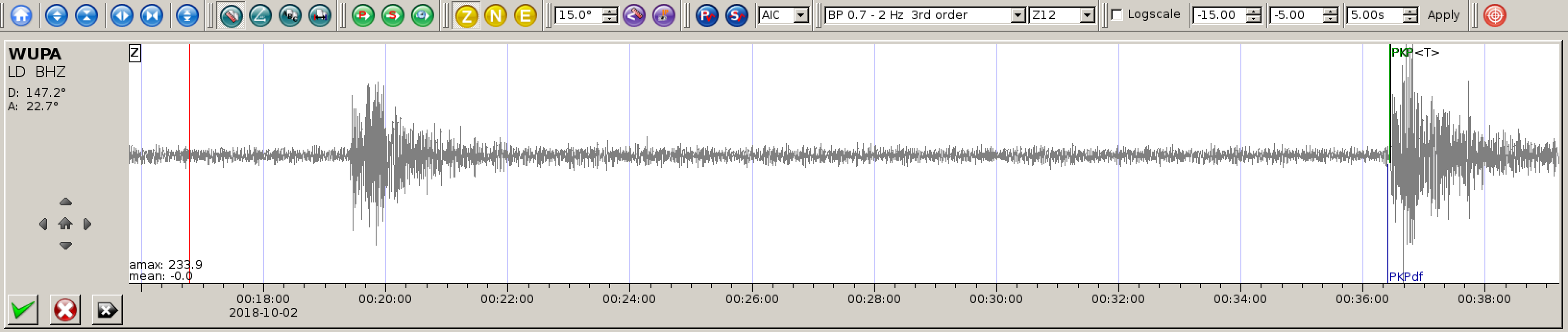
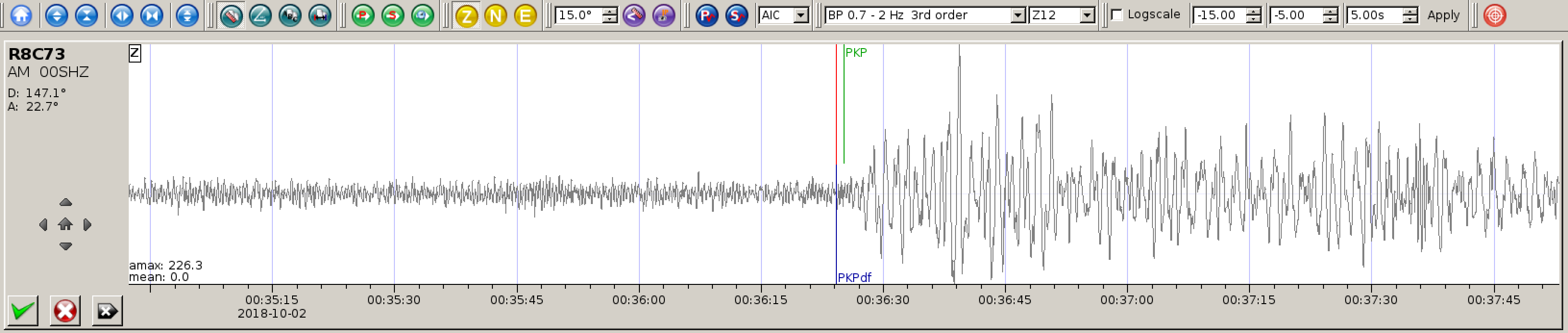
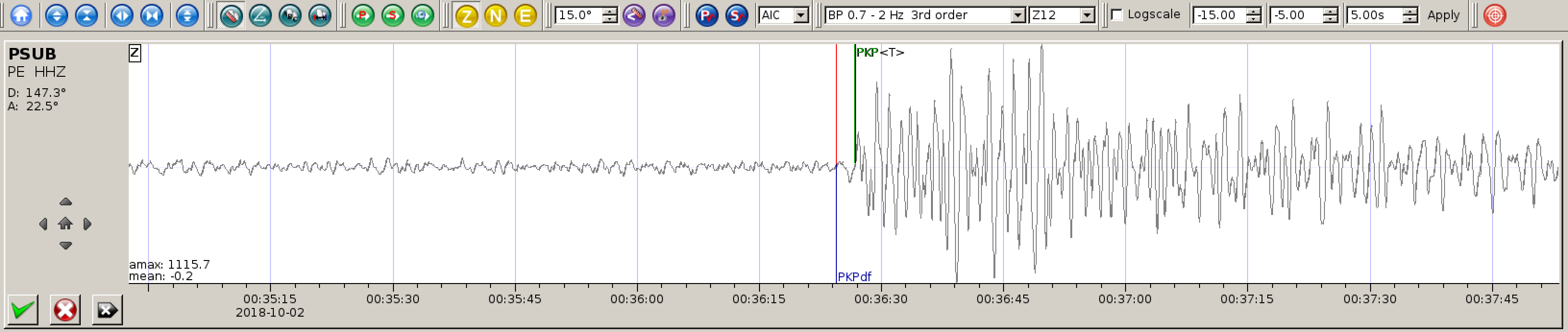
The October 10, 2018, M 7.0 earthquake east of Kimbe, Papua New Guinea, occurred as the result of thrust faulting on or near the plate boundary interface between the subducting Australia and overriding Pacific plates. At the location of the earthquake, the Australia plate moves towards the east-northeast at a velocity of 105 mm/yr with respect to the Pacific plate, and begins its subduction into the mantle beneath New Britain at the New Britain Trench, south-southeast of the earthquake. The moment tensor and depth of the event are consistent with thrust-type motion on the interface between these two plates. Note that at the location of the earthquake, some researchers consider the edges of the Australia and Pacific plates to be divided into several microplates that take up the overall convergence between the Australia and Pacific plates, including the Solomon Sea and South Bismark microplates local to this event. The Solomon Sea microplate moves slightly faster and more northeasterly with respect to the Pacific plate than does the Australia plate due to sea-floor spreading in the Woodlark Basin several hundred kilometers to the southeast of the October 10th earthquake, facilitating the classic subduction evident beneath New Britain.

While commonly plotted as points on maps, earthquakes of this size are more appropriately described as slip over a larger fault area. Thrust-faulting events of the size of the October 10, 2018, earthquake are typically about 40×20 km (length x width).

The plate boundary between the Australia and Pacific plates in the Papua New Guinea region is very active seismically; 28 M 7+ events have occurred within 250 km of the October 10, 2018 earthquake over the preceding century. Few are known to have caused shaking-related fatalities because of the remoteness of the region, though a M 8.0 earthquake in November 2000—one of three similarly sized events over a 2-day period—did cause several deaths. A M 7.2 earthquake in May 1985, just 20 km to the northwest of the October 10, 2018 earthquake, also resulted in one fatality, though that event was a strike-slip earthquake in the upper plate, much shallower than today’s shock. The largest nearby earthquake was a M 8.1 event, 250 km to the northeast of the October 10, 2018, earthquake.

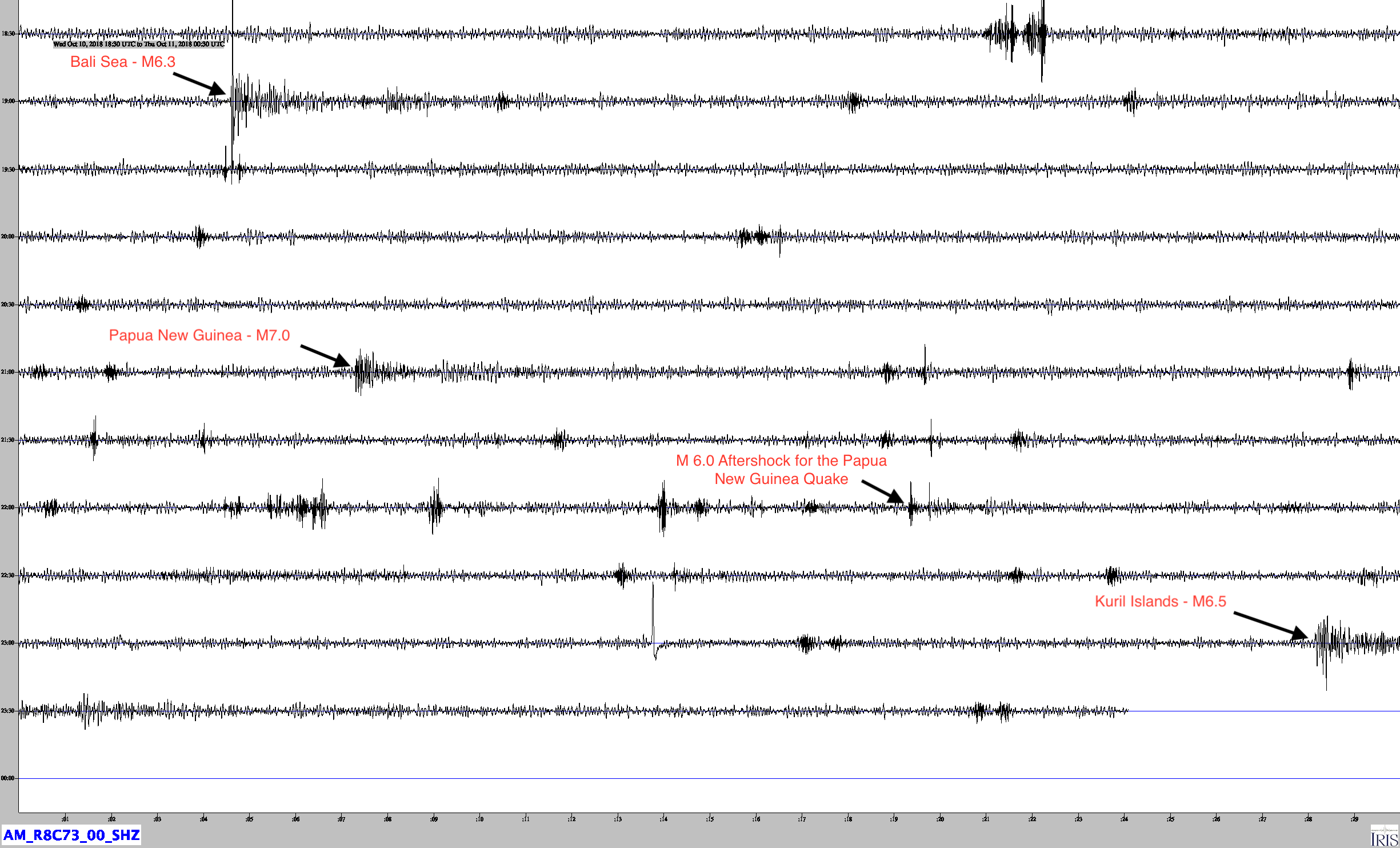
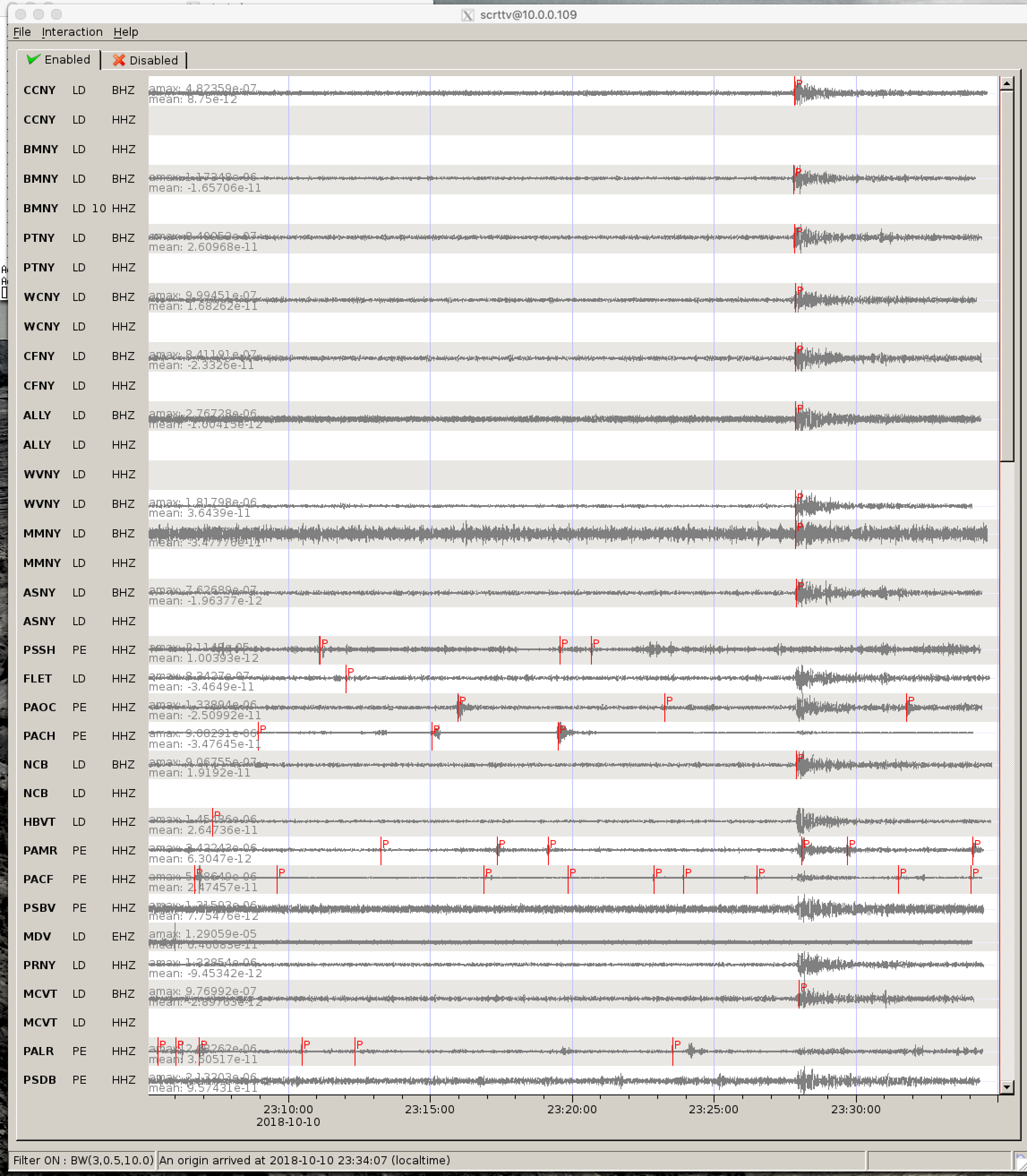
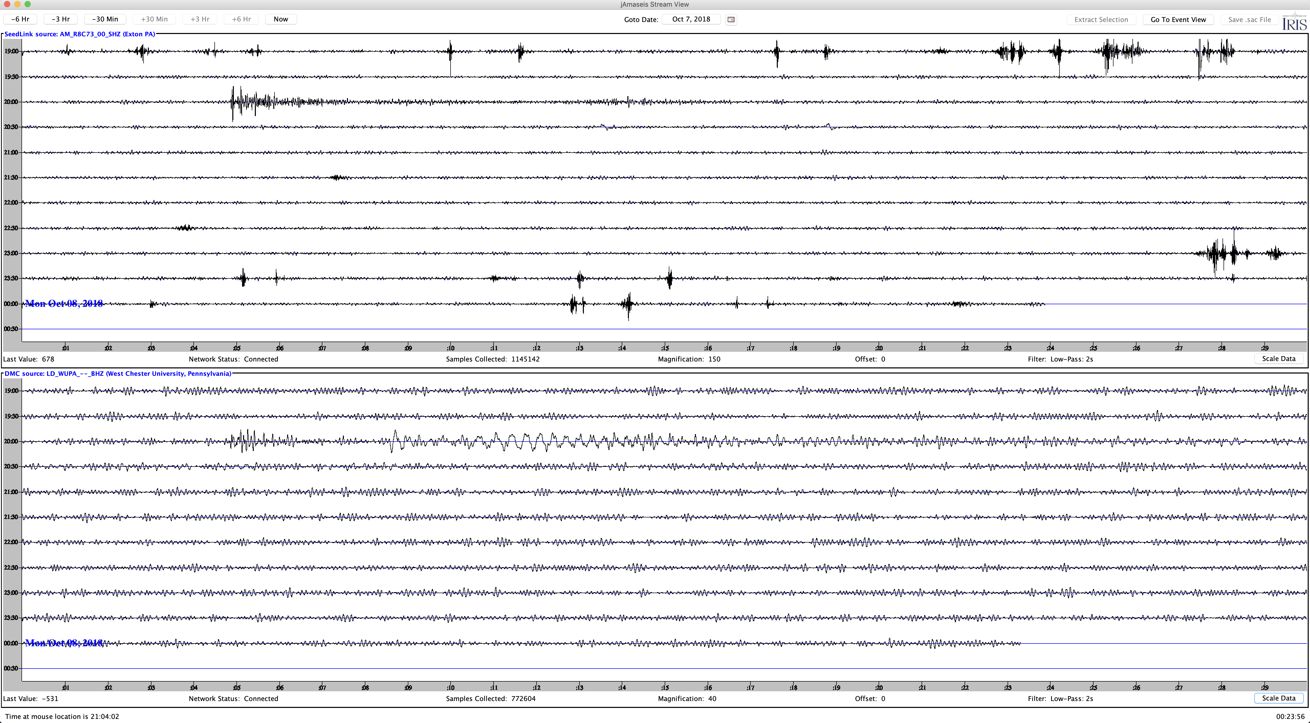
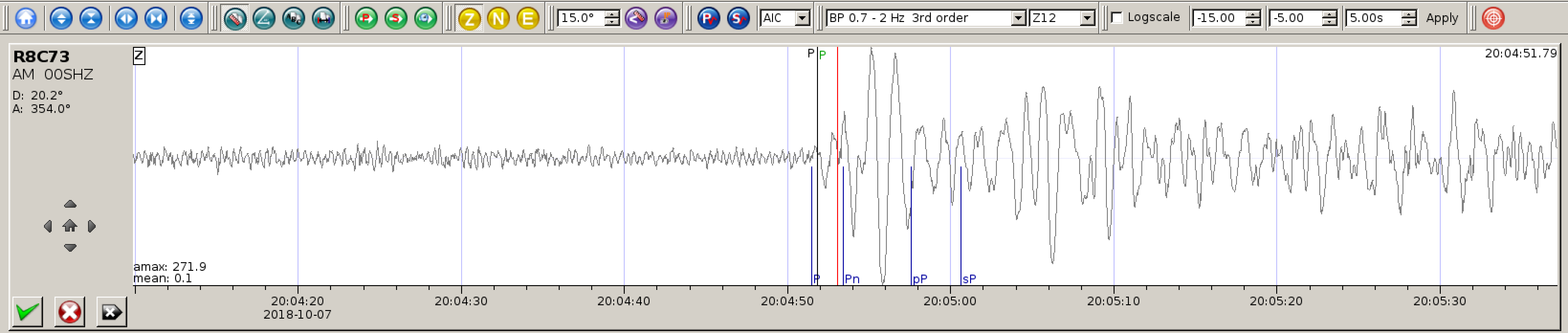
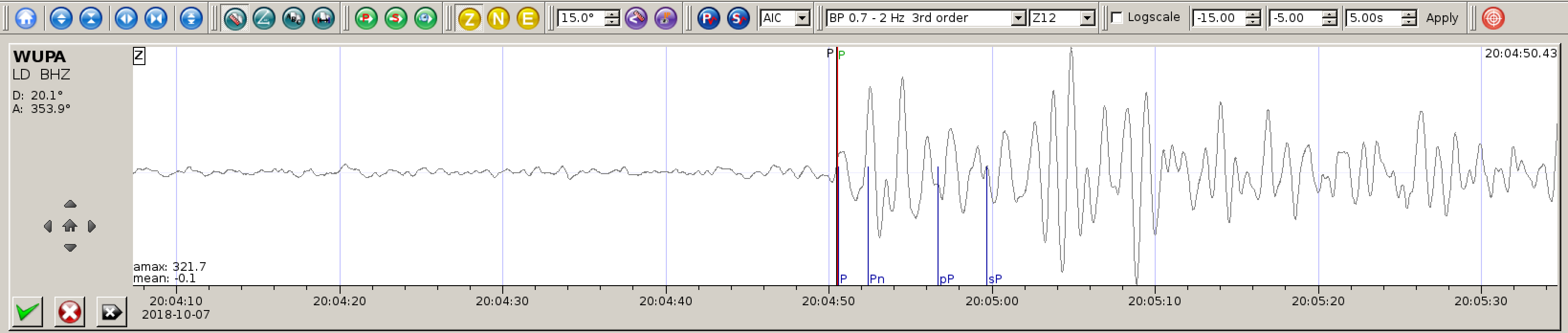
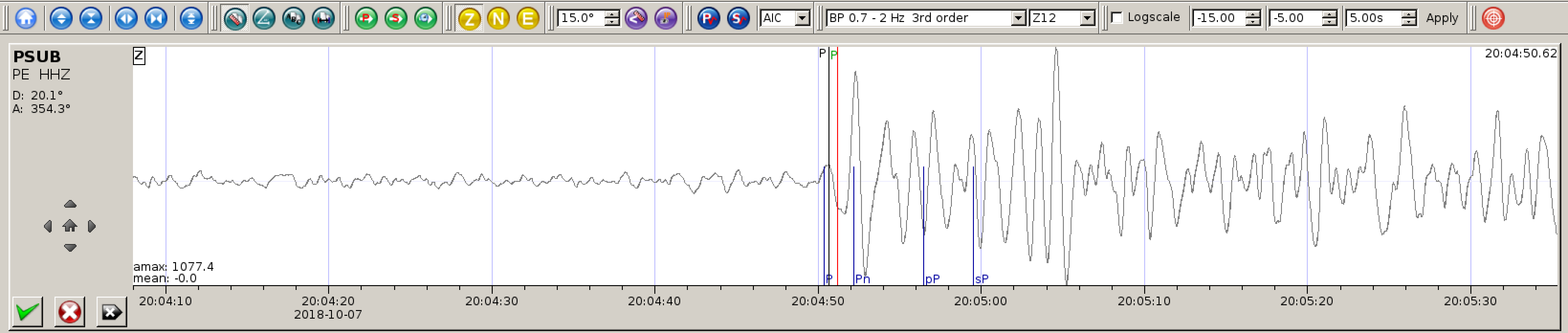
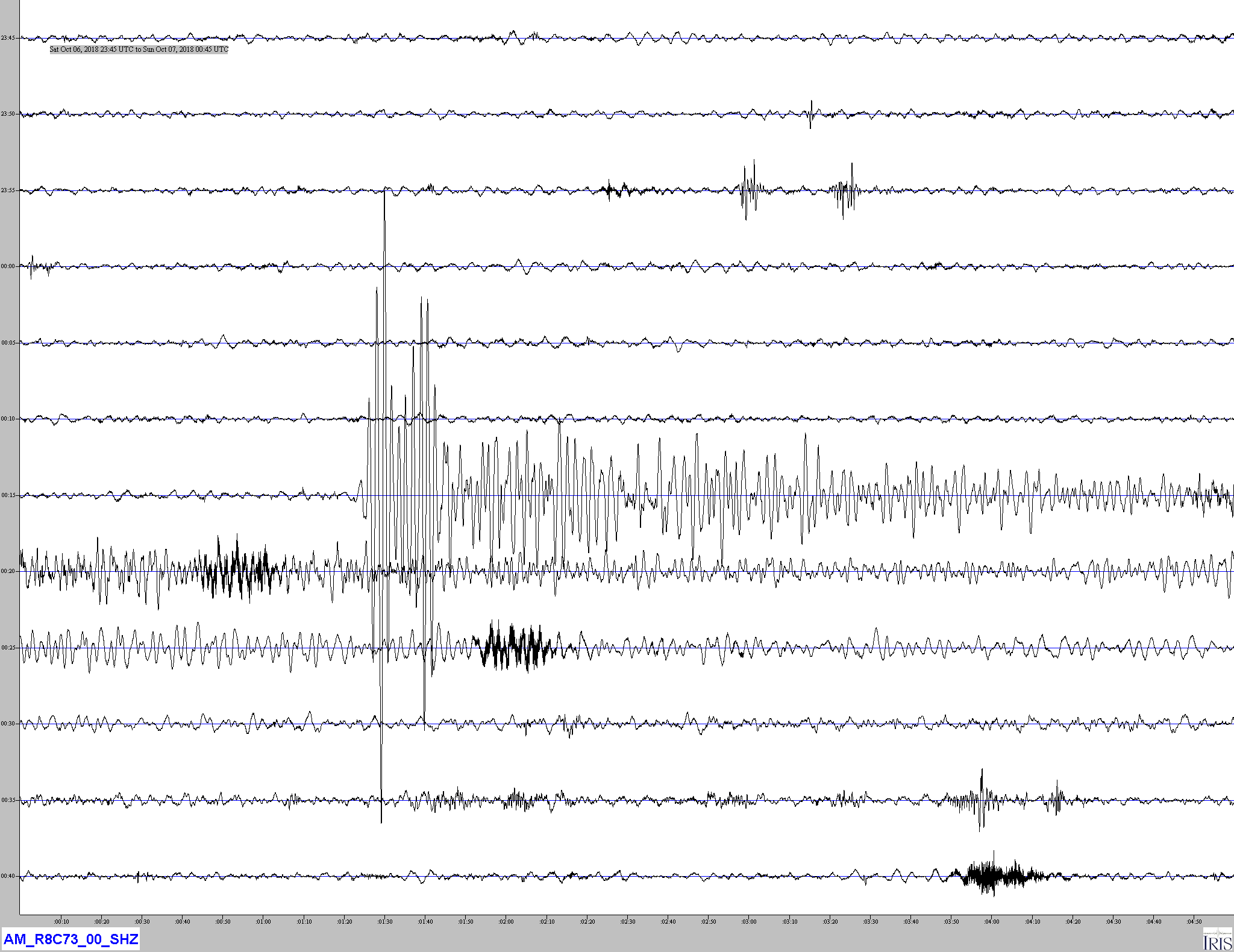
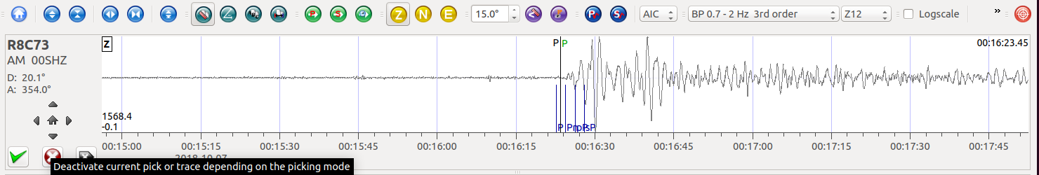
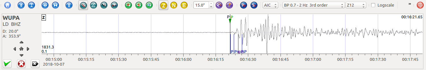
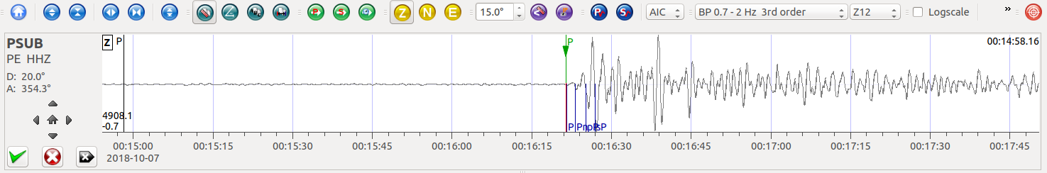
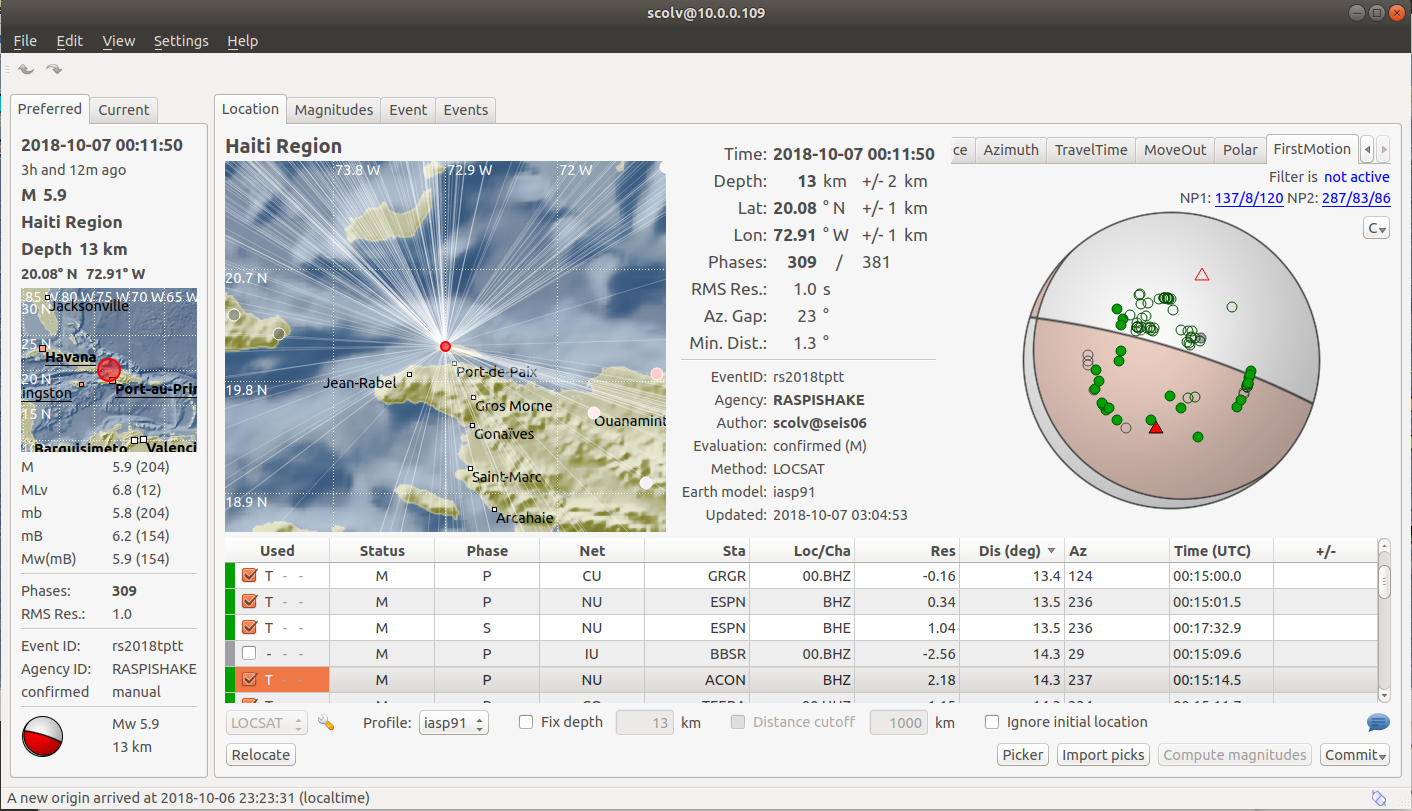
The October 10th earthquake was preceded by several minutes by a M 5.9 earthquake, just to the southeast of the M 7.0 event. In the two hours since the M 7.0 earthquake, several aftershocks have also occurred, including two moderate-sized (M 5.7 and M 5.9) events just to the southwest, and a larger M 6.2 shock 100 km to the northeast and at a depth of about 120 km, within the subducting Australia slab rather than on the interface between the two plates.

One of 4 Magnitude 6+ Earthquakes within a few hours

Jamaseis heliocoder trace of AM.RC8C73.00.SHZ. Four earthquakes are recorded on this graph.
Distance: 126.0 Deg. 13,988 km
Azimuth: 43.3 Deg.
SeisComP3 traces for AM.R8C73.00.SHZ (Exton PA) and LD.WUPA.BHZ (West Chester University, West Chester PA) showing the P wave arrivals.
SeisComP3 display showing the focal mechanism for this event.
SeisComp3 Map View display of the seismometers monitored by Extonweather. Many are colored yellow or orange indicating strong ground motion after the quake.
SeisComp3 scrttv multi-station display showing the earthquake traces across the northeastern United States.

Indonesia – M6.0 – Oct 10, 2018 at 18:44:55 UTC

Position: 7.456°S   114.453°E – Depth:9.0 km

SeisComP3 traces for AM.R8C73.00.SHZ (Exton PA), LD.WUPA.BHZ (West Chester University, West Chester PA), and PE-WUPA.HHZ (Media PA) showing the P wave arrivals.

Distance: 146.1 deg, 16,240 km

Azimuth: 13.7 deg


Haiti – M5.2 – Oct 7, 2018 at 20:00:17 UTC

Position: 20.060N 72.912W – Depth: 10km
USGS Information Page

This is an aftershock of the magnitude 5.9 earthquake earlier in the day.

Jamaseis heliocoder trace of AM.RC8C73.00.SHZ (Exton PA), and LD.WUPA.BHZ (West Chester PA).

Distance: 24.1 Deg. 2,228km
Azimuth: 353.9 Deg.

SeisComP3 P arrival traces for AM.R8C73.00.SHZ (Exton PA), LD.WUPA.BHZ (West Chester University, West Chester PA), and PE.PSUB.HHZ.

Haiti – M5.9 – Oct 7, 2018 at 00:11:49 UTC

Position: 20.041°N 72.975°W – Depth: 11.7km
USGS Information Page

Several people were killed in the area of Port-de-Paix Haiti as a result of this earthquake. Minor shaking was felt in Port Au Prince.

Detailed (5 minutes per line with a 1 Hz low-pass filter applied) Jamaseis heliocoder trace of AM.RC8C73.00.SHZ.
Distance: 20.1 Deg. 2,239km
Azimuth: 354.1 Deg.
P Wave arrivals for AM.R8C73.00.SHZ (Exton PA) and LD.WUPA.BHZ (West Chester University, West Chester PA), and PE.PSUB.HHZ (Media PA) in SeisComP3.
SeisComP3 display showing the fault plane solution (focal mechanism) for this event.
Jamaseis heliograph comparison (30 minutes per line – 1Hz low-pass filter) of AM.R8C73.00.SHZ (Exton PA), and LD.WUPA.BHZ (West Chester PA.

Indonesia – M6.0 – Oct 2, 2018 at 00:16:43 UTC

Position: 10.462°S   120.168°E – Depth: 10km

Jamaseis heliocoder trace of AM.RC8C73.00.SHZ and LD.WUPA.BHZ (West Chester PA). The PP (PkPdf) arrivals are annotated. There was also a M5.9 foreshock that occurred about 18 minutes earlier that can be seen on both traces.

Distance: 147.4 Deg. 16,382km
Azimuth: 22.5 Deg.

Both the magnitude 5.9 and 6.0 shocks are displayed on this SeisComP3 trace of LD.WUPA.BHZ in West Chester PA.

SeisComP3 traces for AM.R8C73.00.SHZ (Exton PA), LD.WUPA.BHZ (West Chester University, West Chester PA), and PE.PSUB.HHZ (Media PA) showing the PP wave arrivals.