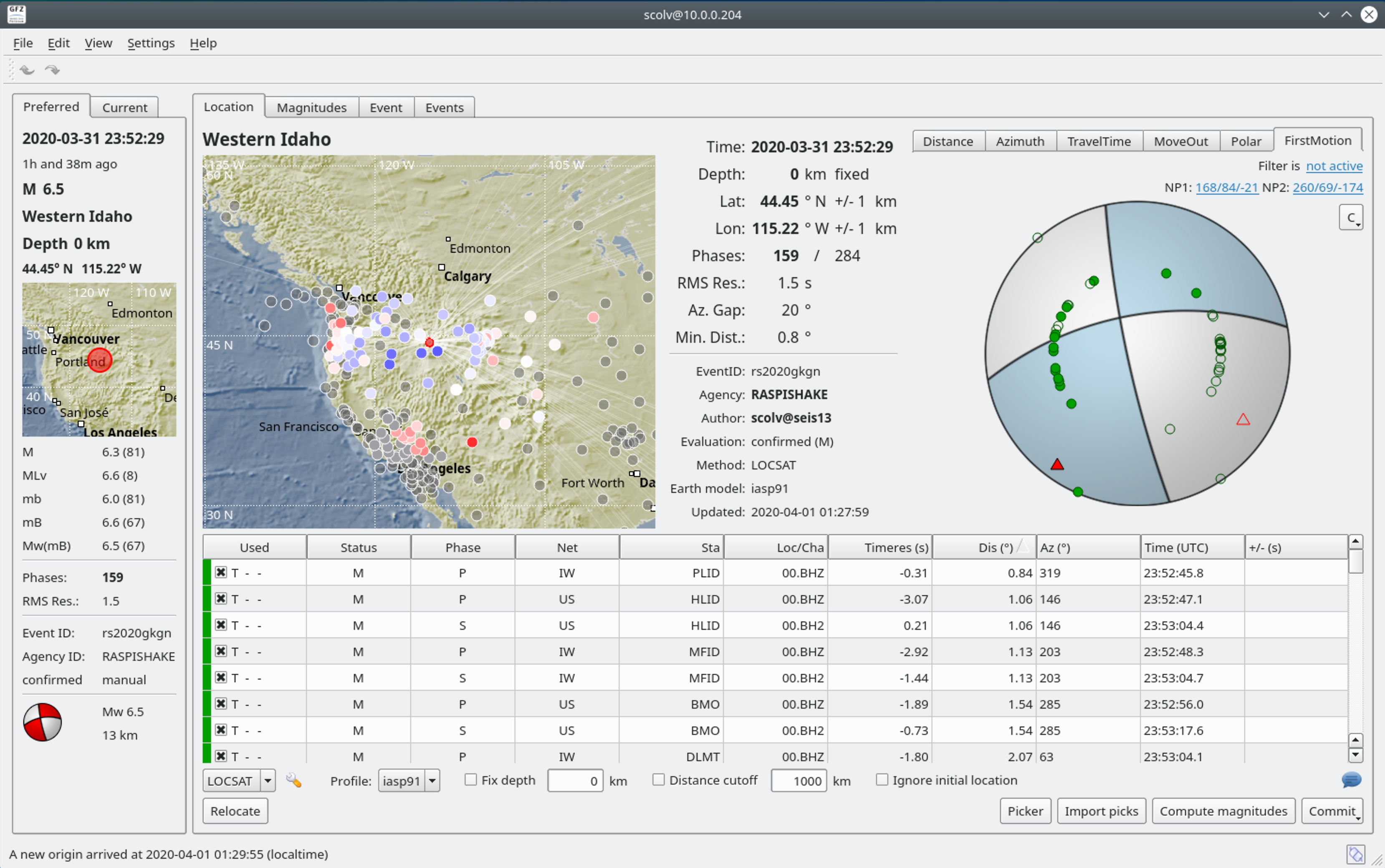
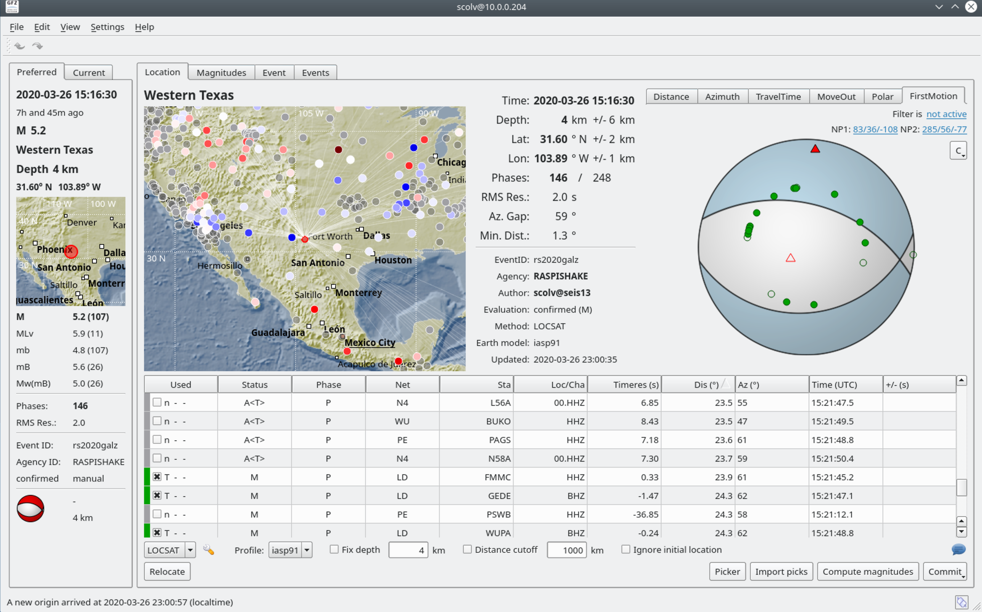
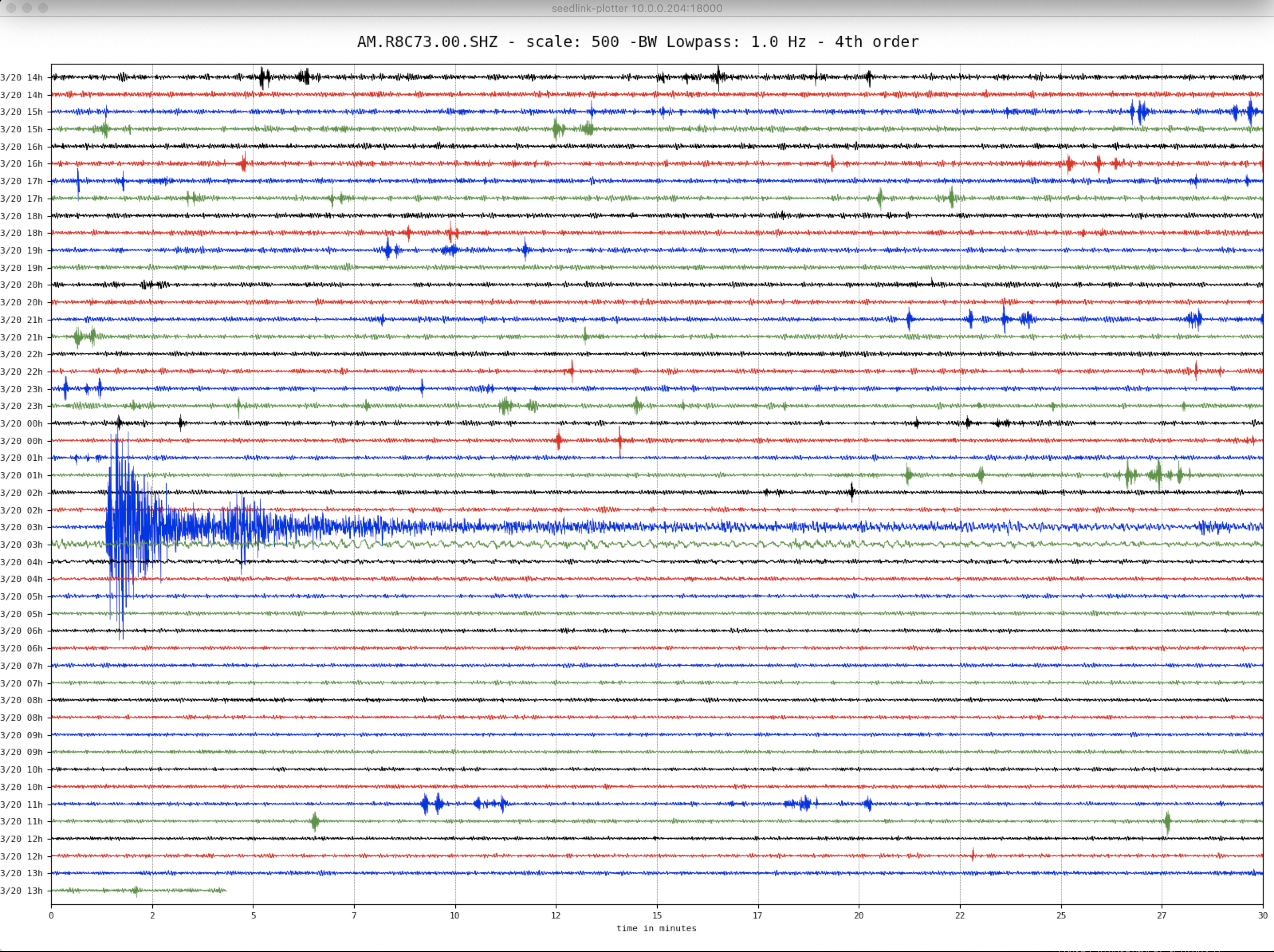
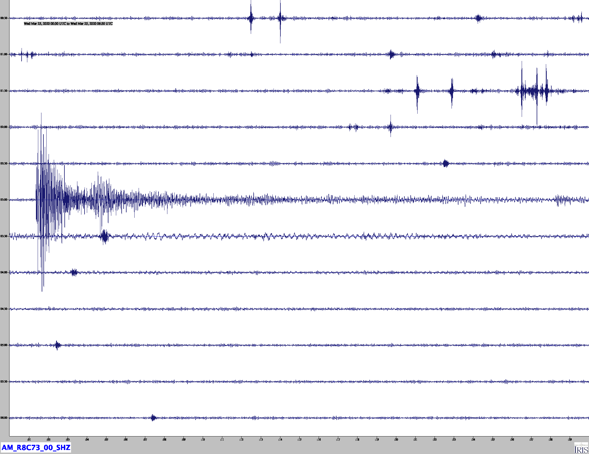
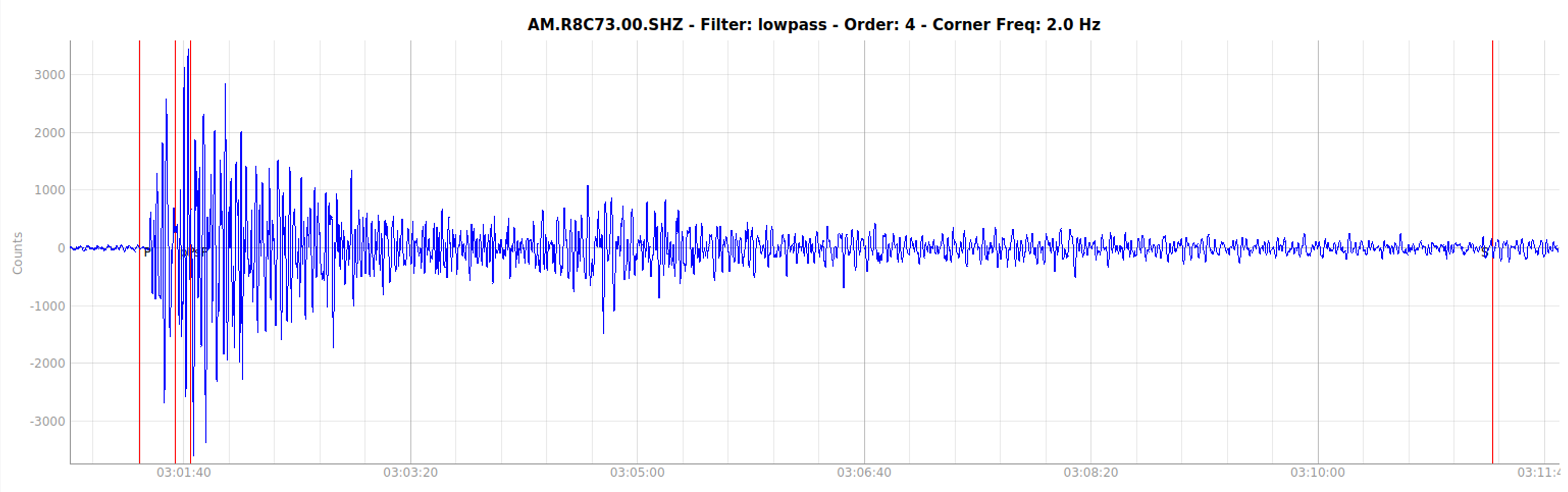
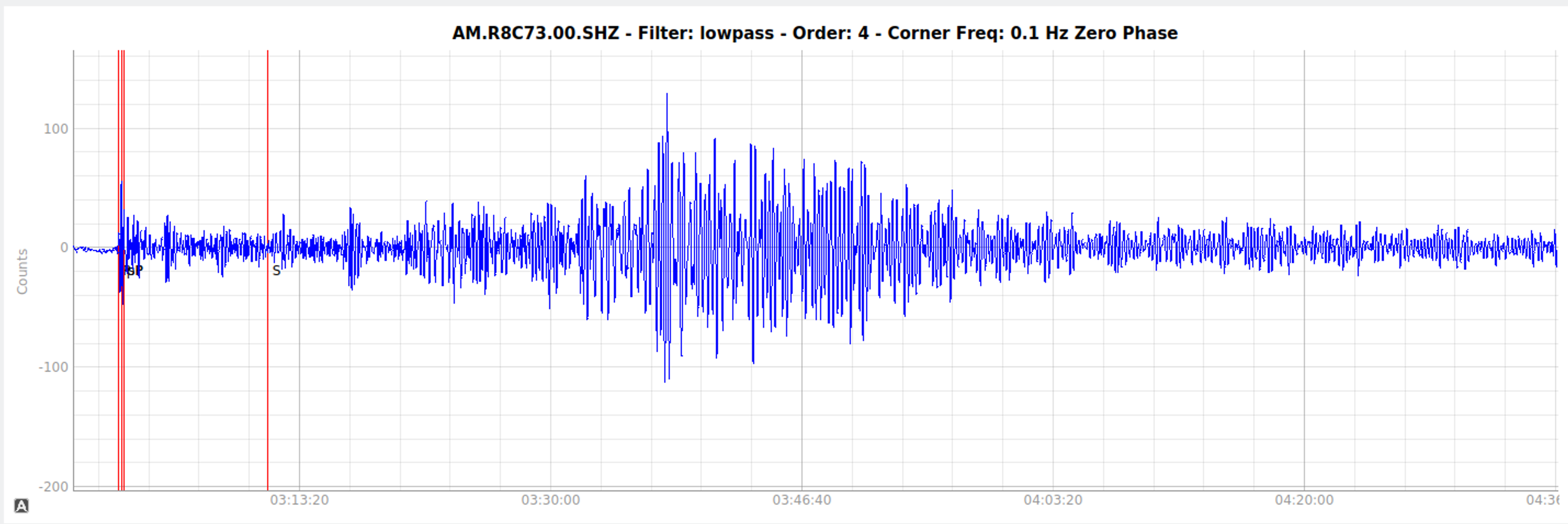
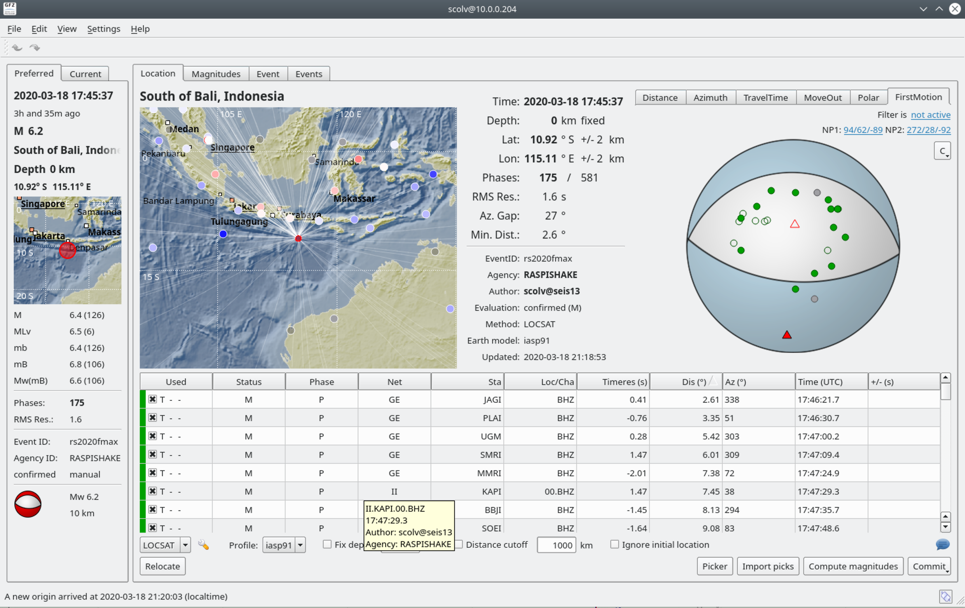
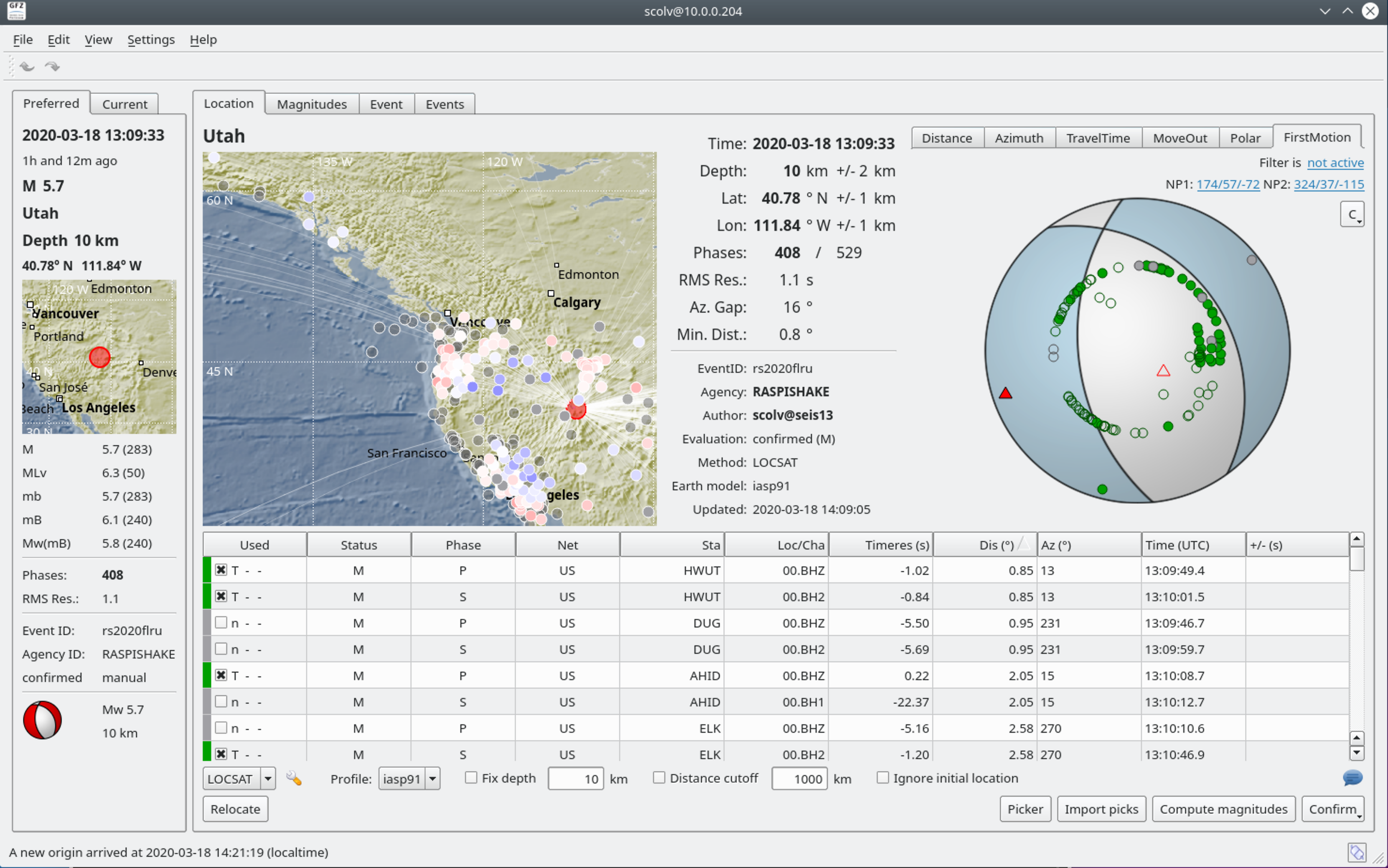
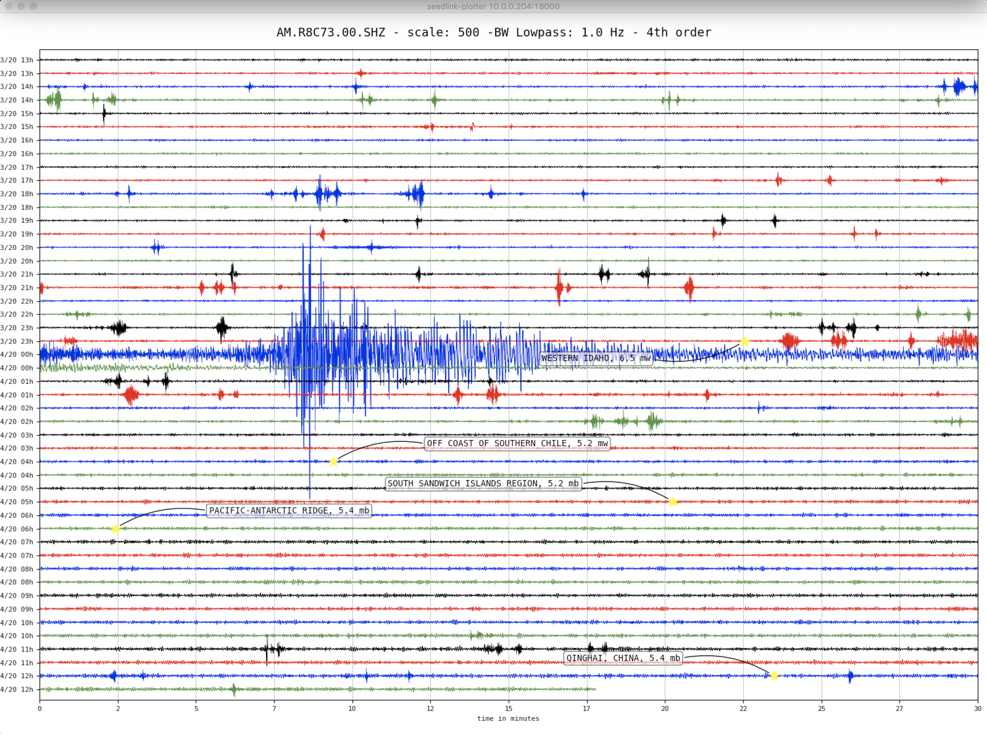
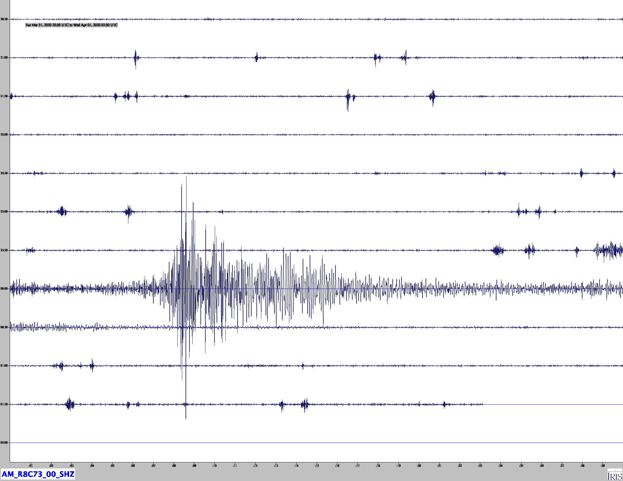
Idaho – M6.5 – March 31, 2020 at 23:52:31 UTC
72km W of Challis, Idaho
| Latitude | Longitude | Depth (km) | Dist (Deg) | Dist (Km) | Azimuth | |
|---|---|---|---|---|---|---|
| 44.448 | -115.136 | 10.0 | 29.4 | 3,267 | 84.6 |
Tectonic Summary
The March 31, 2020, M 6.5 earthquake west of Challis, Idaho (about 120 km northeast of Boise), occurred as the result of complex strike slip faulting within the shallow crust of the North America plate. Preliminary focal mechanism solutions for the event, which describe the style of faulting in an earthquake, indicate slip likely occurred on a steeply dipping fault striking either east-west (right-lateral) or north-south (left-lateral). This earthquake occurred within the Intermountain Seismic Belt, a prominent zone of recorded seismicity in the Intermountain West, and is within the western part of the Centennial Tectonic Belt, an area of southwest-northeast extension north of the Snake River Plain. The quake is about 16 km north-northeast of the Sawtooth fault, a 60-km-long normal fault that extends along the eastern base of the Sawtooth Range.
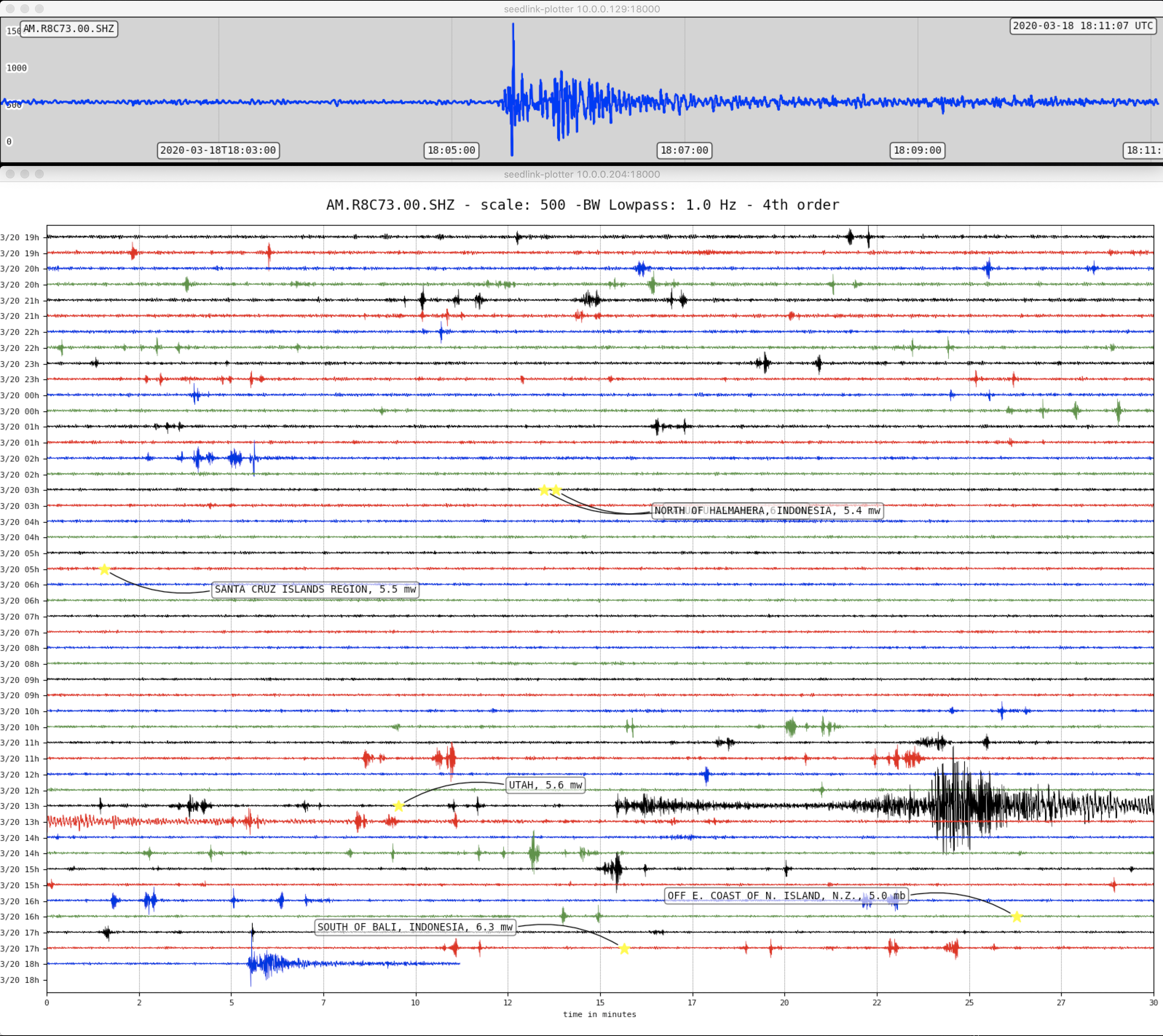
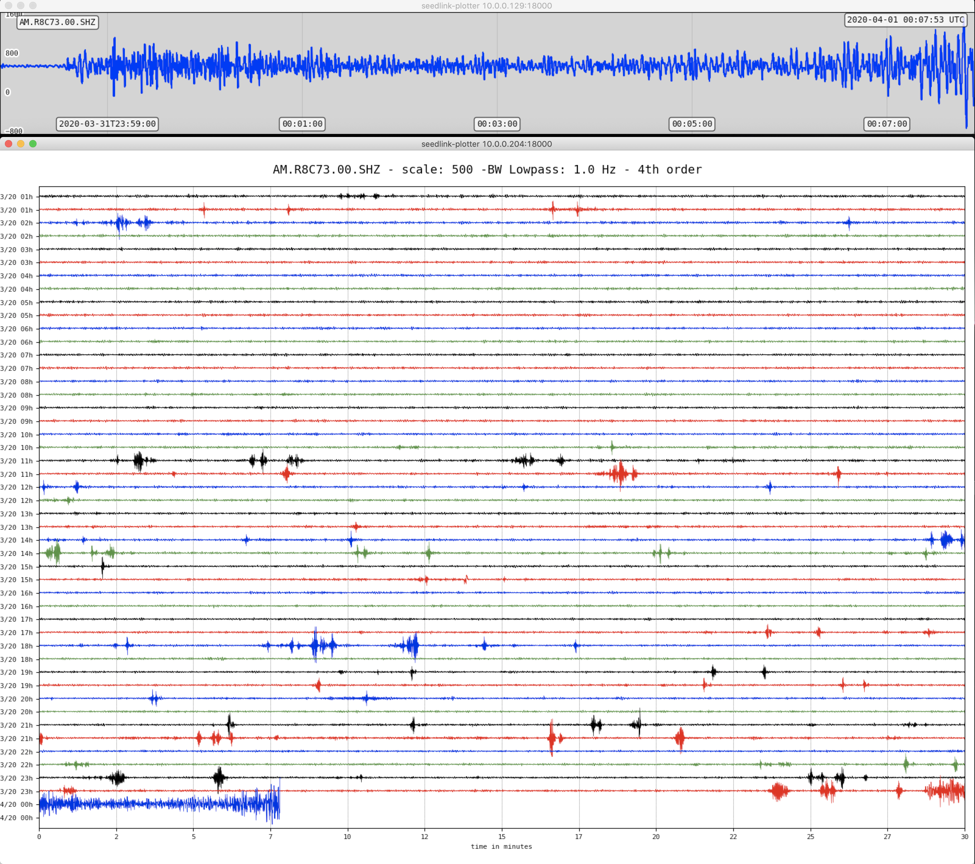
Historic seismicity in the immediate vicinity of the March 31 earthquake is sparse; no earthquakes of M5+ have occurred within 50 km of this event over the past 50 years, and the most notable historic seismicity in the region occurred about 100 km to the east on the Lost River fault zone. This was the site of the 1983 M6.9 Borah Peak earthquake (October 28, 1983), which was followed by five other M 5+ events over the following year, and most recently a M5.0 earthquake in January 2015, about 60 km to the east of today’s event. The March 31, 2020 event is the largest in Idaho since the Borah Peak earthquake. That event killed 2 in Challis, and resulted in over $12M in damage in the Challis-Mackay area. As of 1 hour after this earthquake, two aftershocks (M 4.6, M 3.6) have been located by the USGS, both to the south of the M 6.5 event.
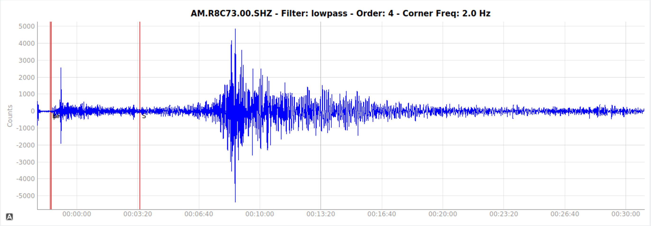
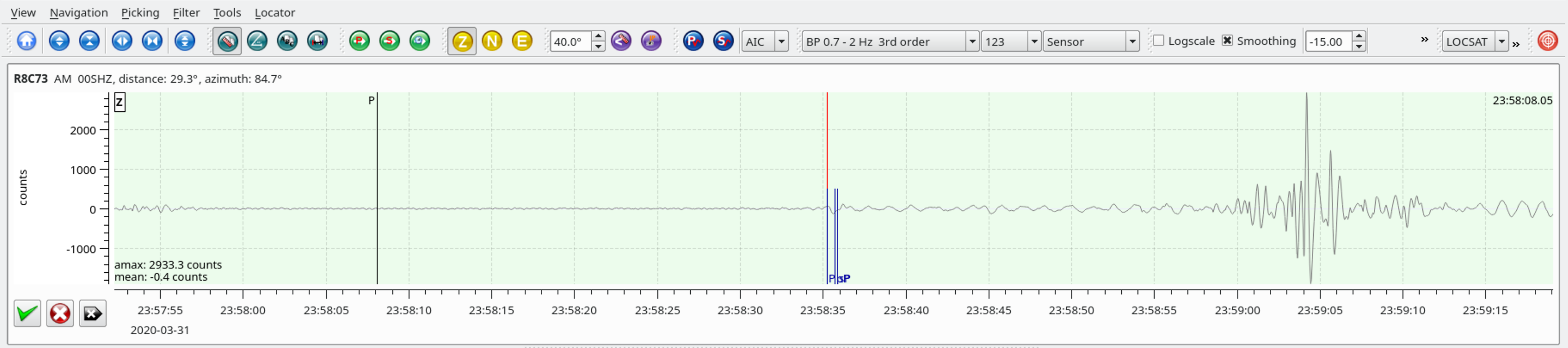
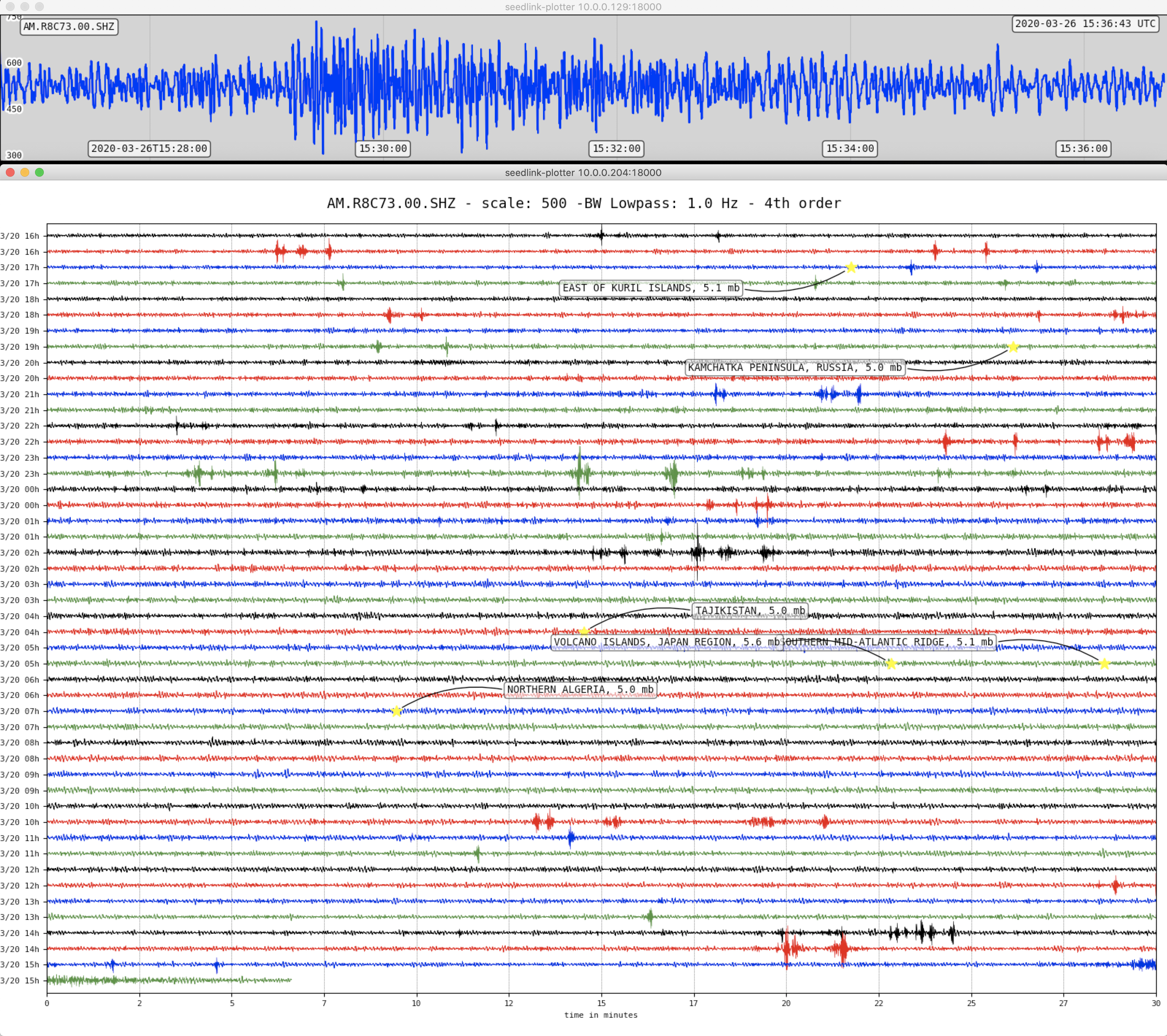
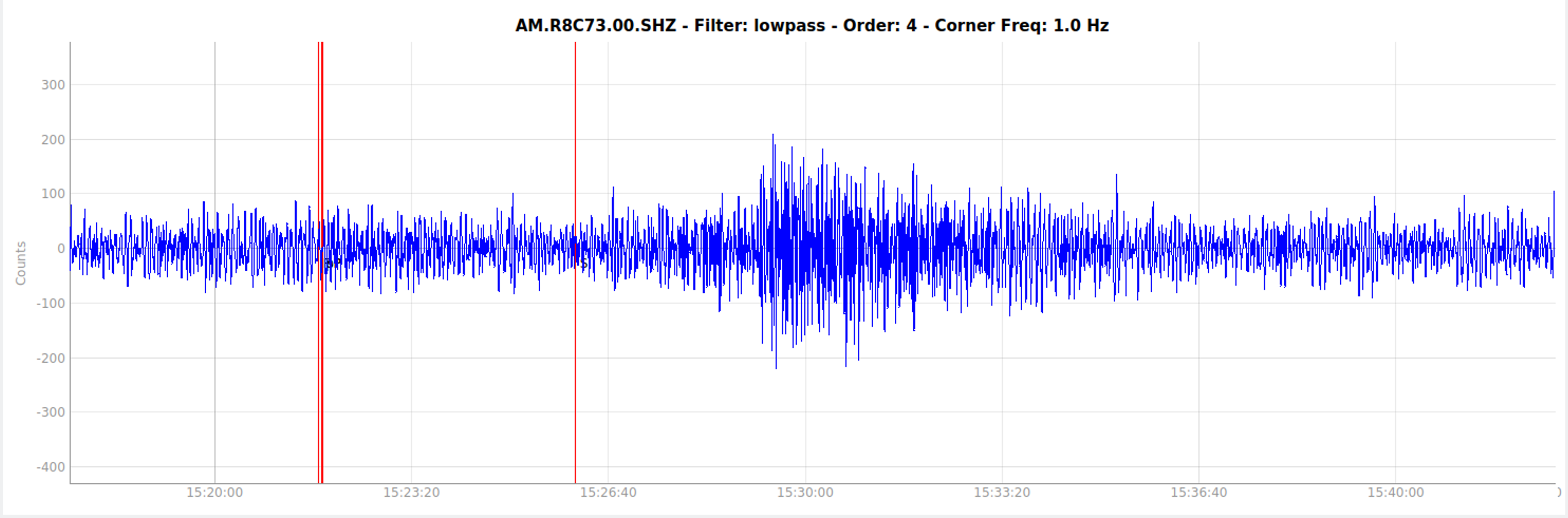
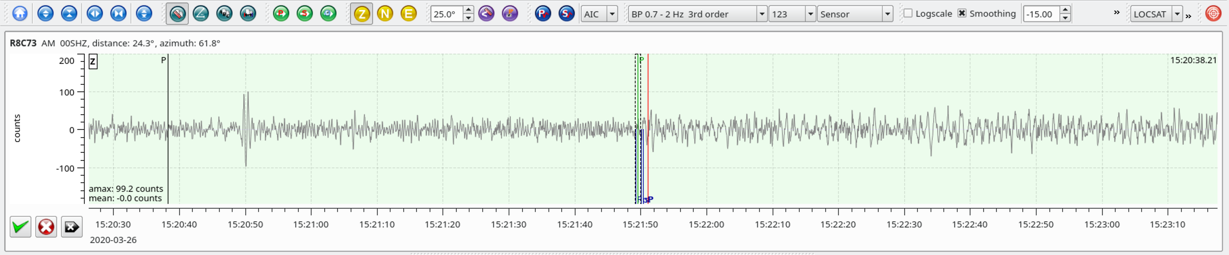
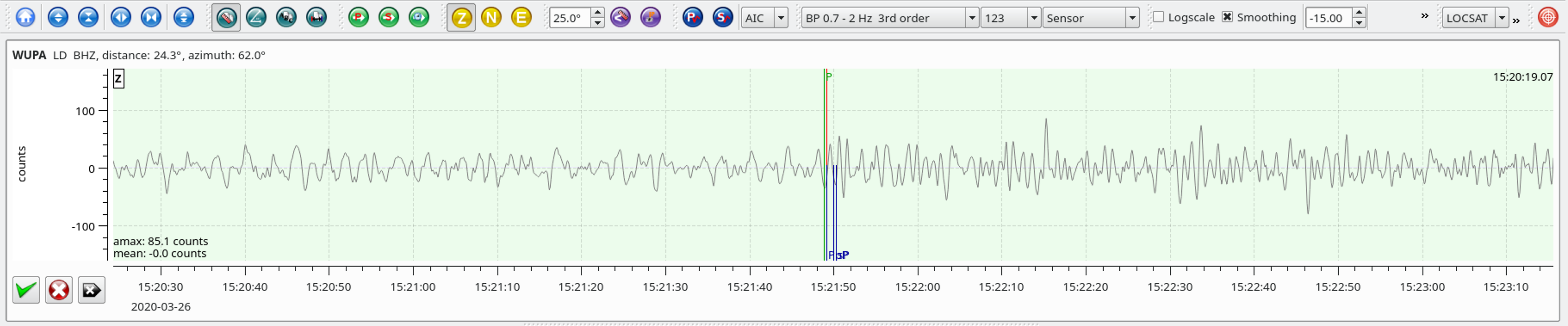
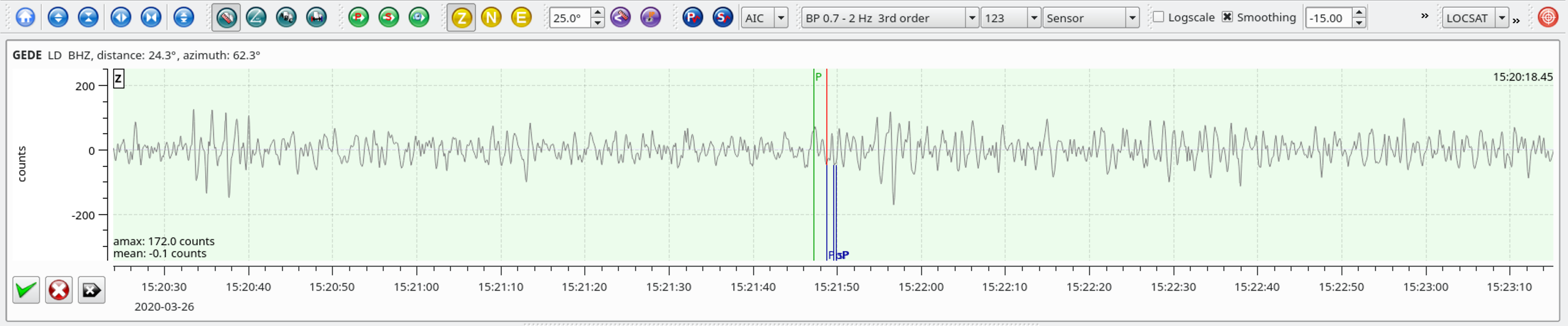
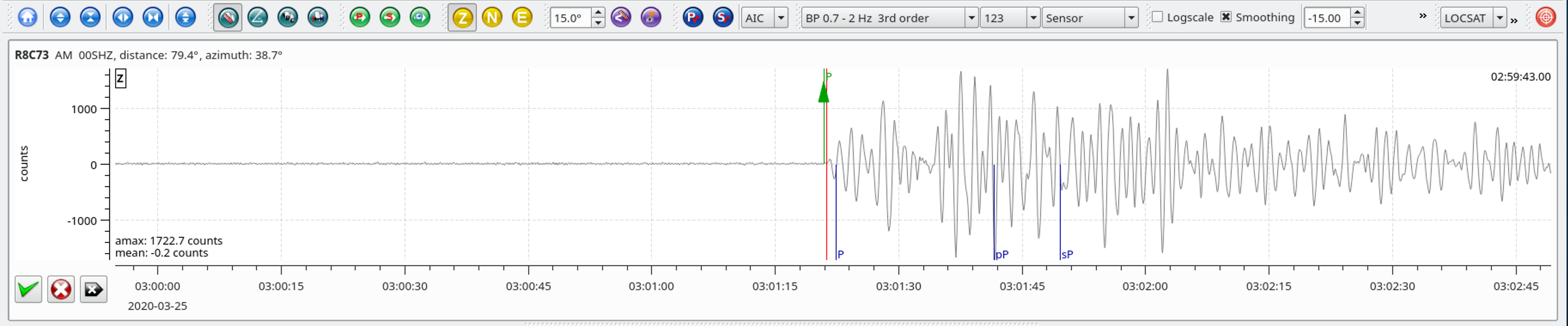
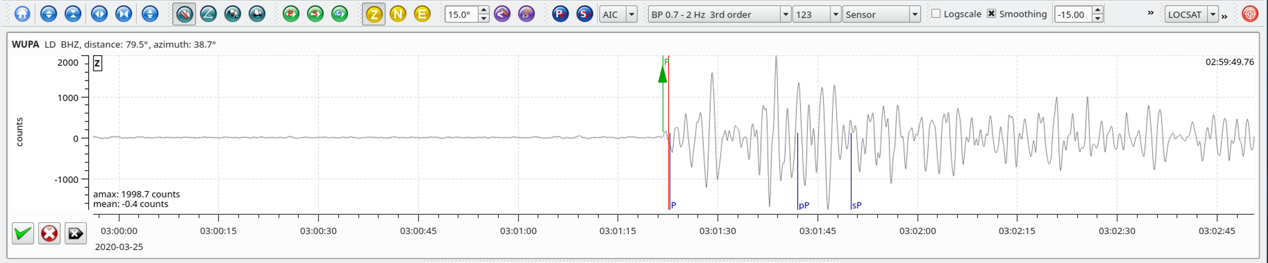
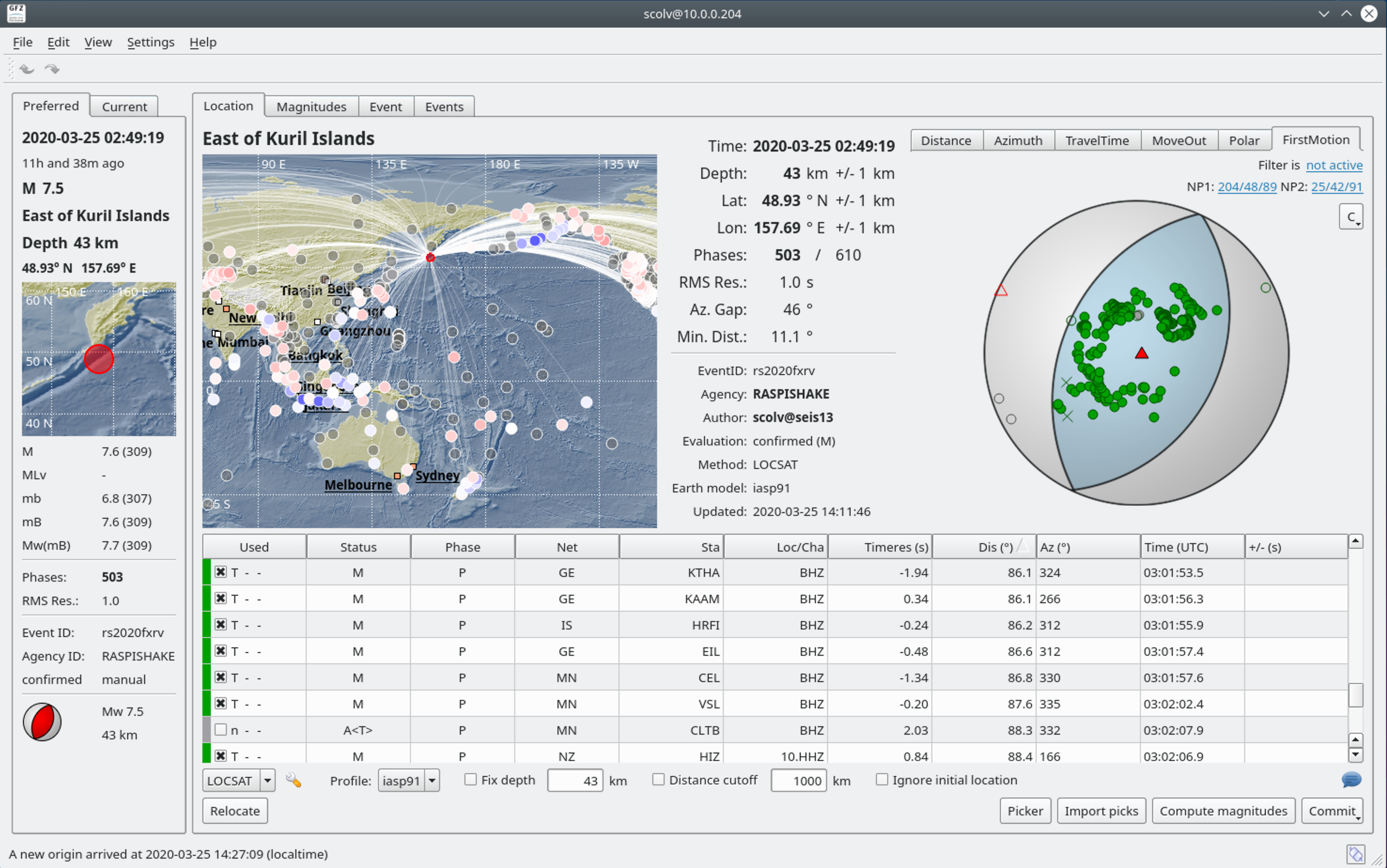
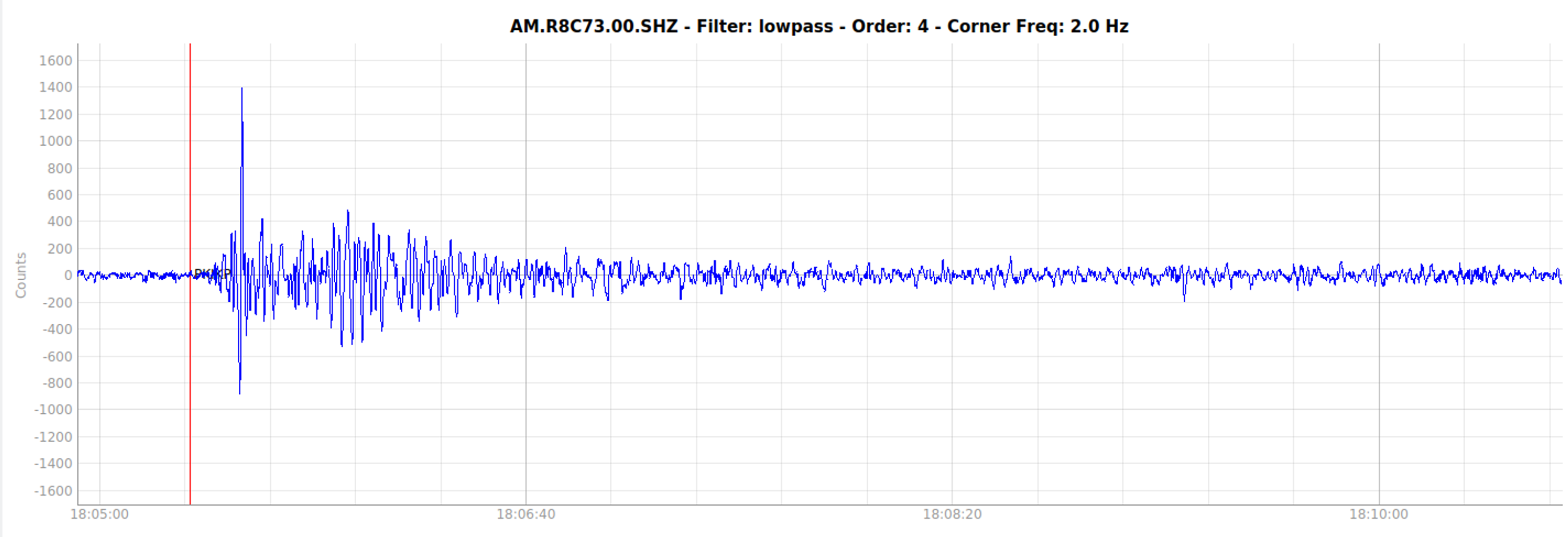
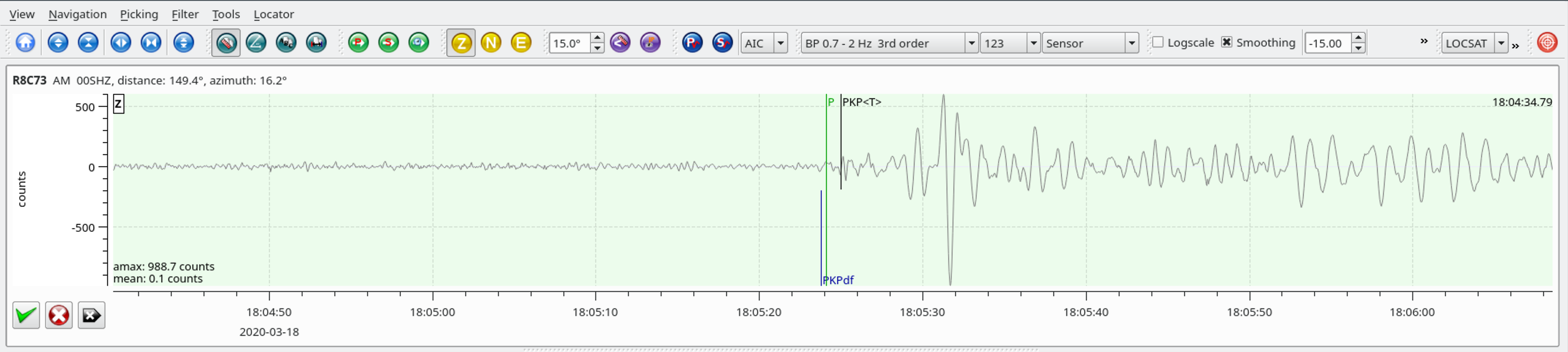
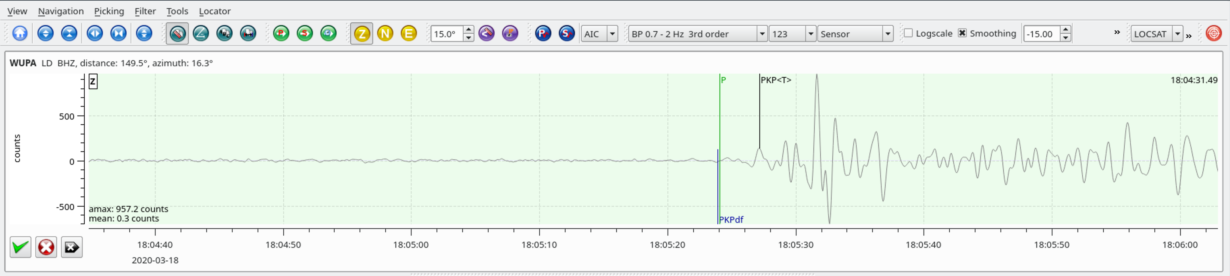
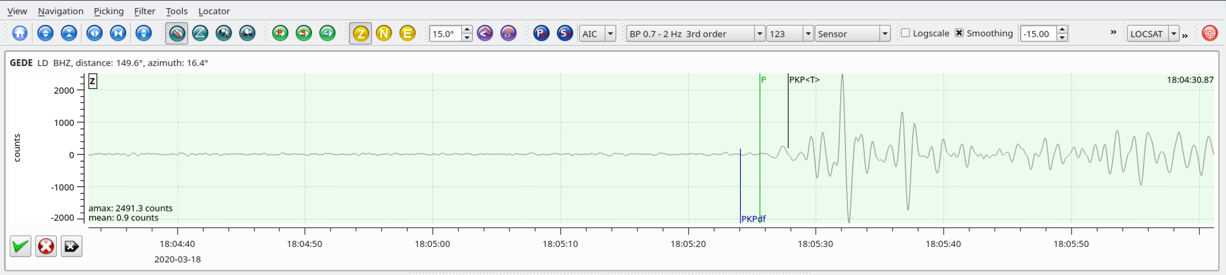
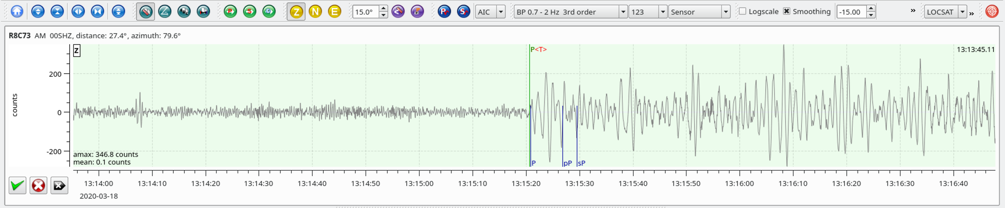
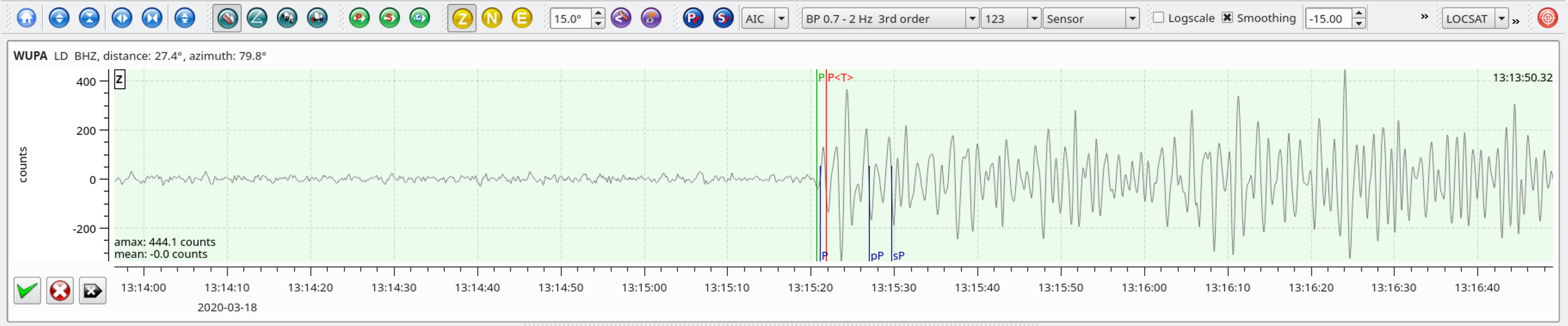
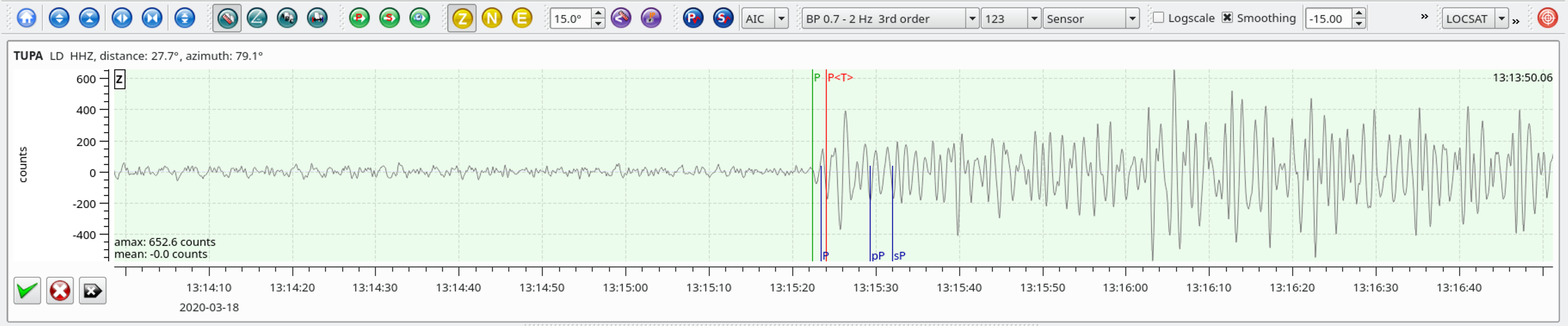
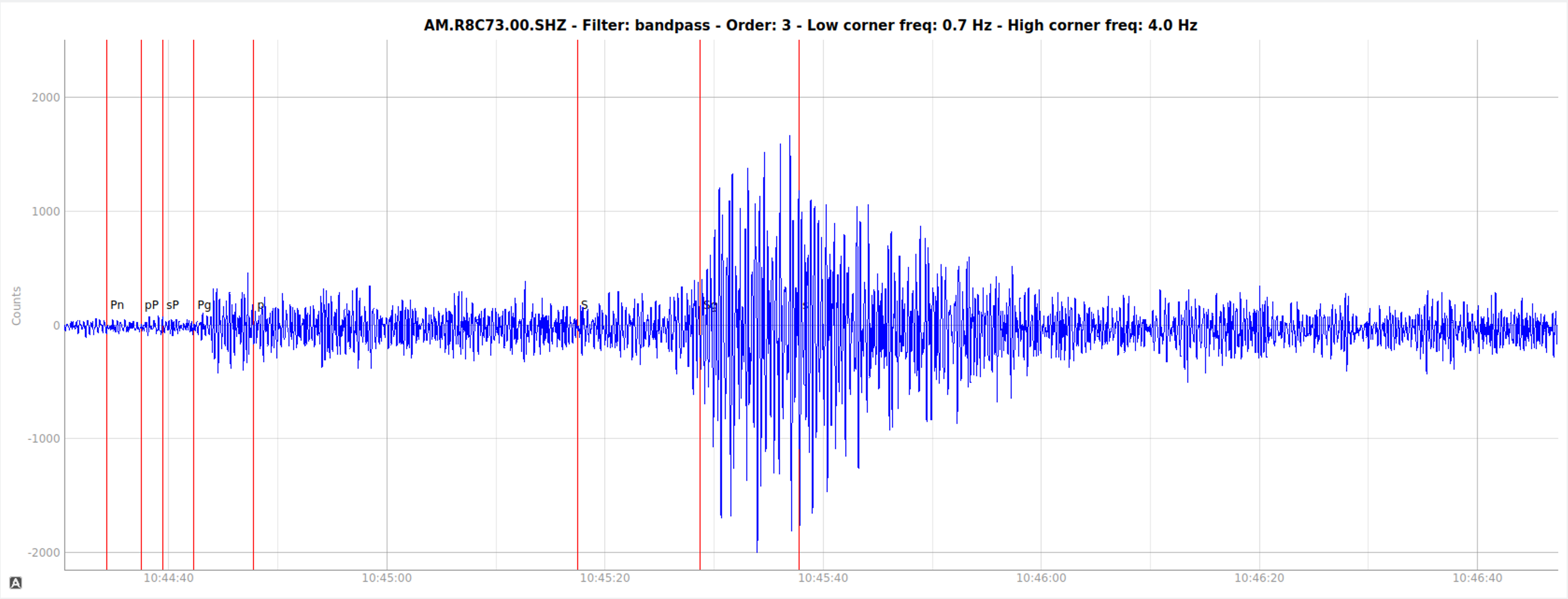
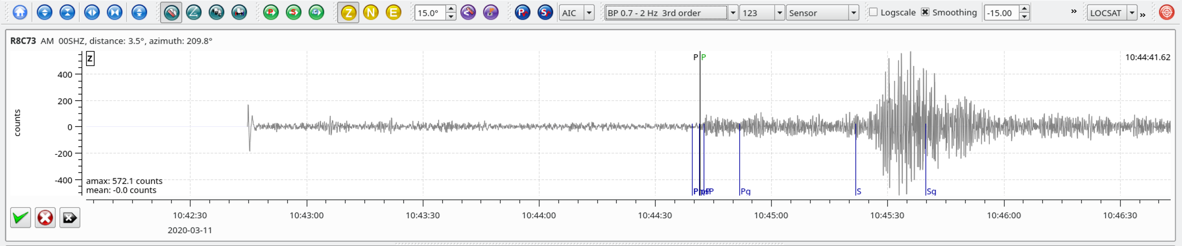
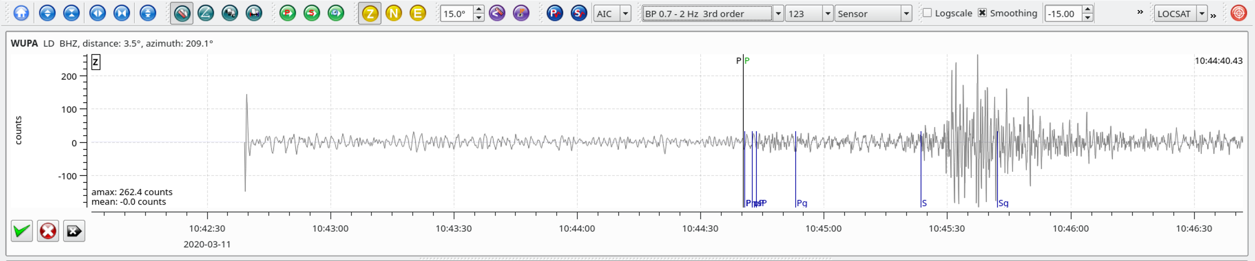
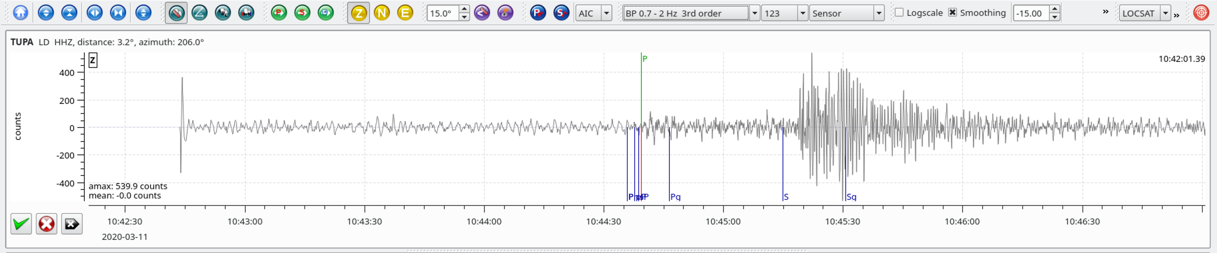
Local SeisComP3 P-wave Arrivals