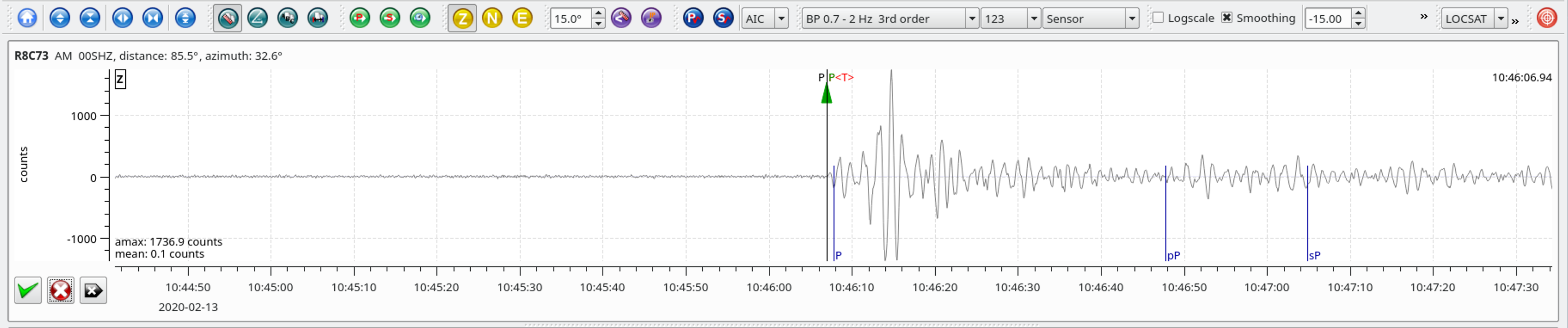
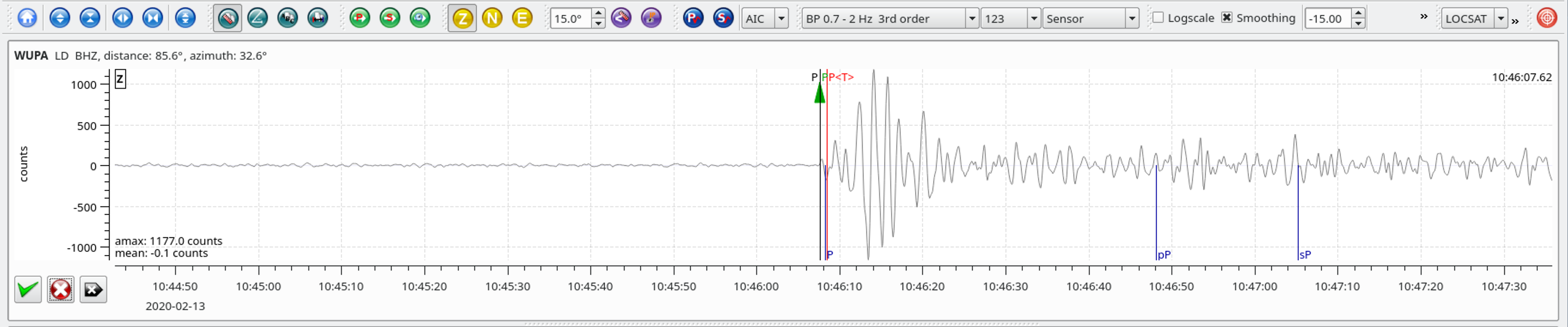
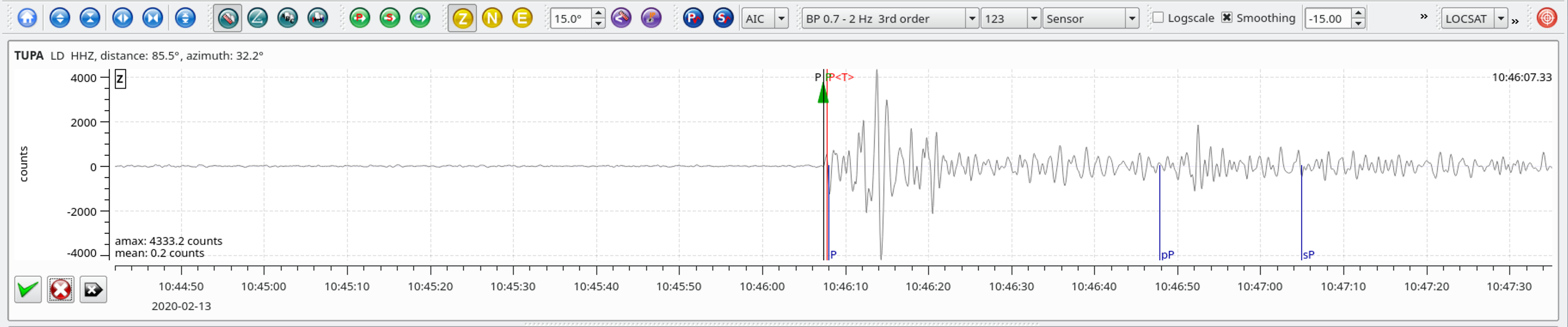
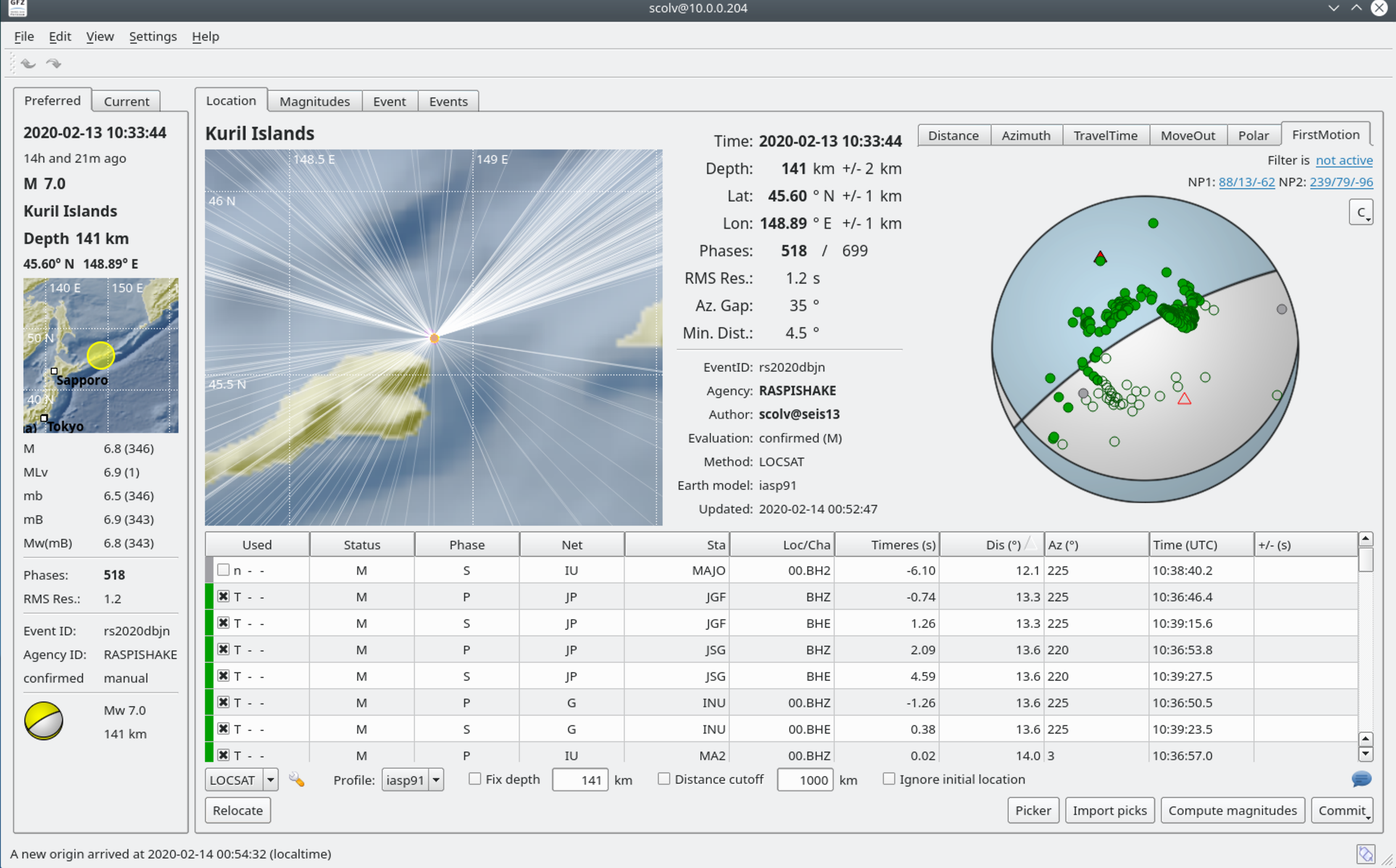
Kuril Islands – M7.0 – Feb 13, 2020 at 10:33:44 UTC
93km ENE of Kuril'sk, Russia
| Latitude | Longitude | Depth (km) | Dist (Deg) | Dist (Km) | Azimuth | |
|---|---|---|---|---|---|---|
| 45.631 | 148.929 | 144.0 | 85.7 | 9,534 | 32.6 |
Local SeisComP3 P-wave Arrivals
| Latitude | Longitude | Depth (km) | Dist (Deg) | Dist (Km) | Azimuth | |
|---|---|---|---|---|---|---|
| 45.631 | 148.929 | 144.0 | 85.7 | 9,534 | 32.6 |
Local SeisComP3 P-wave Arrivals
| Latitude | Longitude | Depth (km) | Dist (Deg) | Dist (Km) | Azimuth | |
|---|---|---|---|---|---|---|
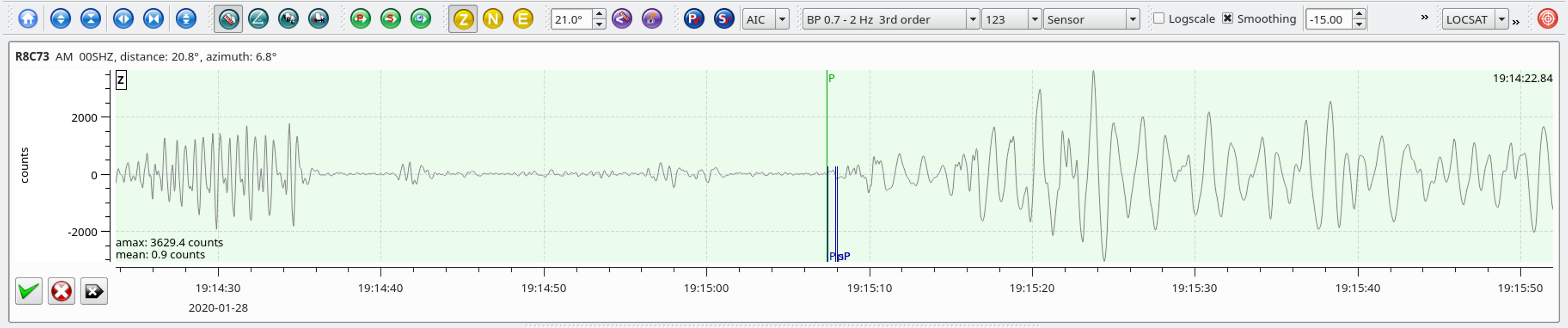
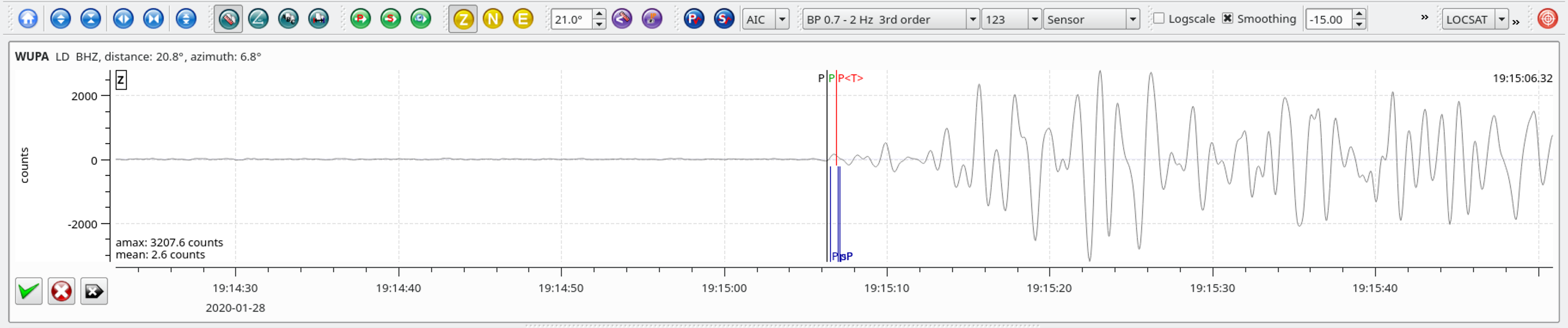
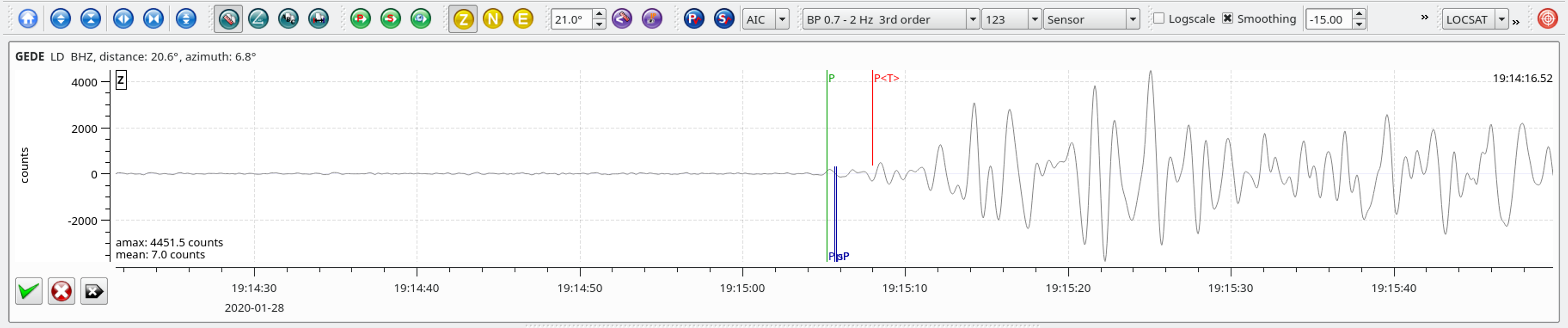
| 19.440 | -78.755 | 10.0 | 20.7 | 2,301 | 6.8 |
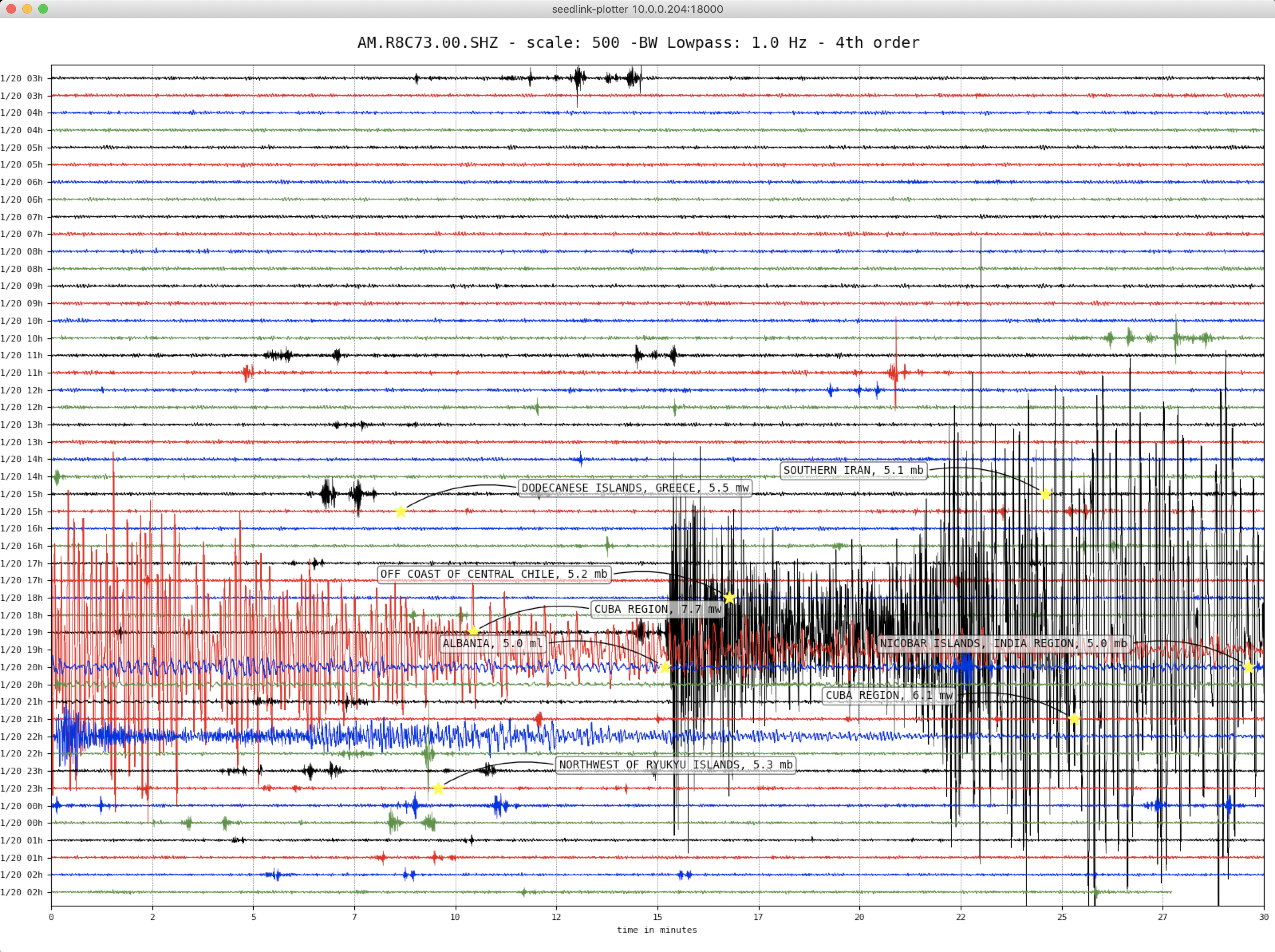
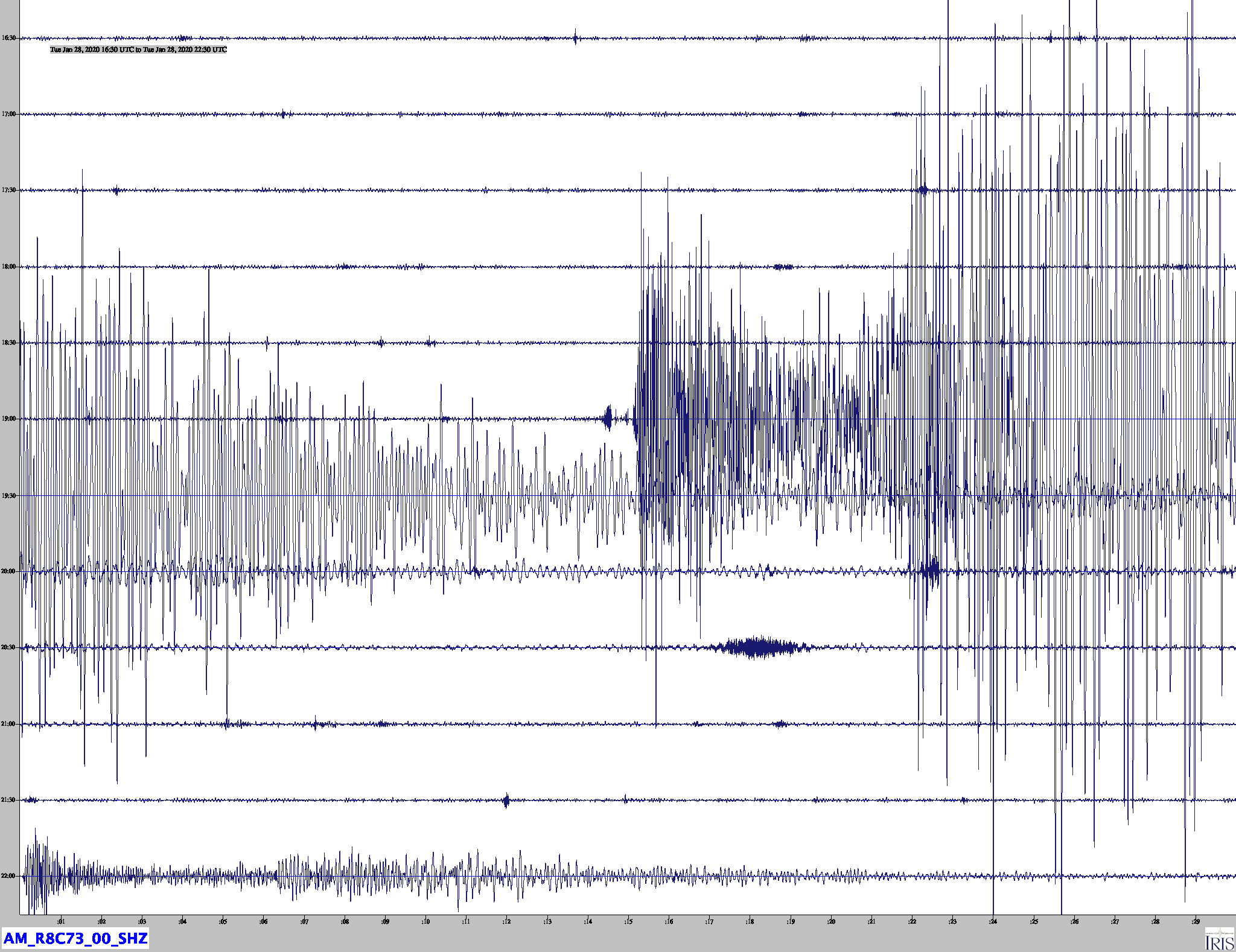
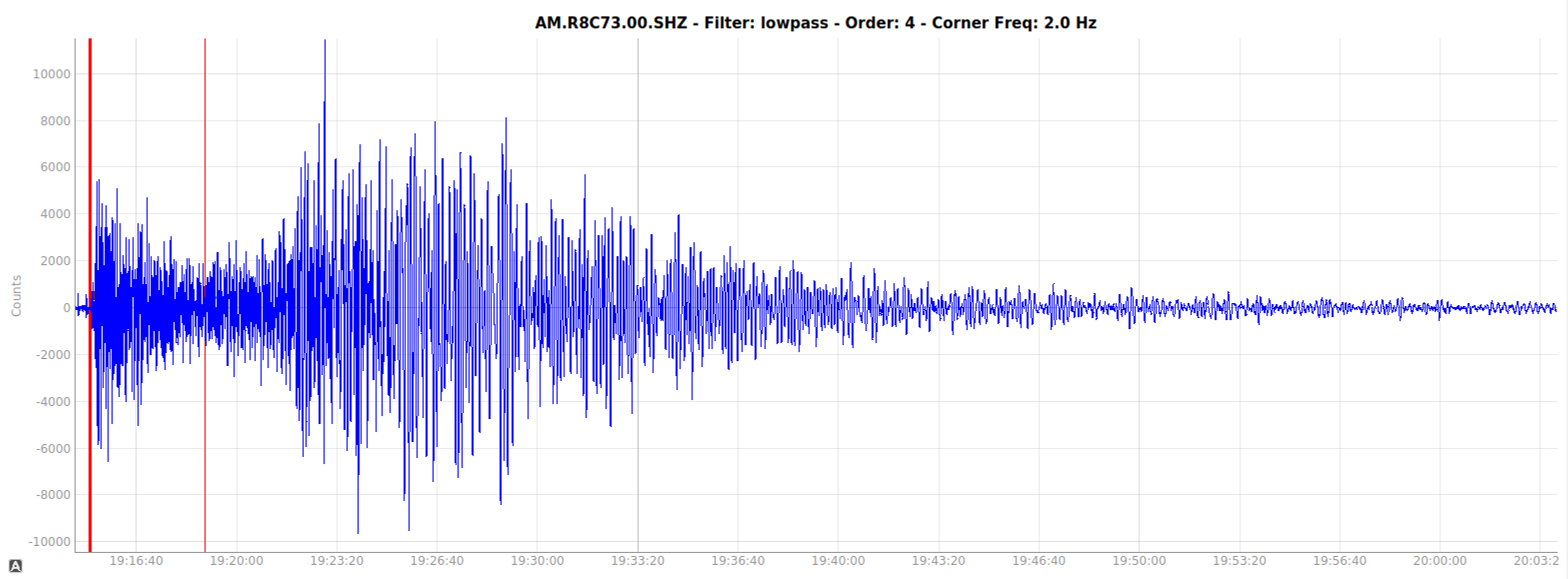
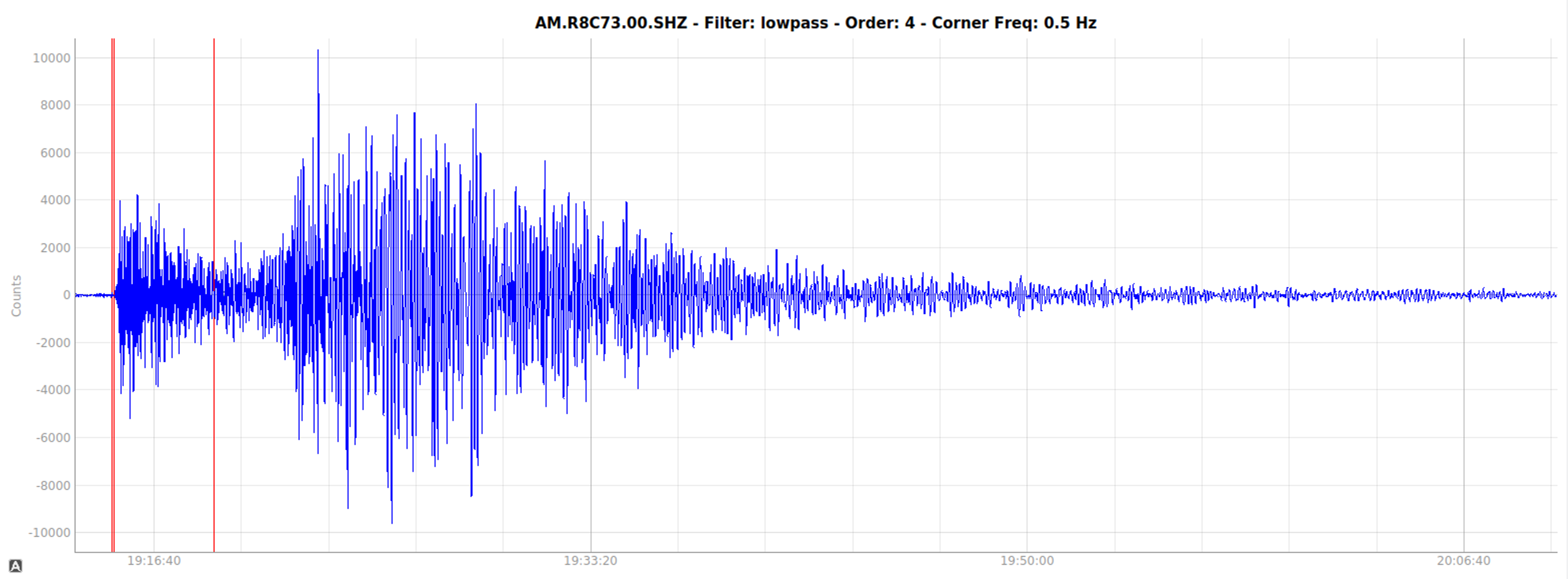
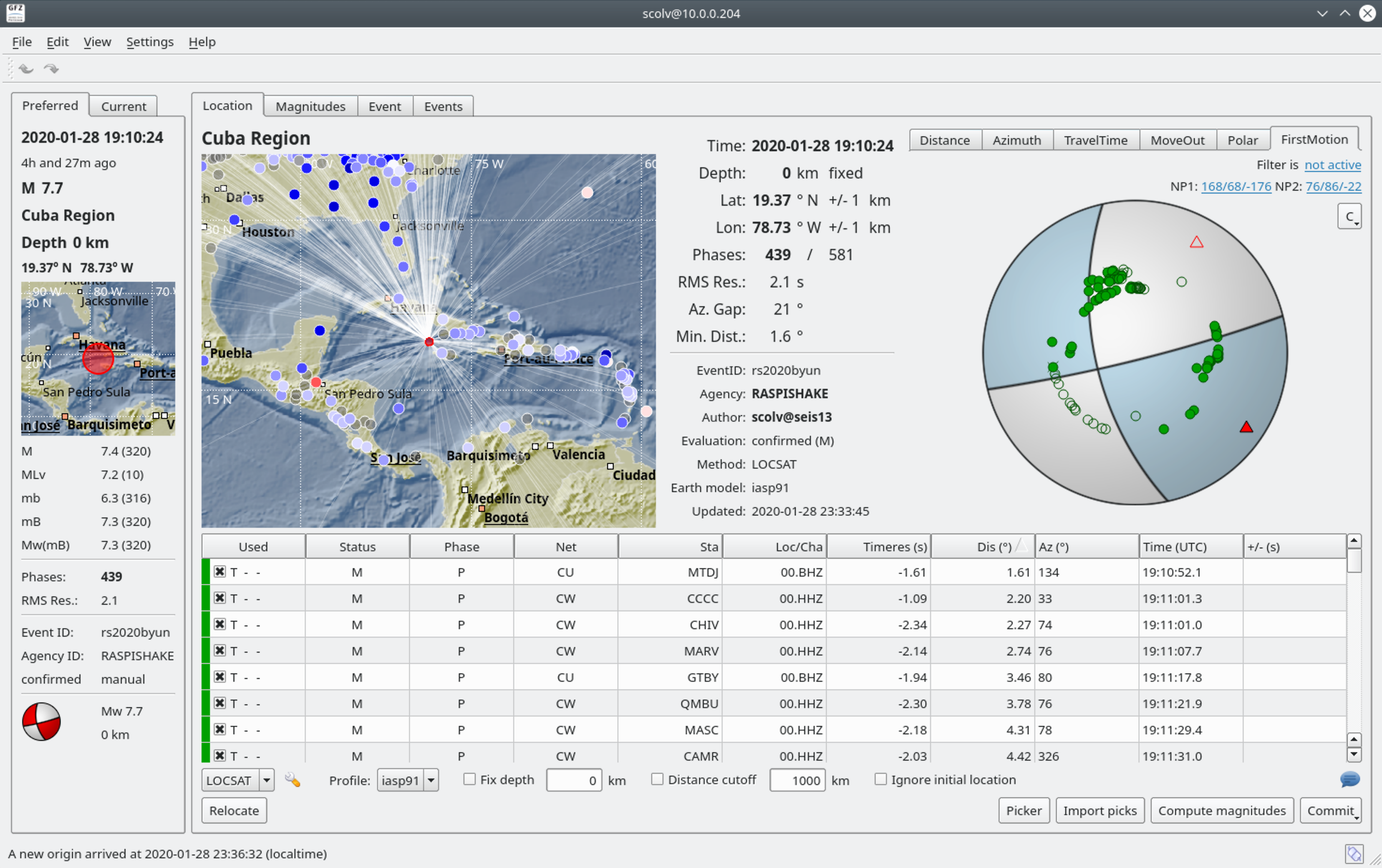
The January 28, 2020, M 7.7 earthquake in the Caribbean Sea to the south of Cuba and northwest of Jamaica occurred as the result of strike-slip faulting on the plate boundary between the North America and Caribbean tectonic plates. Preliminary focal mechanism solutions for the earthquake indicate slip occurred as the result of left-lateral motion on a steep fault striking towards the east-northeast, or as the result of right-lateral motion on a steep fault striking towards the south-southeast. The fault plane striking approximately east-west is consistent with the orientation of the regional plate boundary; this transform structure is named the Oriente Fault. At the location of this earthquake, the North America plate moves to the west-southwest with respect to the Caribbean plate at a rate of approximately 19 mm/yr.
While commonly plotted as points on maps, earthquakes of this size are more appropriately described as slip over a larger fault area. Strike-slip-faulting events of the size of the January 28, 2020, earthquake are typically about 170×25 km (length x width); modeling of this earthquake implies dimensions of about 200×20 km, predominantly west of the hypocenter.
Five other earthquakes of M 6 or larger have occurred within 400 km of the January 28, 2020 event over the preceding half century. These include a M 6.8 earthquake in December 2004, 280 km to the west of today’s earthquake, and a M 6.2 event in May 1992, almost 100 km to the east of today’s quake. Likely because of their location away from land and major population centers, none of these earthquakes are known to have resulted in shaking-related damage or fatalities.
Local SeisComP3 P-wave Arrivals
| Latitude | Longitude | Depth (km) | Dist (Deg) | Dist (Km) | Azimuth | |
|---|---|---|---|---|---|---|
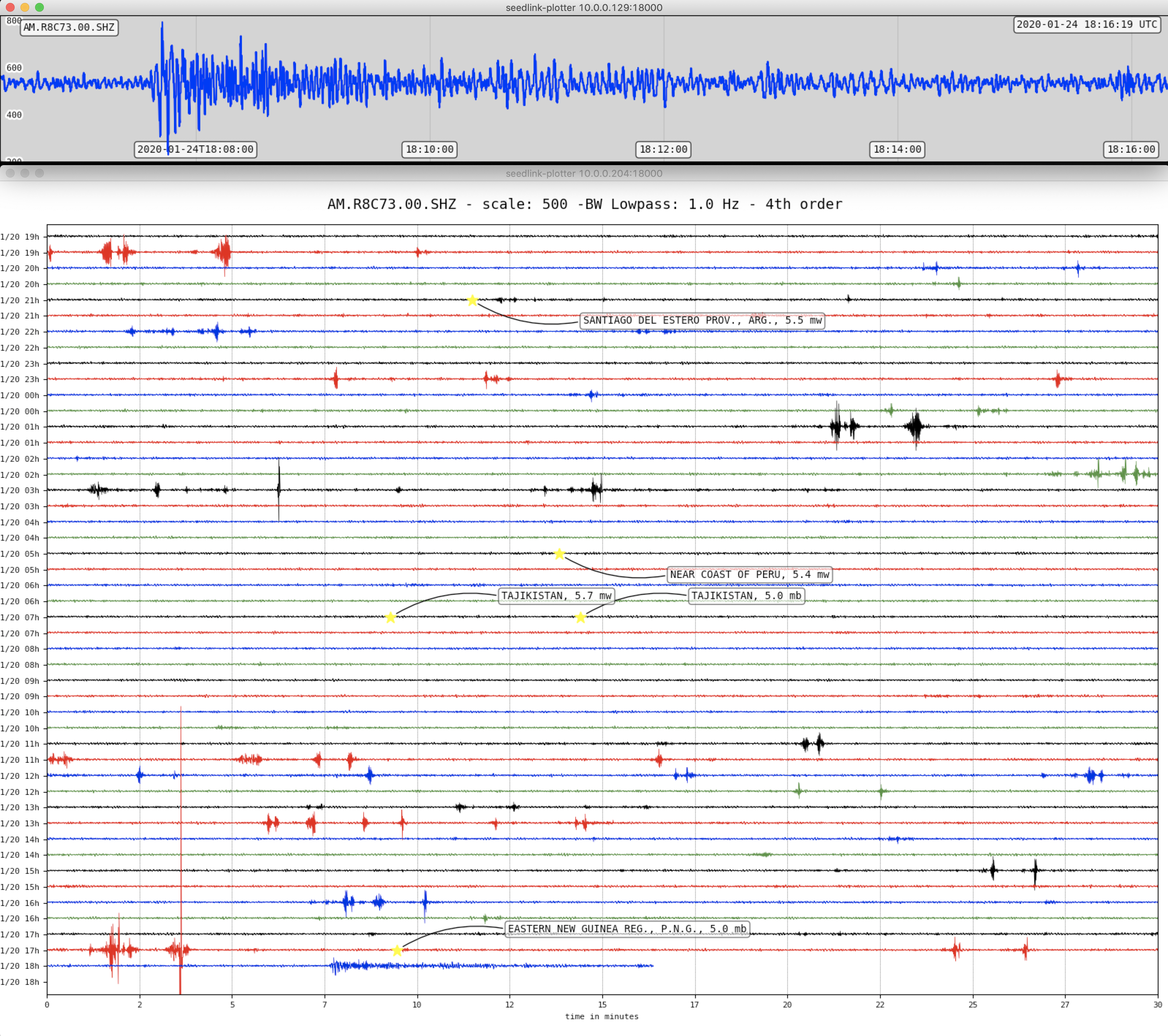
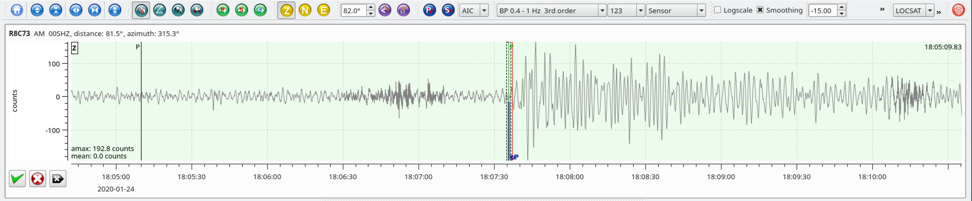
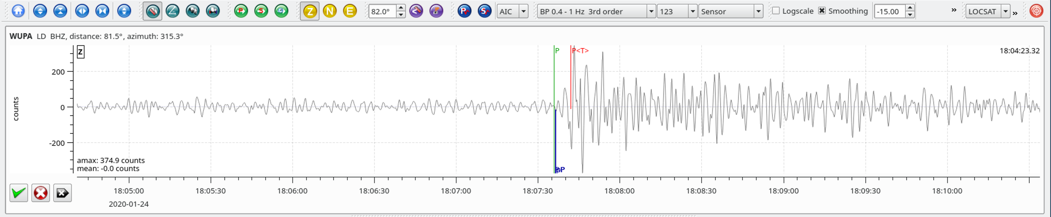
| 38.330 | 39.084 | 10.0 | 81.7 | 9,084 | 315.3 |
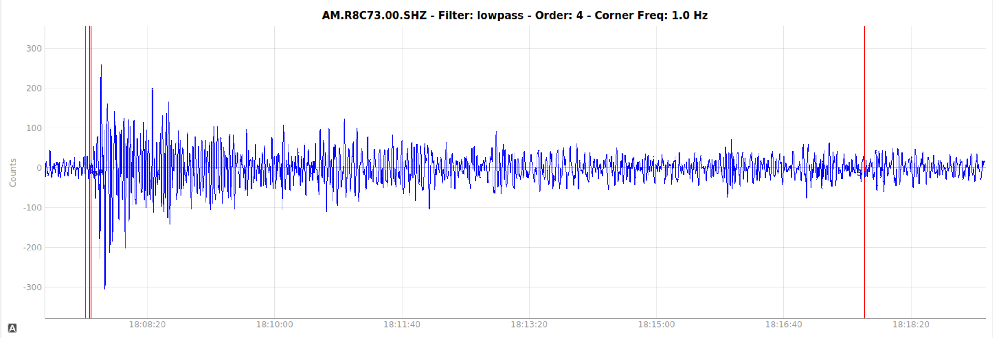
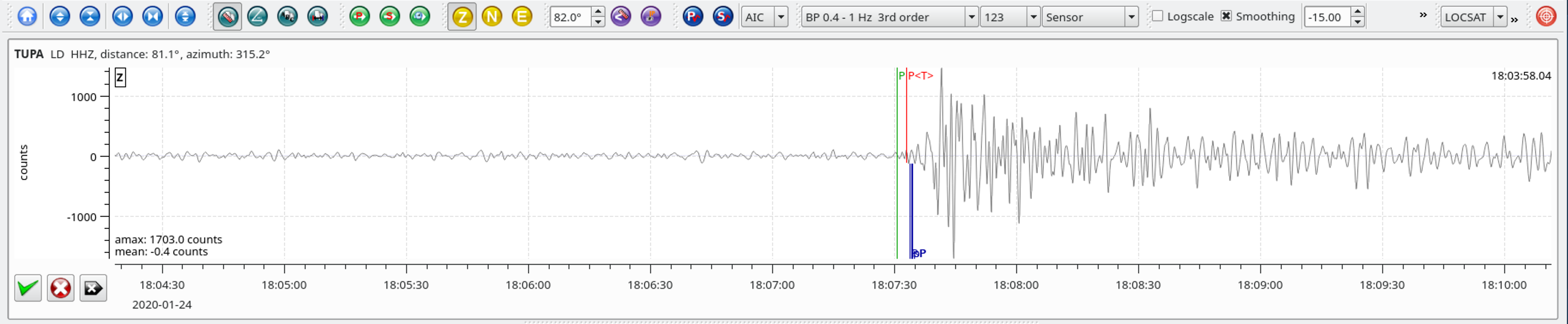
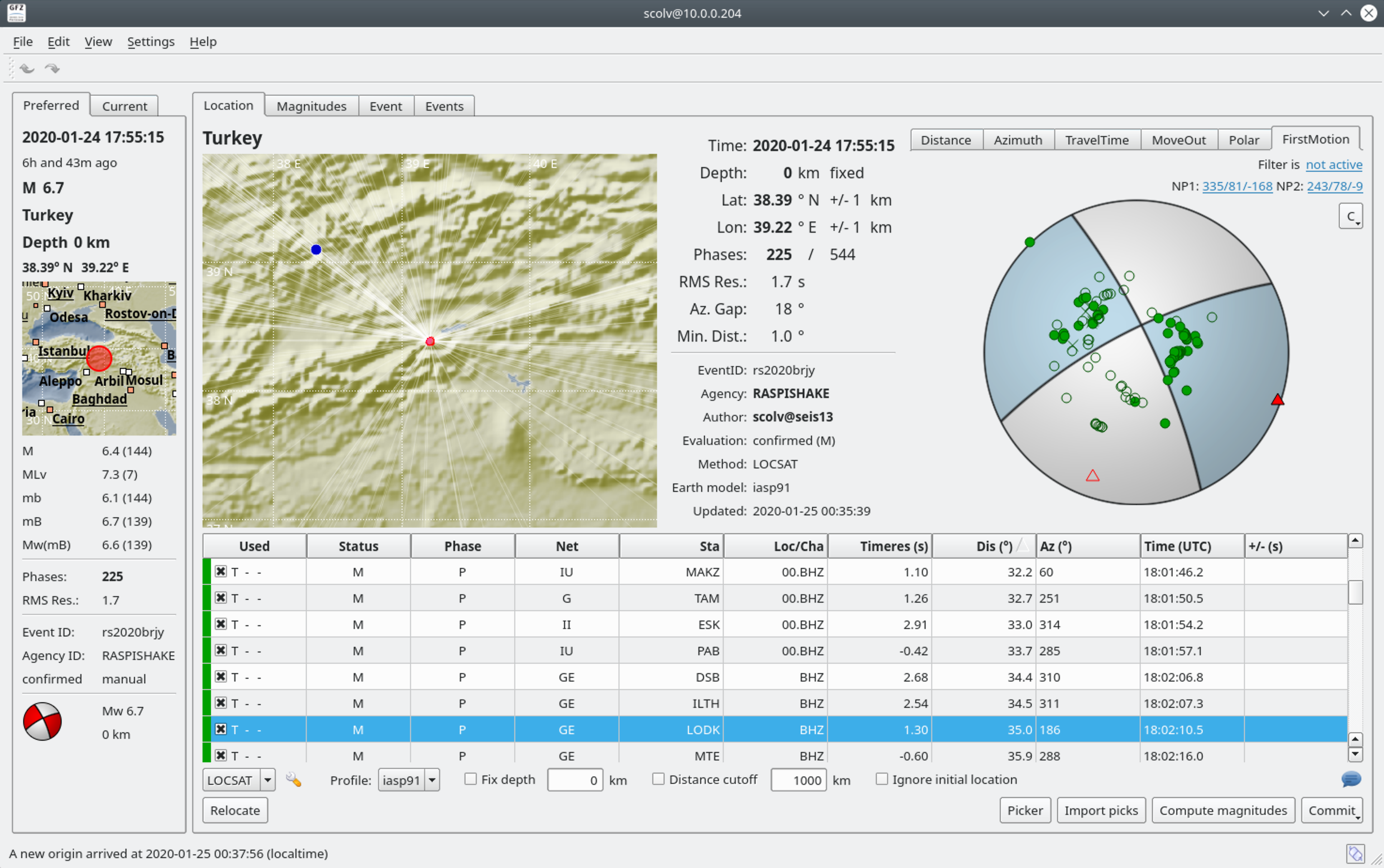
The January 24, 2020, M 6.7 earthquake in eastern Turkey, ENE of Doganyol, occurred as the result of strike-slip faulting on or near the plate boundary between the Arabia plate and the Anatolia Block of the Eurasia plate. Preliminary focal mechanism solutions for the earthquake indicate faulting occurred as the result of either left lateral slip on a near-vertical plane striking west-southwest, or as right-lateral slip on a near-vertical plane striking north-northwest. Slip on the left-lateral plane would be consistent with the orientation of regional faults, and the local plate boundary. At the location of this event, the Arabia plate moves towards the north-northwest with respect to Eurasia at a rate of about 21 mm/yr. The Anatolia Block moves approximately towards the west with respect to both plates, creating right-lateral motion between Anatolia and Eurasia along the North Anatolian Fault in northern Turkey, and left-lateral motion between Anatolia and Arabia along the East Anatolian Fault in southeastern Turkey. The January 24 earthquake is located on or close to the East Anatolian Fault.
Turkey is a tectonically active country, and regularly experiences damaging earthquakes. Within 250 km of the January 24, 2020 earthquake, seven other M6 or larger events have occurred over the preceding half century. Several of these have been destructive; a M6.1 earthquake in May 1986, about 120 km to the west of this earthquake, killed 15 and damaged over 4,000 houses. A M 6.4 in May 2003, 140 km to the northeast of today’s event killed 177 people, injured hundreds, and destroyed over 700 buildings. In March, 2010, a M6.1 earthquake 100 km to the northeast killed 42, injured 100, and destroyed close to 300 buildings. In September 1975, a M 6.7 event (the 1975 Lice earthquake) about 140 km to the east of today’s earthquake killed more than 2,000 people and caused significant local damage. In May 1971, a M 6.9 event (the 1971 Bingöl earthquake) 150 km to the northeast of the January 2020 earthquake killed 65 and also caused significant damage. Farther back in time, the East Anatolian Fault has a history of large earthquakes. Preliminary locations for the January 24, 2020 event place it near a location of East Anatolian Fault that has no documented large rupture since an earthquake in 1875.
Local SeisComP3 P-wave Arrivals
| Latitude | Longitude | Depth (km) | Dist (Deg) | Dist (Km) | Azimuth | |
|---|---|---|---|---|---|---|
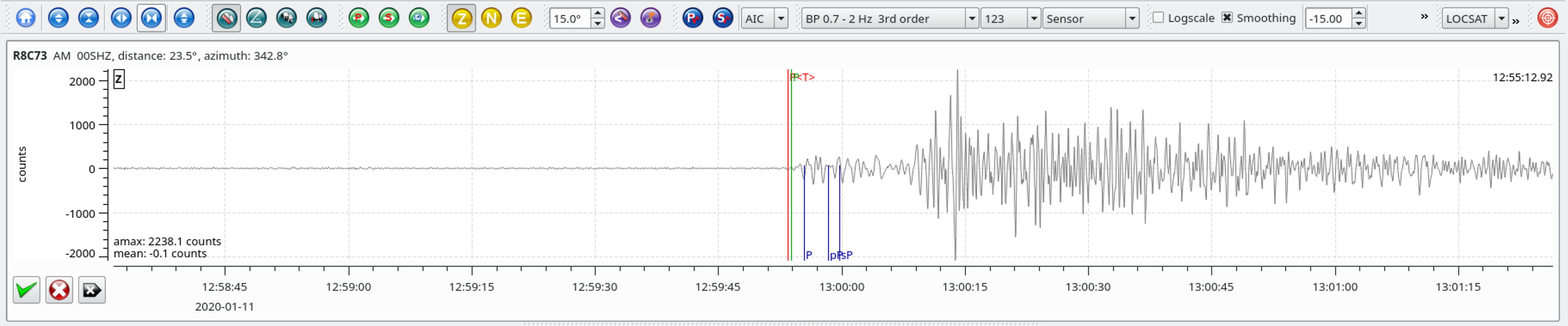
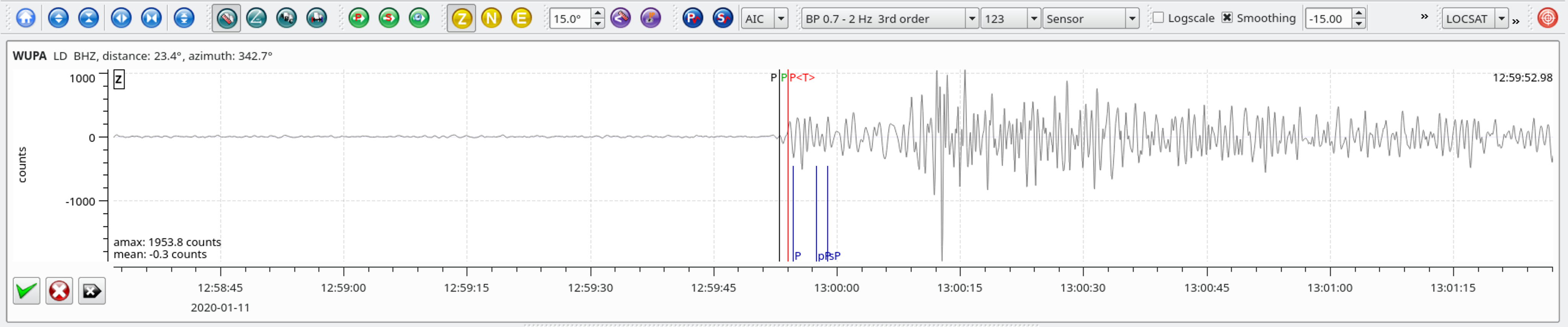
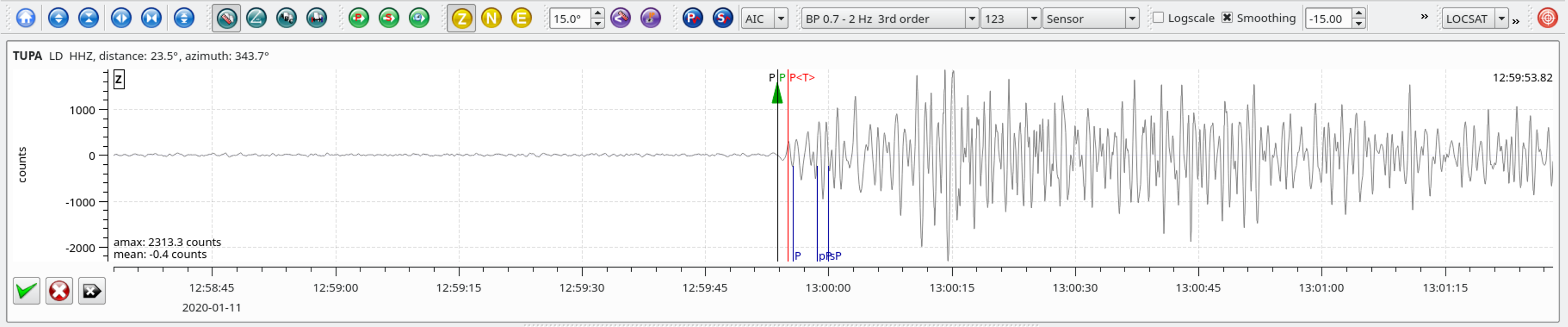
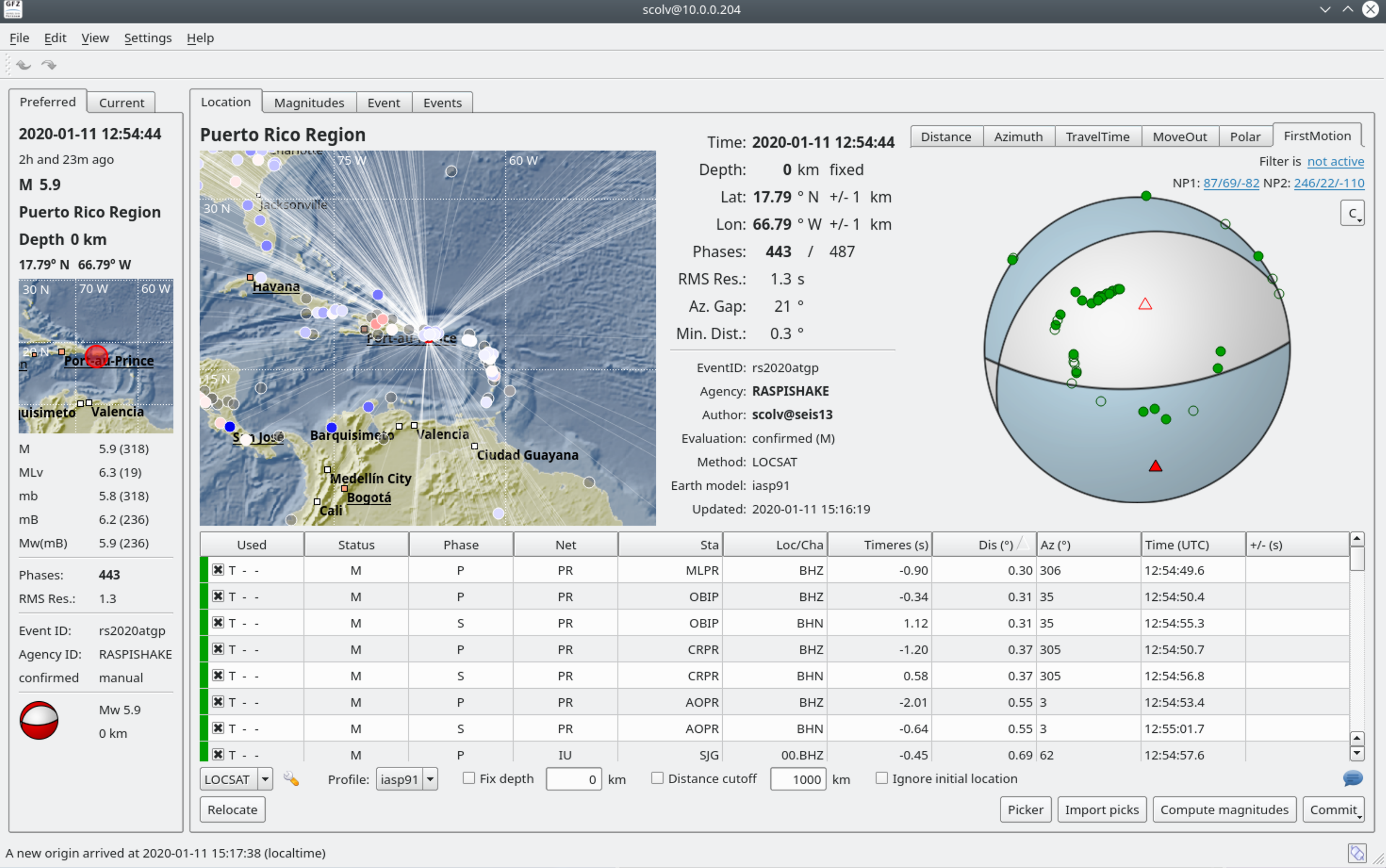
| 17.949 | -66.851 | 5.0 | 23.3 | 2,588 | 342.8 |
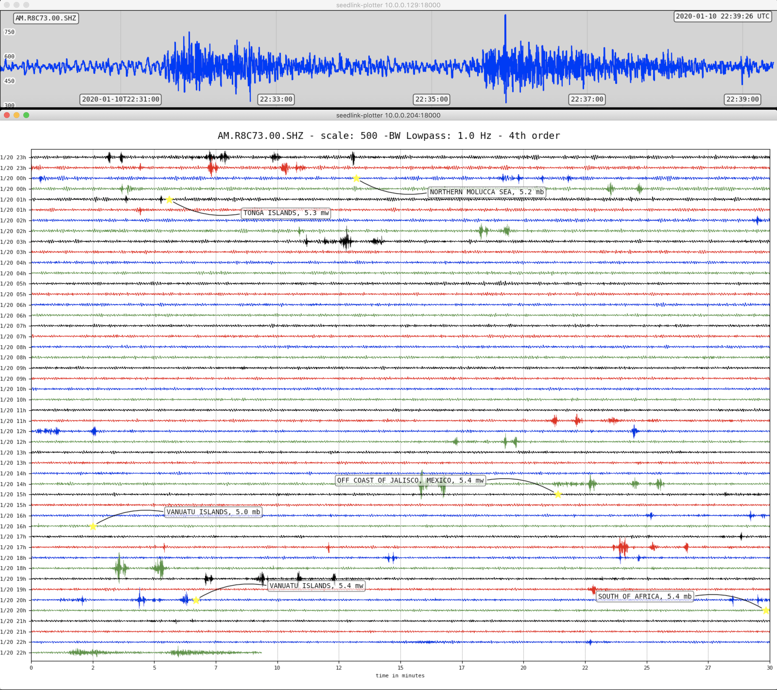
The January 11, 2020, M 5.9 earthquake southwest of Puerto Rico is the latest in a series of strong earthquakes in the same region over the past 2 weeks. This sequence began with a M 4.7 earthquake late on December 28 and a M 5.0 event a few hours later. The largest event in this sequence to date is a M 6.4 earthquake on January 7, which was preceded a day earlier by a M 5.8 event. Since the late December 2019, close to 1,000 M 2+ earthquakes have occurred in this region (400 since the M 6.4 on January 7, the current mainshock), 50 of which were M 4+ (39 since current mainshock), and eight of which were M 5+ (5 since mainshock). The proximity of these events to Puerto Rico, and their shallow depth, mean that many of the M3 and above earthquakes have likely been felt on land.
The earthquakes in this series of events are occurring as the result of intraplate faulting in the offshore deformation zone bound by the Punta Montalva Fault on land and the Guayanilla Canyon offshore. These earthquakes have shown some variation in faulting, mixed between strike slip and normal faulting. The latest January 11, M 5.9 event occurred as the result of normal faulting, with slip on either a shallow plane dipping towards the northwest, or on a steep plane dipping towards the south. This mechanism is consistent with the January 7, M 6.4 mainshock, which demonstrated oblique-normal faulting, and many of the aftershocks since that time. Early events in this sequence, and some of the aftershocks since the M 6.4 event, occurred as the result of strike slip faulting on either a left-lateral plane oriented WNW-ESE, or on a right lateral plane oriented NNE-SSW.
Tectonics in Puerto Rico are dominated by the convergence between the North America and Caribbean plates, with the island being squeezed between the two. To the north of Puerto Rico, North America subducts beneath the Caribbean plate along the Puerto Rico trench. To the south of the island, and south of today’s earthquake, Caribbean plate lithosphere subducts beneath Puerto Rico at the Muertos Trough. While large earthquakes in this region are rare, infrequent naturally occurring large earthquakes are expected given the active tectonic setting. The occurrence of this earthquake is also consistent with latest USGS aftershock forecasts after the M 6.4 event, which prior to this event indicated a 10% probability of a magnitude 6 or above earthquake within a week.
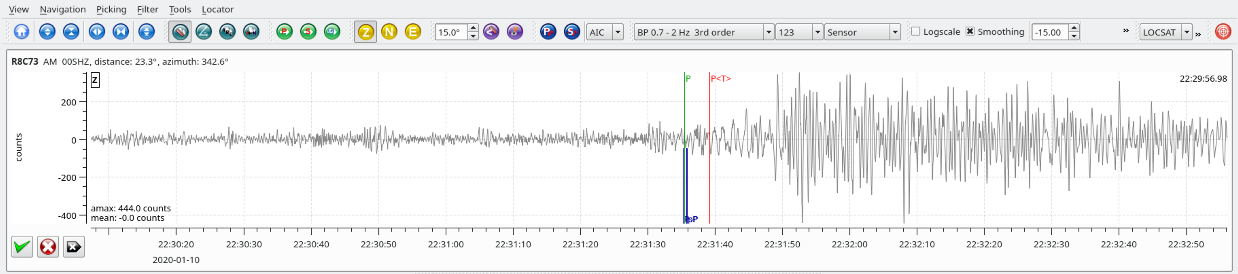
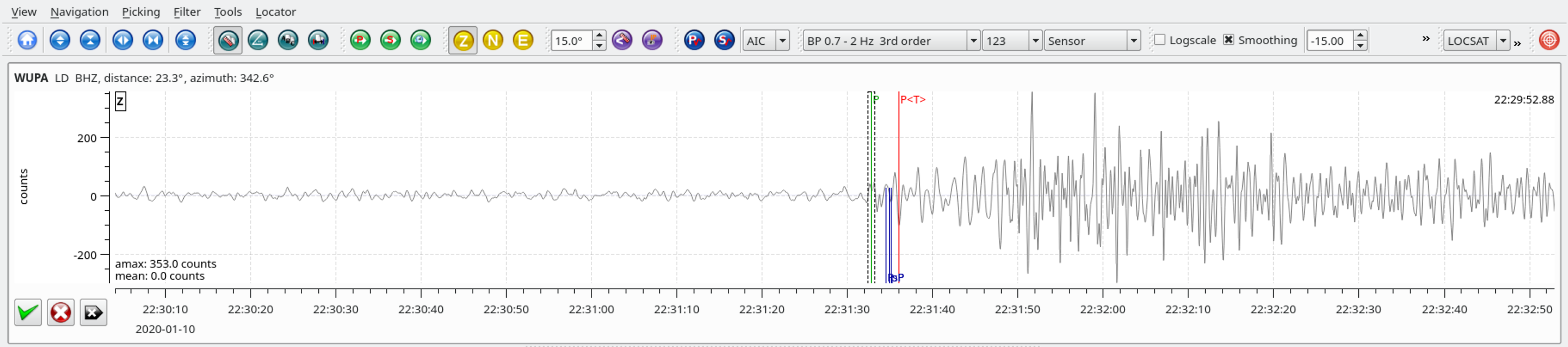
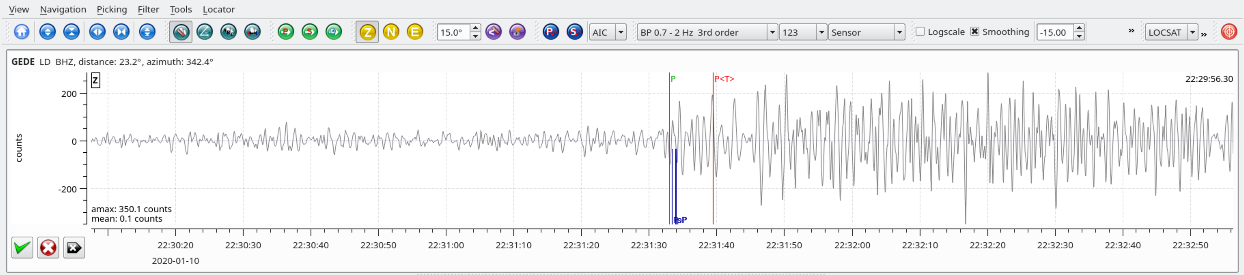
Local SeisComP3 P-wave Arrivals
| Latitude | Longitude | Depth (km) | Dist (Deg) | Dist (Km) | Azimuth | |
|---|---|---|---|---|---|---|
| 17.935 | -66.883 | 9.0 | 23.3 | 2,588 | 342.9 |
Local SeisComP3 P-wave Arrivals
| Latitude | Longitude | Depth (km) | Dist (Deg) | Dist (Km) | Azimuth | |
|---|---|---|---|---|---|---|
| 62.341 | 171.060 | 10.0 | 64.8 | 7,204 | 51.1 |
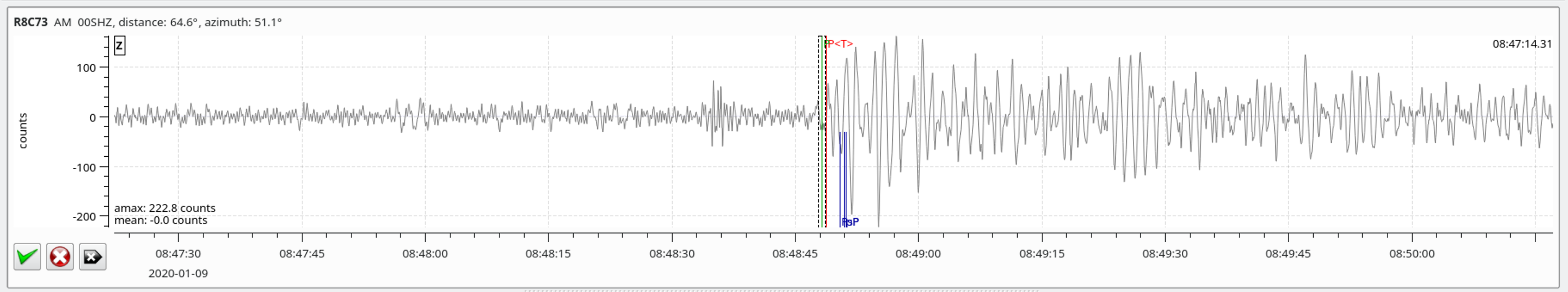
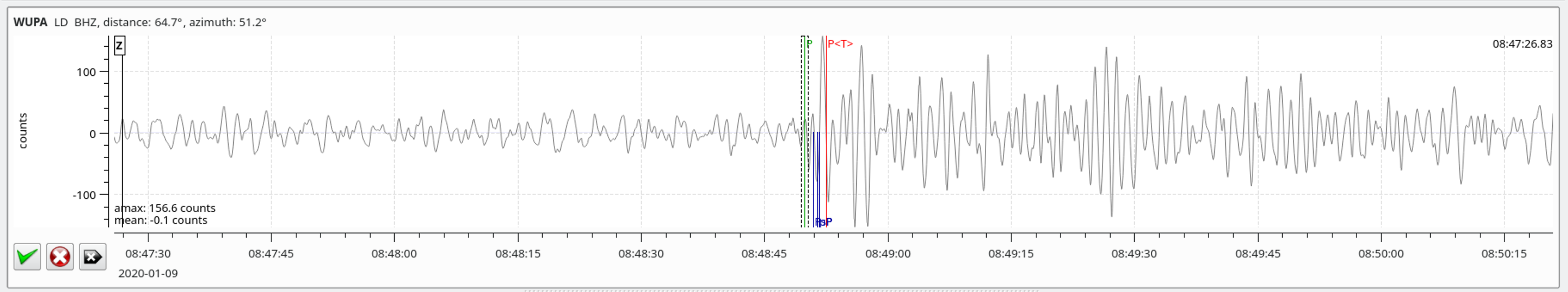
Local SeisComP3 P-wave Arrivals