Position: 55.100°N 164.699°E – Depth: 16.6 km
Tectonic Summary
From The USGS Information Page:
The December 20, 2018 M7.3 earthquake east of Kamchatka peninsula, Russia, occurred as the result of oblique faulting in the northern Pacific Ocean, near the junction of the Kuril-Kamchatka and Alaska-Aleutian oceanic trenches. Focal mechanism solutions indicate slip occurred on a steeply dipping fault striking to the southwest, or on a moderately dipping fault striking northwest. At the location of this earthquake, the Pacific plate moves towards the northwest with respect to the North America plate at a rate of about 76 mm/yr, subducting beneath and translating past the North America plate at the Alaska-Aleutian trench immediately south of this event. The location, depth, and focal mechanism solution indicate this earthquake may have occurred as the result of interplate faulting along this plate boundary structure, or on a related fault taking up motion between these two plates.
The region surrounding today’s earthquake is an active plate boundary and regularly experiences moderate to large earthquakes. Twenty-one other earthquakes of M6.5+ have occurred within 250 km of this event over the preceding century. Many of these occurred within the Kuril-Kamchatka subduction zone to the west of today’s earthquake. The largest nearby historic event in the Alaska-Aleutian system was a M7.0 earthquake to the east of today’s event in August 1925. A M6.7 event occurred to the northeast of today’s earthquake in December 2003. Events in this region are unlikely to cause earthquake-related damage due to their remote location, far from populations.
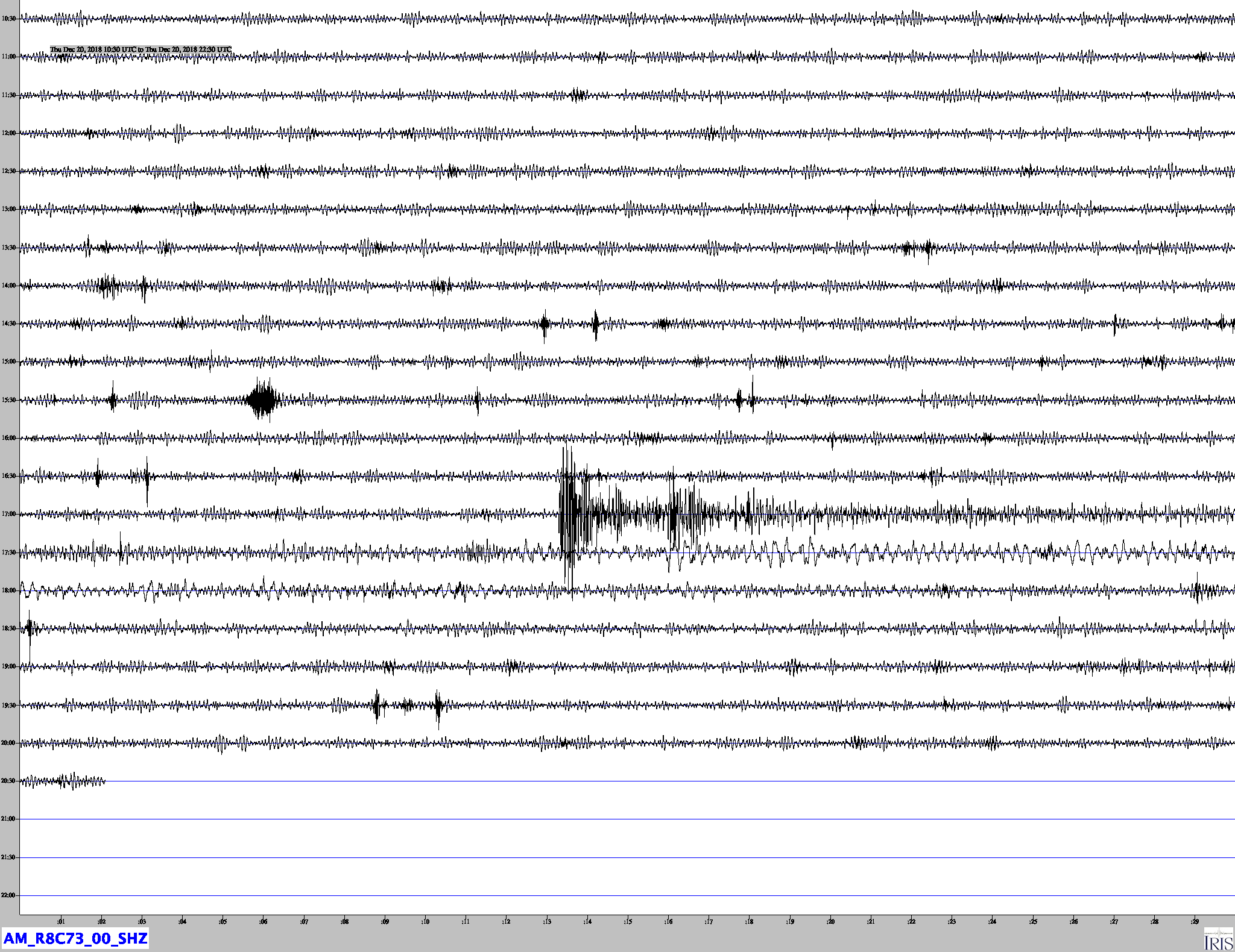
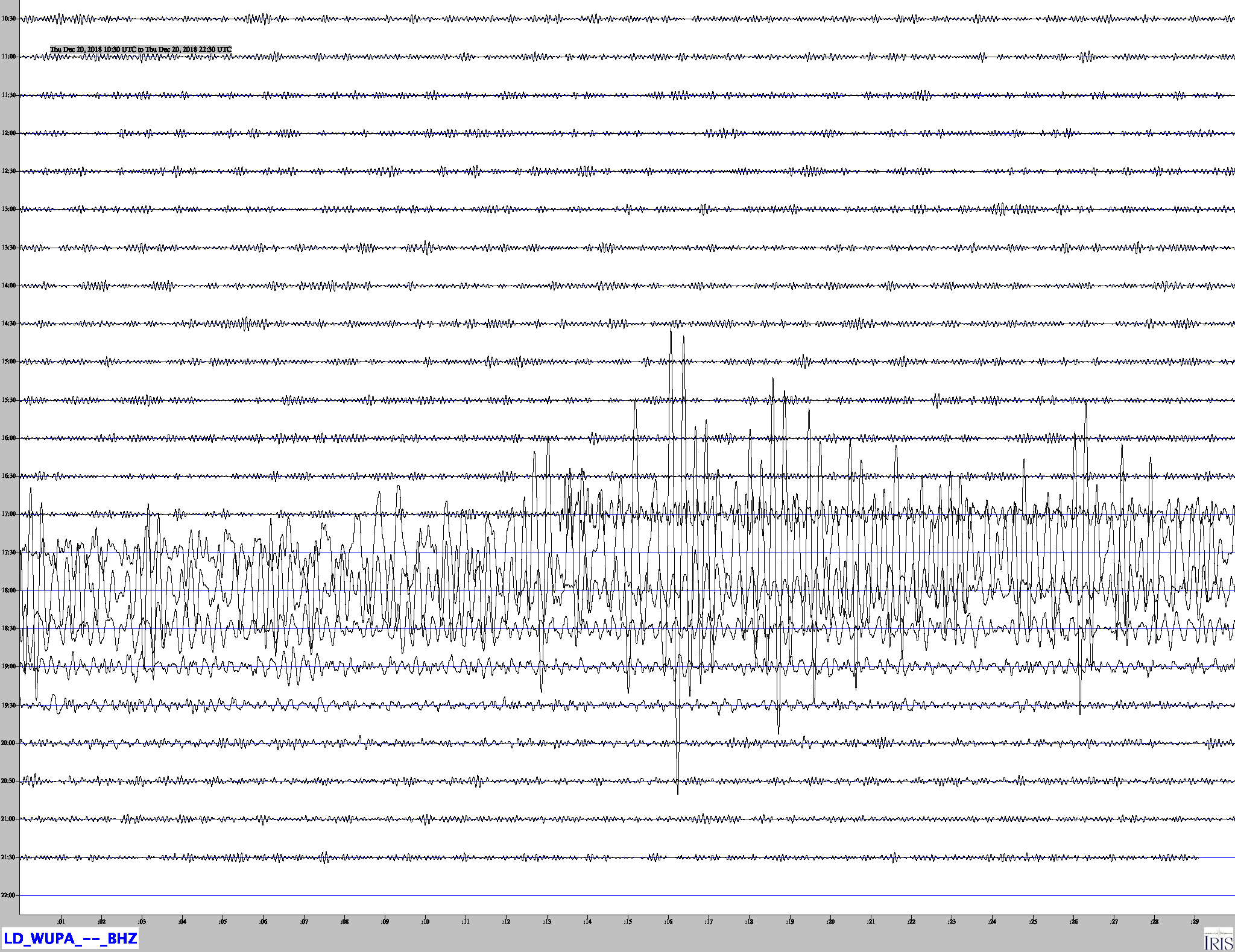
Jamaseis heliocoder traces of AM.RC8C73.00.SHZ and LD.WUPA.BHZ.
Distance: 72.1 Deg. 8,019 km
Azimuth:44.4 Deg.
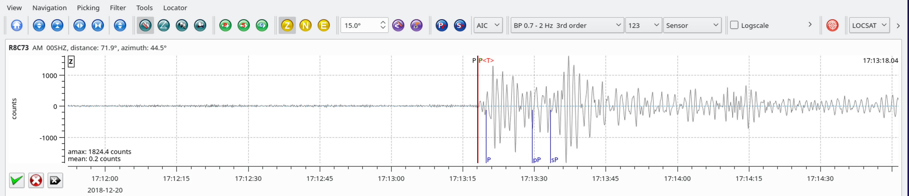
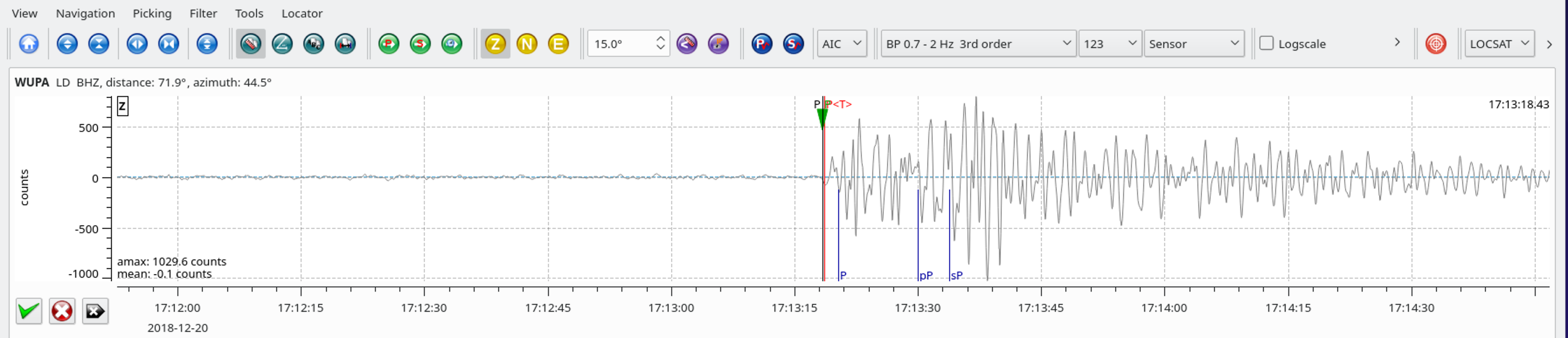
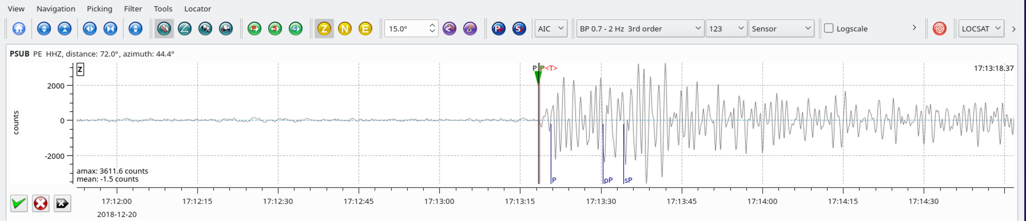
SeisComP3 traces for AM.R8C73.00.SHZ (Exton PA), LD.WUPA.BHZ (West Chester University, West Chester PA), and PE.PSUB.HHZ (Media PA) showing the P wave arrivals.