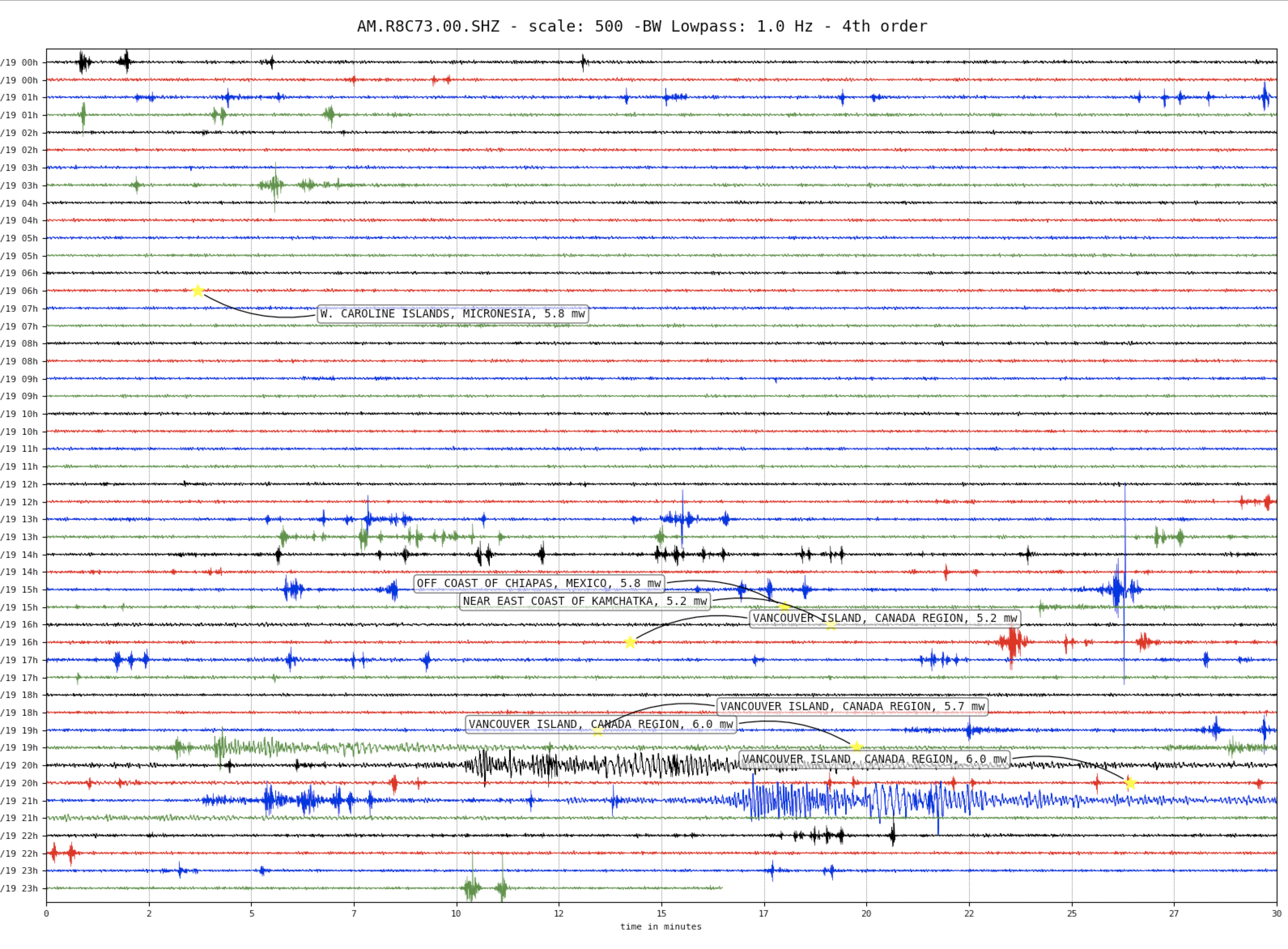
166, 170, 176, and 163km W of Port Hardy, Canada
| Time | Magnitude | Latitude | Longitude | Depth (km) | Dist (Deg) | Dist (Km) | Azimuth | ||
|---|---|---|---|---|---|---|---|---|---|
| 16:44:13 | 5,2 | 50.547 | -129.765 | 10.0 | 38.7 | 4,303 | 84.2 | USGS Information Page | |
| 19:13:25 | 5.7 | 50.569 | -129.823 | 10.0 | 38.8 | 4,307 | 84.2 | USGS Information Page | |
| 19.49.43 | 6.0 | 50.617 | -129.909 | 10.0 | 38.8 | 4,313 | 84.2 | USGS Information Page | |
| 20.56.23 | 6.0 | 50.525 | -129.712 | 10.0 | 38.7 | 4,300 | 84.2 | USGS Information Page |
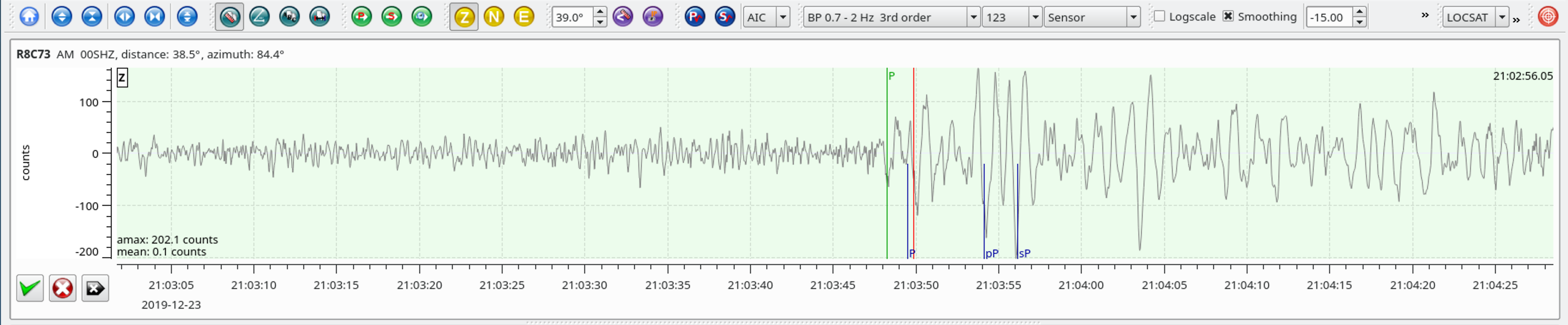
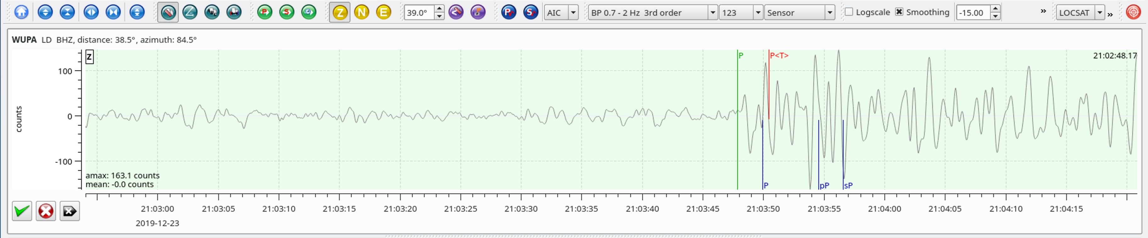
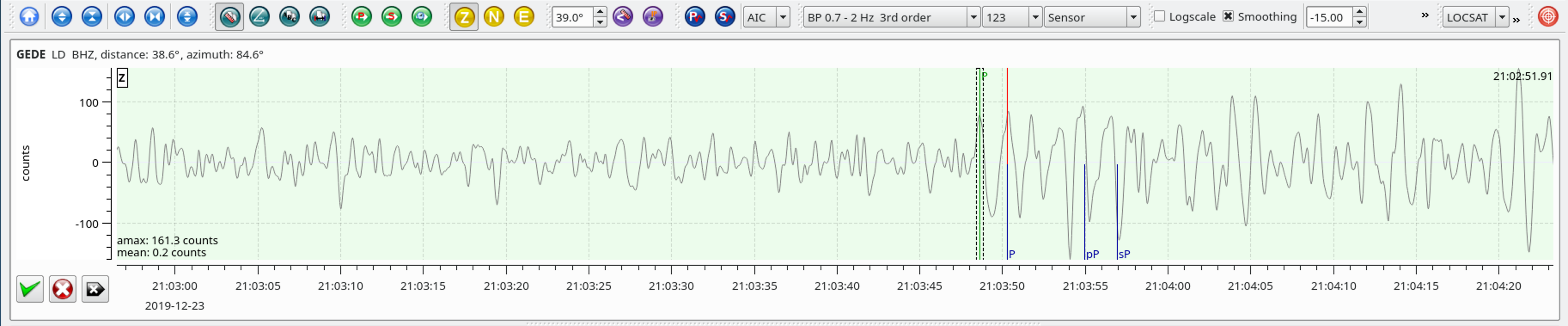
This is a sequence of four earthquakes off the coast of Vancouver Island with magnitudes ranging from 5.2 to 6.0. There were 3 mainshocks preceeded by 2 1/2 hours earlier by a M5.2 foreshock.
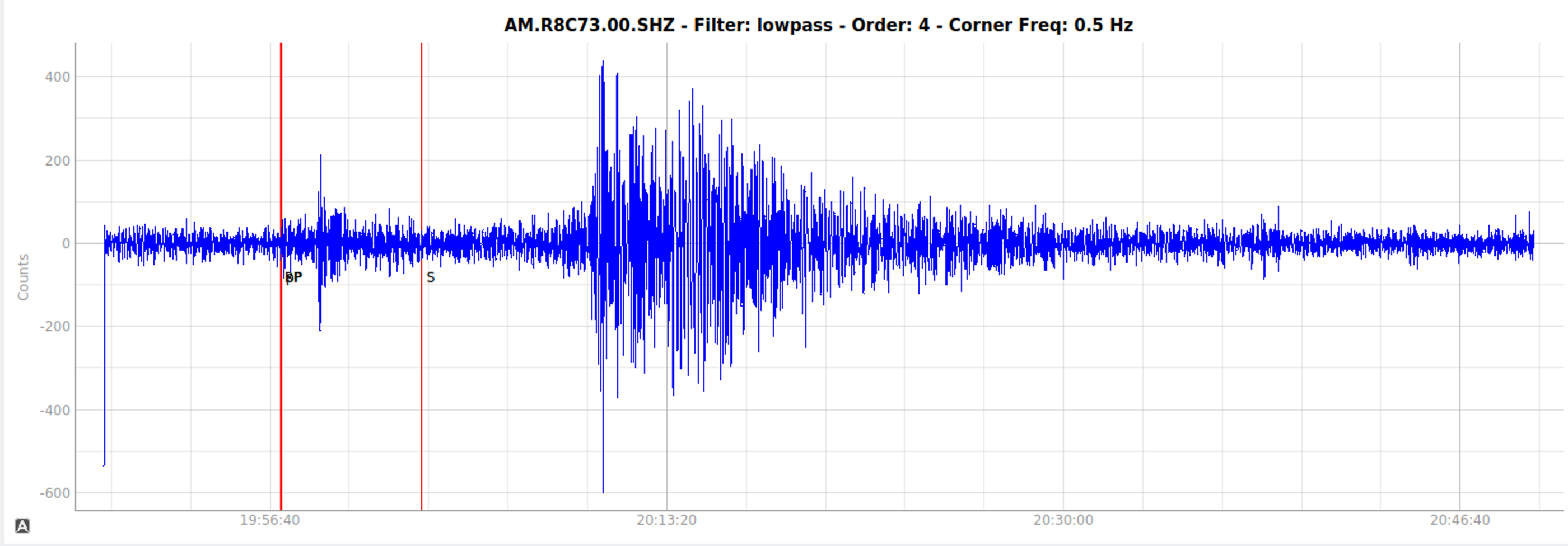
Surface waves arrivals from the 3rd mainshock.
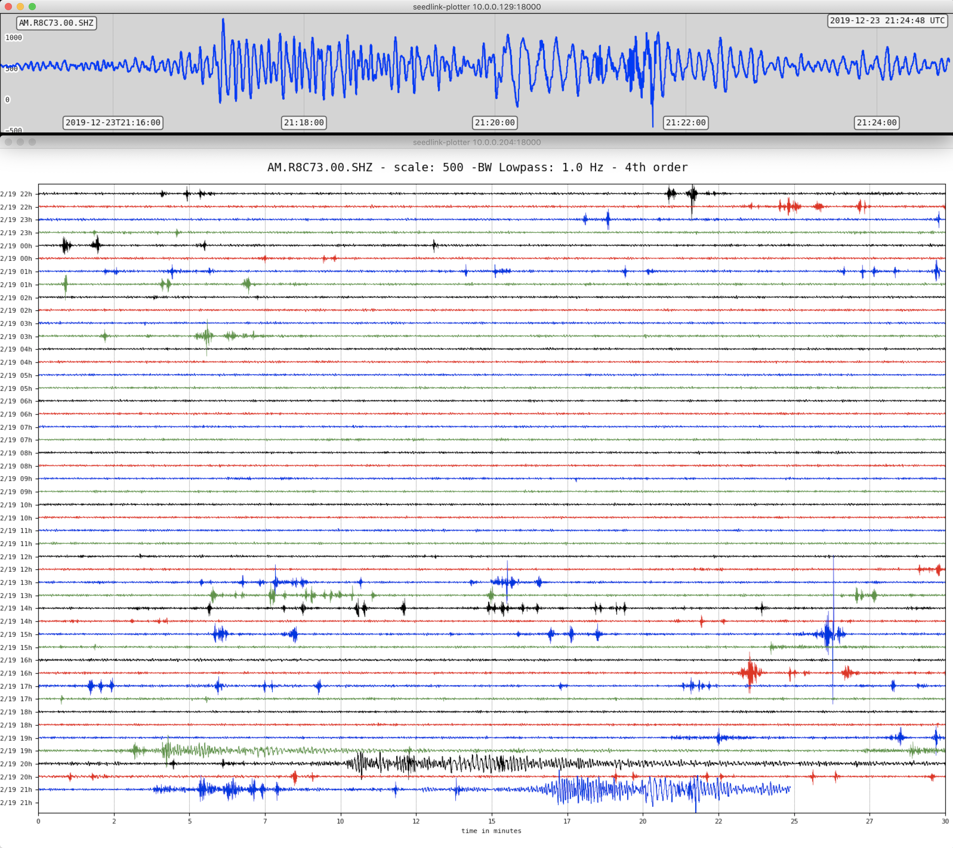
3rd mainshock waveform
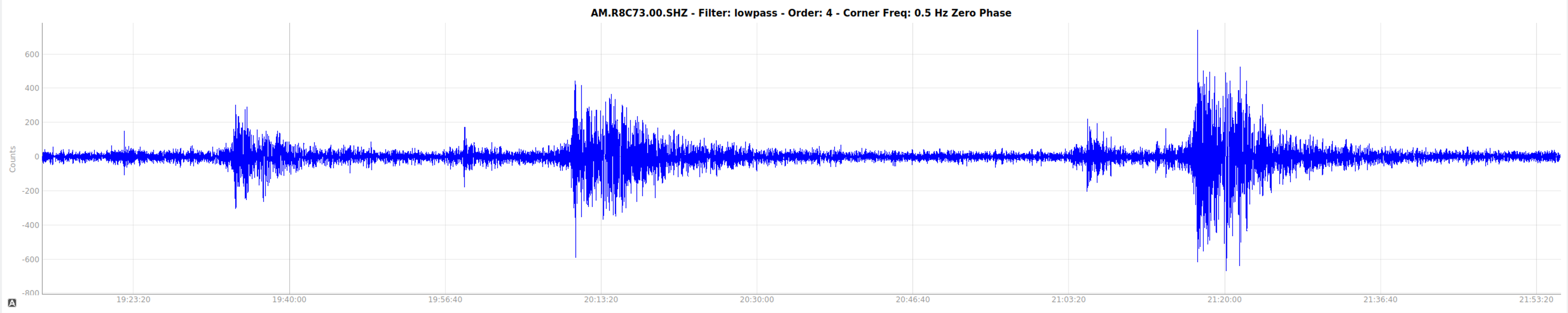
Trace of all three mainshocks.
Local SeisComP3 P-wave Arrivals